Eiger Trail
View Photos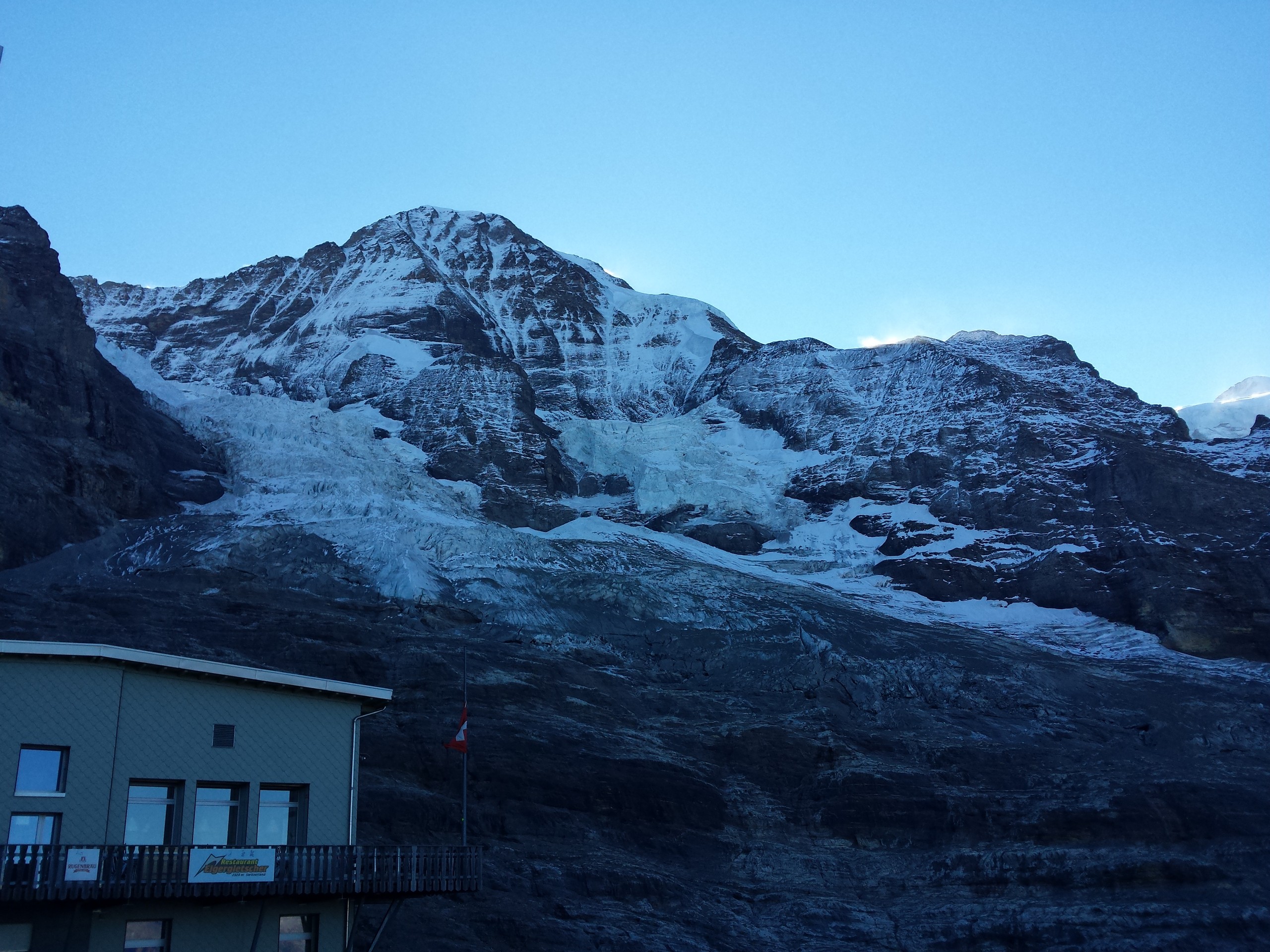
Eiger Trail
Difficulty Rating:
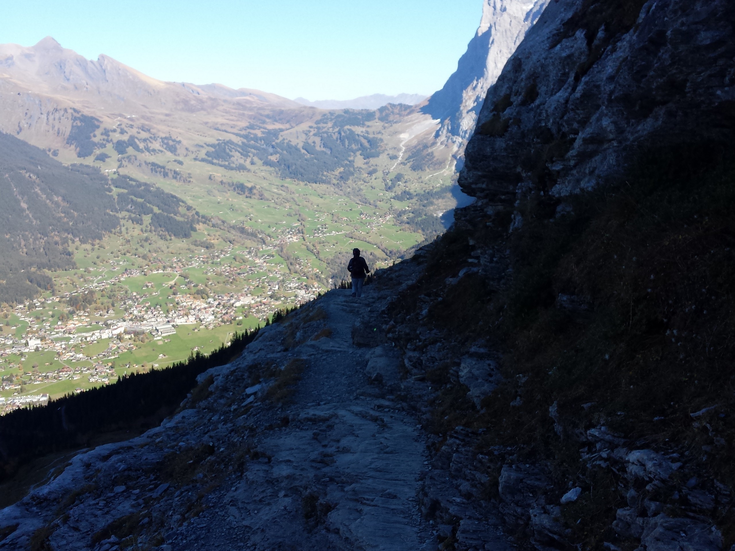
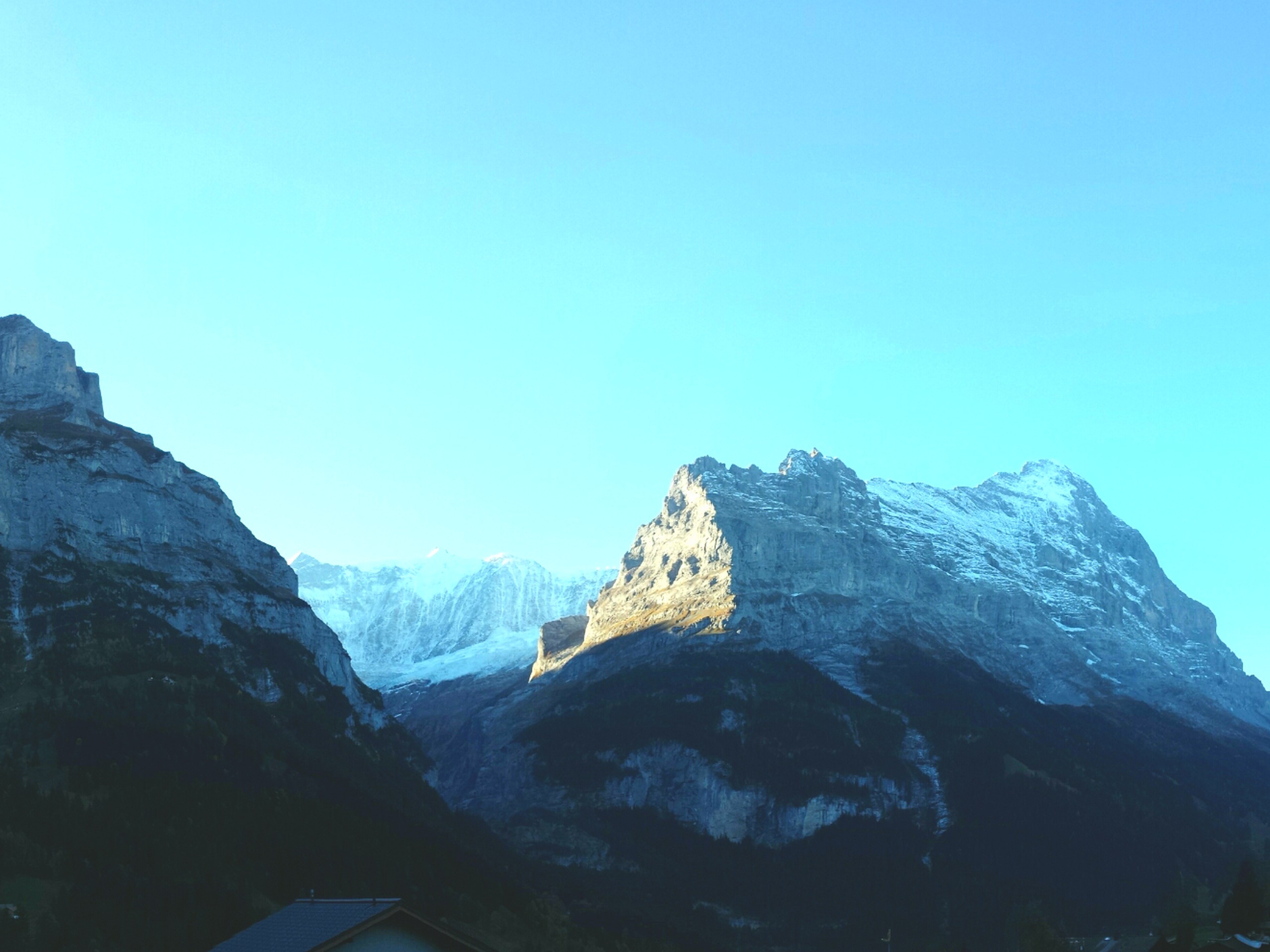
The Eiger Trail skirts the north face of one of the most iconic mountains in Europe. The hike is relatively easy but the views are breathtaking. Besides the imposing presence of the Eiger, you get a good look down to Kleine Sheidegg and the Grindelwald Valley.
Getting there
Starting from Interlaken Ost, take a bus to Lauterbrunnen Bahnhof (train station). From Lauterbrunnen, take a train to Kleine Scheidegg, then transfer to another train that takes you to Eigergletscher. The trip takes about 1 hour and 30 minutes. Alternatively, you can go to Kleine Sheidegg via Grindelwald. The hike will end at Alpiglen, so take note of the train availability and schedule from there to your preferred destination (Lauterbrunnen or Grindelwald). If driving a car, proceed either to Lauterbrunnen or to Grindelwald and park near their train station.

About
| When to do | Mid-June to September |
| Backcountry Campsites | No |
| Pets allowed | Yes |
| Family friendly | Older Children only |
| Route Signage | Average |
| Crowd Levels | Low |
| Route Type | Out and back |
Eiger Trail
Elevation Graph
Weather
Route Description for Eiger Trail
Access to this hike is very dependent on train availability in order to reach the trailhead at Eigergletscher and take you back from the end of the hike at Alpiglen. Make sure the trains are operating to and from both points at a schedule that you can comply with. If you are not sure that trains will be able to operate from Alpiglen when you finish the hike, do not proceed. We recommend giving yourself ample time to complete the hike to avoid being stranded after the last train departs. Consult the tourist information office at Lauterbrunnen or Grindelwald to be sure the trail is open when you plan to hike.
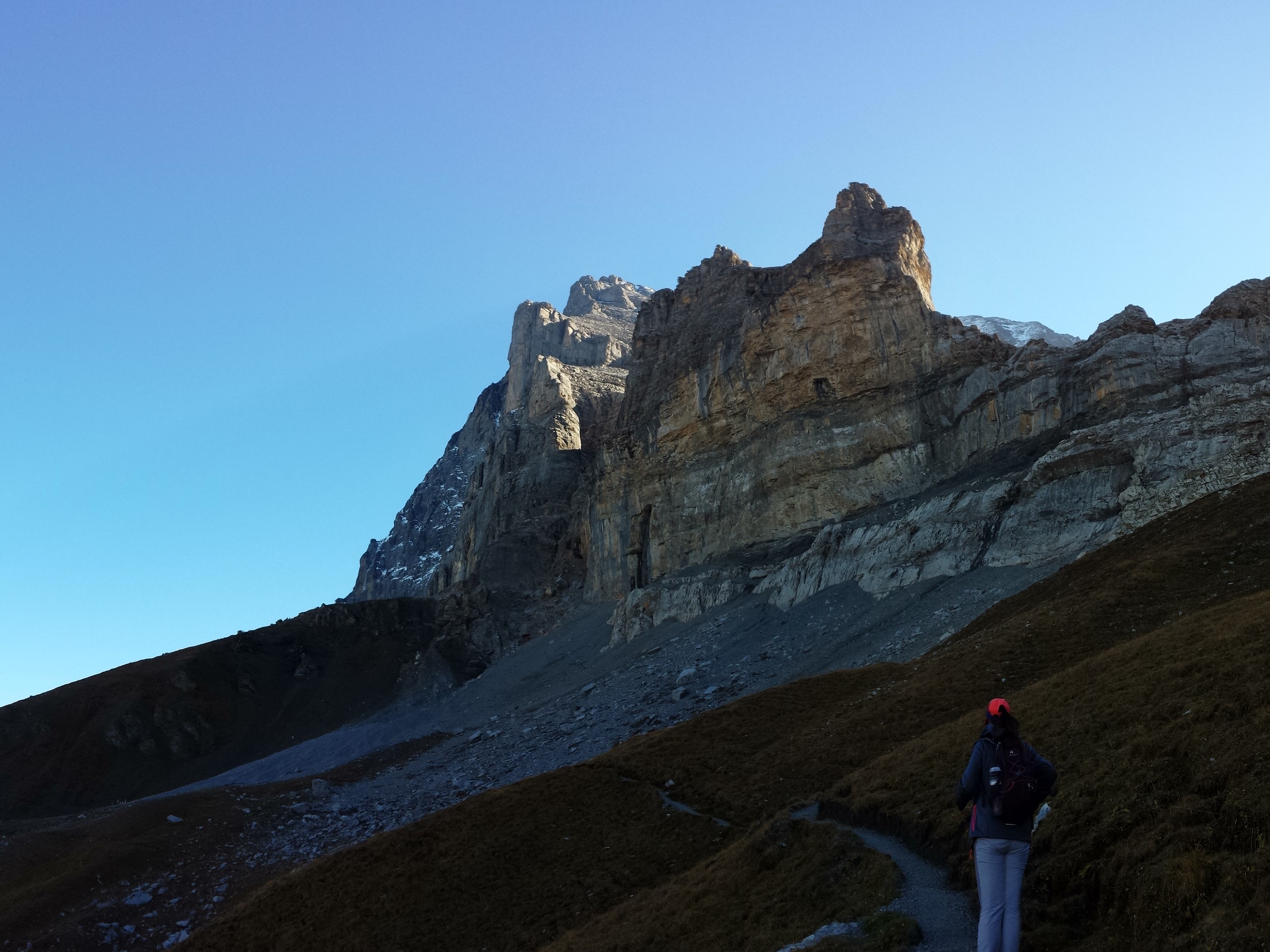
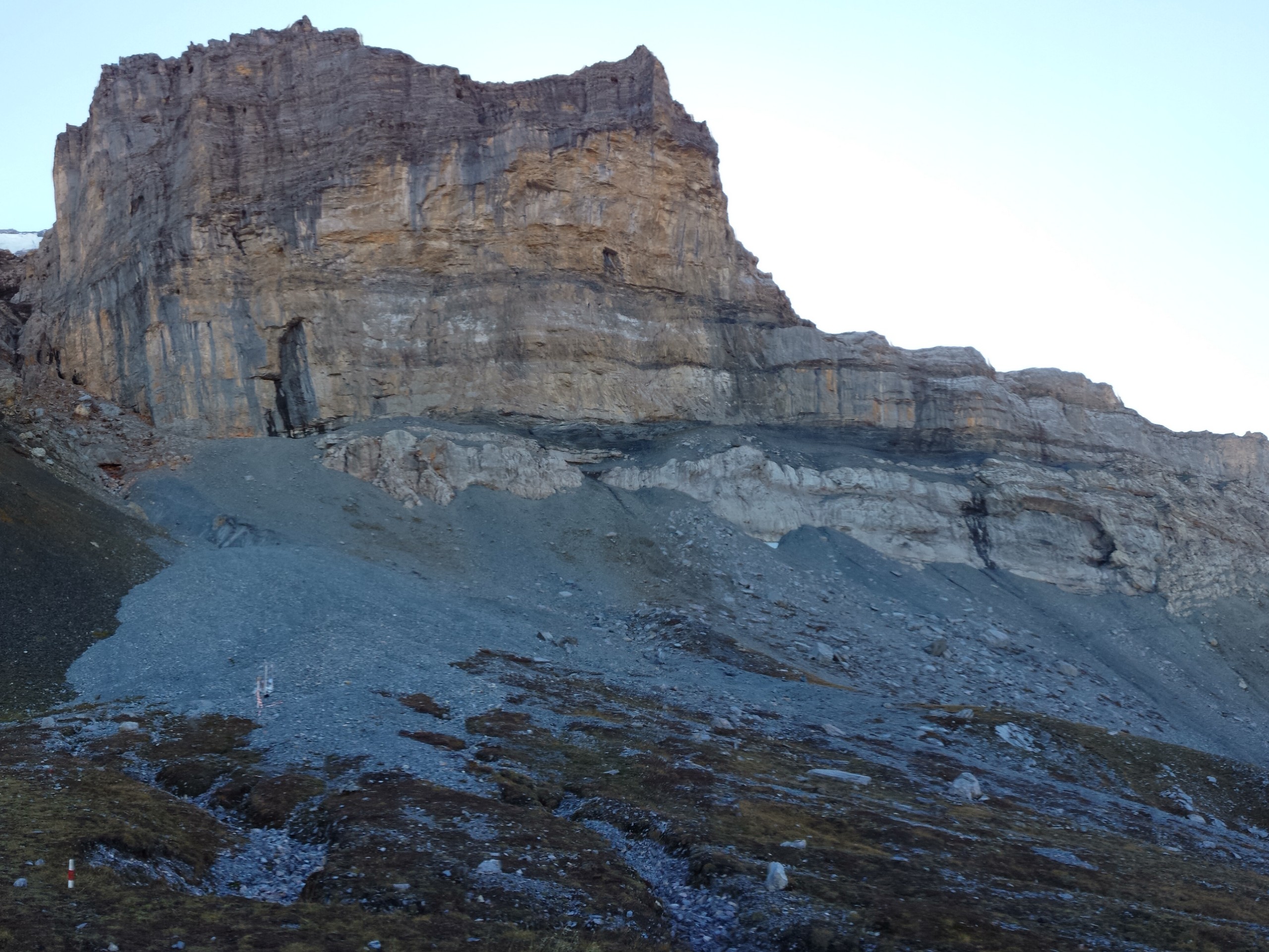
The Eiger Trail is on a rocky and gravel surface and most of the trail descends, so trail runners and light hiking boots will do in summer. Expect chilly temperatures and strong wind at the start of the hike. There is a restaurant at the Eigergletscher train station, and after this there is no food or drink until you finish the hike at Alpiglen.
There was a rerouting of the original Eiger Trail, so closely observe the signs and warnings when you start the hike from the train station. The gps track provided starts by going down to the reservoir, but the official trail takes a more direct route from the train station, though both of them will merge.
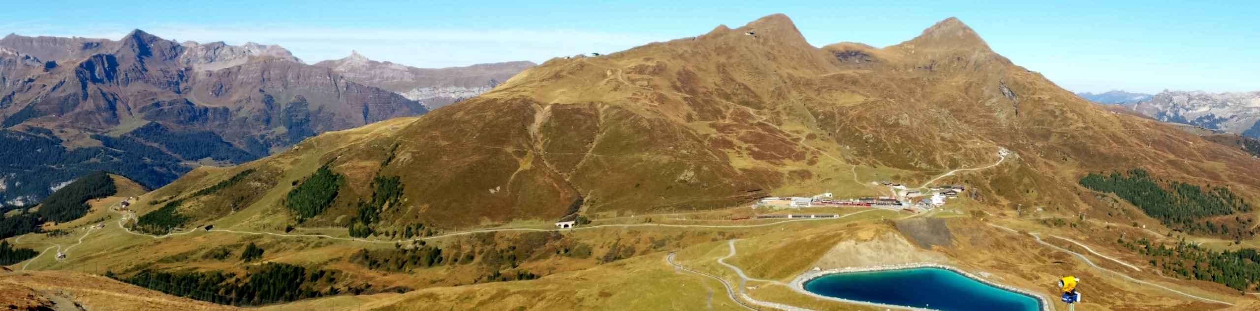
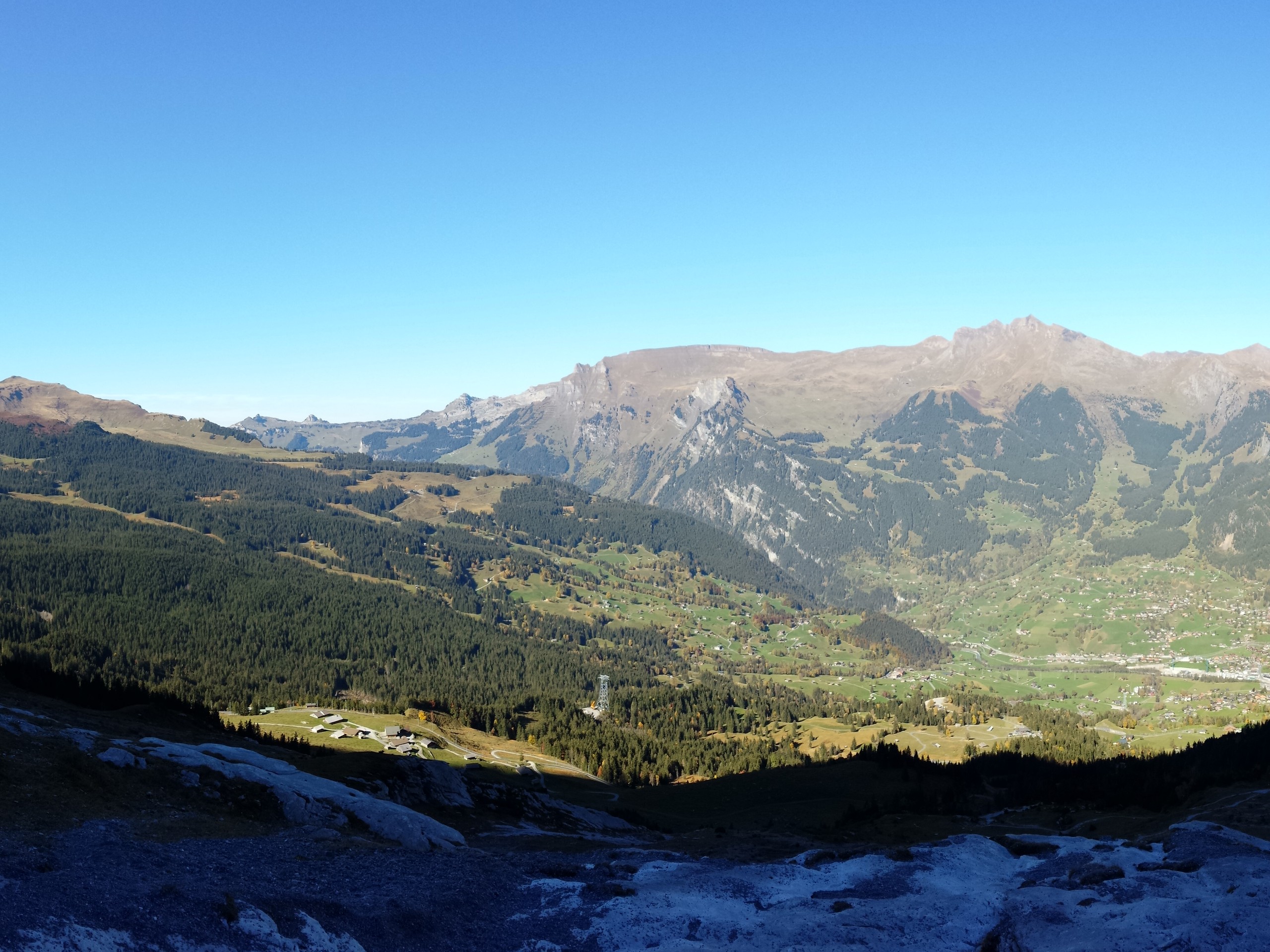
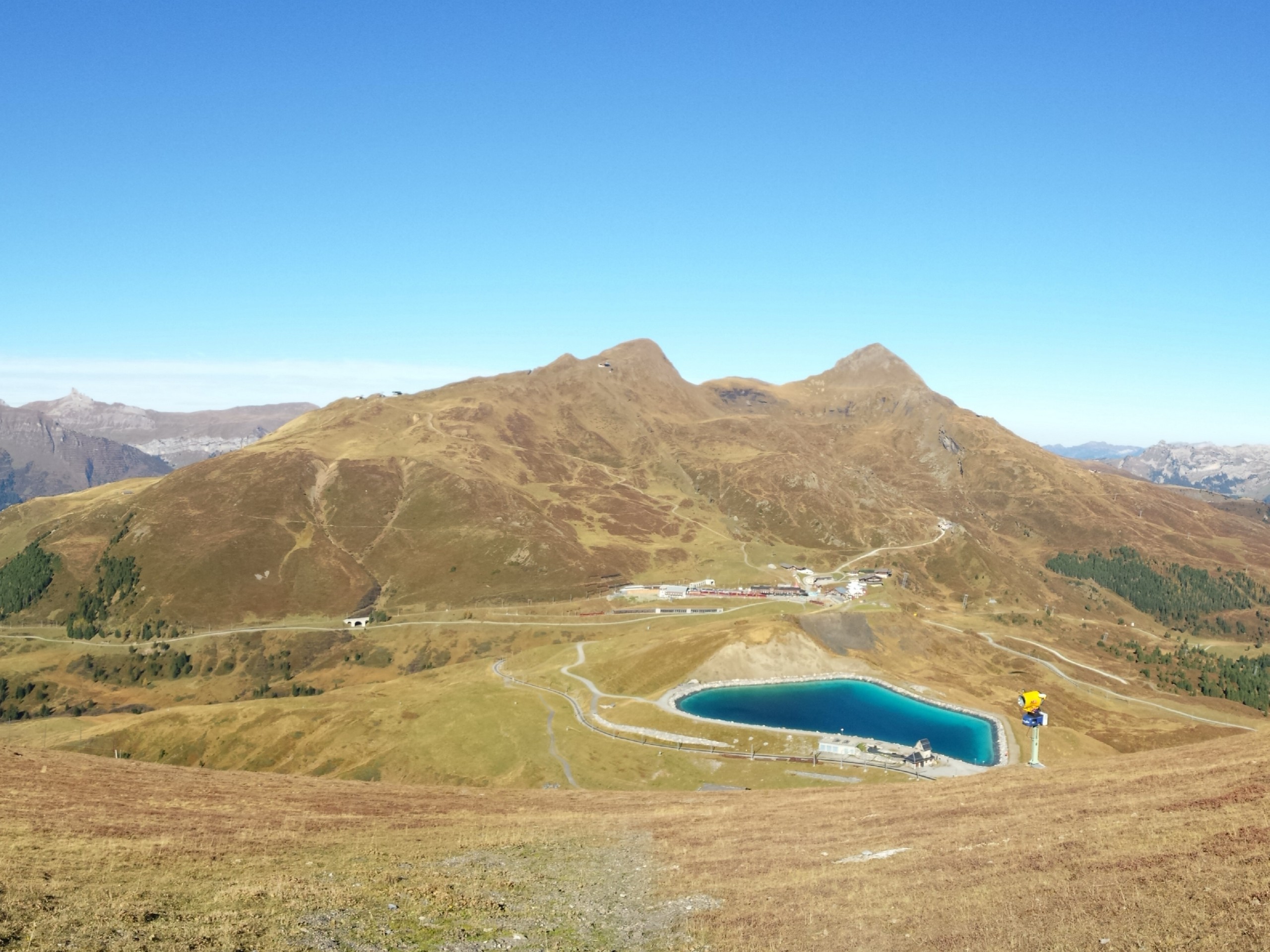
From the train station, move west and then north, descending to Falbodensee, a small water reservoir 2953ft from the train station. From the reservoir, locate the trail eastward that leads to Alpiglen.
The trail will wind up and down along the base of the Eiger until it takes a northward descent down to Alpiglen. From Alpiglen, you can take a train back to Kleine Scheidegg and Lauterbrunnen, or alternately to Grindelwald.
Insider Hints
Plan this hike with an early start and an early finish to account for the train
Even the train ride to and from this hike is very scenic, so ready your camera and snap some photos during the ride
While Interlaken is the nearest big city, Lauterbrunnen and Grindelwald are very charming villages to stay in when visiting this area
Similar hikes to the Eiger Trail hike
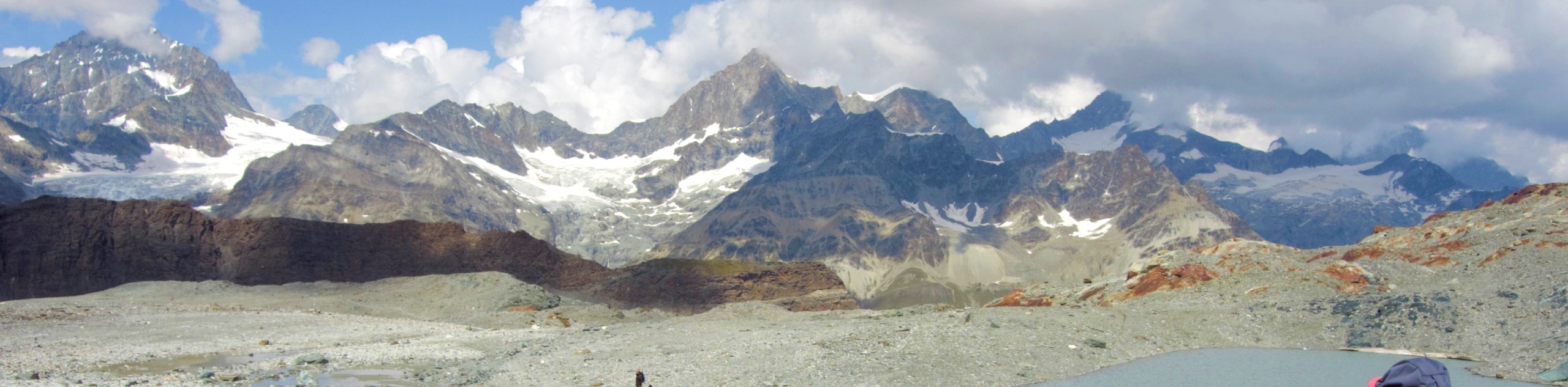
Matterhorn Glacier Trail
The Matterhorn Glacier Trail (Nr. 26) takes you close to the Furgg Glacier and right beside the east flank of…
Edelweiss Refuge Loop
Zermatt is an area strewn with hiking trails that intersect on well signposted routes. This hike can be altered depending…
Daubensee
Hiking around Daubensee Lake gives you a gentle work out with a great view of glaciers, the lake, and the…
Comments