Edelweiss Refuge Loop
View Photos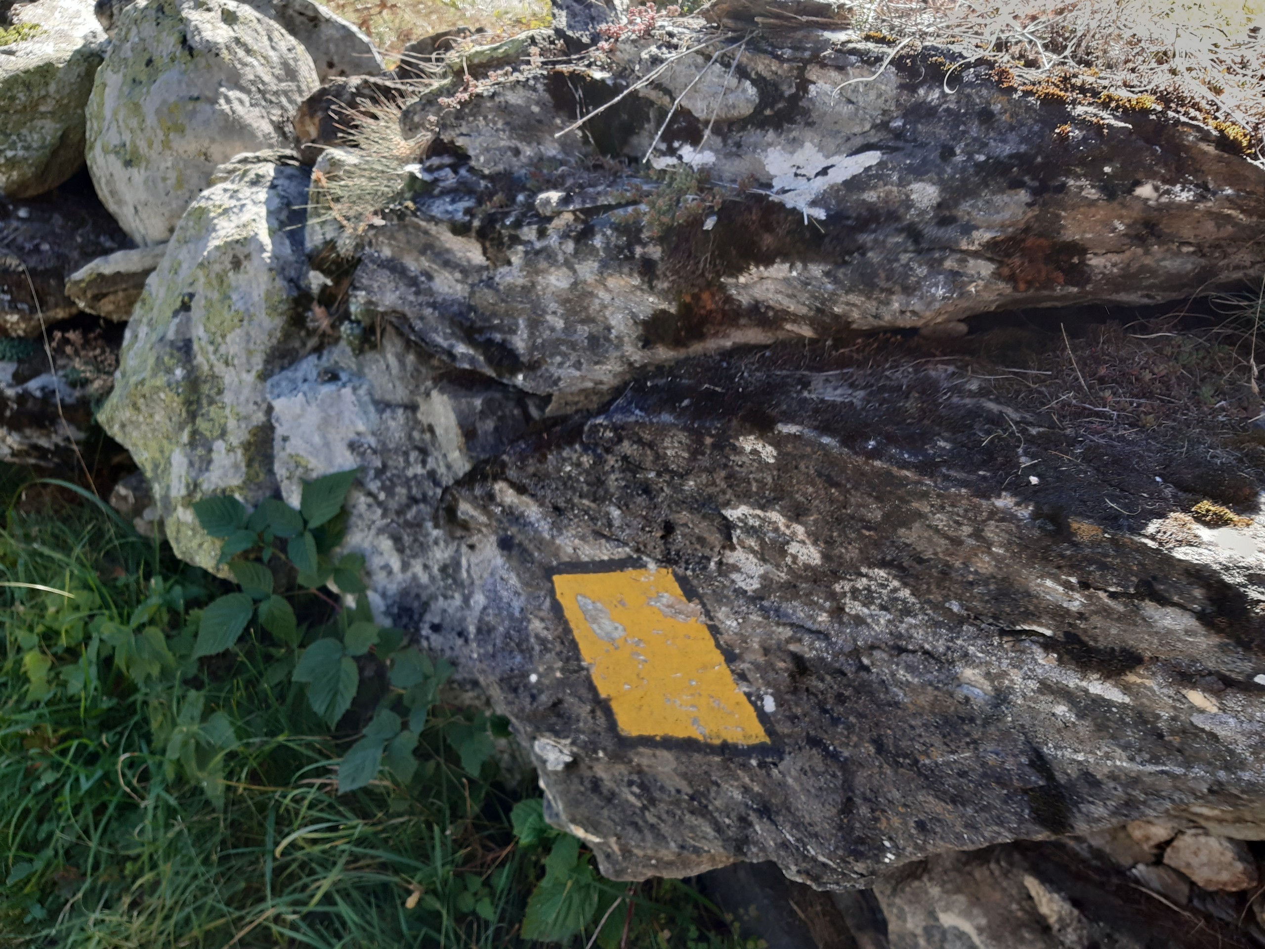
Edelweiss Refuge Loop
Difficulty Rating:
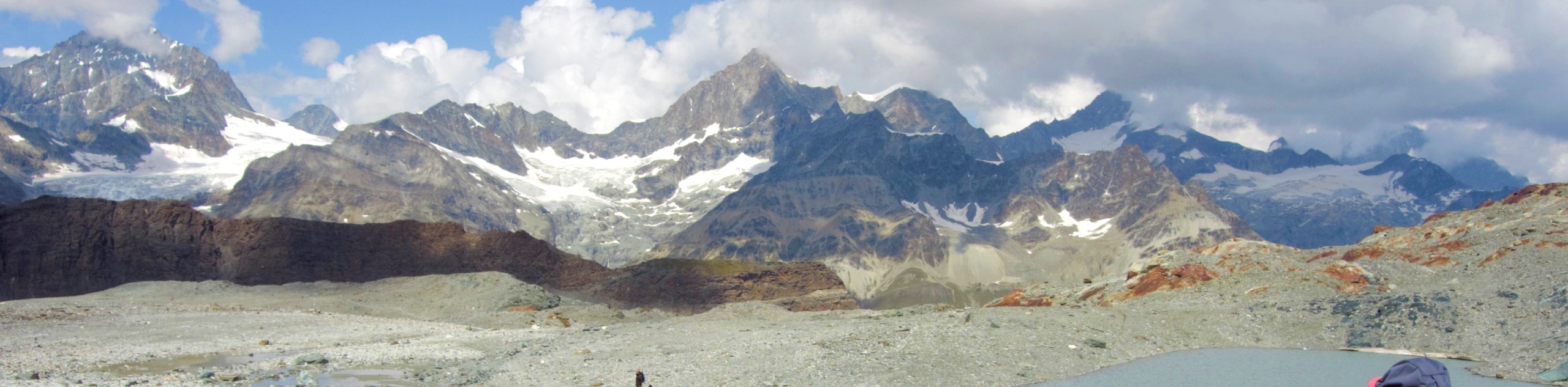
Zermatt is an area strewn with hiking trails that intersect on well signposted routes. This hike can be altered depending on your desired length and difficulty thanks to great signage on the trails. The trail leads to a refuge/restaurant overlooking Zermatt on a cliff edge before taking a less steep route though picturesque villages, finally winding back to Zermatt.
Getting there
Typical access to Zermatt is using the train from Täsch, lower down the valley. This hike takes full advantage, starting directly from the train station. Exit the Zermatt train station and turn right to walk up the main street (Bahnnhofstrasse). Turn right onto Bodmenstrasse and follow it around to the T-intersection. Turn right onto the continuation of Bodmenstrasse and walk past Hotel Butterfly. Look for the dirt track on the right side of the road, which is the starting point.

About
| When to do | June to September |
| Backcountry Campsites | No |
| Pets allowed | Yes - On Leash |
| Family friendly | Older Children only |
| Route Signage | Good |
| Crowd Levels | Moderate |
| Route Type | Circuit |
Edelweiss Refuge Loop
Elevation Graph
Weather
Route Description for Edelweiss Refuge Loop
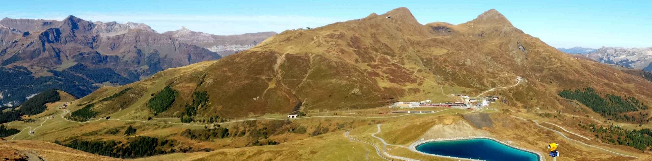
Walk up the dirt track until it meets another track and turn left, where there’s a signpost in the distance. At the signpost, walk up the steep path to your right, following the signpost for Alterhaupt Edelweiss (the name of the refuge). This part of the route is marked with yellow diamonds on rocks between signposts. Walk through the forest until you reach another signpost. Both routes meet further up, but follow the direction of Zermatt Kirche along the flat, open trail to visit a tiny village as a small detour with views over Zermatt below.
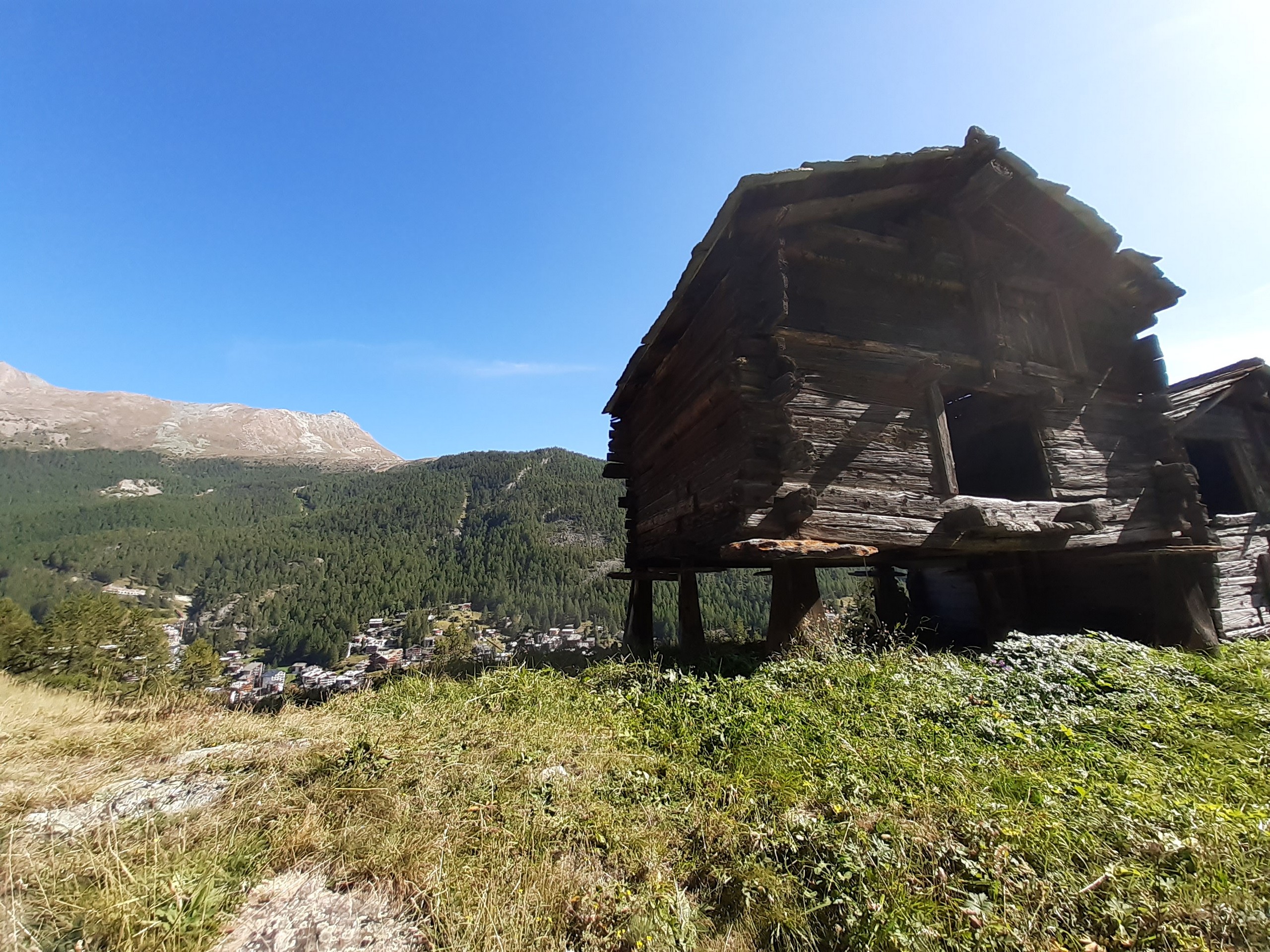
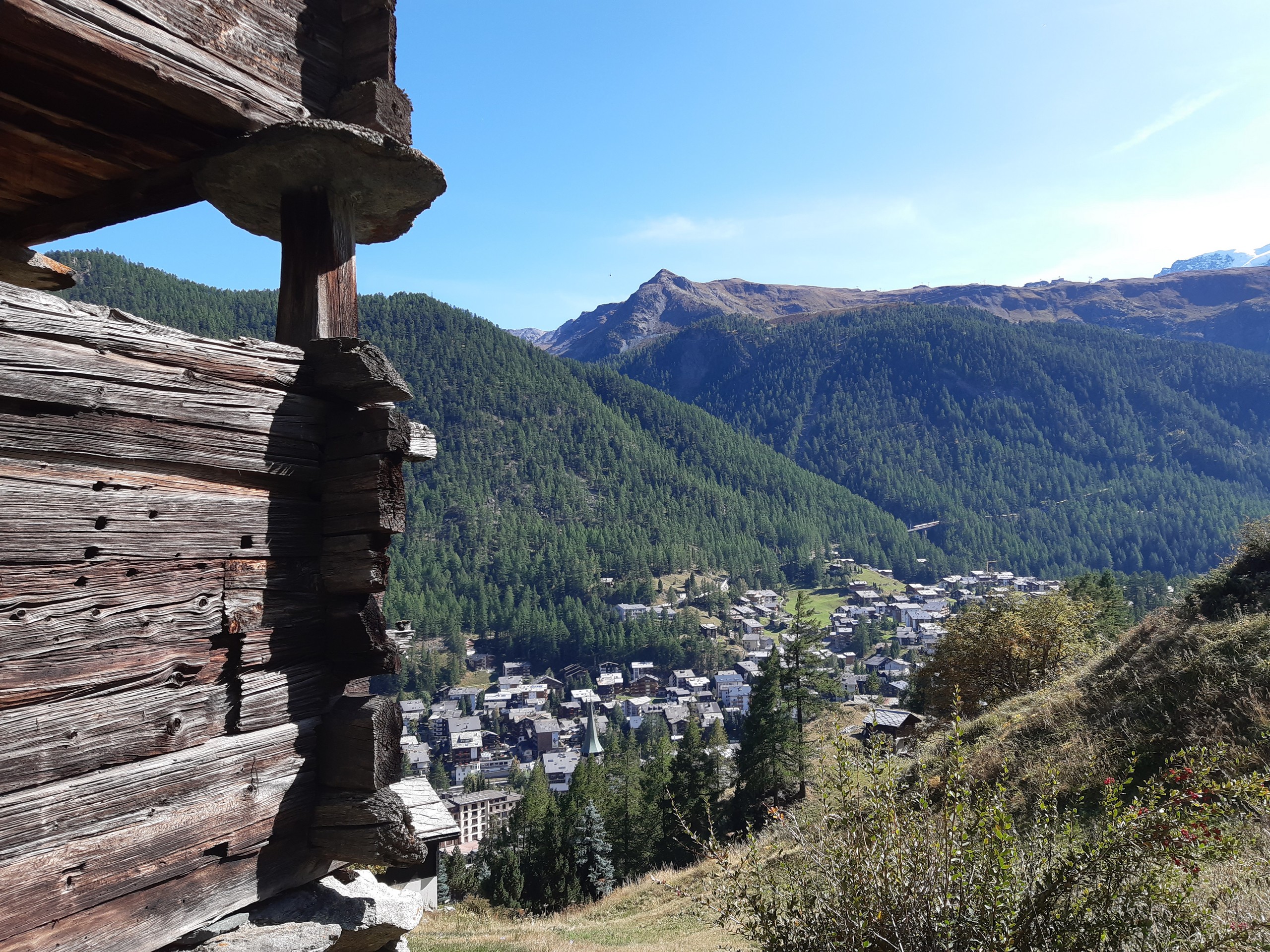
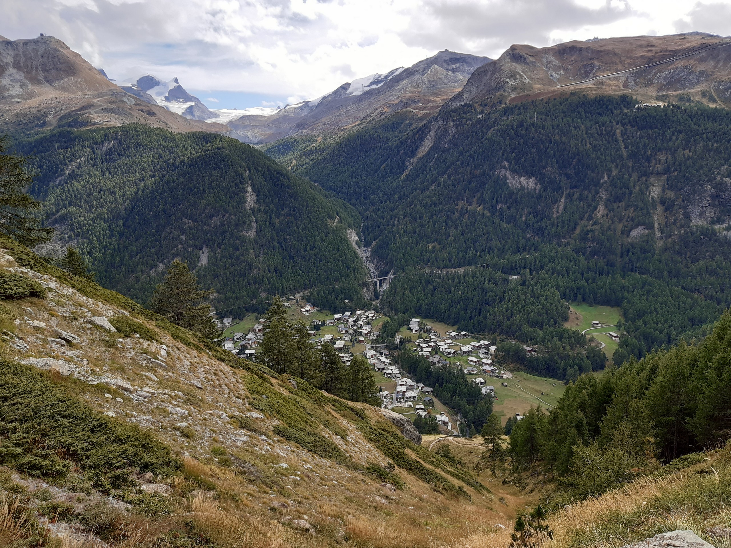
After the village, the path descends a little before a signpost. Follow the arrow for Alterhaupt Edelweiss towards some solid rock and fields. Look up at the cliff to spot the refuge poised on the skyline between the trees.
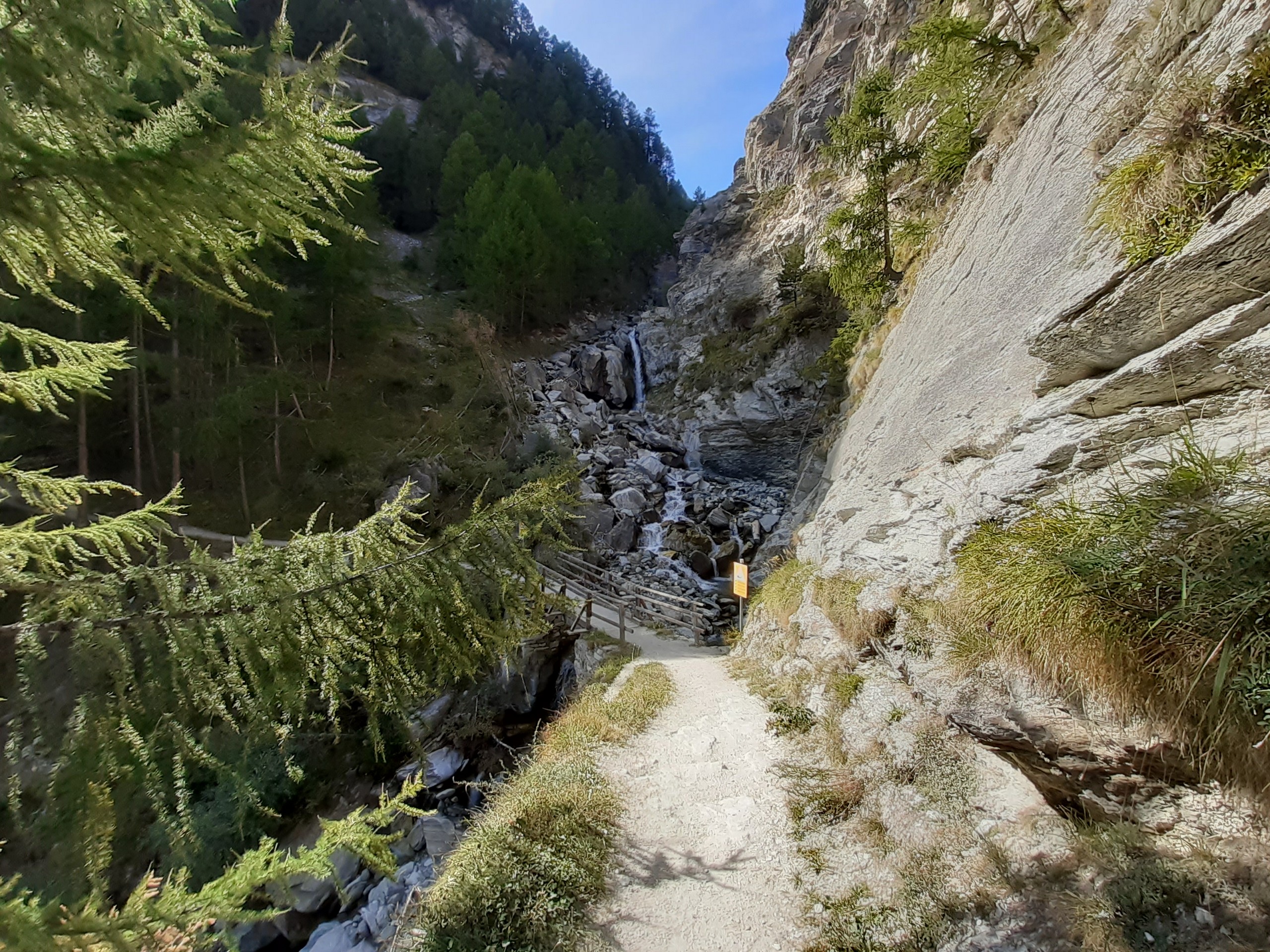
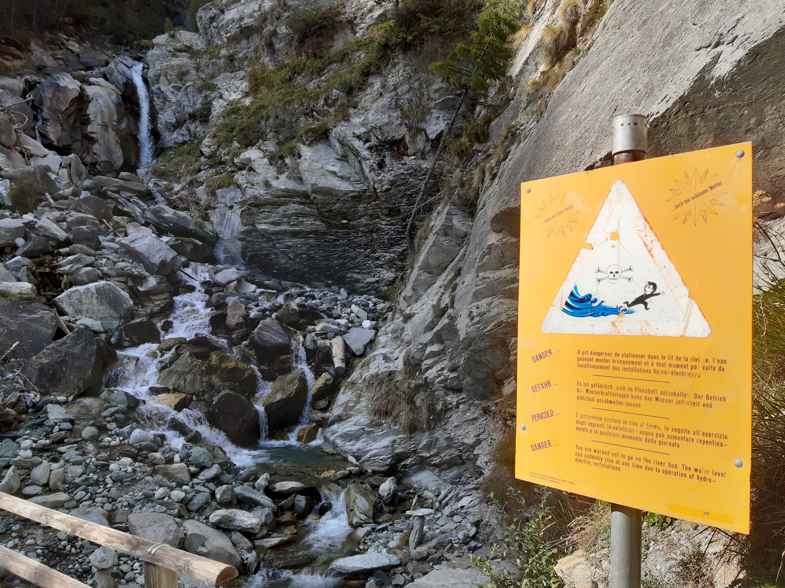
Continue until the trail splits as you near a rocky ravine. Stay on the high road towards the bridge in the distance for an easier route, or take the lower road for a challenge. Cross the bridge and follow the dirt and rock path up, following any signposts for Alterhaupt Edelweiss. This is the steepest part of the walk, but you’re almost at the refuge!
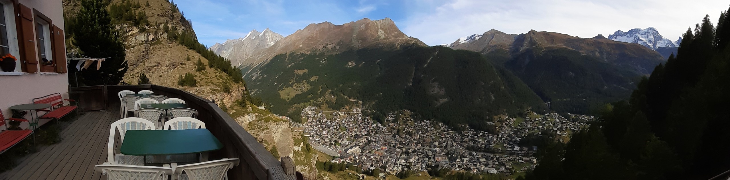
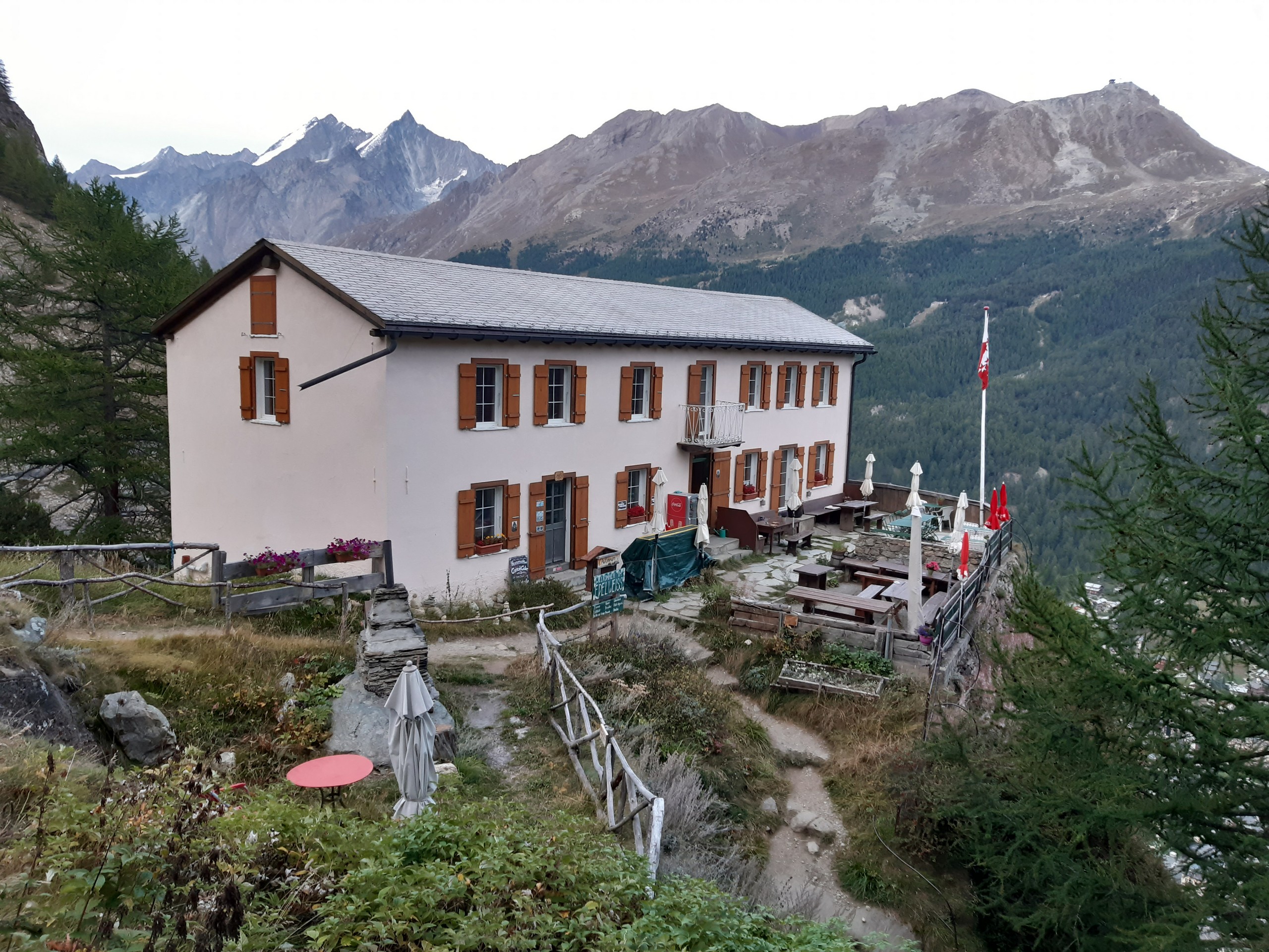
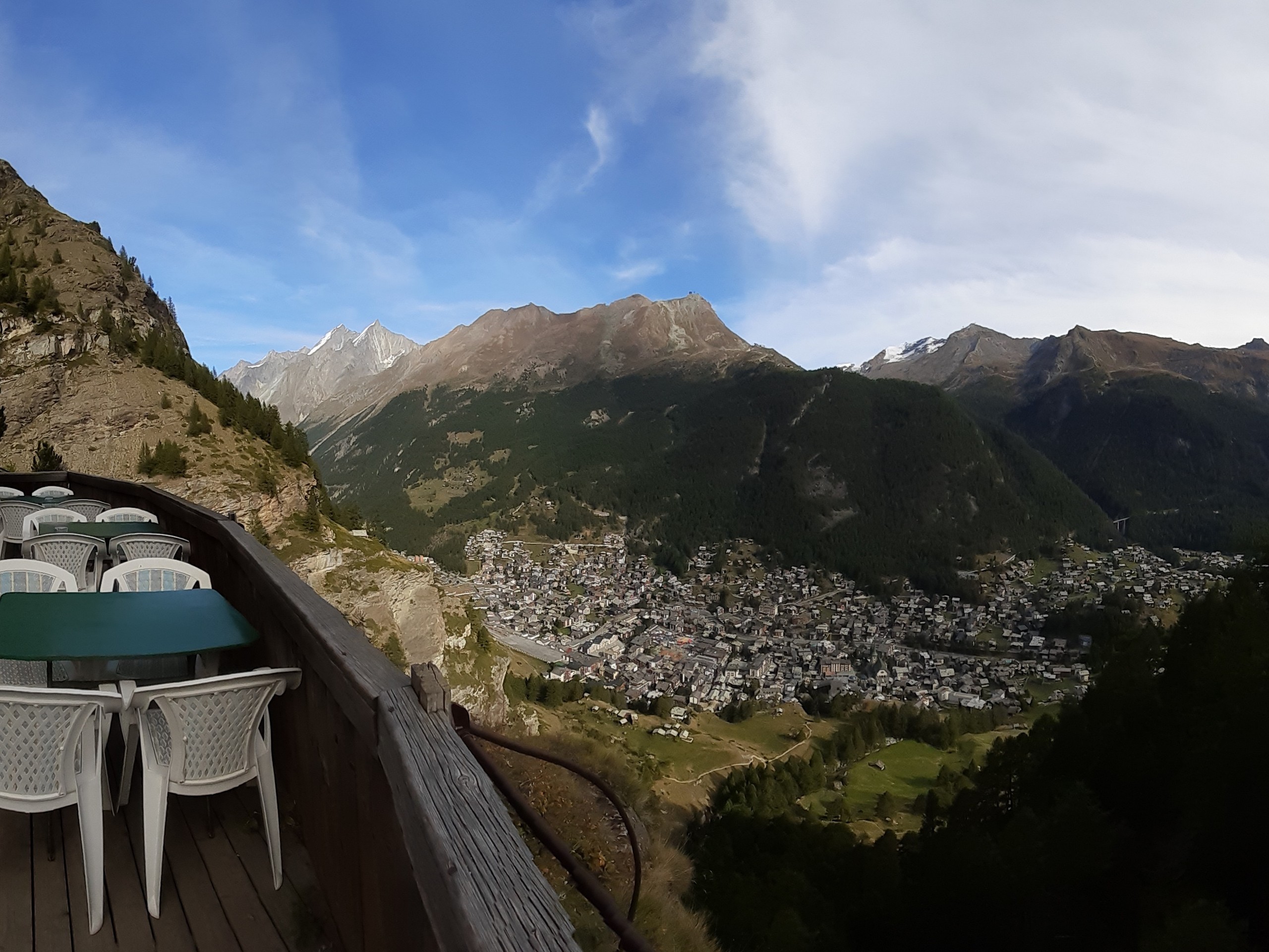
Continue along the path until you’ve arrived. Here, you can stop for lunch or refreshments, or book an overnight stay if you expect to arrive late. Make sure you visit the far end of the terrace for a regal view over the town of Zermatt directly below.
When you’re ready to continue towards Zmutt, take the track between the refuge and the BBQ and after a few metres, take the turn-off to the left that’s signposted for Zmutt (1h20min).
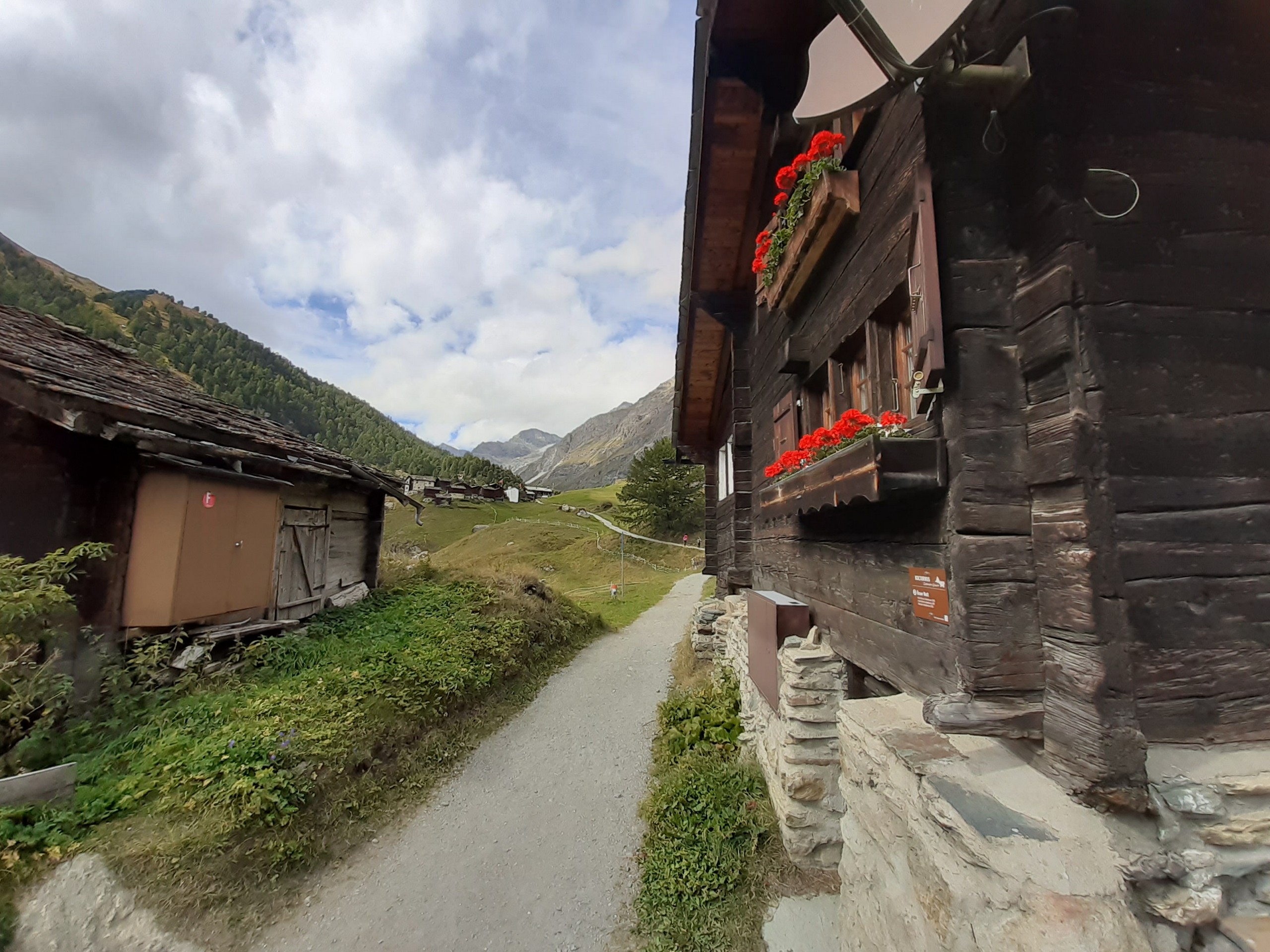
The trail leads up through a forest. Watch for rocks painted with two white stripes with a red stripe between them, although the trail is well worn and easy to follow. After a clearing with the Matterhorn emerging from behind the peaks in front, the track splits in two. Follow the lower track signposted for Zmutt. This descent, marked with yellow diamonds, crosses solid rock, blueberry fields, grazing fields with cattle gates housing the extremely photogenic Valais sheep, and a small section of forest.
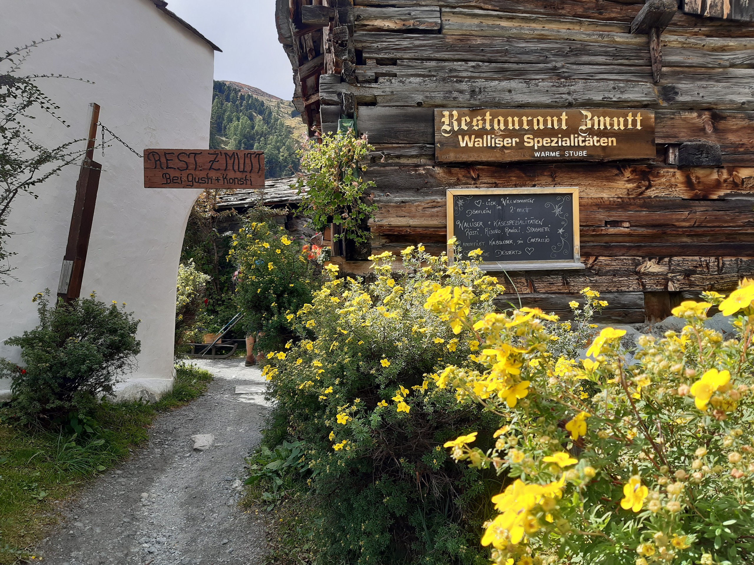
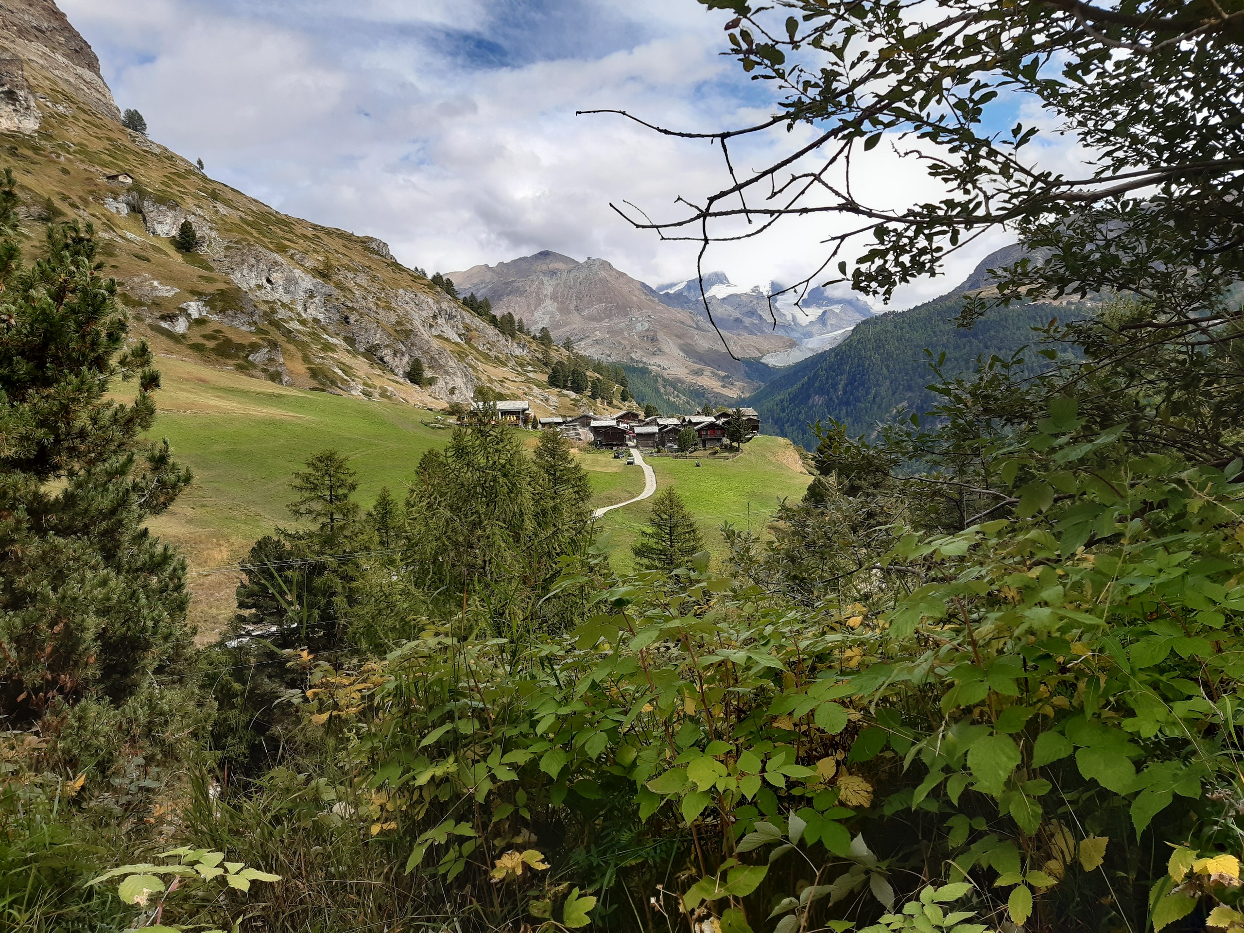
Lower down, the track meets up with other tracks shared between hikers and mountain bikers. Walk past the farmhouse on your right and turn left, following the yellow hiker sign and a sign for Kulterweg 13. Around the corner is another crossroad and signpost. Follow the direction for Zmutt to the right past a traditional wooden chalet from 1551. The gravel track leads up to the charming village of Zmutt, which has a number of restaurants open during peak summer months.
Walk through Zmutt and follow the signs towards Furi. The flat gravel pedestrian path will lead down to a bridge and up to a wide sealed road. Turn left and follow the sealed road to Furi, stopping for raspberries along the way if they’re in season.
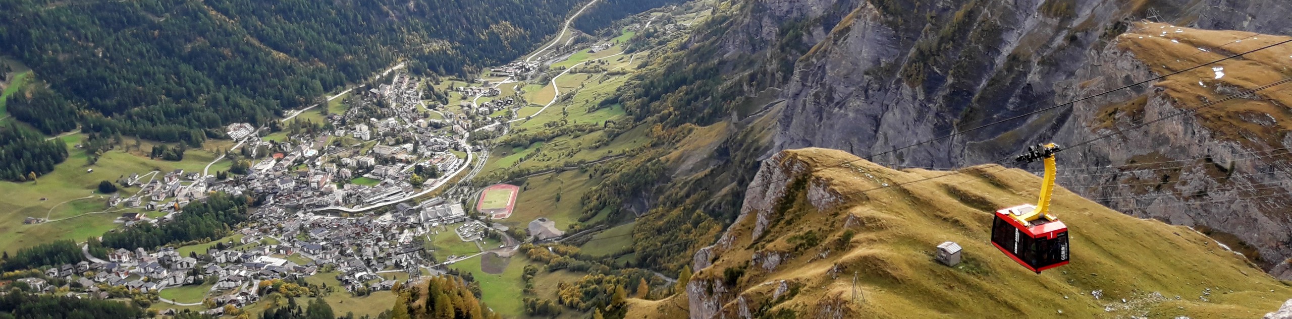
In Furi, you have the choice to take the ski lift back to Zermatt or to follow the track under the lift. If you choose to walk, take the road beside the ski lift so the lift is on your right. A few metres on when you reach the signpost, take the gravel stairs on the left which wind down the valley, alternating between stairs with a handrail and a flat path. Stay on this narrow path, which leads back under the ski lift and beside the river that leads to Zermatt.
Follow the river trail back to town and then choose your own way back to the station, which is well signposted throughout town.
Insider Hints
Zermatt is expensive, so either choose your restaurants wisely or bring your own food. The small crepe shop near the town centre is a low-cost solution!
There are no public toilets on this hike.
The peaks around Zermatt remain snowy throughout the year (the glacier is open for year-round skiing).
Similar hikes to the Edelweiss Refuge Loop hike
Matterhorn Glacier Trail
The Matterhorn Glacier Trail (Nr. 26) takes you close to the Furgg Glacier and right beside the east flank of…
Eiger Trail
The Eiger Trail skirts the north face of one of the most iconic mountains in Europe. The hike is relatively…
Daubensee
Hiking around Daubensee Lake gives you a gentle work out with a great view of glaciers, the lake, and the…
Comments