Daubensee
View Photos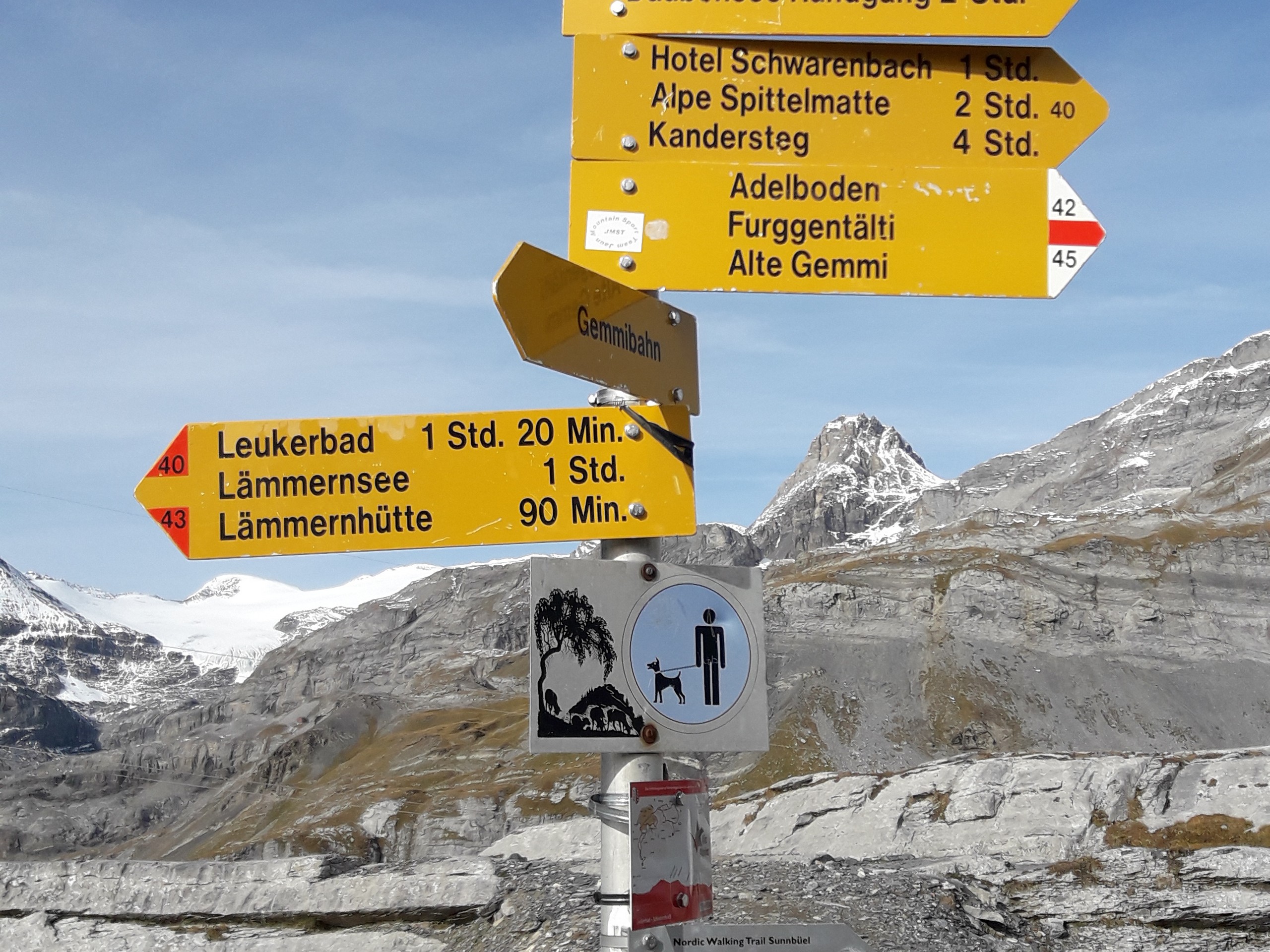
Daubensee
Difficulty Rating:
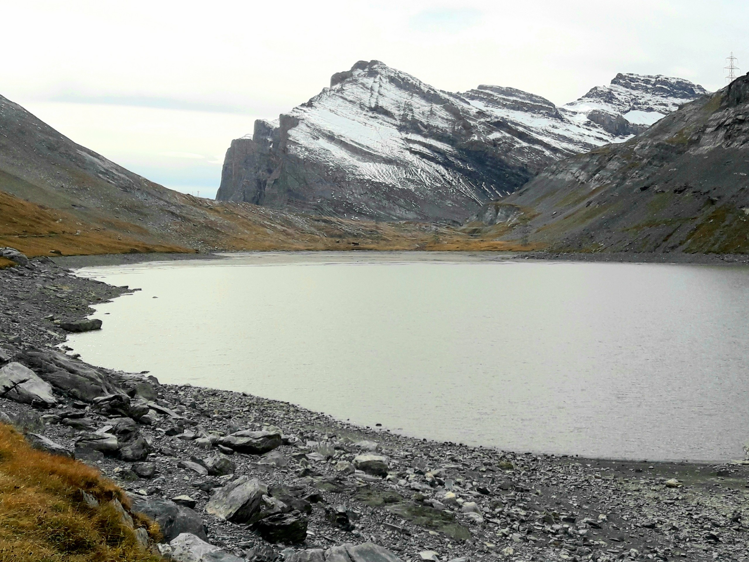
Hiking around Daubensee Lake gives you a gentle work out with a great view of glaciers, the lake, and the surrounding summits. The hike itself is not strenuous but you have to mind a bit of exposure on the narrow trail. A picnic along the trail will let you soak in the picturesque setting. Every year, a shepherd festival is held to mark the friendship between the Bernese Oberland and the Vallais region where 800 sheep are herded to the banks of the lake on the last Sunday of July.
Getting there
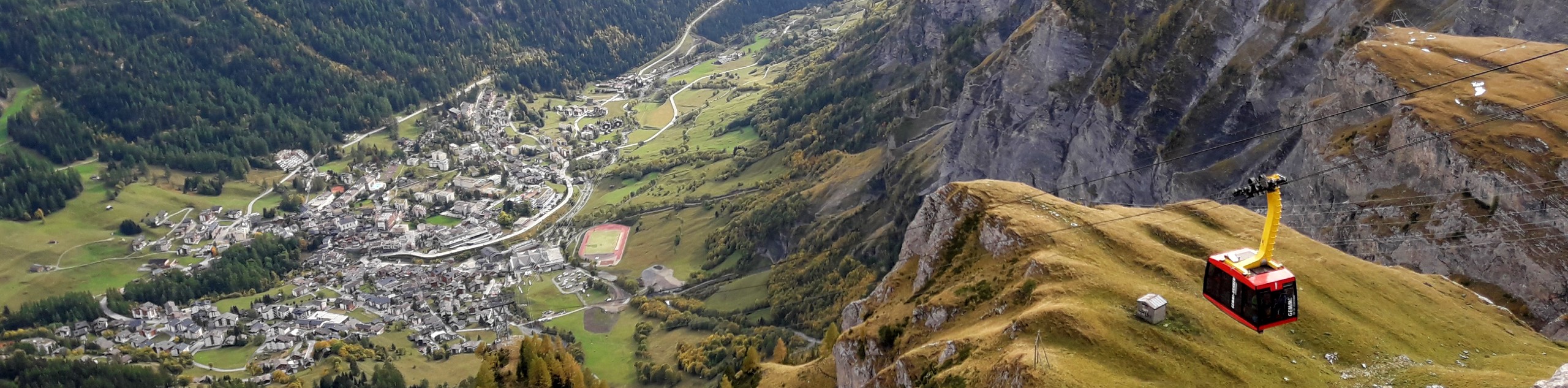
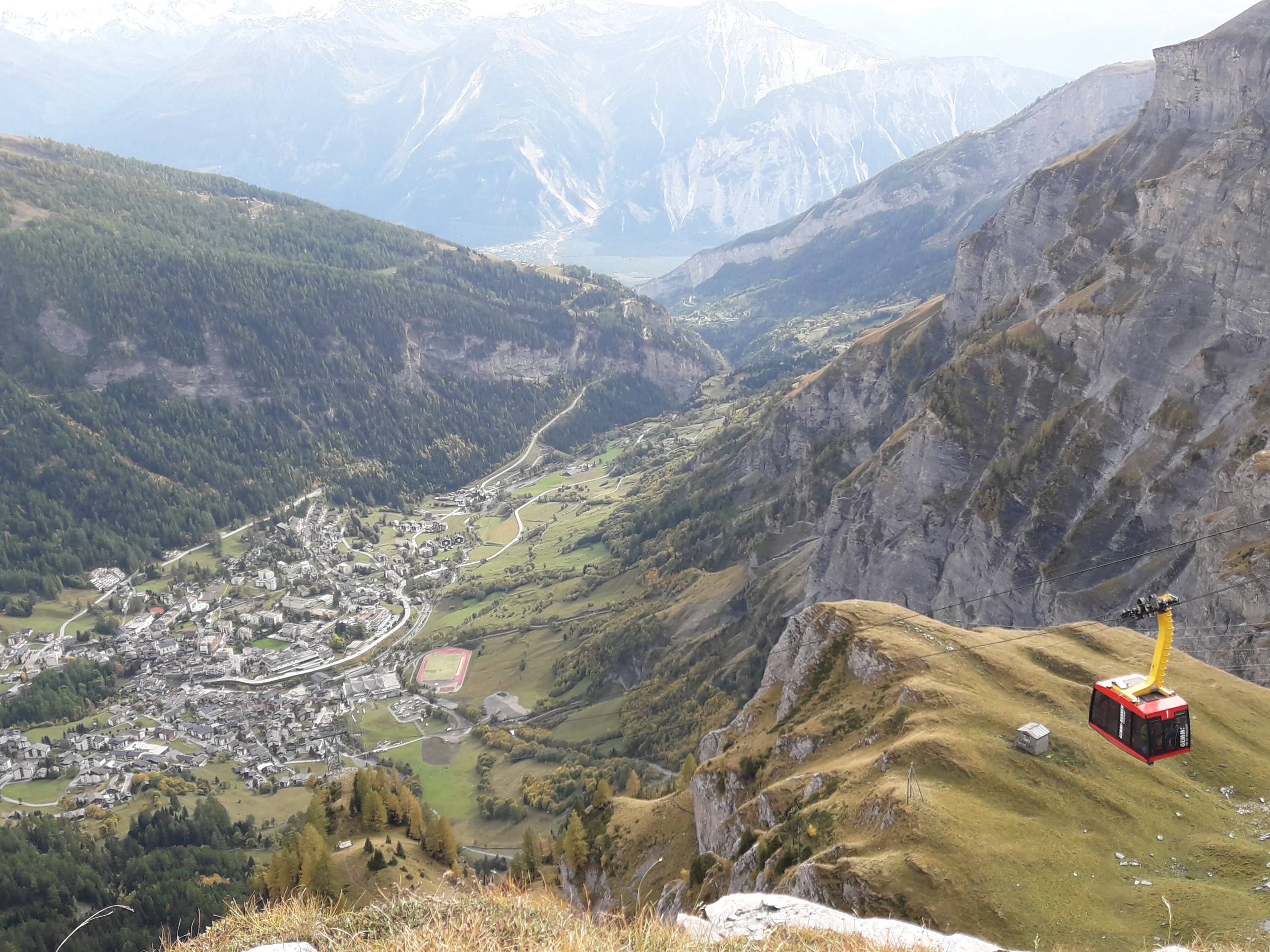
Daubensee is located in the municipality of Leukerbad in the canton of Valais (Wallis in German). From Sion, the capital city of Valais, you can drive 24.9mi to Leukerbad in about 40 minutes. Park at the Gemmi cable car station (4629ft) and get a ticket to the Gemmipass station (7710ft) which will be your jump-off point for the hike.

About
| When to do | June to October |
| Backcountry Campsites | Camping Sportarena Leukerbad |
| Pets allowed | Yes |
| Family friendly | Older Children only |
| Route Signage | Average |
| Crowd Levels | Low |
| Route Type | Circuit |
Daubensee
Elevation Graph
Weather
Route Description for Daubensee
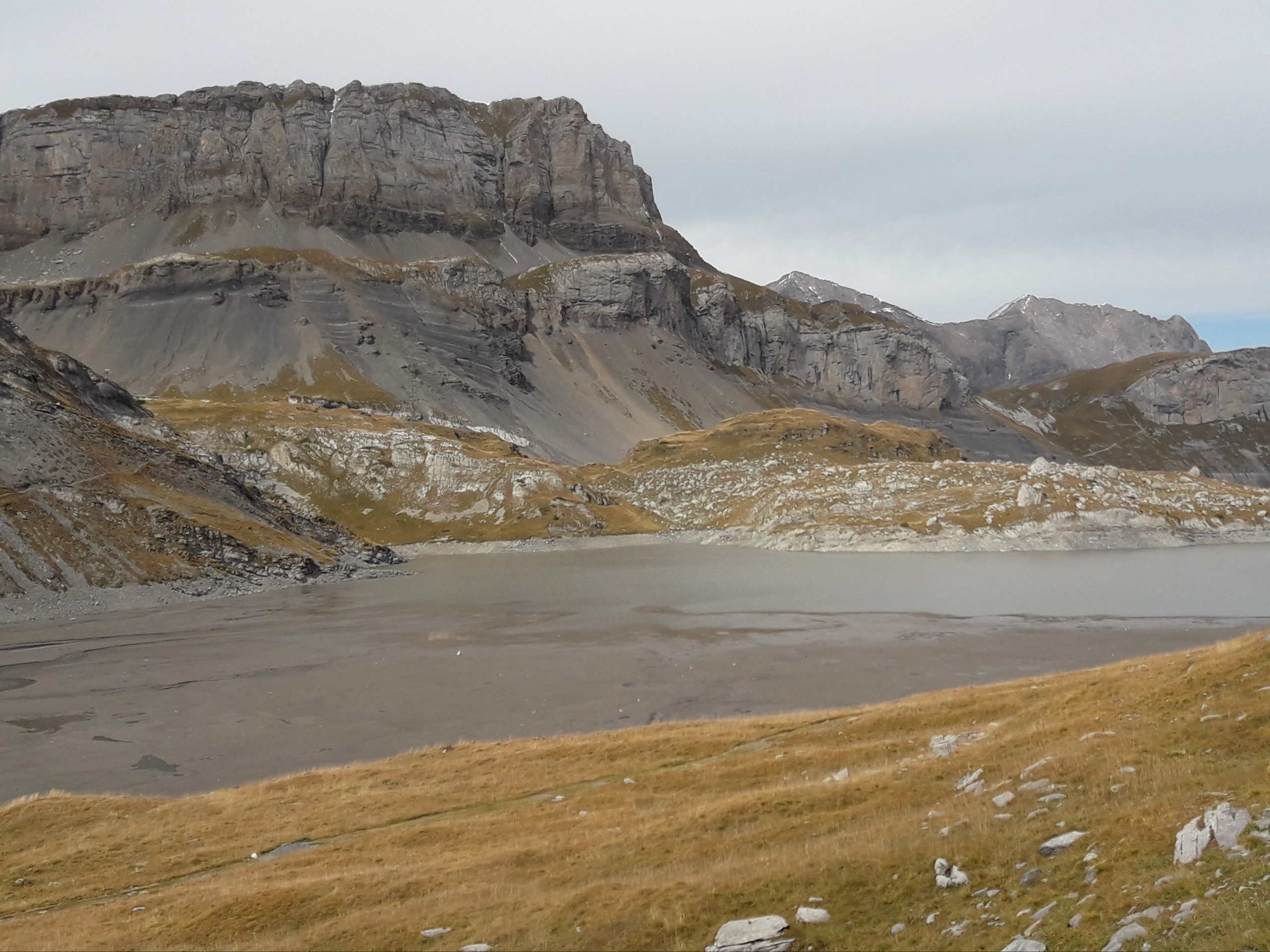
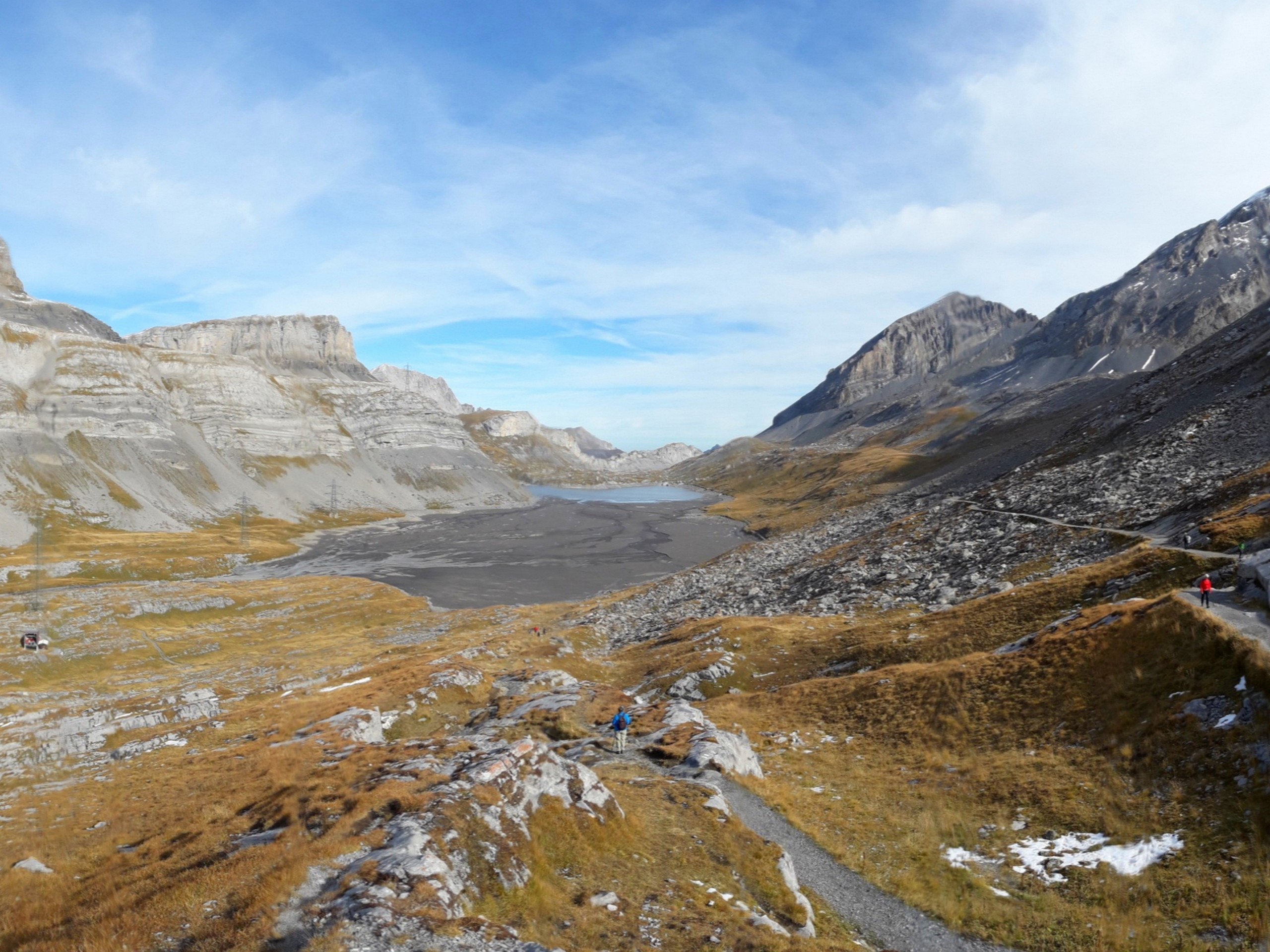
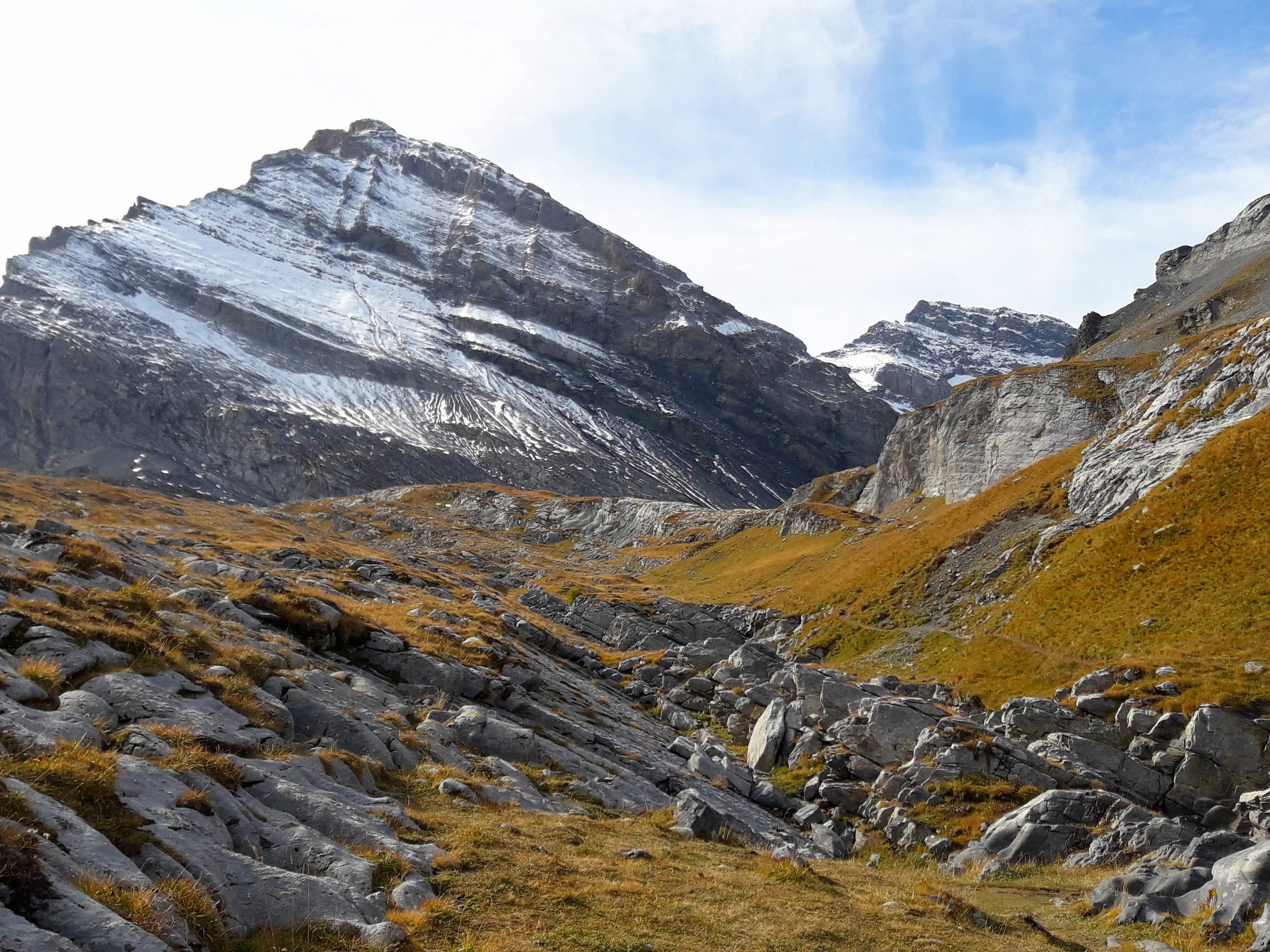
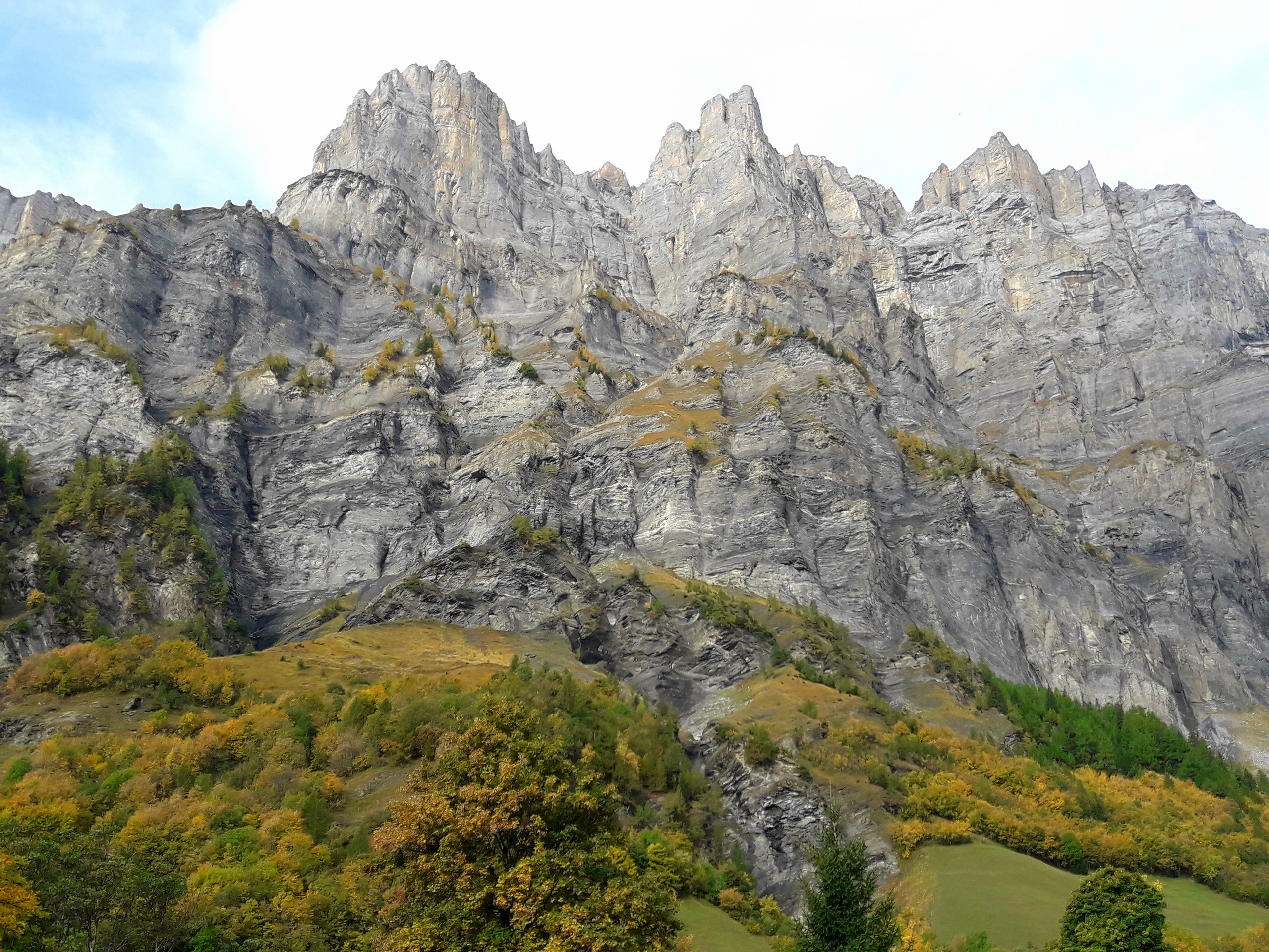
The trail surface is mostly gravel and packed dirt, so trainers or light hiking shoes should suffice. There is a restaurant and WC facility at the lift station, and there won’t be any until you return. During the hike, you will see Daubenhorn (9649ft), Schwarzhorn (10640ft), Scheerhorn (10430ft) and Llameren Glacier.
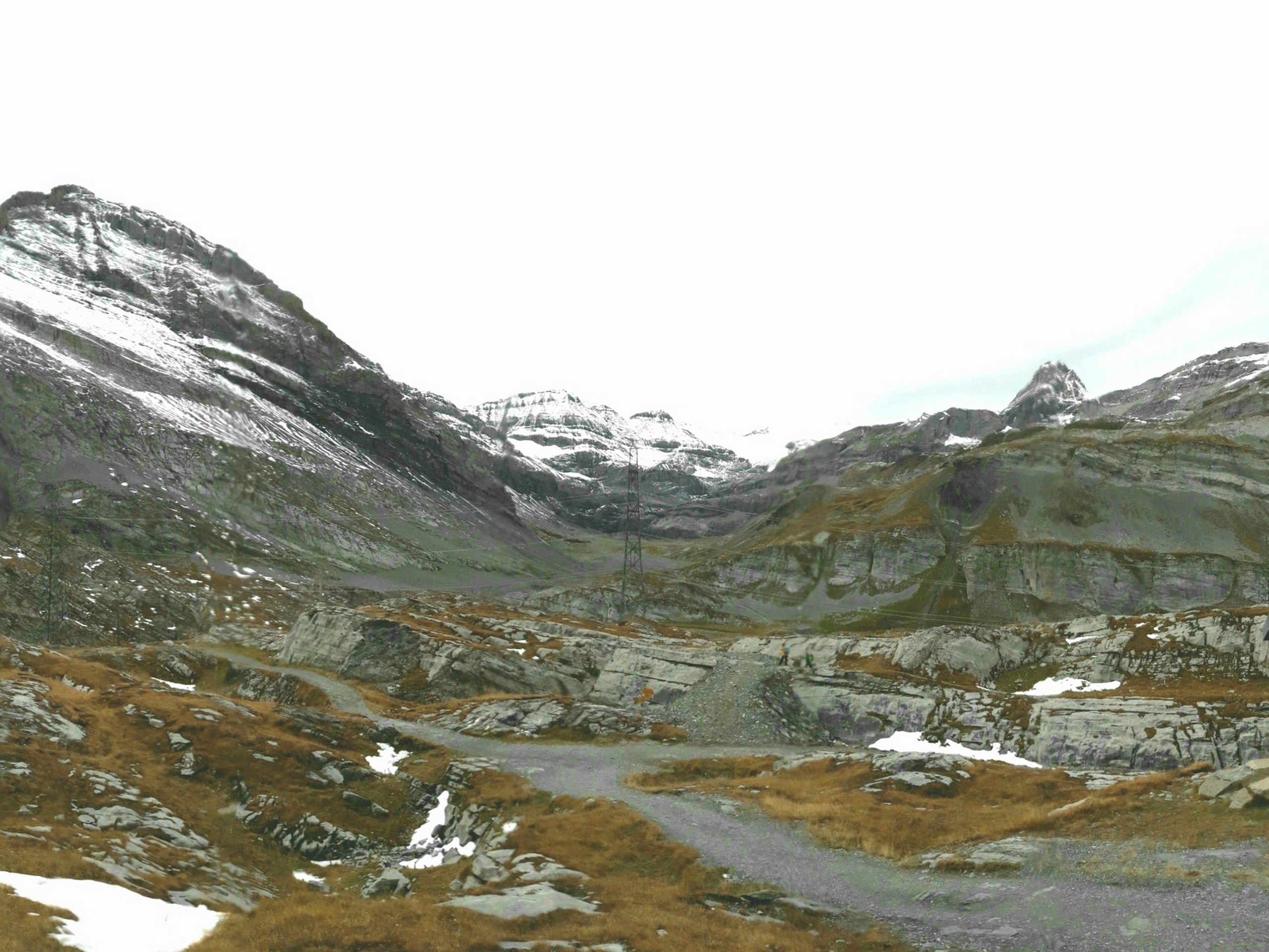
When you arrive at the Leukerbad – Gemmi lift station, check the schedule of the last lift going down for the day, then plan your hike accordingly. Take the lift up to Gemipass (7710ft). From the Gemmipass station, a lift goes down to the Daubensee lift station (about 7277ft). You could ride the lift down to the Daubensee station but it is better to walk so you can take pictures of the lake and valley.
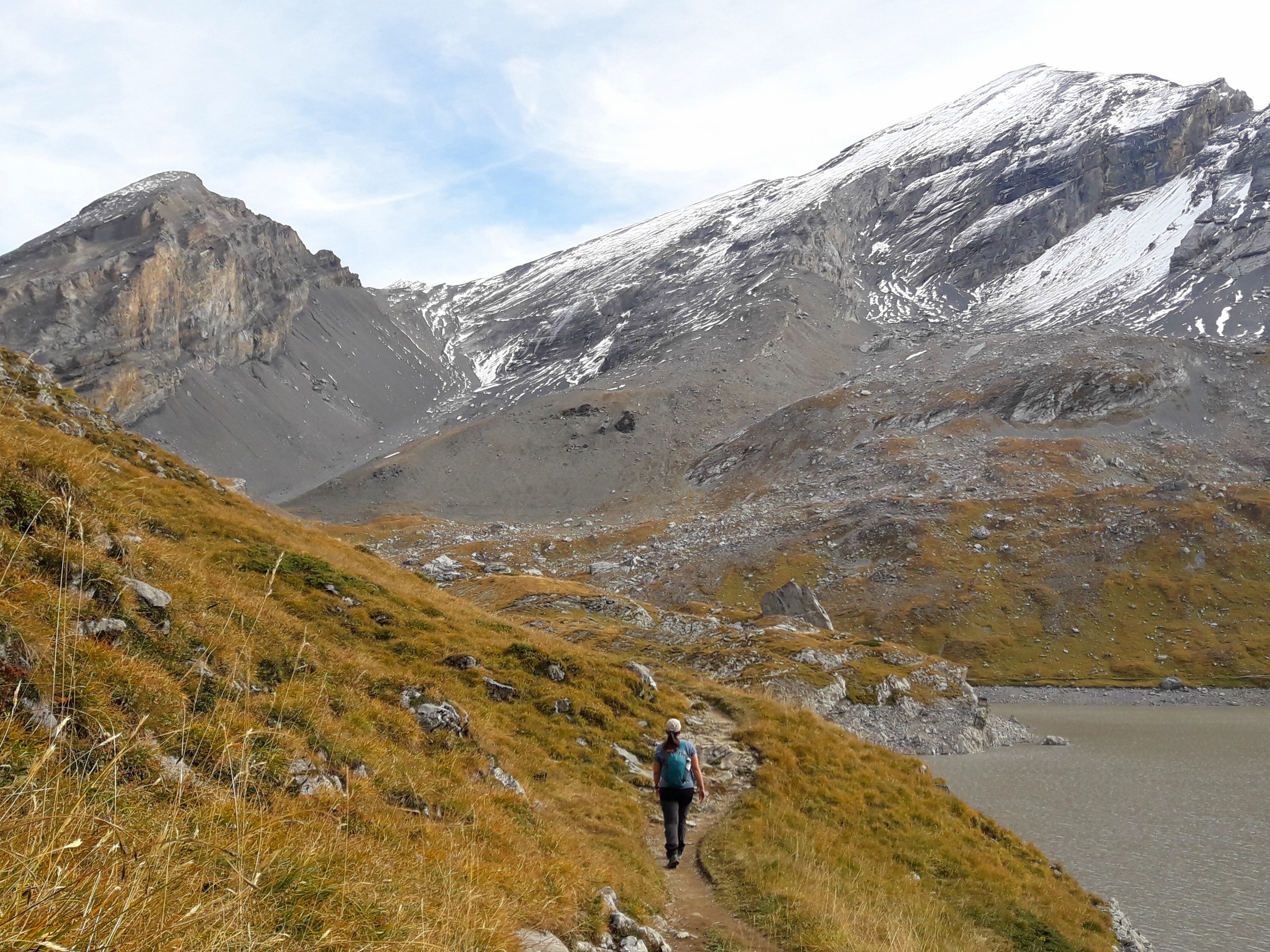
Start the hike from the Gemmipass lift station and follow the path downhill towards the lake. Check your gps and watch out for a fork on the trail that leads to the west of the lake, the path should lead you to the Daubensee lift station. The trail continues past the Daubensee lift station and crosses a small river that feeds the lake. The path will continue northward on the western bank of Daubensee, ascending gently.
The trail gets narrower and will pass an area of scree on the west side of the lake. Avoid spending too much time here as there may be danger of rockfall. Part of the trail is exposed with a steep drop to the lake on one side, so be careful and keep children close.
Keep moving until you reach the north end of the lake, ideal for a picnic. Follow the path southward on the east bank of the lake back to the Gemmipass lift station.
Insider Hints
There is a campground in Leukerbad called Camping Sportarena.
The campground can accommodate tents and campervans, and they also have rooms (no heating, basic beds) made of converted culverts, but book them well ahead
The restaurant at the Gemmipass lift station serves good food, and it’s worth a stop after your hike.
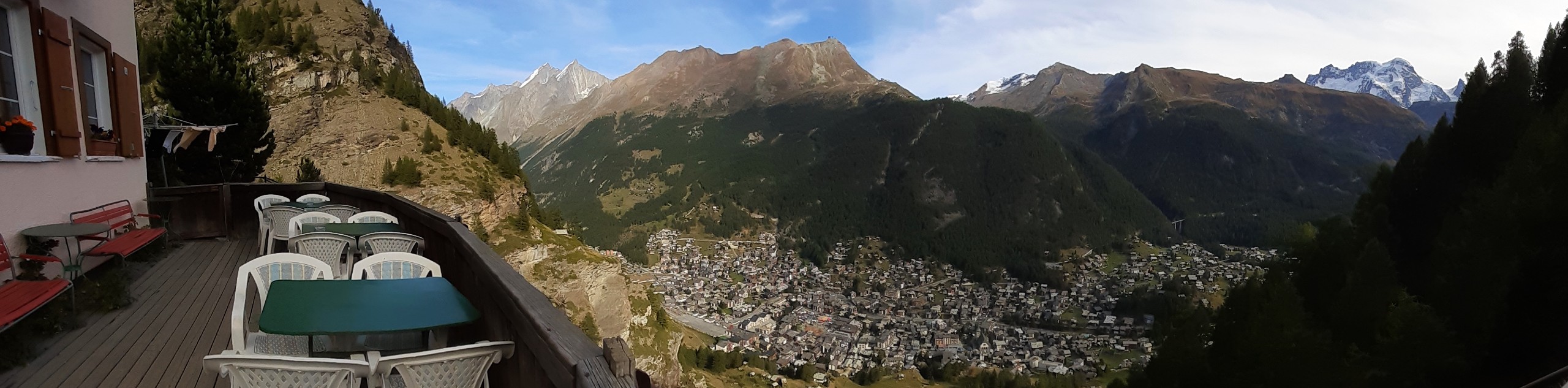
There is a viewing deck at the Gemmipass restaurant, but you can get an even better vantage point by walking about 131ft northeast of the lift station up along the cliff edge to see down the valley to Leukerbad.
If you want a more family-friendly hike, walk the path on the east side of the lake (right side of the lake coming from the lift station) all the way to the north end, then reverse your route back to the lift station to avoid the exposed portion of the trail.
Similar hikes to the Daubensee hike
Matterhorn Glacier Trail
The Matterhorn Glacier Trail (Nr. 26) takes you close to the Furgg Glacier and right beside the east flank of…
Eiger Trail
The Eiger Trail skirts the north face of one of the most iconic mountains in Europe. The hike is relatively…
Edelweiss Refuge Loop
Zermatt is an area strewn with hiking trails that intersect on well signposted routes. This hike can be altered depending…
Comments