Aletsch Glacier
View Photos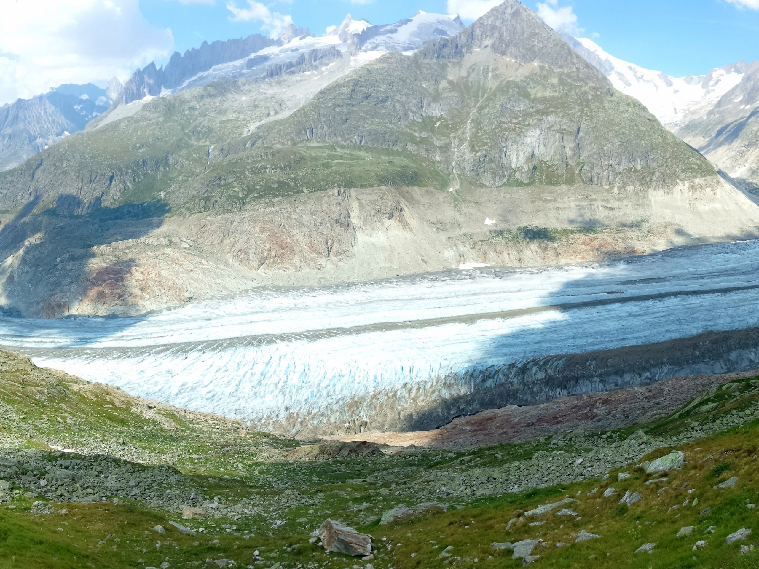
Aletsch Glacier
Difficulty Rating:
The Aletsch Glacier hike gives you a great view of the largest glacier in the Alps from an elevated vantage point. The hike is easy and starts with a gentle descent. There is a chance you will encounter marmots on the trail.
Getting there
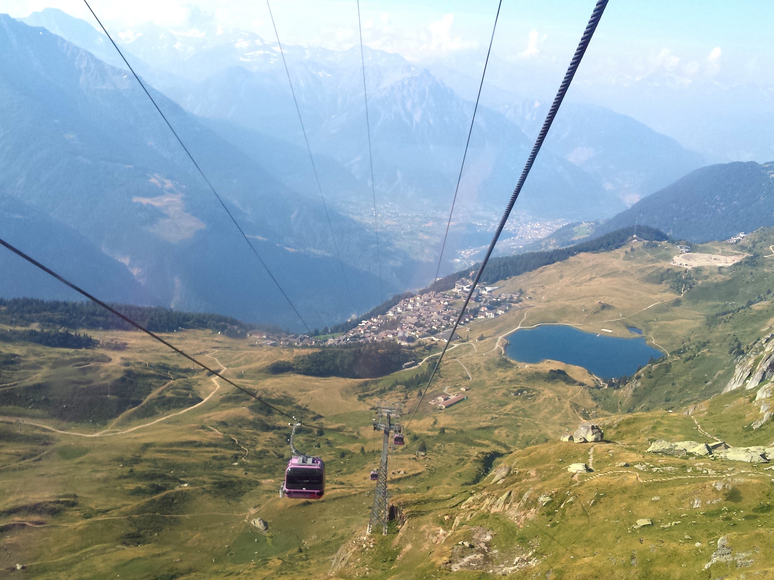
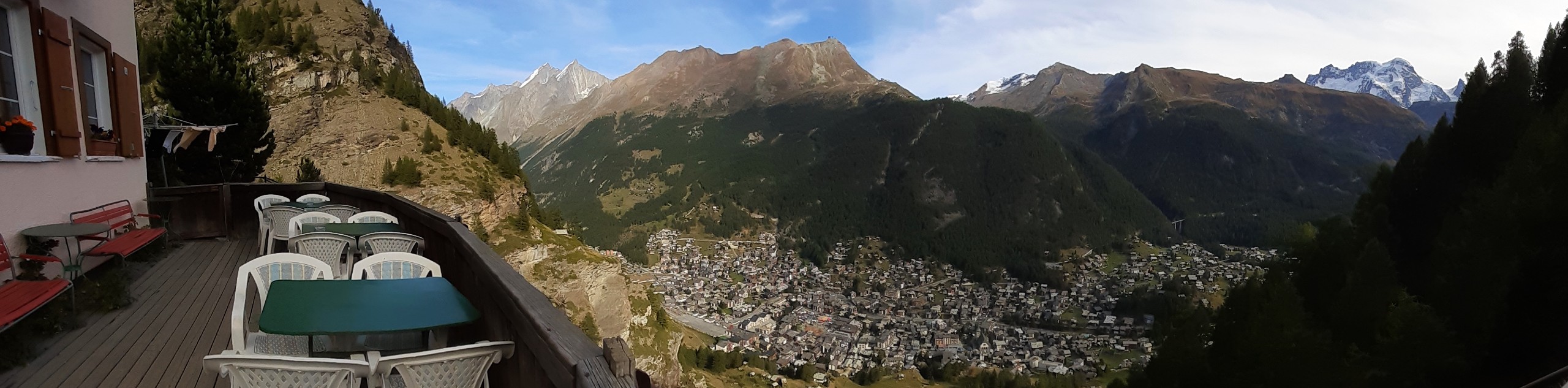
The Aletsch Glacier is near Bettmeralp, in the Canton of Valais. From Lausanne, you can drive 105.6mi to Bettmeralp (about two and a half hours). You will need to take a lift up to Bettmeralp village at 6562ft elevation. Another lift to Bettmerhorn lift station (8661ft) takes you to the start of the hike.

About
| When to do | May to October |
| Backcountry Campsites | No |
| Pets allowed | Yes |
| Family friendly | Older Children only |
| Route Signage | Average |
| Crowd Levels | Low |
| Route Type | Out and back |
Aletsch Glacier
Elevation Graph
Weather
Route Description for Aletsch Glacier
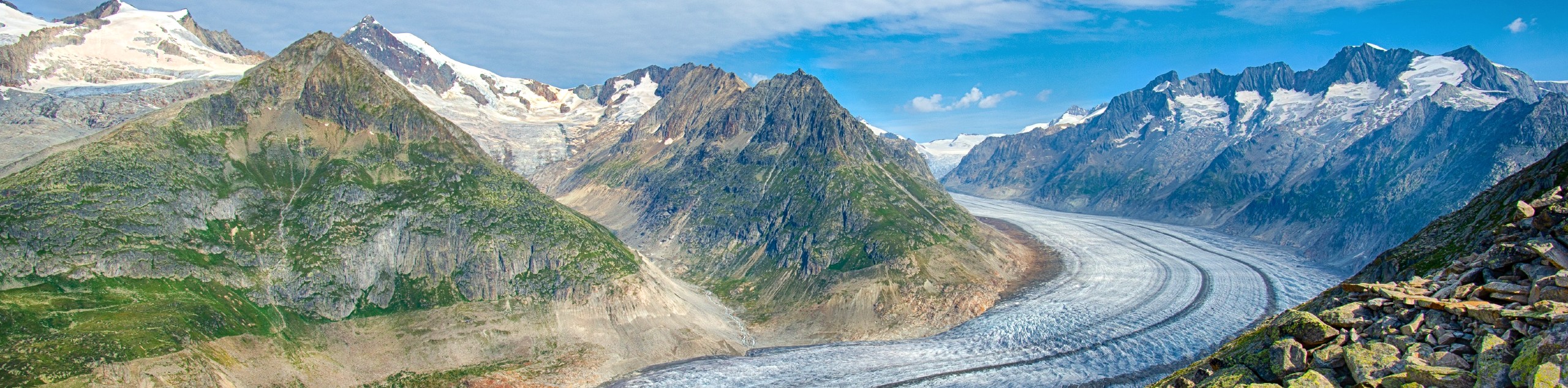
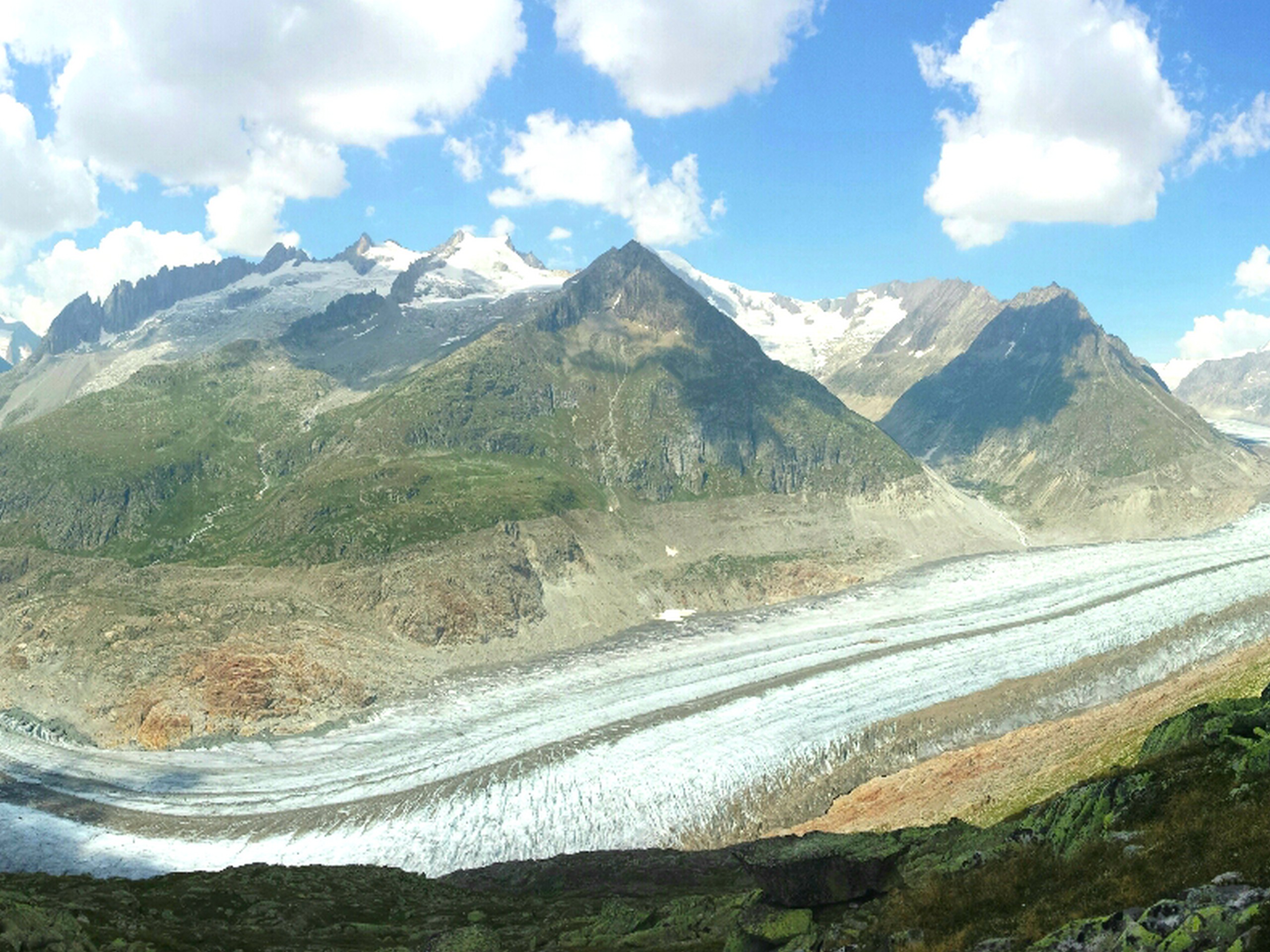
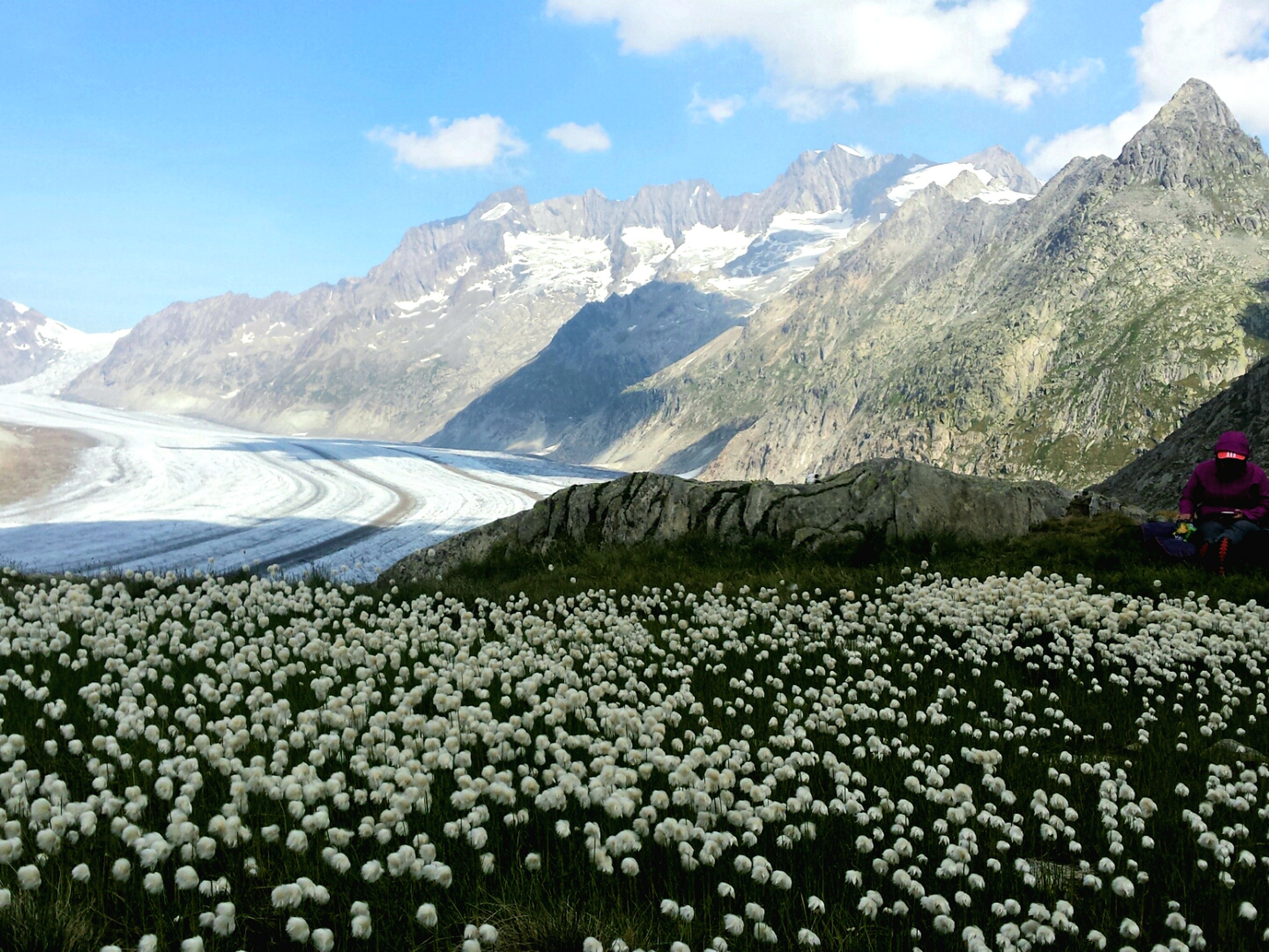
The Aletsch Glacier is the largest glacier in the Swiss Alps at a staggering 14.3mi long. This route will take you on a trail alongside the glacier from a safe distance. The trail is rocky, so light hiking boots are recommended as a baseline. There is a restaurant and restroom at the Bettmerhorn station should you need a quick break, as there are no amenities after this.
Find out what time the last lift will operate from Bettmerhorn station and set a turn around time for your group. Once you hit this time, head back to the lift station even if you have not reached the turn around point of the GPS route. You don’t want to get stuck!
From the Bettmerhorn lift station, follow the trail westward and downhill towards the glacier. There is a fork on the trail about 1640ft from the lift station, head to the right here.
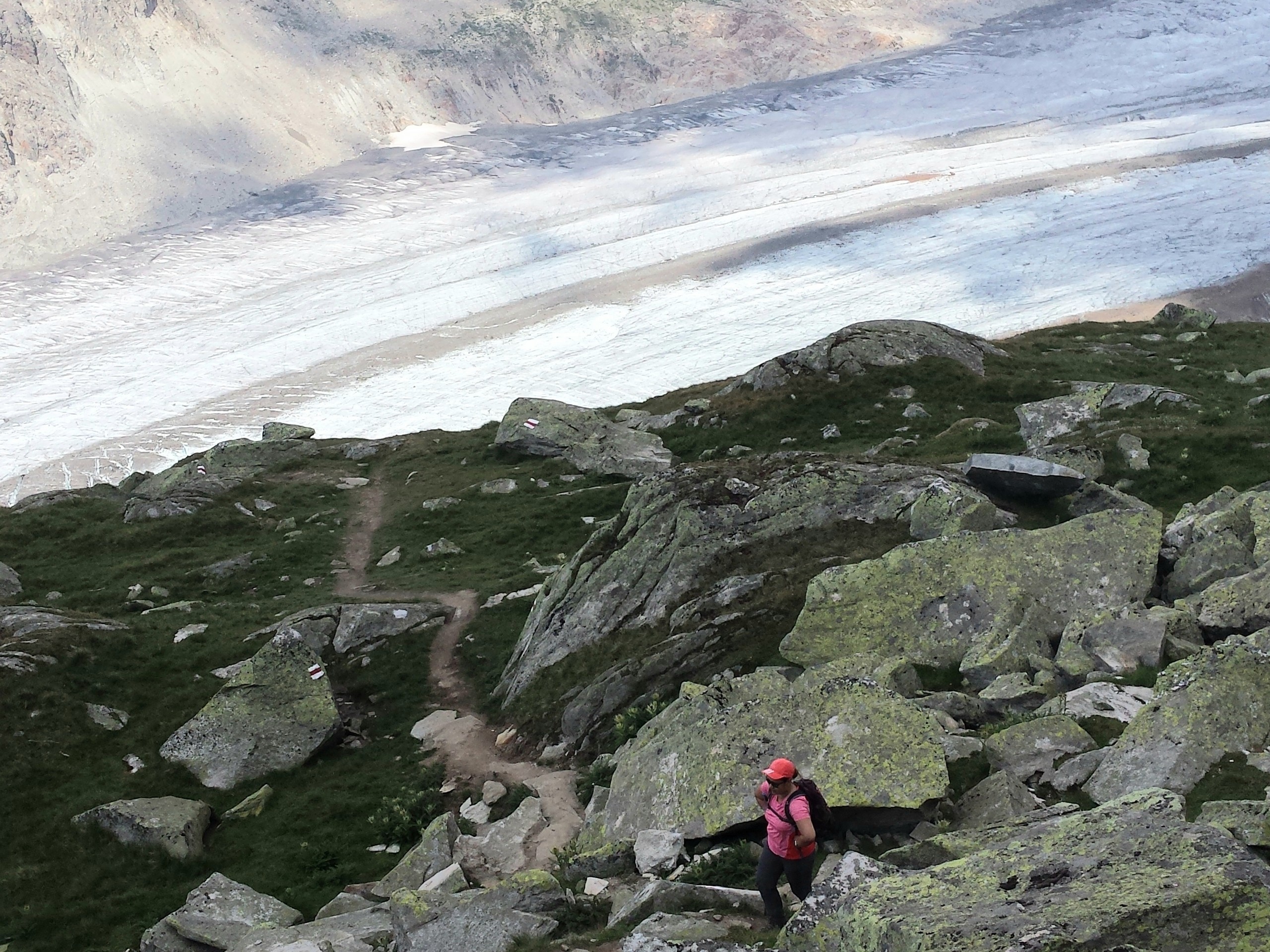
The trail zig zags steeply downwards to the glacier then levels out and heads northeastward parallel to the glacier. You will cross an area of moraine or unconsolidated rocks, and we recommend moving through this section without delay due to the possibility of rockfall.
Follow the trail until you hit the turnaround point indicated by the GPS route, about 1.9mi from the lift station. This is a great time for a picnic. Reverse the route back to the lift station with some time allowance before the last lift service for the day. The trail becomes steep as you get near the lift station, so save a bit of energy for the end.
Insider Hints
There is multi-day parking at the lower lift station below Bettmeralp.
Have your camera ready in case you spot a marmot beside the trail.
Staying overnight or two at Bettmeralp village will give you more time to enjoy the hike and surrounding area. Several hotels are located in the village, but book ahead.
If you will stay in a hotel in Bettmeralp, take note that all your luggage has to go up by the gondola
Similar hikes to the Aletsch Glacier hike
Matterhorn Glacier Trail
The Matterhorn Glacier Trail (Nr. 26) takes you close to the Furgg Glacier and right beside the east flank of…
Eiger Trail
The Eiger Trail skirts the north face of one of the most iconic mountains in Europe. The hike is relatively…
Edelweiss Refuge Loop
Zermatt is an area strewn with hiking trails that intersect on well signposted routes. This hike can be altered depending…
Comments