Alltwen to Mynydd y Dref Walk
View Photos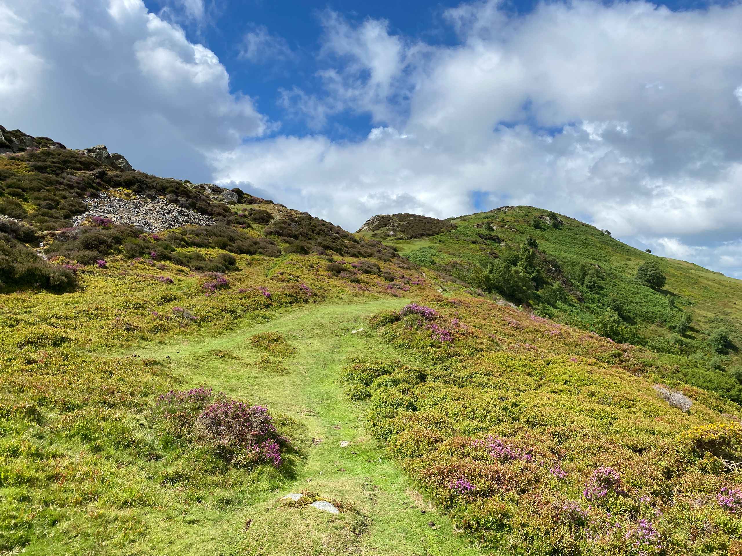
Alltwen to Mynydd y Dref Walk
Difficulty Rating:
Alltwen to Mynydd y Dref is a wonderful walk when you’re a bit short on time for Snowdonia’s larger mountains, or if you’re visiting Conwy and want some excellent views of the area. The walk starts at a lay-by along a road running south of the mountains, and quickly ascends to the summit of Alltwen. Then it’s north to Penmaen-Bach, the second of your three summits, with the opportunity for a quick scramble if you’re keen. Finally, the North Wales Path leads you to the top of Mynydd y Dref (Conwy Mountain). After taking in the sea views, return along the North Wales Path back to the lay-by to wrap up the adventure.
Getting there
The Alltwen to Mynydd y Dref Walk starts along the Sychnant Pass Rd., which runs from Conwy in the east to Penmaenmawr in the west. If driving west from Conwy, you’ll reach a lay-by in approximately 2.5mi, just past the Pensychnant Conservation Centre. Pull over here to park and start the walk.

About
| When to do | February-November |
| Backcountry Campsites | No |
| Pets allowed | Yes - On Leash |
| Family friendly | Older Children only |
| Route Signage | Average |
| Crowd Levels | Moderate |
| Route Type | Lollipop |
Alltwen to Mynydd y Dref Walk
Elevation Graph
Weather
Alltwen to Mynydd y Dref Walk Description
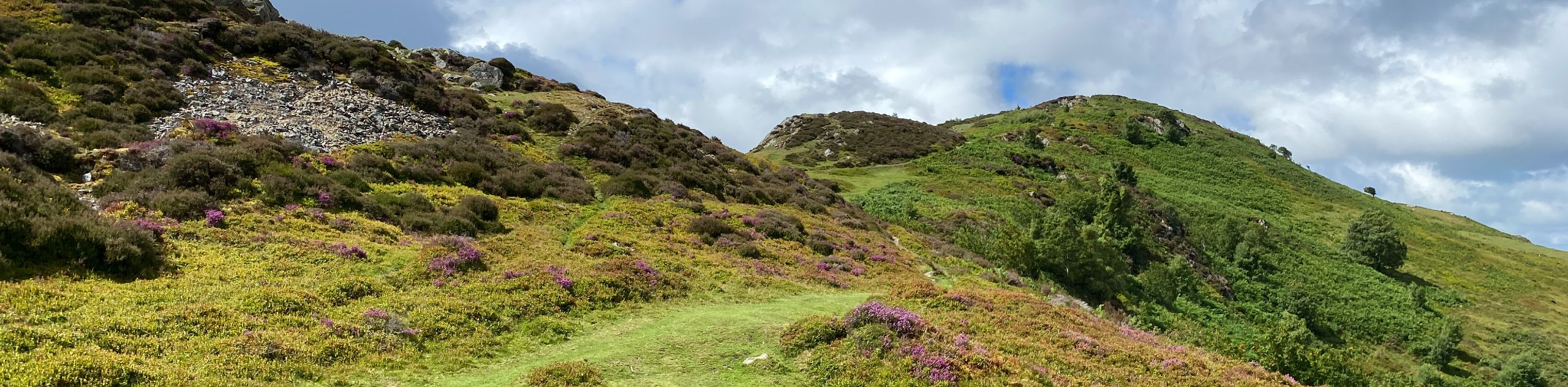
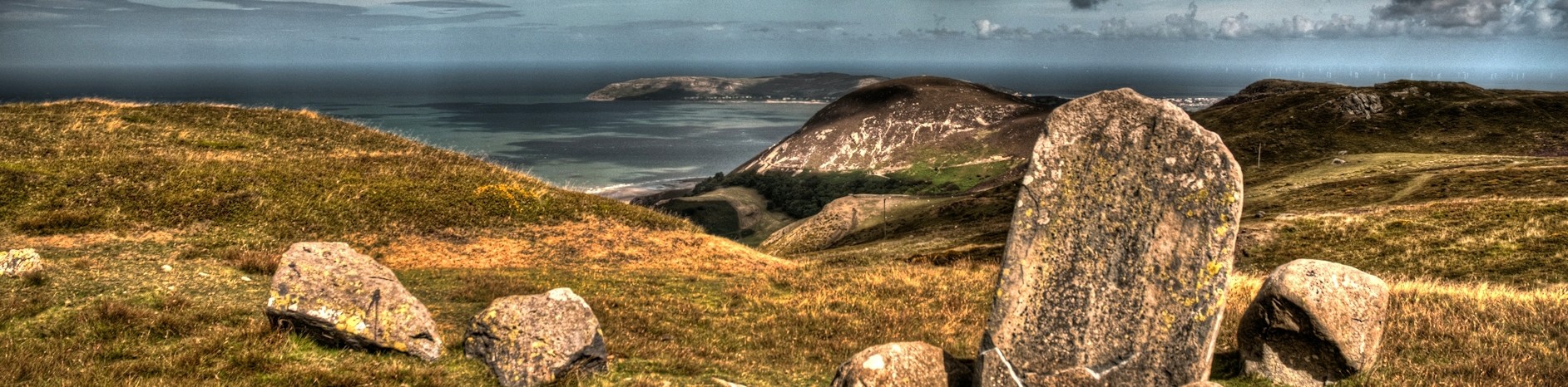
Head up from the lay-by on the path that originates from its western end. This path soon turns quite distinctly to the right, but another narrow path continues ahead along your northwest bearing. Follow this up to the summit of Alltwen. It’s a short but relatively steep ascent, rewarding you with panoramic views of Puffin Island to the northwest and the Carneddau range to the south. Your next peak is Penmaen-Bach, reached by a path that leads north and slightly east past a wall. The most direct route to the summit is a quick scramble, marked on this map—you can also simply follow the path as it loops around to the top.
The final peak of the day is Mynydd y Dref (also known as Conwy Mountain). A narrow path leads south then southeast along a wall, soon joining up with the broad North Wales Path. Turn left and ramble along this easily followed path east to the summit of Mynydd y Dref. Excellent views of the sea on one side and the Carneddau on the other reward your efforts. When you’re ready to descend, turn back and follow the North Wales Path the way you came, walking all the way back to the very first path you came in on. You’ll need to ford a stream before turning left to make your way back to the car park.
Similar hikes to the Alltwen to Mynydd y Dref Walk hike

Foel Goch via Bwlch Tryfan Walk
A walk up Foel Goch via Bwlch Tryfan is an excellent way to take in the iconic beauty of Tryfan…
Moel Wnion from Rachub
Walking up Moel Wnion from Rachub is a superb exploration of the Carneddau’s lower reaches. A gate at the end…
Druid’s Circle Walk
The Druid’s Circle Walk is a unique adventure in the hills of northwestern Wales. While plenty of Snowdonia walks offer…
Comments