Shark Fin Cove Loop
View Photos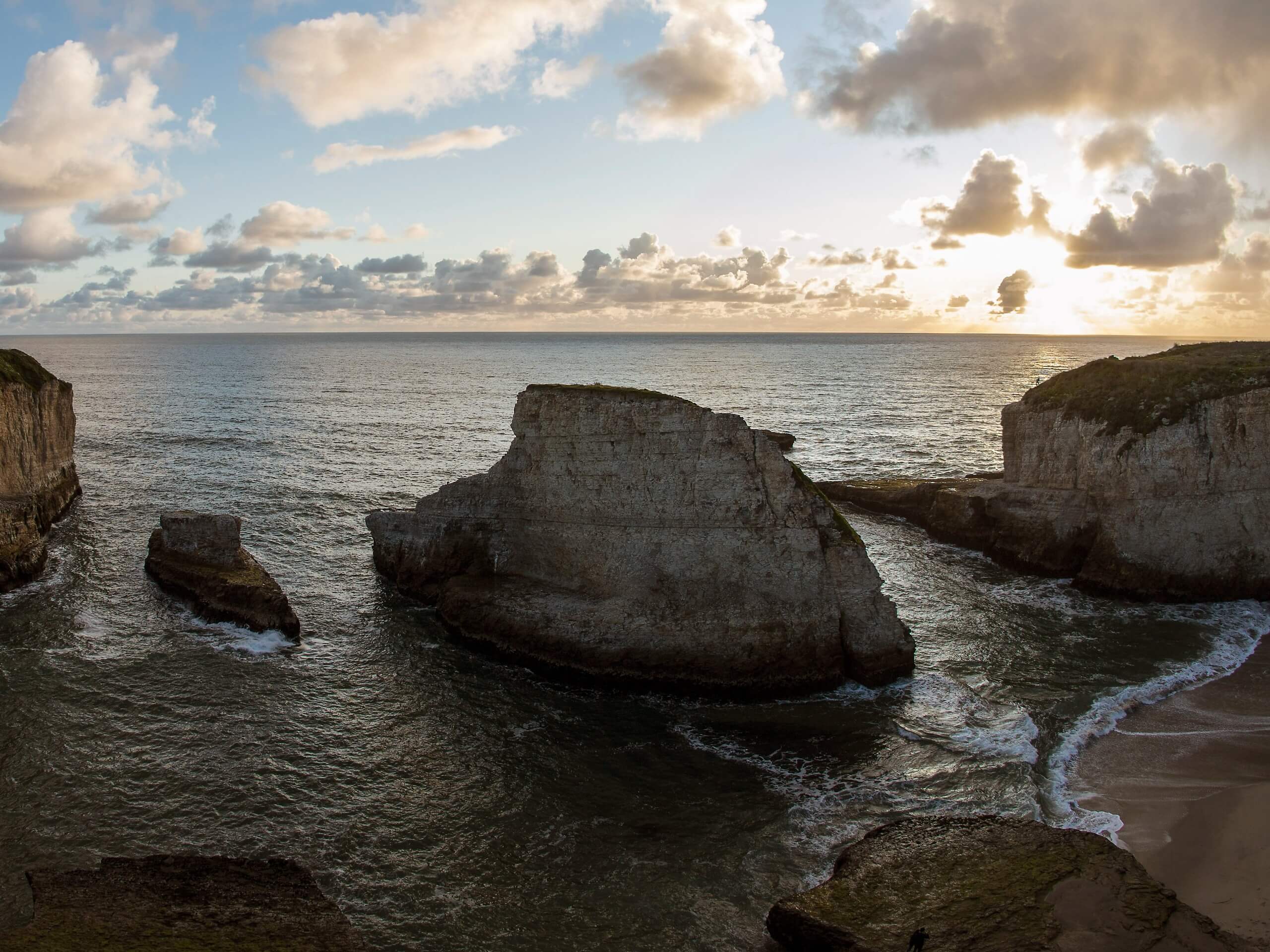
Shark Fin Cove Loop
Difficulty Rating:
The Shark Fin Cove Loop is a wonderful expedition along the California coast that boasts breathtaking maritime views. Plunge down onto the pristine beaches and explore the impressive sea cave before climbing up to the cultivated farmlands atop the cape. When in the San Francisco area, a trip to this beautiful setting is well worth the detour.
Getting there
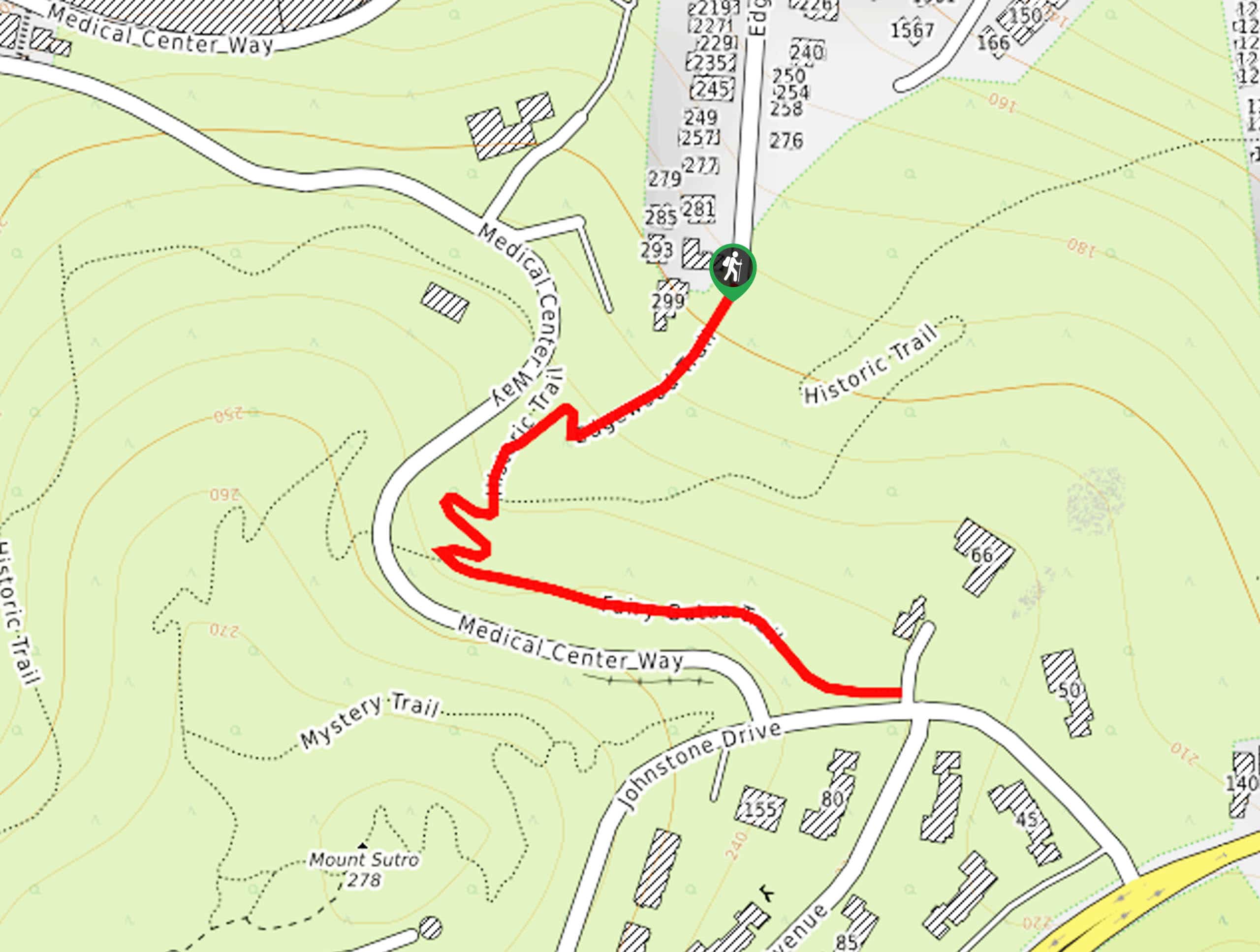
The Shark Fin Cove Loop Hike departs from the parking lot and trailhead off State Route 1.

About
| Backcountry Campground | No |
| When to do | Year-round |
| Pets allowed | No |
| Family friendly | Yes |
| Route Signage | Average |
| Crowd Levels | High |
| Route Type | Lollipop |
Shark Fin Cove Loop
Elevation Graph
Weather
Shark Fin Cove Loop Description
The Shark Fin Cove Loop boasts an unrivaled experience. Located south of San Francisco, this route attracts plenty of weekend traffic—mostly composed of city-goers seeking an urban escape. Those seeking a more secluded experience are encouraged to head out on early weekday mornings to beat the crowds. Note sections of this hike are steep—so exercise careful footing and take your time. Additionally, when exploring the Shark Fin Cove, it is important to be mindful of the tides and crashing surf—only venture into the sea cave at low tide. Additionally, this hike is often windy and shrouded in fog—so dress in layers as insurance against changing conditions.
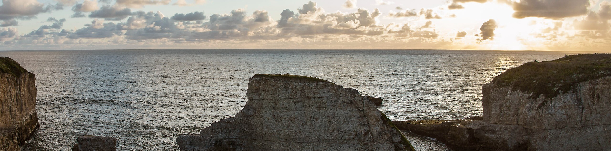
It is no surprise that this area is often abundant with photographers and sightseers—the Shark Fin Cove Loop exhibits other-worldly views of the dramatic coastal headlands, the surging surf, and the shark tooth-shaped rock. Head out in the evening to enjoy the scene of the golden sun setting over the Pacific, lighting the side of Shark Tooth Rock in a postcard perfect manner. Intrepid explorers can even scale down the coastal cliffs to Shark Fin Cove—an eroded sea cave along the pristine shoreline. This wonderful trail is unlike no other, and we cannot recommend it enough—just don’t forget to charge your camera.
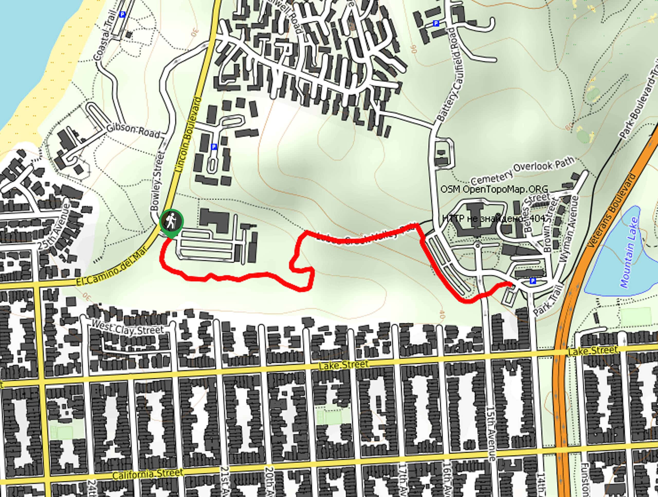
Embark on your adventure along the Shark Fin Cove Loop from the trailhead off State Route 1. Setting out from here, take the Bonny Doon Access Tail down the vertiginous terrain to the sandy beach. Mind your footing on the sheer bluff, and you will soon intersect with Liddell Creek. Travel north along the sandy beach, merging onto the northernmost access trail back up to the top of the headlands. When you reach this intersection, follow the leftmost trail, hugging the edge of the cliffs. Enjoy the inspiring views of the Pacific and the dramatic coastline that stretches along the surf. Following this route, you will ultimately reach the access trail down to Shark Tooth Beach—take this route down the cape to the beach.
Admire the beauty of Shark Tooth that adorns the Pacific, and if the tide is low, explore Shark Fin Cove. Explore at your leisure and take plenty of photos before climbing northwest back up to the top of the headlands. This lovely path will guide you back along the edge of the coastal cliffs through the cultivated farmlands. Appreciate the scene of the lush vegetation adorned with seasonal wildflowers, and at the following two junctions, turn right. Now meandering southeast away from the coast through the verdant meadowlands and alongside the railroad, you will ultimately be delivered back to the trailhead, marking the end of your epic excursion.
Trail Highlights
Shark Fin Rock
Shark Fin Cave is located in the Coast Dairies State Park, south of San Francisco down State Route 1. The beach is named not for an abundance of sharks, but instead for the shark tooth-shaped rock formation that protrudes from the Pacific. It is believed that thousands of years ago this rock was an extension of the headlands, but years of coastal geomorphology eroded the cliffs.
Shark Fin Cove
This wonderful area also boasts another geological wonder—Shark Fin Cove. The amazing sea cave beckons exploration from visiting adventurers. When exploring, it is important to be mindful of the tides and crashing surf—avoid this area when the water is high to avoid getting caught in the eroded cove. Head out at sunset and enjoy the scene of the sea cave framing the impressive outcrop in the waters.
Frequently Asked Questions
Are there sharks at Shark Fin Cove?
Contrary to popular belief, sharks are not a danger at Shark Fin Cove—instead, it’s the crashing surf when exploring the sea cave!
Where is Shark Fin Cove?
Shark Fin Cove is located off State Route 1 south of San Francisco.
Are dogs permitted In Shark Fin Cove?
Dogs are permitted on the trails along Shark Fin Cove, but they are not allowed on the beach.
Insider Hints
Be mindful of the crashing surf when exploring the shoreline
Maintain on the marked paths when wandering along the headlands as the drop-offs are incredibly steep
Charge your camera, the scenes along this route are picture-perfect
Please pack out all your garbage and do not bring glass onto the beach
Similar hikes to the Shark Fin Cove Loop hike
Lobos Creek Valley Path Hike
The Lobos Valley Creek Path Hike is a lovely adventure in Presidio Park that hikers of all skill levels and…
Hippie Hill and Stow Lake Loop Hike
The Hippie Hill and Stow Lake Loop Hike boasts a magical experience in the Golden Gate Park. Explore the city’s…
Fairy Gates Trail
The Rose Valley Falls Hike boasts an enchanting experience in San Francisco. Explore the Mount Sutro Open Space Reserve’s nook…
Comments