

San Francisco Bay Trail: Foster City
View PhotosSan Francisco Bay Trail: Foster City
Difficulty Rating:
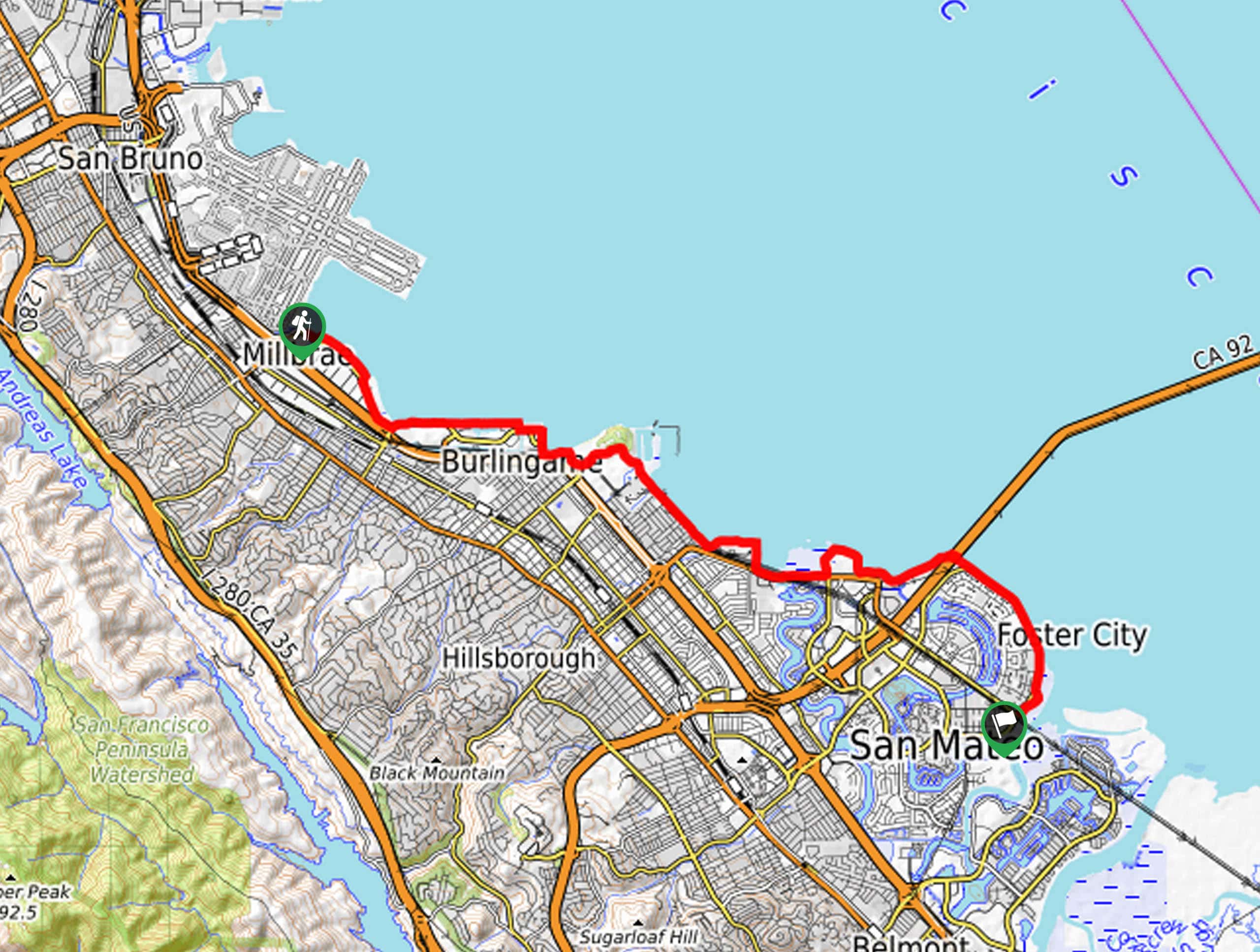
The San Francisco Bay Trail: Foster City is a wonderful path along the bay that can be enjoyed by adventurers of all sorts. Hike, bike, or run along the shoreline, watching the planes land at the nearby airport along the way.
Getting there
This hike departs from the San Francisco Bay Trailhead off Old Bayshore Highway.
About
| Backcountry Campground | No |
| When to do | Year-round |
| Pets allowed | Yes - On Leash |
| Family friendly | Yes |
| Route Signage | Poor |
| Crowd Levels | High |
| Route Type | One Way |
San Francisco Bay Trail: Foster City
Elevation Graph
Weather
San Francisco Bay Trail: Foster City Description
Those seeking a shoreline walk in the Bay Area will enjoy this adventure. Indulge yourself in wonderful views of the bay as you pass one park after another—including a dog park! This accessible route is highly frequented, so expect to share the trail with others and be mindful of bikers passing by! Note this trail is one-way, so be sure to leave a vehicle or arrange for pickup at the path’s end. Lastly, there are several detours and route changes that are poorly signposted, so we encourage the use of the trail GPS.
Embark on your adventure along the San Francisco Bay Trail: Foster City from the trailhead off Old Bayshore Highway near the San Francisco International Airport. The initial segment of your trek follows the San Francisco Bay Trail before diverting inland through the side streets. Using the trail GPS, you will eventually reconnect with the shoreline path, wandering past Bayside Park. Crossing the footbridge over Anza Lagoon, you will reach the Coyote Point Recreational Area shortly.
Using the GPS, you will eventually merge onto the Gerry Mon Memorial Bike Path and then onto the Foster City Levee Trail. Follow this route along the shoreline all the way to the trail’s end at Foster City Blvd.
Similar hikes to the San Francisco Bay Trail: Foster City hike

Bridge to Nowhere via East Fork Trail
The hike to the Bridge to Nowhere via East Fork Trail is a fun little adventure in the Angeles National…

Mount San Antonio and Mount Baldy Notch Trail
The Mount San Antonio and Mount Baldy Notch Trail is a beautifully scenic, albeit physically demanding, adventure in the Angeles…

Echo Mountain via Sam Merrill Trail
The Echo Mountain via Sam Merrill Trail is a beautifully scenic adventure in the Angeles National Forest of Southern California…


Comments