

Mount Sutro Loop
View PhotosMount Sutro Loop
Difficulty Rating:
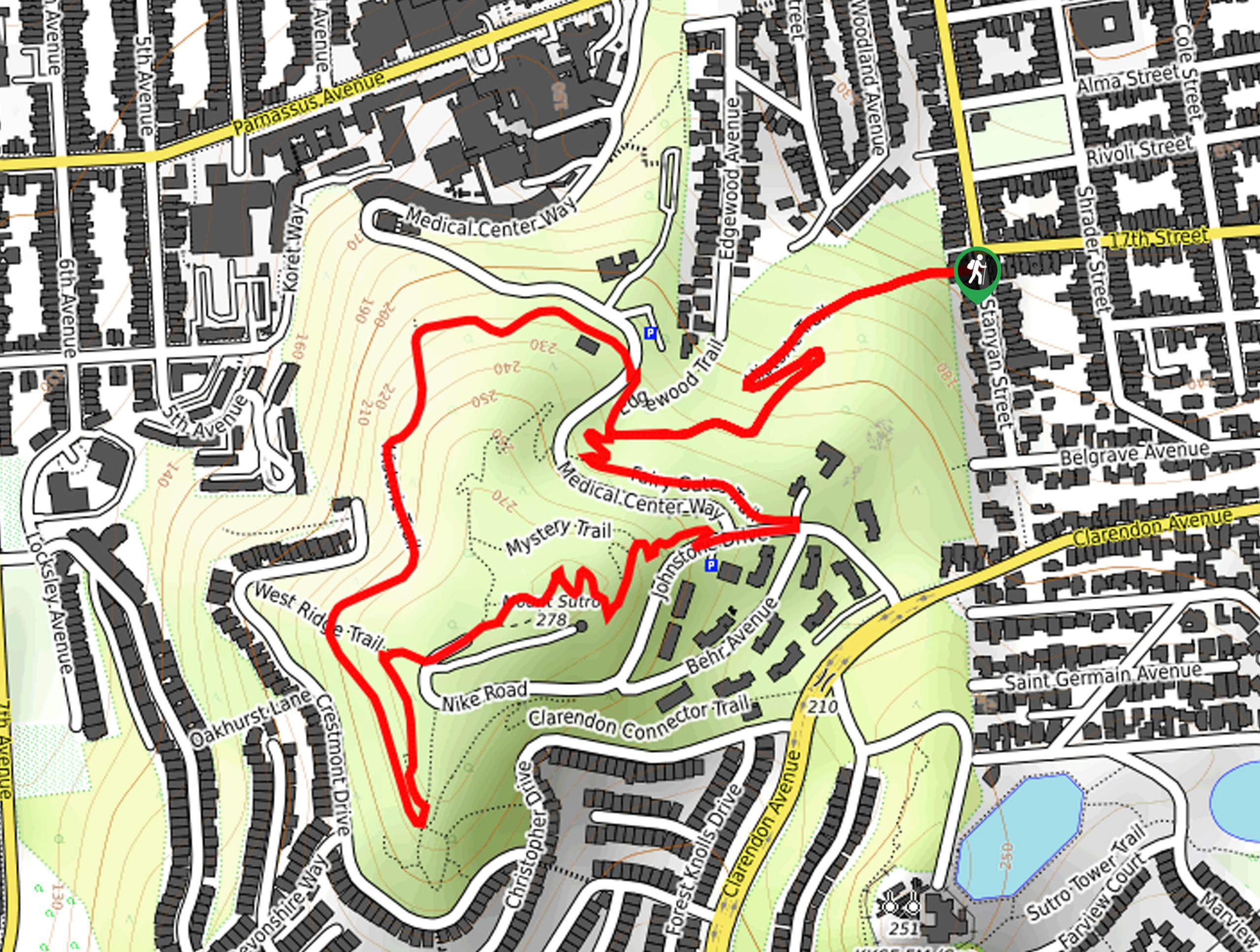
The Mount Sutro Loop is an excellent trail through a lush open space near UCSF. This lovely adventure boasts the opportunity to escape the chaos of the urban setting and reconnect with nature without having to leave city limits.
Getting there
The Mount Sutro Loop departs from the Historic Trailhead off Stanyan Street
About
| Backcountry Campground | No |
| When to do | Year-round |
| Pets allowed | Yes - On Leash |
| Family friendly | Yes |
| Route Signage | Average |
| Crowd Levels | High |
| Route Type | Lollipop |
Mount Sutro Loop
Elevation Graph
Weather
Mount Sutro Loop Description
Offering a unique experience, the Mount Sutro Loop is a well-revered adventure. Get outside into the fresh air as you explore the wilderness patch. You may even notice goats when hiking—these guys manage the vegetation growth! Those who make it to the summit of Mount Sutro will be rewarded with interrupted views of San Francisco, including distance sights of the Golden Gate Bridge and Alcatraz! Note there is no designated parking lot for this hike, so those with vehicles will have to park along the street.
Setting out from the Historic Trailhead, the Mount Sutro Loop follows the Historic Trail southwest, gradually climbing into the woodlands. Not long after your departure, you will reach an intersection; keep left here onto the Fairy Gates Trail. This route will soon end; turn right here onto Johnstone Drive, merging onto the East Ridge Trail at the following junction. Follow this path up to the summit of Mount Sutro and marvel at the wonderful vistas. Revel in the views, then continue along the trail, connecting with the West Ridge Trail, then the Gardener’s Trail at the next intersection.
When you ultimately reach the path’s end, reconnect with the Historic Trail. Gently descending the grade, this wooded path will eventually deliver you back to the trailhead.
Similar hikes to the Mount Sutro Loop hike

Bridge to Nowhere via East Fork Trail
The hike to the Bridge to Nowhere via East Fork Trail is a fun little adventure in the Angeles National…

Mount San Antonio and Mount Baldy Notch Trail
The Mount San Antonio and Mount Baldy Notch Trail is a beautifully scenic, albeit physically demanding, adventure in the Angeles…

Echo Mountain via Sam Merrill Trail
The Echo Mountain via Sam Merrill Trail is a beautifully scenic adventure in the Angeles National Forest of Southern California…


Comments