
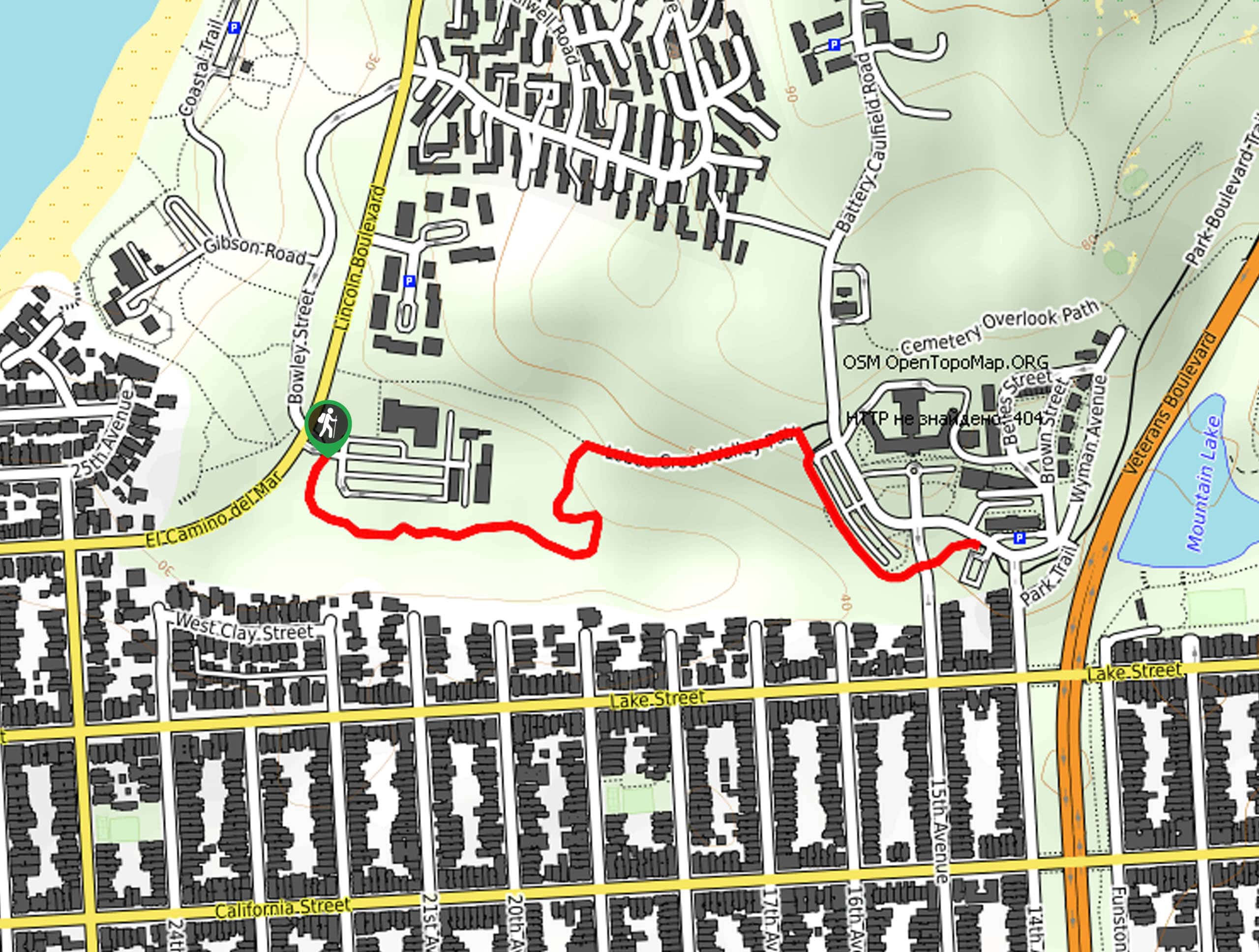
Lobos Creek Valley Path Hike
View Photos
Lobos Creek Valley Path Hike
Difficulty Rating:
The Lobos Valley Creek Path Hike is a lovely adventure in Presidio Park that hikers of all skill levels and ages can enjoy. Wander through the valley bound by lush chaparral and a diversity of wildflowers. This scenic route is a must-add to your adventure itinerary.
Getting there
Access this hike via the trailhead off Howard Road.

About
| Backcountry Campground | No |
| When to do | Year-round |
| Pets allowed | Yes - On Leash |
| Family friendly | Yes |
| Route Signage | Average |
| Crowd Levels | Moderate |
| Route Type | Out and back |
Lobos Creek Valley Path Hike
Elevation Graph
Weather
Lobos Creek Valley Path Hike Description
Those seeking a short, easy-going outdoor adventure in San Francisco will enjoy the scenic Lobos Valley Creek Path Hike. Exhibiting a diversity of flora and fauna, this stimulating trail beckons the exploration of visitors and locals alike. Admire the variety of chaparral and wildflowers as you make your way to an overlook of the Presidio Landmark. Note the terrain is exposed to the elements, so wear SPF and dress in layers as insurance against changing conditions.
Setting out from the trailhead off Howard Road, the Lobos Valley Creek Trail wanders south along the Lobos Valley Creek Trail. Tracking south, the path will shortly redirect you east, gradually climbing through the meadows. Presenting the perfect opportunity for birding, you will likely notice seagulls, swallows, sandpipers, and more soaring above or exploring the arid terrain. Soon the path will more intensely ascend through the valley, up to Presidio Landmark.
Admire the beauty of the impressive landmark from here and rehydrate before retracing your footing down the path back to the trailhead.
Similar hikes to the Lobos Creek Valley Path Hike hike

Hippie Hill and Stow Lake Loop Hike
The Hippie Hill and Stow Lake Loop Hike boasts a magical experience in the Golden Gate Park. Explore the city’s…
Fairy Gates Trail
The Rose Valley Falls Hike boasts an enchanting experience in San Francisco. Explore the Mount Sutro Open Space Reserve’s nook…

Cliff House Hike
Indulge yourself in wonderful coastal views along the Cliff House Hike. This lovely shoreline path in the Golden Gate National…
Comments