

Echo Mountain via Sam Merrill Trail
View PhotosEcho Mountain via Sam Merrill Trail
Difficulty Rating:
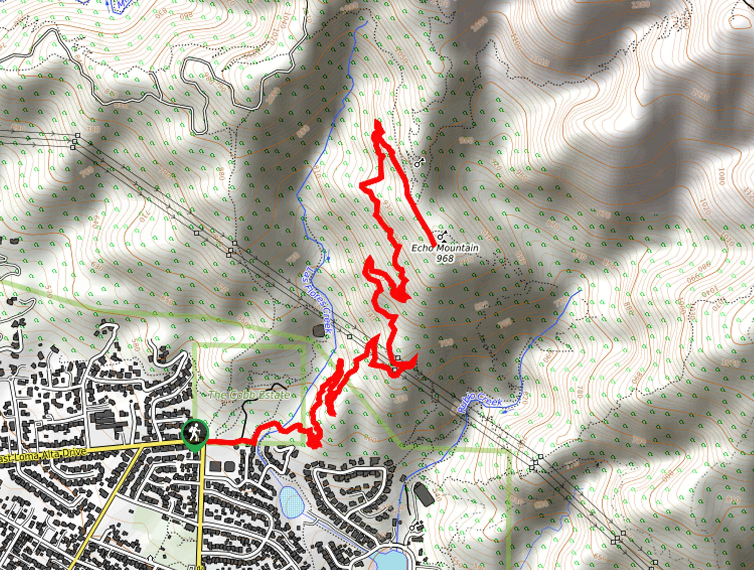
The Echo Mountain via Sam Merrill Trail is a beautifully scenic adventure in the Angeles National Forest of Southern California that features sweeping views of the surrounding landscape. While out on the trail, you will pass through the Cobb Estate, before climbing uphill past the ruins of the Mount Lowe Observatory to reach the summit of Echo Mountain. Hikers should be sure to arrive early, as this trail can become quite busy and congested during peak hours.
Getting there
The trailhead for this hike can be found at the Cobb Estate, at the corner of E Loma Alta Drive and N Lake Avenue in Altadena.
About
| Backcountry Campground | No |
| When to do | Year-Round |
| Pets allowed | Yes - On Leash |
| Family friendly | Yes |
| Route Signage | Average |
| Crowd Levels | High |
| Route Type | Out and back |
Echo Mountain via Sam Merrill Trail
Elevation Graph
Weather
Echo Mountain via Sam Merrill Trail Description
If you are looking to take in the natural beauty of the San Gabriel Mountains of Southern California, then the Echo Mountain via Sam Merrill Trail is a great route to explore; however, there are also a few downsides to hiking this trail. As the area sees fairly high volumes of foot traffic, you will want to ensure that you arrive early to secure parking and beat the crowds. Additionally, you will need to display a valid adventure pass in your vehicle prior to starting your hike.
Even though you will almost certainly be sharing the trail with other adventurers, this hike is a great experience that will showcase the history and natural beauty of Angeles National Forest. For starters, you will hike past the ruins of the Echo Mountain House, which was once a luxury resort in the area for the wealthy. You will also be exposed to some incredible views from the summit of Echo Mountain itself, making for a great day-hike that is accessible for a wide range of outdoor enthusiasts.
Setting out from the trailhead, you will make your way east to enter the Cobb Estate and pass through the gate after roughly 100ft. From here, you will keep straight along the Sam Merrill Trail, continuing to the east for another 0.2mi to cross over Las Flores Creek.
Here, the trail will begin to climb uphill and turn to the northeast, working through the rugged terrain of the mountains for the next 1.1mi. At this point, you will turn left at a junction and continue along the path for another 1.3mi, enjoying the pleasant views of the surrounding landscape.
At the next junction, keep to the right as you pass by the ruins of the former Mount Lowe Observatory and the ruins of what was once the Echo Mountain House luxury resort. Shortly after the ruins, you will continue uphill to the summit of Echo Mountain, where you will enjoy some beautiful views of the Southern California landscape. From here, simply turn back and work your way downhill to return to the trailhead where you began your adventure up Echo Mountain via the Sam Merrill Trail.
Trail Highlights
Ruins of Echo Mountain House
Opening in 1894 along the newly built Mount Lowe Railway, Echo Mountain House was a luxury resort that served wealthy tourists looking to explore the San Gabriel Mountains. It contained 80 rooms, a dance hall, casino, astronomical observatory, and even a zoo. Several setbacks eventually led to its closure, including two fires and the government realization that the railway was built on Federal lands. The ruins can still be seen by hikers passing through the area.
Insider Hints
Arrive early to secure parking and beat the crowds
Wear proper hiking footwear
Keep your dog on a leash at all times
Similar hikes to the Echo Mountain via Sam Merrill Trail hike

Bridge to Nowhere via East Fork Trail
The hike to the Bridge to Nowhere via East Fork Trail is a fun little adventure in the Angeles National…

Mount San Antonio and Mount Baldy Notch Trail
The Mount San Antonio and Mount Baldy Notch Trail is a beautifully scenic, albeit physically demanding, adventure in the Angeles…

Lewis Falls Trail
Hiking the Lewis Falls Trail is a spectacular, if fairly short, adventure in the Angeles National Forest that will take…


Comments