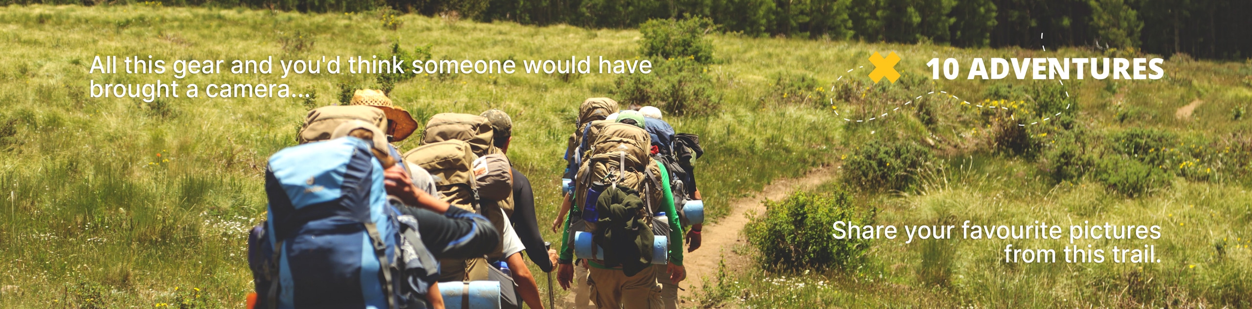
Cataract Falls Trail
View Photos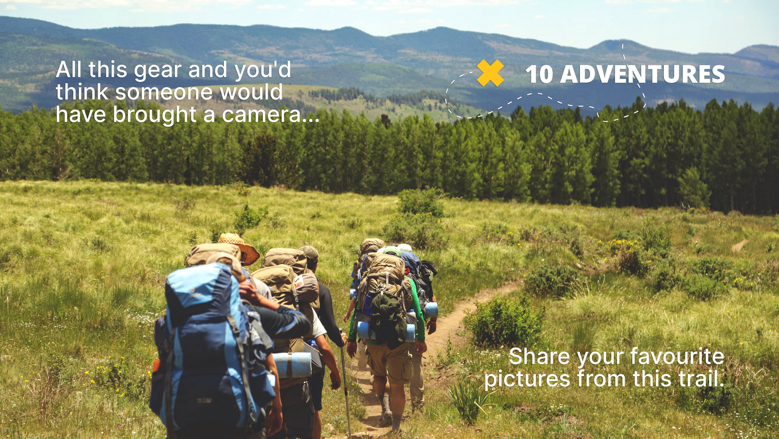
Cataract Falls Trail
Difficulty Rating:
Indulge yourself in the beauty of the lush Californian temperate forests along the Cataract Falls Trail. This lovely adventure travels through the natural sanctuary adorned with charming multi-step cascades bound by moss-cloaked boulders and redwoods.
Getting there
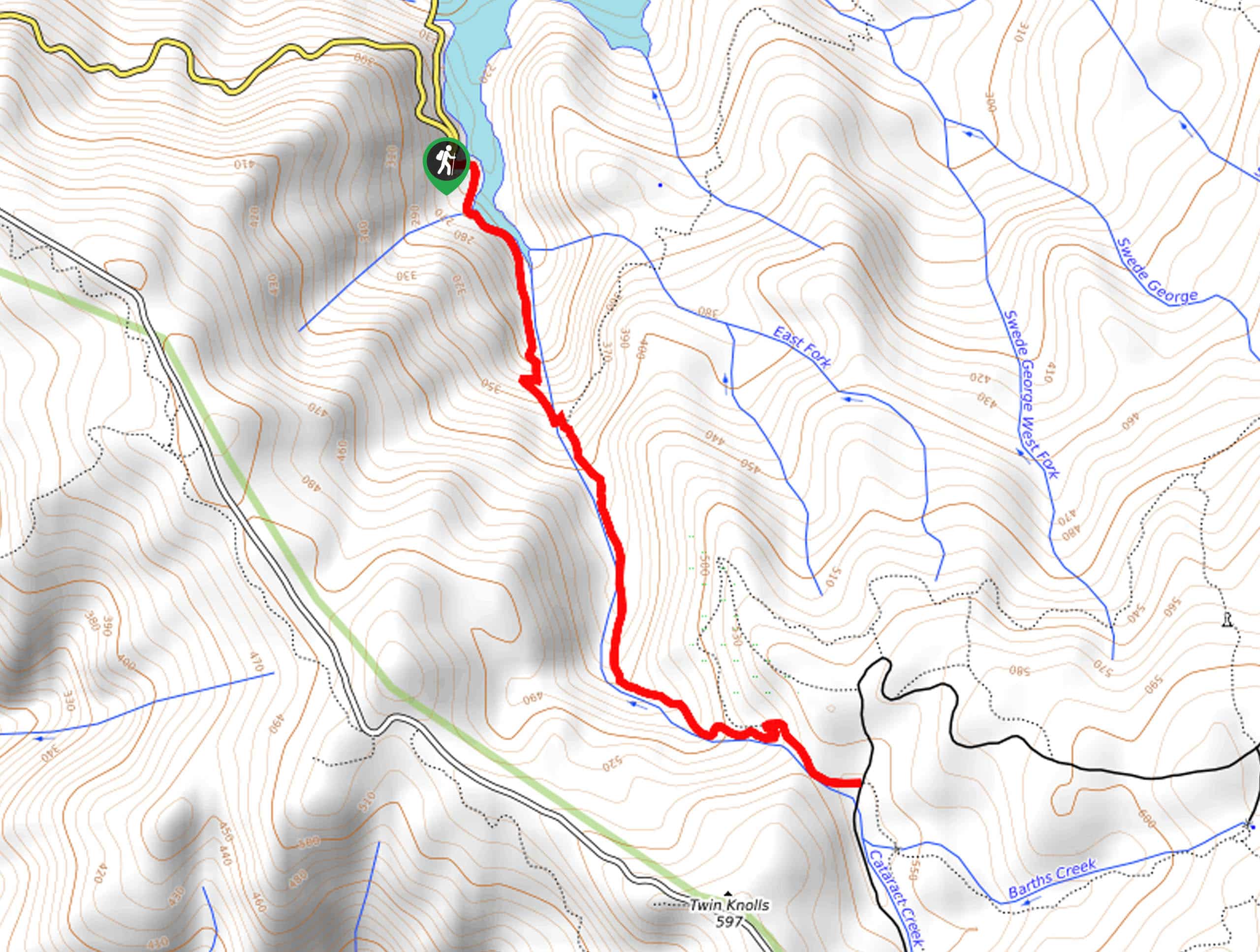
The Cataract Falls Trail is accessed via the Cataract Trailhead off Fairfax-Bolinas Road.

About
| Backcountry Campground | No |
| When to do | Year-round |
| Pets allowed | Yes - On Leash |
| Family friendly | Yes |
| Route Signage | Good |
| Crowd Levels | Extreme |
| Route Type | Out and back |
Cataract Falls Trail
Elevation Graph
Weather
Cataract Falls Hike Description
The Cataract Falls Trail is an amazing urban escape near San Francisco through a magical setting. Explore the lush woodlands and marvel at the beauty of the cascades that bisect the terrain. As to not disappoint, it is important to note that this path is best explored in the rainy season, as the creek often dries in the summer months! Though inviting, swimming is prohibited in the pools beneath the falls. Additionally, though many climb the rocks that bound the falls, this is not recommended as the moss-covered outcrops are extremely slippery. Note the path is rated as moderate due to the elevation gain, so prepare to stretch those legs and pack plenty of water!
Indulge in the enchanting nature of the temperate forest along the Cataract Falls Trail. Contrary to most adventurers in the area, this route is best explored in the rainy winter season when the vegetation is abundant and lush, and the Cataract Falls surge over the moss-cloaked boulders. Get a workout in as you admire the beauty of the mystical landscape and let the soothing sounds of the gurgling waters lull you into a state of relaxation. Exhibiting the diversity of the area’s flora, this trail travels through redwood stands, tanoak, California bay, madrone, ferns, and more. This route is undoubtedly one of the best hikes in the Bay Area!
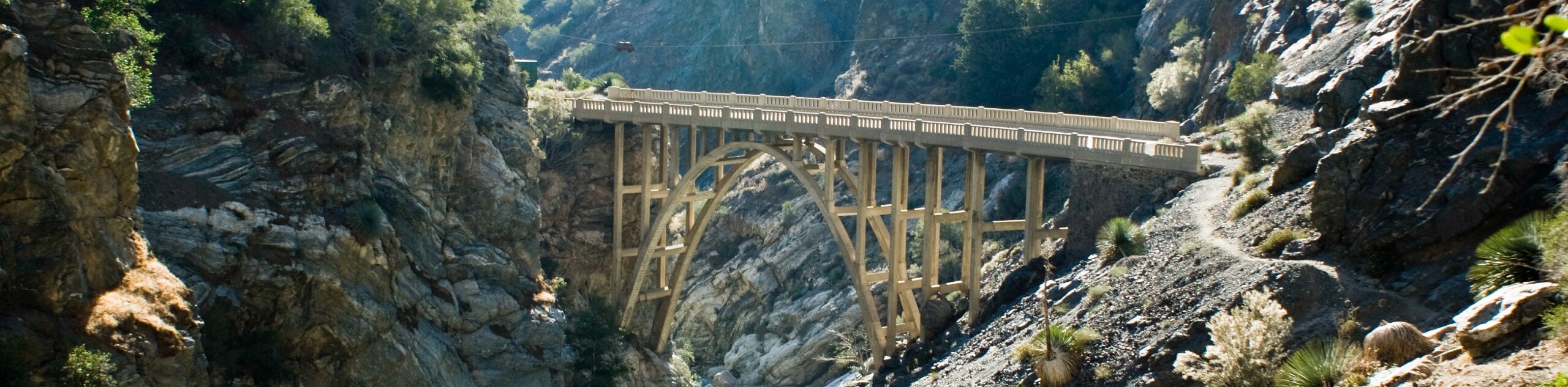
Embark on your adventure along the Cataract Falls Trail from the Cataract Trailhead. Setting out from the trailhead, the enchanting path travels south along the shore of Alpine Lake before escaping into the wilderness. Gradually climbing along Cataract Creek, this wonderful adventure affords picture-perfect scenes of the meandering creek bound by moss coats, boulders and trees. Let the sounds of the gurgling waters lull you into a state of relaxation as you climb—distracting you from your tired legs! Eventually, the trail will cross a beautiful footbridge that boasts wonderful views of the cascading creek and idyllic pool.
Soon after crossing the bridge, you will confront a junction; keep right here, wandering along the creek. The further you ascend, the better the scenery—marvel in the postcard perfect scenery and keep an eye out for lizards as you trek. You will ultimately reach the famous falls that so famously promote this wonderful hike. Admire the scene of the endless greenery and multi-step waterfall that plunges down the rocky canyon. From here, continue climbing up to the trail’s end, then turn around and retrace your footing back down to the trailhead—marking the end of your gorgeous adventure.
Frequently Asked Questions
Where are the Cataract Falls?
The Cataract Falls Trail is an epic day hike near Fairfax, California.
How long is the Cataract Falls Trail?
The Cataract Falls Trail is a 2.8mi out-and-back hike.
Can you swim in Cataract Falls?
No, swimming is prohibited in Cataract Falls as it is one of the streams of drinking water for Marin County.
Insider Hints
It is not recommended to explore the bounding boulders of Cataract Falls as the moss-cloaked boulders are incredibly slippery
This hike is best in late winter or after rainfall
Charge your camera, the scenery is picture-perfect
Note the washrooms are located at the trail’s end
This leg is a butt-burner—pack plenty of water
Dress in layers as much of this route is shaded as it climbs through the forestlands
Use trekking poles if you have sore knees
Similar hikes to the Cataract Falls Trail hike
Bridge to Nowhere via East Fork Trail
The hike to the Bridge to Nowhere via East Fork Trail is a fun little adventure in the Angeles National…
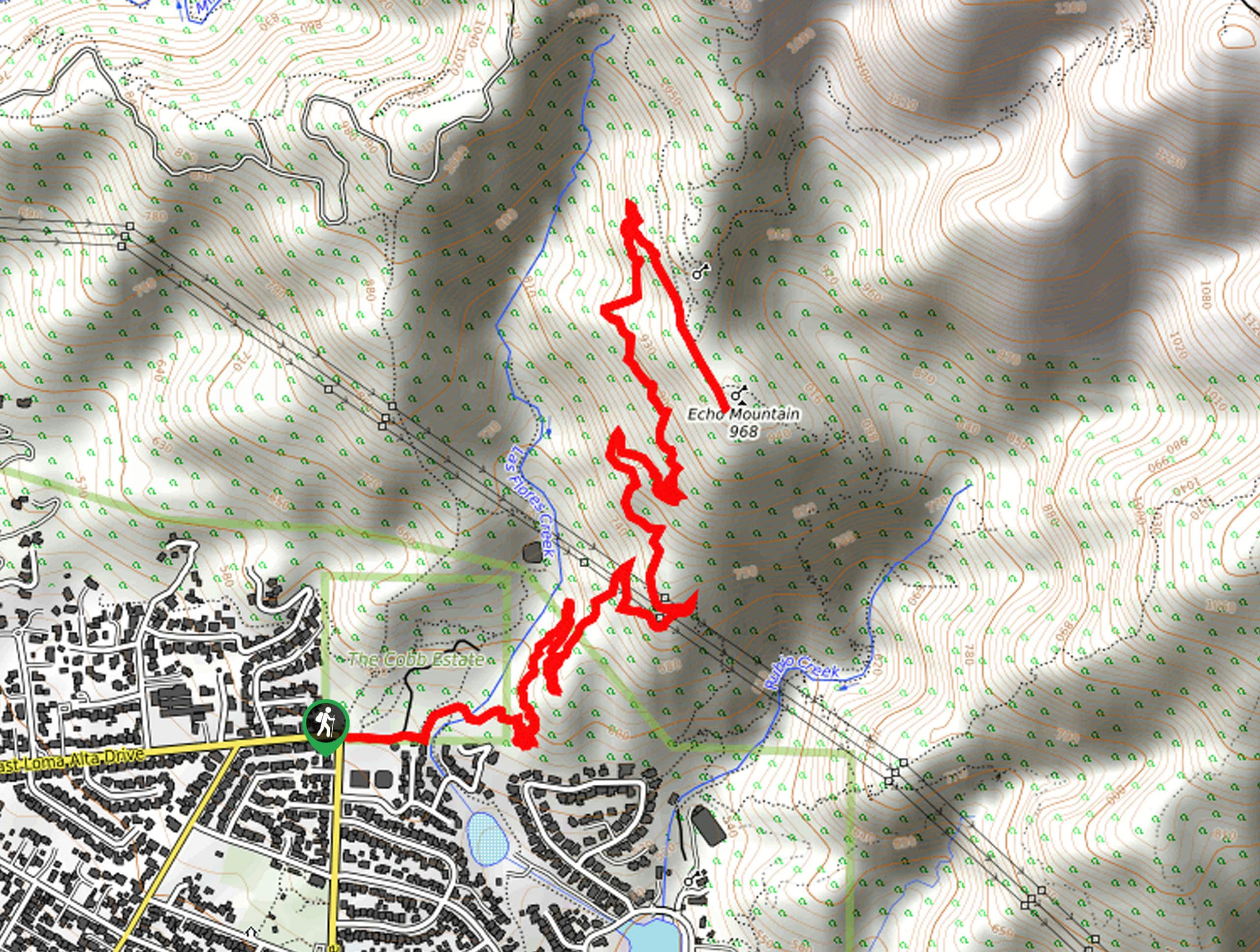
Echo Mountain via Sam Merrill Trail
The Echo Mountain via Sam Merrill Trail is a beautifully scenic adventure in the Angeles National Forest of Southern California…
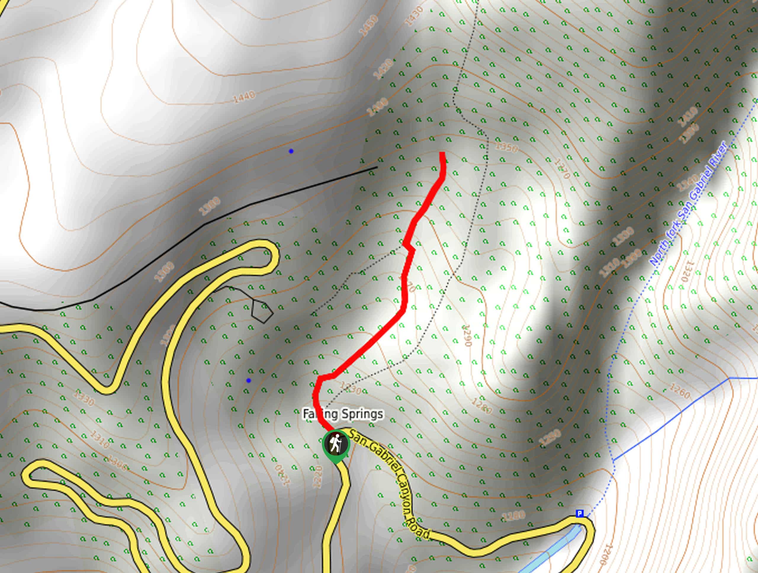
Lewis Falls Trail
Hiking the Lewis Falls Trail is a spectacular, if fairly short, adventure in the Angeles National Forest that will take…
Comments