

Big C and Tightwad Hill Hike
View PhotosBig C and Tightwad Hill Hike
Difficulty Rating:
The Big C and Tightwad Hill Hike is a scenic hike above Berkeley that offers wonderful views of the Bay Area. Wander through eucalyptus trees up to the overlook and watch a game taking place in the California Memorial Stadium below.
Getting there
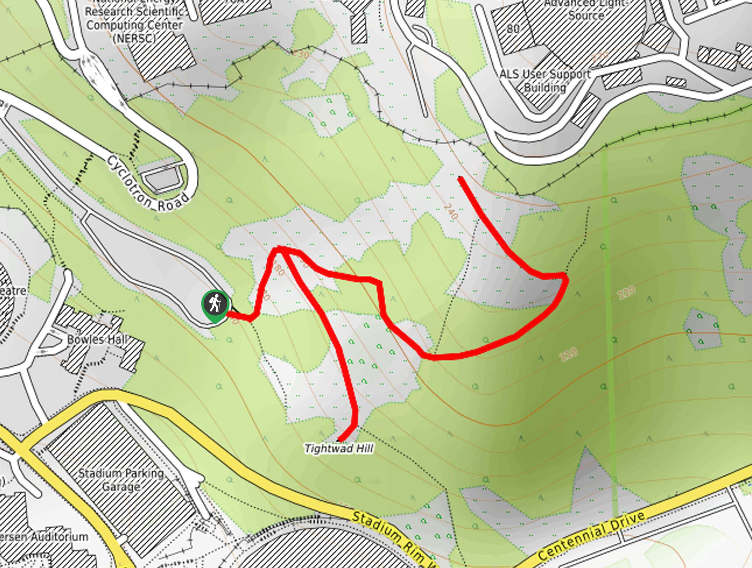
The Big C and Tightwad Hill Hike departs from the trailhead off Cyclotron Road.
About
| Backcountry Campground | No |
| When to do | Year-round |
| Pets allowed | Yes - On Leash |
| Family friendly | Yes |
| Route Signage | Poor |
| Crowd Levels | Moderate |
| Route Type | Out and back |
Big C and Tightwad Hill Hike
Elevation Graph
Weather
Big C and Tightwad Hill Hike Description
The Big C and Tightwad Hill Hike is a great adventure for hikers of all skill levels and ages. Indulge yourself in the beauty of the Bay Area and catch a game of football free of charge. Compared to other hikes in the area, this one boasts a more tranquil experience—with the exception of game time. Note that sections of his route are steep, though most hikers should be able to easily manage. Note that the path is not well signposted, so the trail GPS may prove useful.
Setting out from the trailhead off Cyclotron Road, the Big C and Tightwad Hill Hike travels north to an intersection. Here keep left and continue your climb up the lush mountainside. Following the dirt through eucalyptus trees, the route will wind up to the summit of the Big C. Revel in the incredible views of the Bay Area from here and when you are ready, retrace your footing down to the initial junction.
At this point, turn left, and you will be redirected southeast to Tightwad Hill. Here, you will likely be in the company of fellow explorers if there is a game going on below. To get back to the trailhead, simply backtrack the way you came, turning left at the intersection.
Similar hikes to the Big C and Tightwad Hill Hike hike

Bridge to Nowhere via East Fork Trail
The hike to the Bridge to Nowhere via East Fork Trail is a fun little adventure in the Angeles National…

Echo Mountain via Sam Merrill Trail
The Echo Mountain via Sam Merrill Trail is a beautifully scenic adventure in the Angeles National Forest of Southern California…

Lewis Falls Trail
Hiking the Lewis Falls Trail is a spectacular, if fairly short, adventure in the Angeles National Forest that will take…


Comments