

The Foal And Marble Ridge hike
View PhotosThe Foal And Marble Ridge hike
Difficulty Rating:
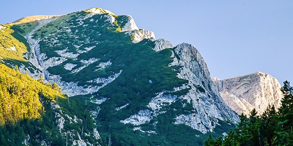
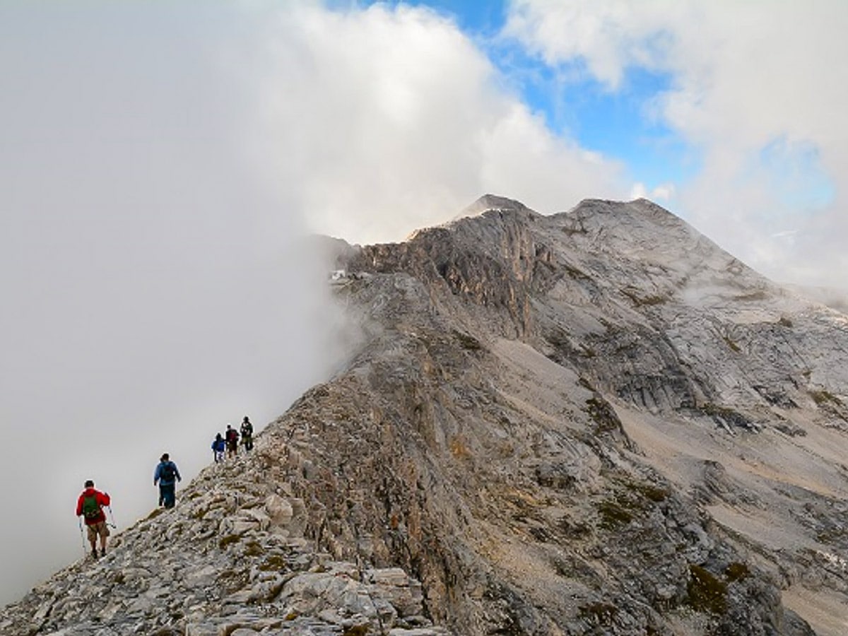
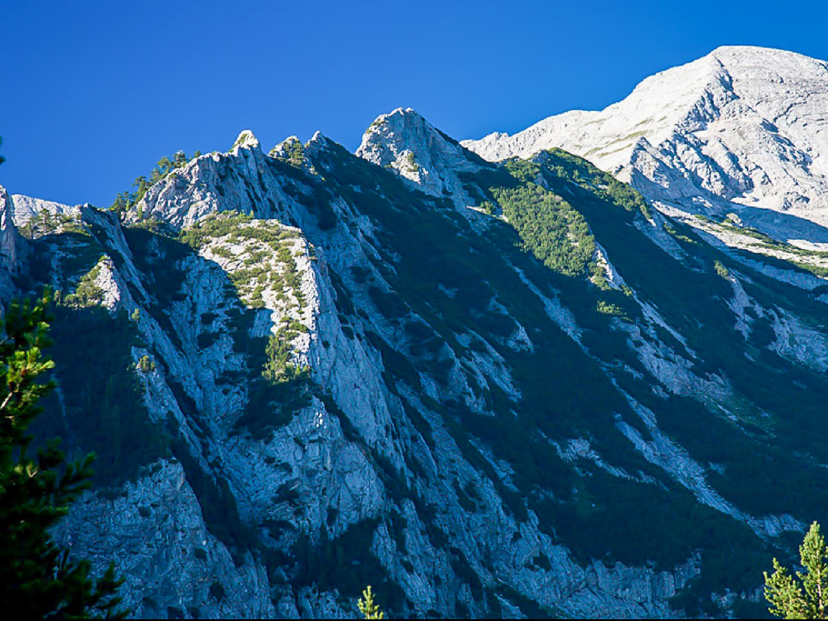
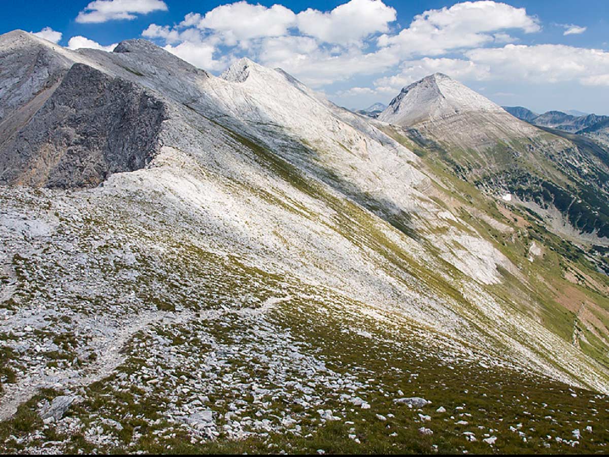
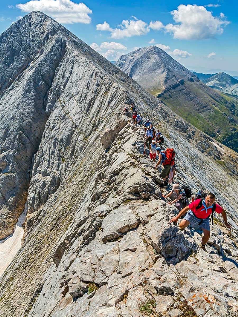
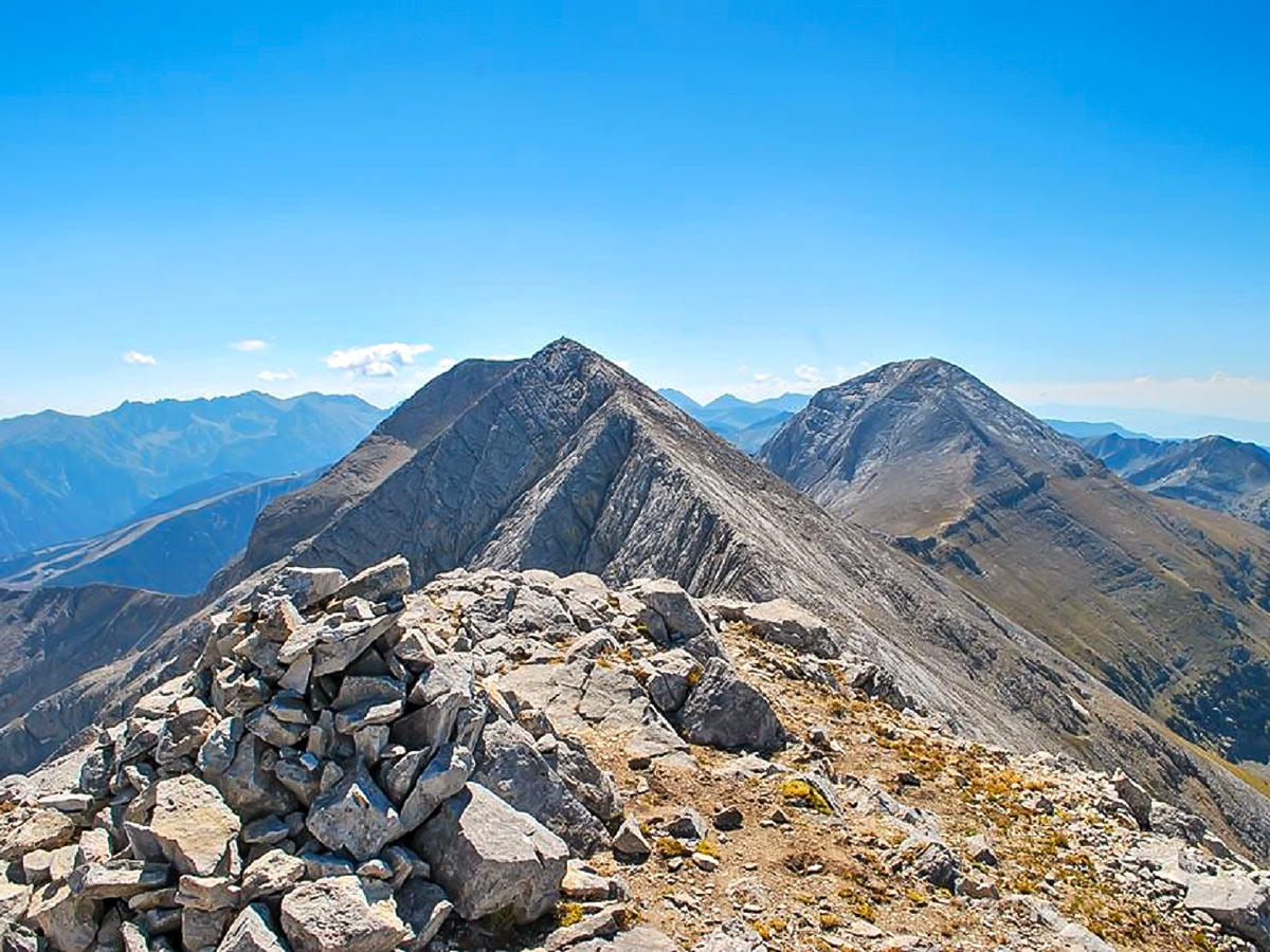
Challenging, strenuous, but exploding with aesthetics, this route along The Foal and Marble Ridges entices, stuns, and enchants. This route thrives as one of the most classic hikes in the Pirin range (and in Bulgaria, in general), thanks to the knife-sharp, jagged marble ridge towering high above the valley—it's also the highest part of the mountain. Metamorphic marble coats 30% of the Pirin range, which illuminates a sleek white look, one that emulates snow-capped peaks.
Getting there
The trek begins from Banderitsa hut, located in the Banderitsa valley, which is around 7.5mi above Bansko ski resort. You'll need to take a taxi to get to the hut from Bansko.
About
| When to do | June to September |
| Family friendly | No |
| Route Signage | Average |
| Crowd Levels | Low |
| Route Type | Out and back |
The Foal And Marble Ridge
Elevation Graph
Weather
Route Description for The Foal And Marble Ridge
Before you begin this satisfying, yet challenging Foal and Marble Ridge hike, do know that it’s a one-way route, so you’ll need to either book a reservation at Yavorov hut, where the trek ends, or arrange transportation to the Pirin golf resort, situated near Bansko. If you have energy, you can also walk an additional two hours to the golf resort.
The route starts its first stage north from Banderitsa hut, following white-green-white markings on trees and rocks. In the beginning, the path ascends to 40 degrees through some old pine forests, some junipers and pine bushes. After half an hour, the trail reaches the Little Cauldron–a lake-less cirque, surrounded by ridges, and located at 7054ft above the sea.
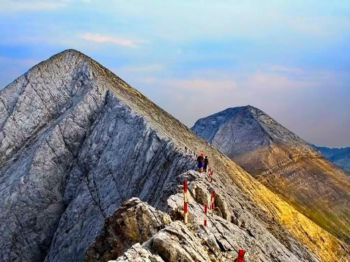
From here, you can easily spot the trail. It climbs towards the Big Cauldron. The last 5 minutes of this ascent is quite steep (up to 45 degrees), yet safe. The terrain also becomes rockier. Eventually, you’ll reach the Big Cauldron, which sits at 8005ft above the sea. Admire the large lake-less cirque dominated by the overwhelming north face of Mount Vihren. Here the terrain becomes rocky, but it isn’t too steep. At the entrance of the Big Cauldron, the path joins the white-red-white marked trail and you’ll follow these markings for the remaining duration of the trek.
The path goes across the Big Cauldron and starts turning right (northwest) to go around the massive face of Vihren. It starts climbing a very rocky and quite steep section. Eventually, the angle heightens to 50 degrees. Be careful during this part!
After you finish this challenging section, the trail snakes through a grassy slope, which leads straight to Premkata (the saddle), which sits between Mount Vihren and the Marble ridge. The altitude here is 8891ft above the sea. It may take around 2.5 hours to reach this point.
During the second stage, the trail advances through the most exposed part of the Marble ridge. It starts with a climb north, towards Mount Kutelo (9541ft above sea level). It is not steeper than 35 degrees, and the terrain is very stony and broken. The trail does not climb to the summit, but 200ft below the peak, it turns left (northwest) and starts slicing across the slope.
Do note that in winter one must go through the summit!
Soon after the slope steepens, exercise caution along this part—try to avoid slipping and falling to the left.
At the end of this section, there is a short (80ft) climb on pure rock with a 45-degree angle. You’ll need to use the fixed metal rope during this ascent. This saddle is the pinnacle of the whole hike; it is the famous “Foal”—a 700ft long col, which, at its widest, stretches to around 40 cm. Thankfully, the rope makes this part a little safer than it once was. It’s called the “Foal” because people found it to be less scary to ride a horse than walk this part. Use the fixed metal rope to descend the 1500ft vertical drop. Once on the northwestern side of the Foal, the path continues cutting through the slope of the Marble ridge and falls to a deep saddle before climbing close to the next summit—Bayuvi Dupki (9252ft above the sea).
If you’re trekking this part in winter, you need to go through all of the summits and not cut through the slopes.
After Bayuvi Dupki, the ridge becomes a bit lower and, after another descent, it reaches a tiny little shelter. The “Foal” shelter sits at 9055ft above sea level and is the most popular shelter in Bulgaria. It usually takes around 4.5 hours to reach this point for the trailhead.
From here the trail enters the third stage, it dips further into Marble ridge and towards the northwest. The next summit, Kamenititsa, stands tall at 8944ft above the sea, and after it, the ridge widens. The last summit, which sits significantly lower than the previous ones, is Razlojki Suhodol (8662ft above the sea). Straight after this summit, the ridge descends a bit more until it reaches a saddle before the next peak. You can spot a large Christian cross on top of the pinnacle on this saddle. This cross marks the northern end of the Marble ridge and the end of this stage. It may take around 5.5 hours to reach this point from the start.
The start of the fourth stage heads straight to the north, where a beautiful valley opens up. You’ll head down into the valley. The first hour of the descent is quite mild. It traverses grassy terrain and isn’t super steep. Soon the path, which always follows the left (western) bank of the river, enters the century-old pine forest. From here, you can marvel at the ridge known as “The Ladder.” Once you’re in the woods, the terrain elevates in difficulty. Watch out for the rocks and tree roots scattered along the path. The angle of steepness also increases to 30 degrees. The most challenging part of this section ends when the trail reaches an abandoned stone building, resembling an old shelter, on the left side. After these ruins, through a forest path, the route reaches the finishing point–Yavorov hut, which sits at 5709ft above sea level.
Insider Hints
You can find tasty snacks and hot beverages at Banderitsa hut. You'll have to pre-order if you want a meal.
This is a one-way trek, but you can always book a night at the Yavorov hut at the end of your journey.
This is a challenging hike to do in the winter, so it may be best to do this trek in summer, especially if you aren’t an experienced hiker.
Bring and wear snowshoes, an avalanche transceiver, avalanche shovel & probe, crampons if you plan on doing this hike in winter.
Similar hikes to the The Foal And Marble Ridge hike
Mount Vihren
This challenging 6.8mi hike eventually reaches Mount Vihren, which stands tall at 9561ft above sea level.…
Mount Polejan
Polejan peak (also called Polezhan) might not be the highest in the Pirin Mountain Range, but it impresses with its…
Frog Lake
The Banderitsa and Demyanitsa valleys grant hikers the chance to meander amid one of the most popular and picturesque areas…



Cocoah Medeza 6 years ago
A stunning hike that poses some danger, especially if you're not physically fit. It's better to hike in groups if you know you have underlying heart problems.
Elaine S. 6 years ago
Gorgeous hike with challenging ascends and descends. It's really worth visiting. But it's better to plan ahead of time and don't forget to bring enough water.
Malik Samosa 6 years ago
Best place to see spectacular panoramic views. The range looks amazing! Takes some time and effort to get there but it's worth it.
Heather Blitz 6 years ago
The terrain was nice and challenging. It made me sweat a lot. It's also one of the most unique hikes in the park. I truly enjoyed hiking here.
Bobbie K. 6 years ago
This hike was pretty hard on my knees. It really consumed so much of my energy and patience. The best advice I can give is to wear proper shoes and rest whenever needed.
Emiko Satoru 6 years ago
This hike got some fabulous views! Perfect for sunrise and sunset on the right side of the mountain top.