

Lower South Fork Skokomish Trail
View PhotosLower South Fork Skokomish Trail
Difficulty Rating:
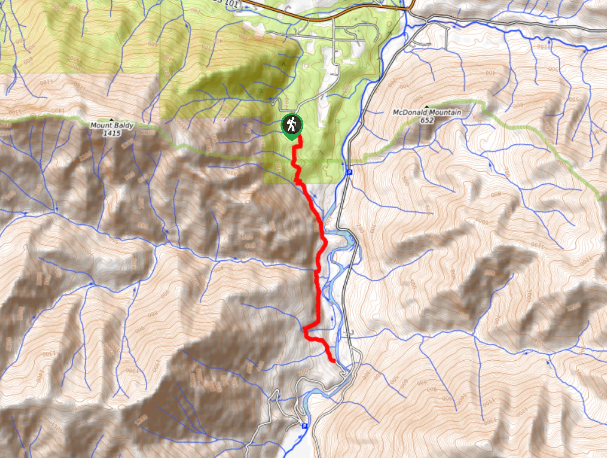
The Lower South Fork Skokomish Trail is a 11.8mi hiking trail in Olympic National Park that is moderately difficult and lightly trafficked. This hike is mostly a walk in the woods with peekaboo views of the river, making it very laid-back. Besides some elevation gain at the start, it’s a flatter, more gradual route.
Getting there
The trailhead for the Lower South Fork Skokomish Trail is on Forest Road 2353 at the signed trailhead.
About
| Backcountry Campground | No |
| When to do | June-November |
| Pets allowed | No |
| Family friendly | Yes |
| Route Signage | Poor |
| Crowd Levels | Moderate |
| Route Type | Out and back |
Lower South Fork Skokomish Trail
Elevation Graph
Weather
Lower South Fork Skokomish Trail Description
The Lower South fork Skokomish Trail is a mostly relaxed hike that allows you to go as far as you want up to 11.8mi. This hike is mostly through the woods with here-and-there glances of the river.
Begin from the signed trailhead. The first section of the trail is the steepest as you climb up over a butte that you’ll then descend on the other side. There are two spur trails on your right on top of the butte, so stay left and then head down to the river.
Meander through the trees alongside the water, crossing creeks and enjoying the solitude of the forest. While our GPS route shows a turnaround point, you can head back whenever you feel ready as the trail continues beyond this point, although some hikers find the path less defined past this point.
Retrace your steps to the trailhead.
Similar hikes to the Lower South Fork Skokomish Trail hike

West Elwha River Trail
The West Elwha River Trail is a lovely moderate walk alongside the river to the Altair Campground and back. This…

Humes Ranch Loop Trail
Humes Ranch Loop Trail is a heavily trafficked loop hike in Olympic National Park. This trail is very beautiful and…

Mount Angeles via Switchback Trail
Mount Angeles via Switchback Trail is an exciting hike that starts out more gradual before ending with a fairly demanding…


Comments