
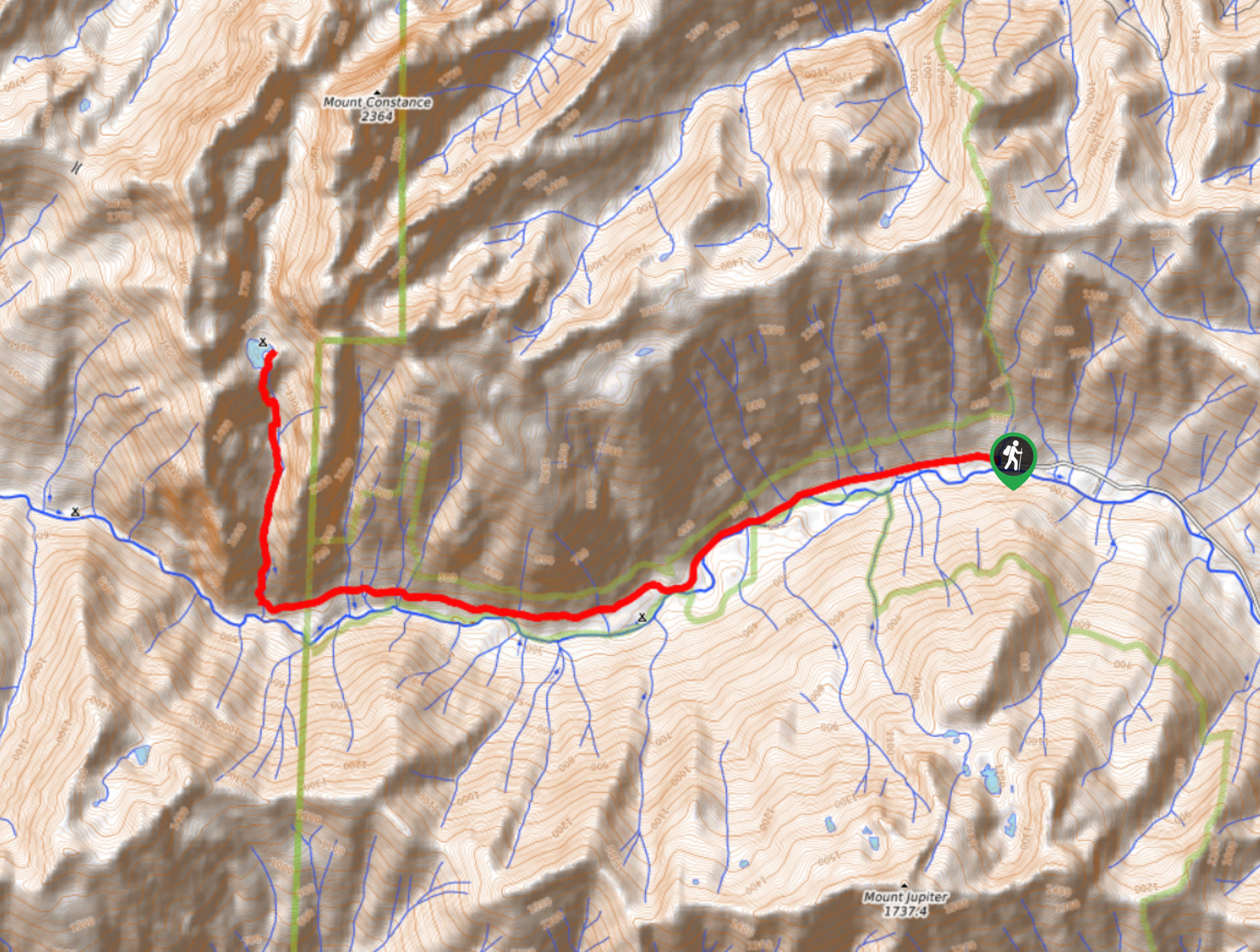
Lake Constance Trail
View Photos
Lake Constance Trail
Difficulty Rating:
Lake Constance Trail is no small feat. In fact, it’s a huge one, often regarded as the hardest hike in the Olympics. This 14.5mi trail requires 4898ft of elevation gain, but the devil is in the details—parts of this route are very, very steep and dangerous, and there is little respite from the grind. Some hikers can do it in a (long) day, but most adventurers backpack. Come prepared for the adventure of a lifetime!
Getting there
The trailhead for Lake Constance Trail is at the western terminus of Dosewallips Road.

About
| Backcountry Campground | Elkhorn Dispersed Campground |
| When to do | July-October |
| Pets allowed | No |
| Family friendly | No |
| Route Signage | Poor |
| Crowd Levels | Low |
| Route Type | Out and back |
Lake Constance Trail
Elevation Graph
Weather
Lake Constance Trail Description
Lake Constance Trail is regarded as the hardest and steepest hike in Olympic National Park, and as such, we only recommend this trail for experienced, confident hikers. It’s a very full day trip if you intend to finish it without backpacking, so prepare appropriately and give yourself ample time. Watch for ribbons and red markers as you go.
The initial stretch follows Dosewallips Road along the river, which is gorgeous. When you come to the Elkhorn Campground, stay right at the Y-junction. After a few more miles (about 5 from the trailhead), the trail to Lake Constance is on your right, heading straight up. The big push begins here. It’s relentlessly straight up with np switchbacks to aid your progress. You’ll be climbing with your hands for long stretches and this section lasts for a full two miles, which will likely feel like the longest two miles of your life.
Pull yourself over the last ridge to the Lake, a purely stunning sight and a very welcome reprieve. If you’re camping, make your home for the night. If you’re headed back before nightfall, prepare for the brutally steep descent and begin to retrace your steps.
Similar hikes to the Lake Constance Trail hike
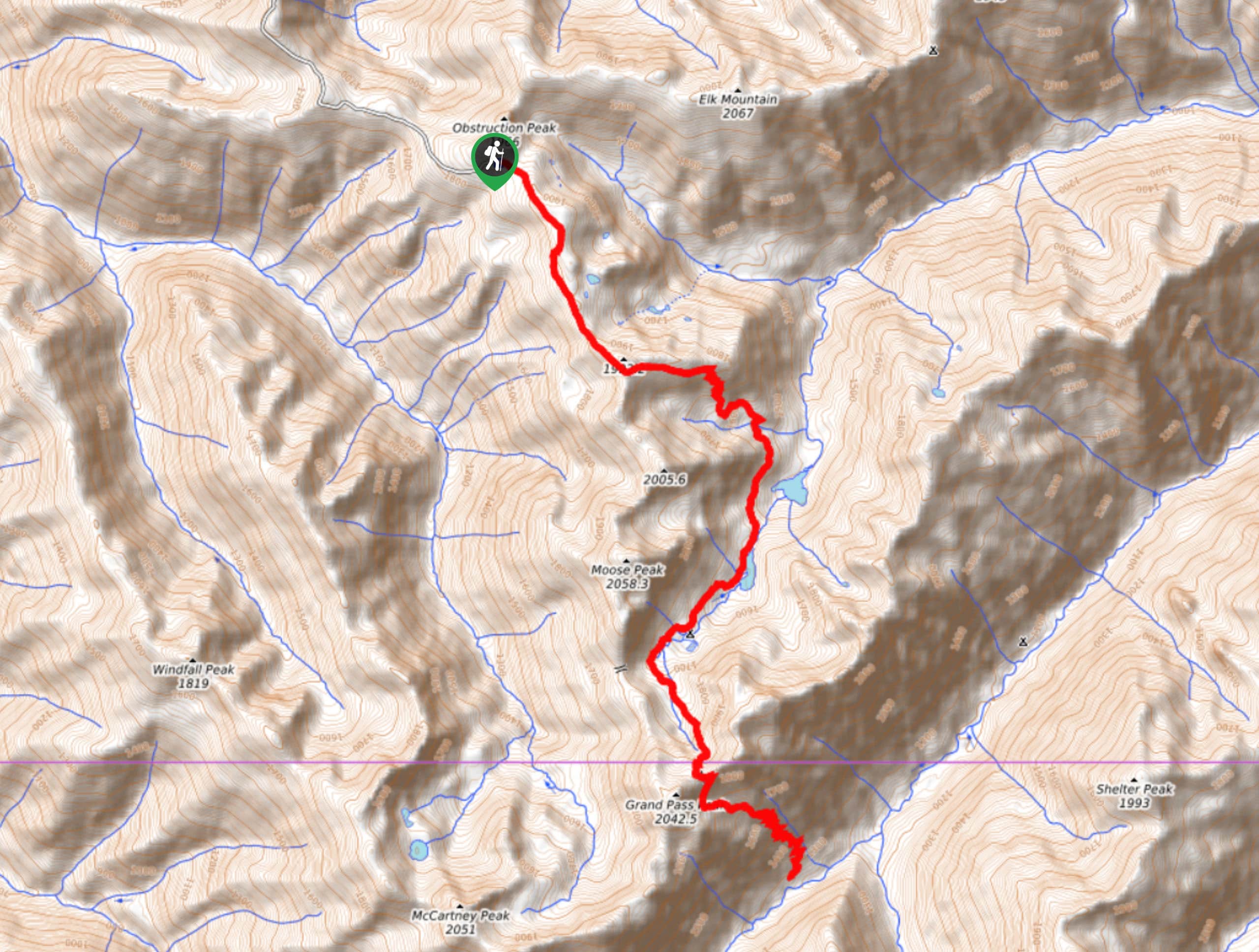
Grand Pass Trail
Grand Pass Trail is a beast of a day hike, with over 13.7mi to cover across varied, steep…
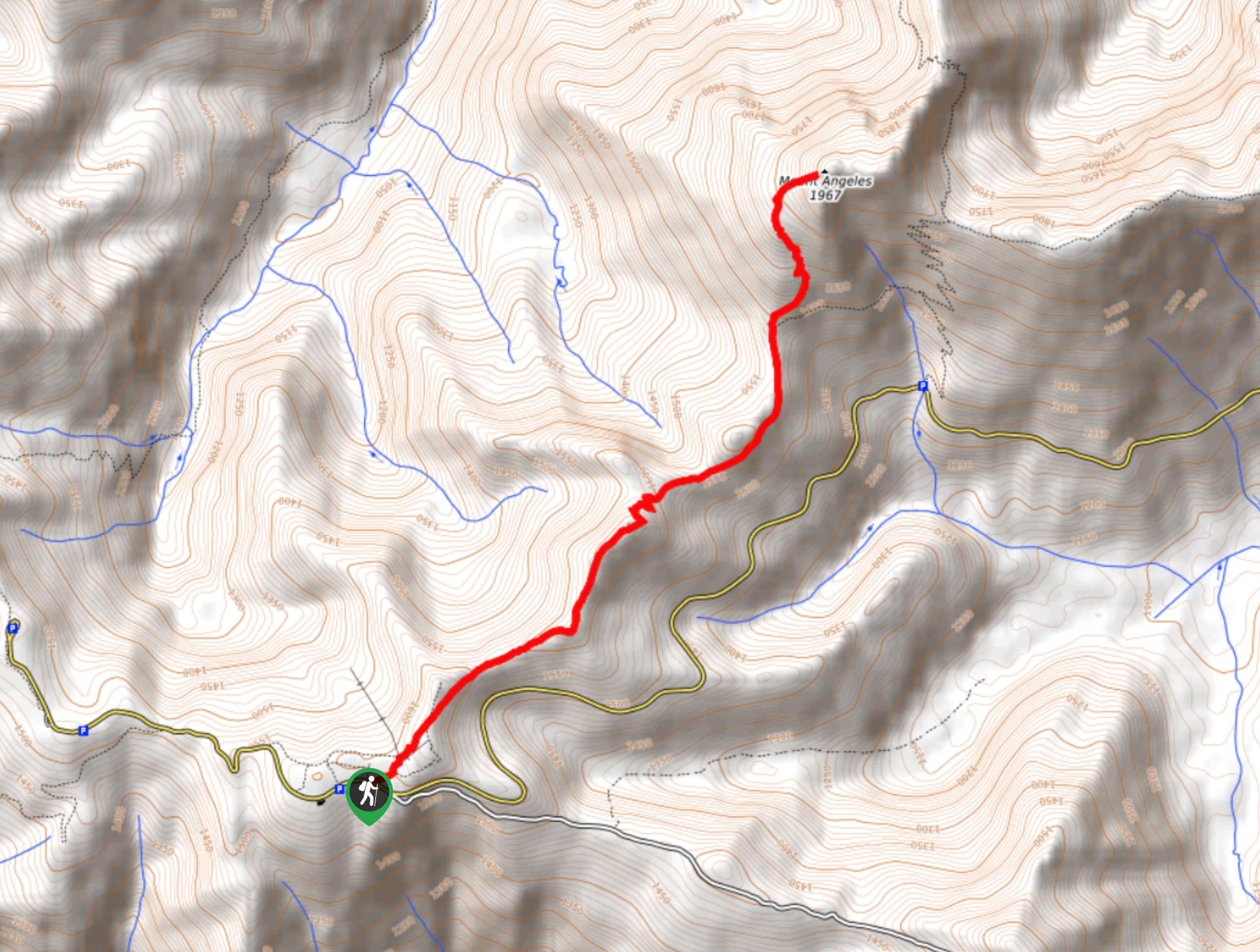
Mount Angeles via Sunrise Ridge Trail
Mount Angeles via Sunrise Ridge Trail is a challenging hike that starts out more forgiving before ending with a demanding…

Heather Park and Mount Angeles via Lake Angeles Trail
Heather Park and Mount Angeles via Lake Angeles Trail is a 15.8mi
Comments