

Twin Lakes Hike
View PhotosTwin Lakes Hike
Difficulty Rating:
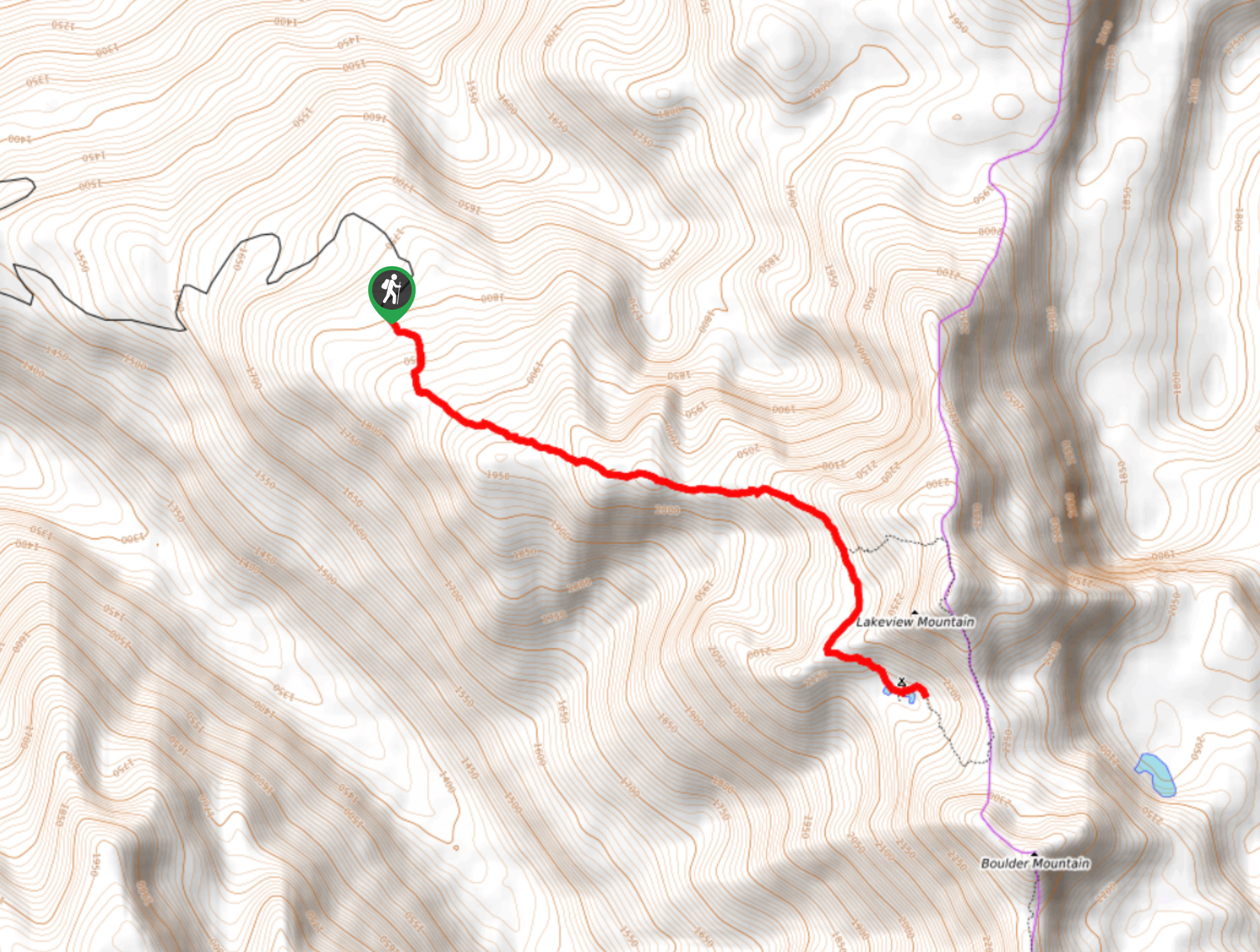
The Twin Lakes Hike, carved in the Monashees in the North Okanagan, is a must-do hike if you’re an avid outdoor enthusiast! If you’re staying in Vernon or Kelowna, you will have to drive slightly further than the more popular tourist hikes stretched across the Okanagan Valley. Still, the unreal view of the intimidating mountains surrounding glistening lakes makes the entire drive (and intense walk up) so worth it.
Getting there
To get to the Twin Lakes Hike, you’ll need to head to Cherryville! From BC-6, you’ll turn right onto N Fork Road before taking a left to stay on North Fork Road. Eventually, you’ll take a right onto ‘Road’ and keep right. 4.5mi later, you’ll arrive at the parking lot.
About
| When to do | July-August |
| Backcountry Campsites | No |
| Pets allowed | Yes - On Leash |
| Family friendly | No |
| Route Signage | Average |
| Crowd Levels | Low |
| Route Type | Out and back |
Twin Lakes Hike
Elevation Graph
Weather
Twin Lakes Hike Description
The Twin Lakes Hike in the Okanagan Valley explodes with a masterpiece-like canvas of mountainous paintings. Throughout the journey, you’ll encounter lush scenery backed by mountains stretching into the horizon and alpine lakes nestled in verdancy. This hike is short, but it’s not for the faint of heart! Almost immediately, it gets your heart pumping and your blood flowing, but after 679ft of elevation gain and 2.5mi later, you’ll reach the pinnacle of your journey.
The main trail is well-marked and easy to follow. However, depending on the amount of energy left in your tank, you can always veer off and ascend Lakeview Mountain for views of Twin Lakes, Lake Andrew, and Monashee Provincial Park. Expect to go route-finding and to gain an additional 1083ft in elevation while you’re at it. The best way to reach this (highly recommended) view is to walk around the furthest lake counterclockwise and go up the boulder field towards the saddle. Take a left from here and walk through a lush meadow until you reach the peak. Revel in the views before descending to the next saddle, through a field until you get to the stream. Take a left, following the meadows, and head back to the main trail to return the way you came. The additional section of the hike adds 1.8mi to your journey.
If you want to avoid hiking in snow, it’s best to do this hike in late July!
Similar hikes to the Twin Lakes Hike hike

Okanagan Mountain Hike
The Okanagan Mountain Hike is an incredible backcountry hike that gets your heart pumping, unveiling a reel of views en…

Blue Grouse Mountain Hike
The Blue Grouse Mountain Hike near Kelowna, BC, is a challenging hike that carries you up a steep ascent to…

Denison Lake Trail
When summer rolls around, the Okanagan Valley’s scorching hot weather propels most to flock to the beaches, but why not…


Comments