
Denison Lake Trail
View Photos
Denison Lake Trail
Difficulty Rating:
When summer rolls around, the Okanagan Valley’s scorching hot weather propels most to flock to the beaches, but why not change things up a bit and go on a well-shaded hike to a backcountry lake, where you can cool off and bask in quieter, remote views. The Denison Lake Trail immerses you in the Okanagan’s less-travelled rustic backyard!
Getting there
To get to the trailhead for Denison Lake Trail from Vernon, head to BC-6 and continue driving for a while until you reach Creighton Valley Road just after Lumby. Take a right here. 4.0mi into the logging road, pull into a small lot and start your walk from here. There are some ribbons on the trees, but they can be hard to spot at the entrance. Look out for them!

About
| When to do | May-September |
| Backcountry Campsites | Rustic camping available |
| Pets allowed | Yes - On Leash |
| Family friendly | Older Children only |
| Route Signage | Average |
| Crowd Levels | Low |
| Route Type | Out and back |
Denison Lake Trail
Elevation Graph
Weather
Denison Lake Trail Description
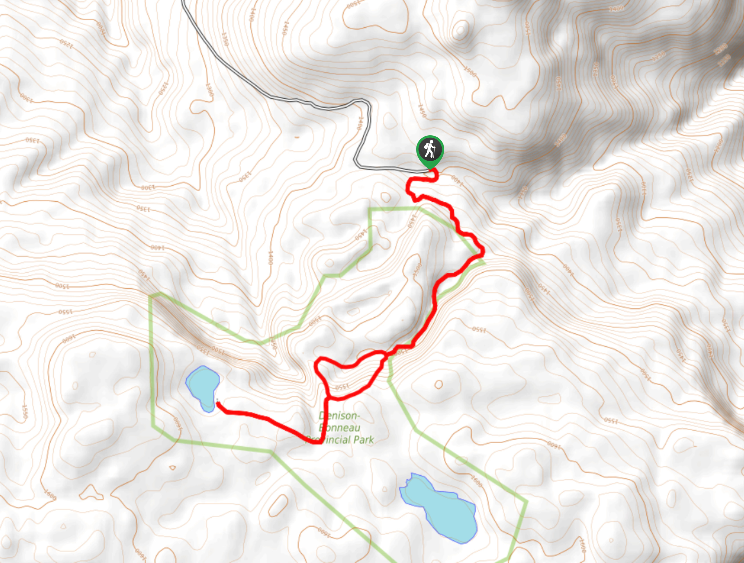
Denison Lake Trail in the Okanagan Valley is an excellent summer-day activity! The well-shaded trail follows a relatively flat path with some undulations. At one point, you’ll reach a trail junction, which is the start of a loop. You’ll continue this loop on your way back! Look out for green arrows on the trees to help direct you.
On your way to the lake, head left and take another left at the next junction. Continue walking until you see the lake. You’ll return the way you came, but to switch things up, take the other side of the loop on the way back, which joins up with the initial path.
Similar hikes to the Denison Lake Trail hike
Okanagan Mountain Hike
The Okanagan Mountain Hike is an incredible backcountry hike that gets your heart pumping, unveiling a reel of views en…
Glen Canyon Greenway Trail
The Glen Canyon Greenway Trail, located in West Kelowna, is a family-friendly hike that blends flat, easy-going terrain with more…
Blue Grouse Mountain Hike
The Blue Grouse Mountain Hike near Kelowna, BC, is a challenging hike that carries you up a steep ascent to…
Comments