

Crawford Canyon, Astrid and Lookout Trail
View PhotosCrawford Canyon, Astrid and Lookout Trail
Difficulty Rating:
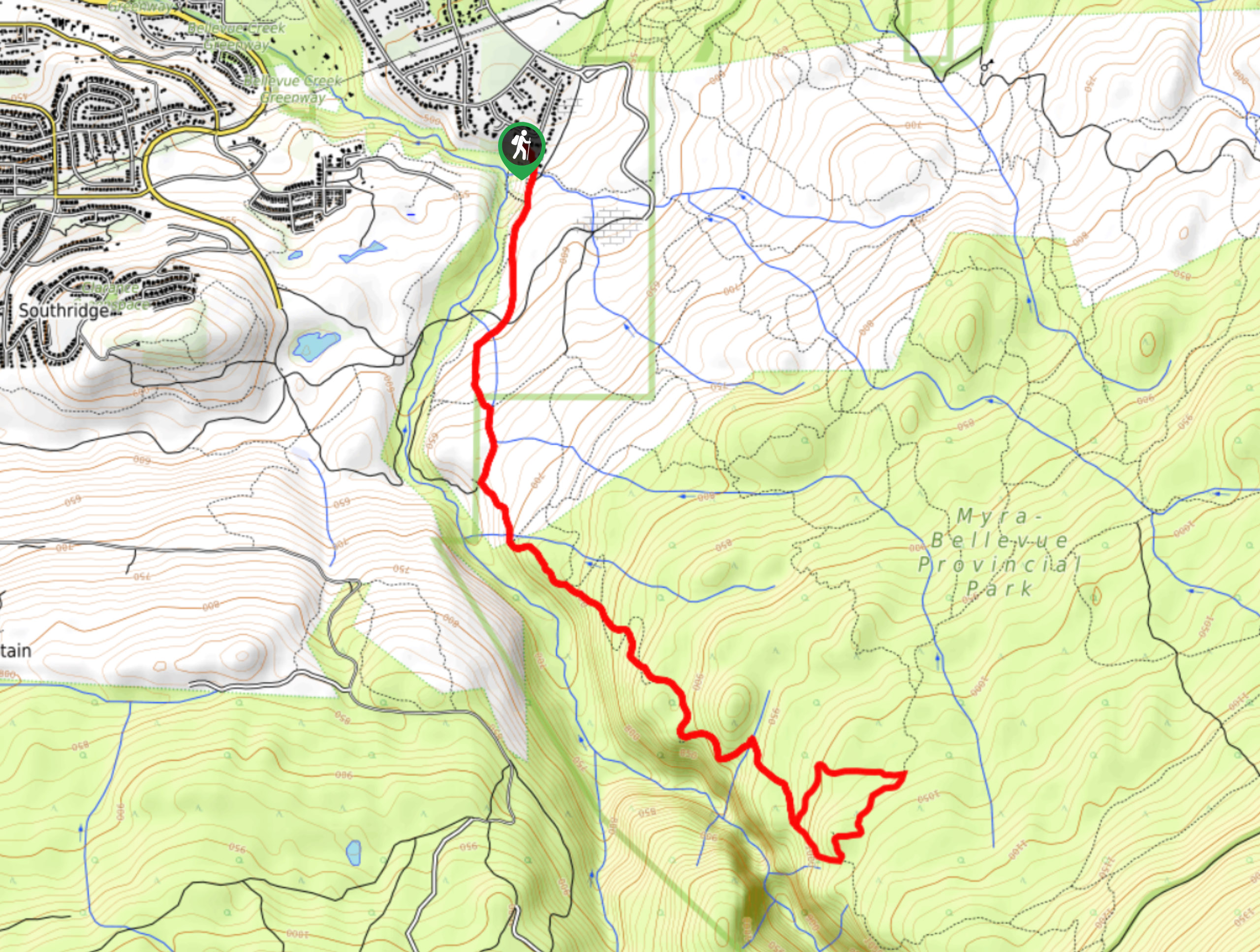
The Crawford Canyon, Astrid and Lookout Trail takes you from Canyon Falls Park to Myra-Bellevue Provincial Park. It fuses remarkable trails to form one incredibly scenic hike that boasts of waterfalls and a bird’s eye view of Okanagan Lake nestled in the valley below.
Getting there
To get to the trailhead for The Crawford Canyon, Astrid and Lookout Trail, head to Canyon Falls Court, a residential area that has you parking in the cul-de-sac.
About
| When to do | April-October |
| Backcountry Campsites | No |
| Pets allowed | Yes - On Leash |
| Family friendly | Older Children only |
| Route Signage | Poor |
| Crowd Levels | Low |
| Route Type | Lollipop |
Crawford Canyon, Astrid and Lookout Trail
Elevation Graph
Weather
Crawford Canyon, Astrid and Lookout Trail Description
The Crawford Canyon, Astrid and Lookout Trail in the Okanagan Valley is a lightly trafficked lollipop route that takes you past two waterfalls. One has the option to reach the foot of the waterfall via a rope, so if you’re up for a fun, technical challenge, you won’t want to miss out on trying this out. Be sure to exercise caution! This hike stretches across Canyon Falls Park and Myra-Bellevue Provincial Park, giving you a chance to not only view waterfalls but to marvel at a view of Okanagan Lake from up high.
Near the turn-around point, you’ll embark on the loop portion of this hike before following the same path back to your car.
Be sure to bring a GPS or a map to ensure you stay on the right path, as the signage isn’t the greatest.
Similar hikes to the Crawford Canyon, Astrid and Lookout Trail hike
Okanagan Mountain Hike
The Okanagan Mountain Hike is an incredible backcountry hike that gets your heart pumping, unveiling a reel of views en…
Glen Canyon Greenway Trail
The Glen Canyon Greenway Trail, located in West Kelowna, is a family-friendly hike that blends flat, easy-going terrain with more…
Blue Grouse Mountain Hike
The Blue Grouse Mountain Hike near Kelowna, BC, is a challenging hike that carries you up a steep ascent to…


Comments