Fairhead Circular Walk
View Photos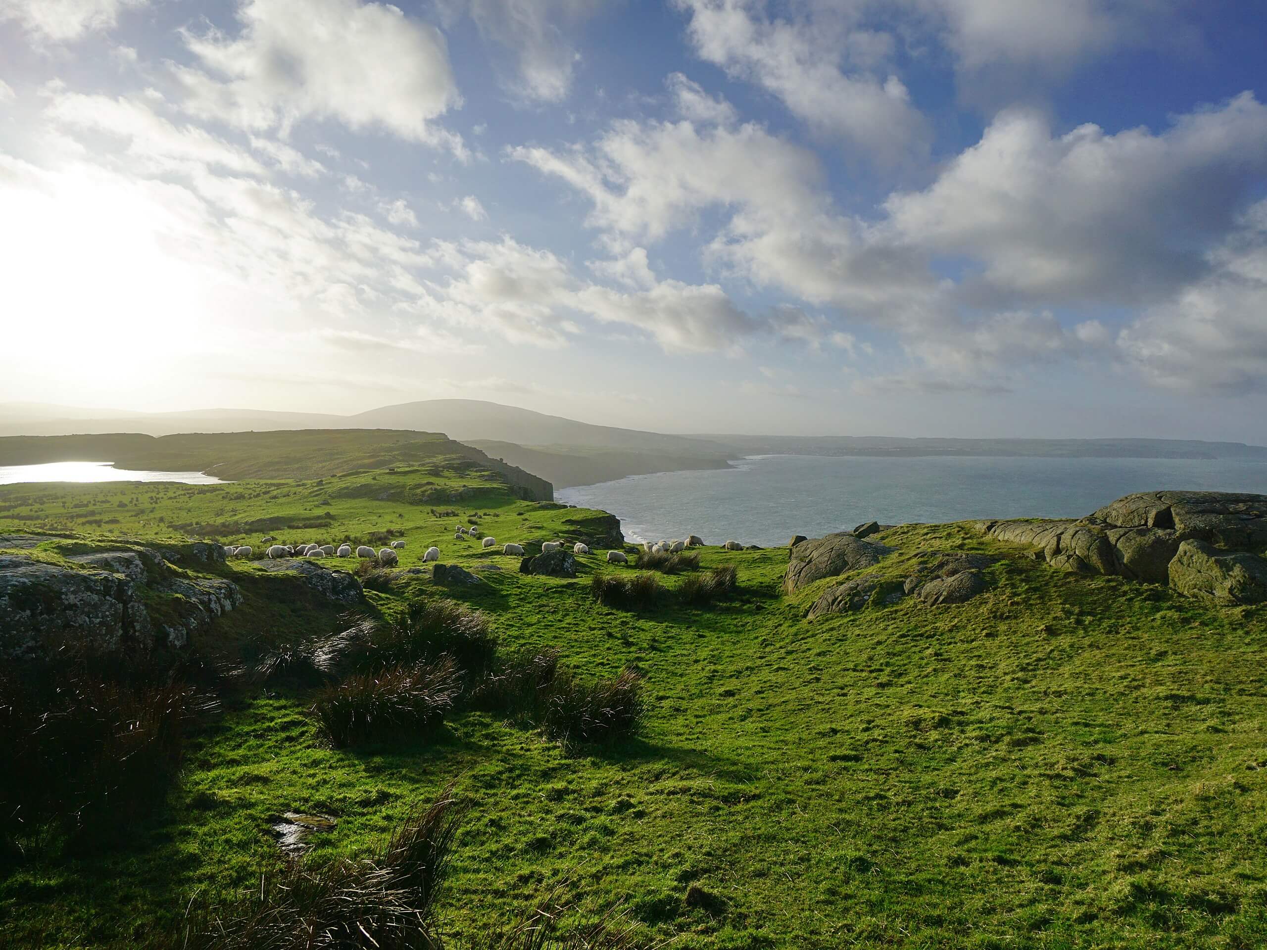
Fairhead Circular Walk
Difficulty Rating:
The Fairhead Circular Walk is an amazingly scenic adventure in Northern Ireland that will see you traverse the terrain atop one of the largest climbable rock walls in Northwest Europe. While out on the trail, you will make your way around the primitive farmlands atop Fairhead, while enjoying some stunning views of the rugged coastal landscape. This truly is a memorable adventure that you won’t want to miss out on!
Getting there
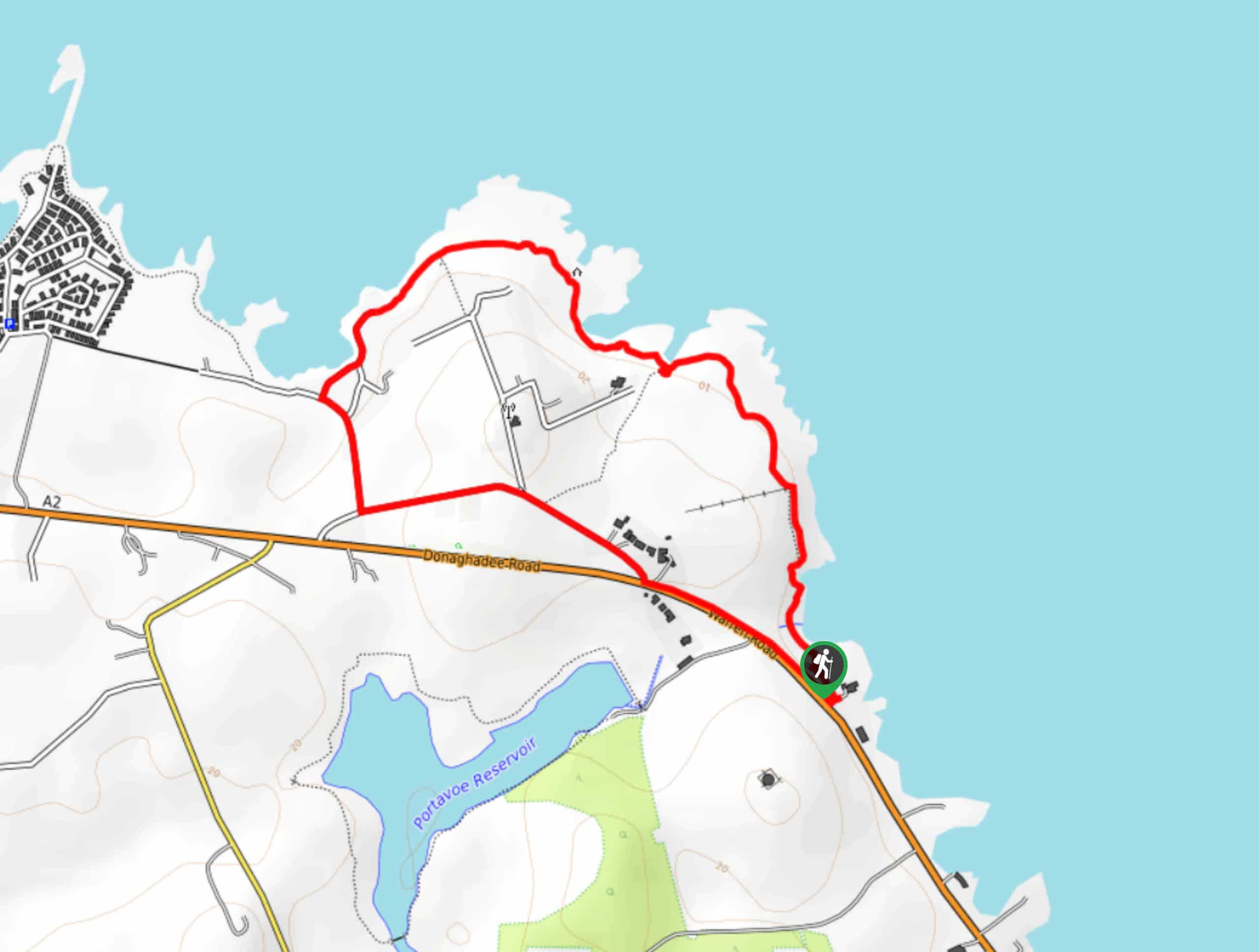
To reach the trailhead for the Fairhead Circular Walk from Ballycastle, head southeast on Mary Street/A2 for 0.2mi and turn left onto Cushendall Road, following it for 2.0mi. Turn left here onto Torr Road and follow it for 0.6mi, keeping straight onto Fairhead Road. Follow this for 1.7mi to reach the trailhead.

About
| Backcountry Campground | No |
| When to do | Year-Round |
| Pets allowed | Yes - On Leash |
| Family friendly | Yes |
| Route Signage | Average |
| Crowd Levels | High |
| Route Type | Circuit |
Fairhead Circular Walk
Elevation Graph
Weather
Fairhead Circular Walk Description
Fairhead is an iconic location along the coast of Northern Ireland and as such, it can become quite busy. Be sure to arrive early if you want to secure parking. Additionally, the terrain here is fairly rugged in places, and while it is a fairly easy route without much elevation gain, you will still want to wear some comfortable walking shoes.
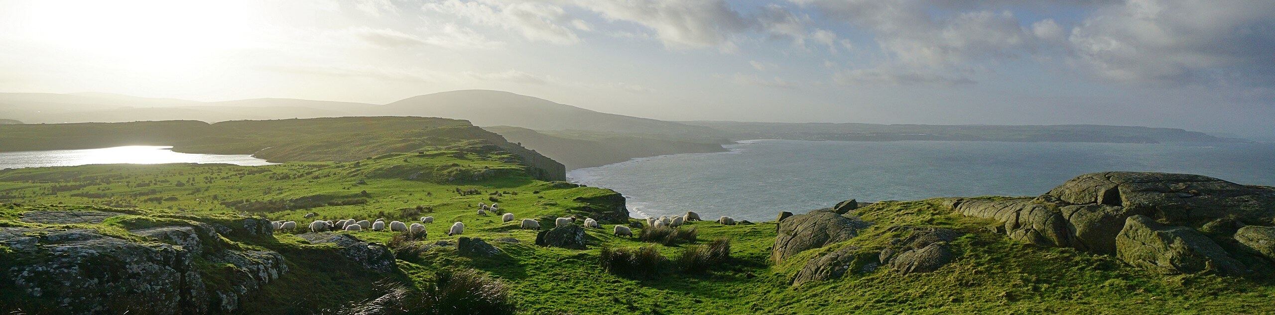
Even with all of these things considered, this is a fantastic walking route that will expose you to some of the most beautifully scenic terrain that Northern Ireland has to offer. Fairhead is an imposing cliff that stands 196m above the sea, offering expansive views along the coast that include Rathlin Island to the northwest. It is such an impressive sight that Claudius Ptolemaeus may have even written about the cliffs in his 2nd Century CE work Geography. In any case, if you find yourself in the area, you would be remiss if you skipped out on the opportunity to walk this amazing route.
Setting out from the trailhead, you will make your way to the north to traverse the rugged terrain, passing by the waters of Lough na Cranagh Crannog on your left as you work your way to the coast. Once there, you will follow the trail as it bends to the west, working along the edge of the imposing cliff as you take in the stunning views across the sea that extend out to Rathlin Island.
Continue along the trail as it skirts the rugged cliffside and turns to the southwest. Here, you will have a great sightline looking out to Ballycastle, as you keep on and pass by Lough Doo. Shortly after passing by the small lake, the trail will bend to the southeast and eventually meet up with a lane. Following this to the left, you will make your way along the final portion of the walk that will bring you back to the trailhead where you started the Fairhead CIrcular Walk.
Trail Highlights
Fairhead
Located at the northeastern corner of County Antrim, Fairhead is a 3.1mi mountain cliff that offers stunning views looking out onto Rathlin Island. It is possible that the imposing rock formation was mentioned in Ptolemy’s 2nd Century CE work Geography as a point along the coast referred to as Robogdion.
Standing 643ft above the sea, the impressive cliff is a popular destination for rock climbers, as the rock face forms vertical columns that resemble an organ’s pipes and make for excellent climbing. The formation is one of the largest climbable rock walls in Northwest Europe.
Frequently Asked Questions
What is Fairhead formed from?
Fairhead Cliff is formed from an igneous rock called dolerite, being created by volcanic activity roughly 60mya.
How high is Fairhead?
The rockwall at Fairhead is roughly 100m tall and stands 196m above the sea.
Insider Hints
Wear proper walking footwear for this adventure.
Make sure to arrive early, as this is a popular walking route.
Similar hikes to the Fairhead Circular Walk hike
Helen’s Tower Walk
The Helen’s Tower Walk is a quick adventure in County Down that will lead you slightly uphill to an historic…
Drumnaph Nature Reserve Walk
The Drumnaph Nature Reserve Walk is a fun outdoor excursion that will lead you through a variety of landscapes offering…
Orlock Point Walk
The Orlock Point Walk is a beautifully scenic coastal adventure in County Down, Northern Ireland that offers some nice views…
Comments