

Beaghmore Stone Circles Walk
View PhotosBeaghmore Stone Circles Walk
Difficulty Rating:
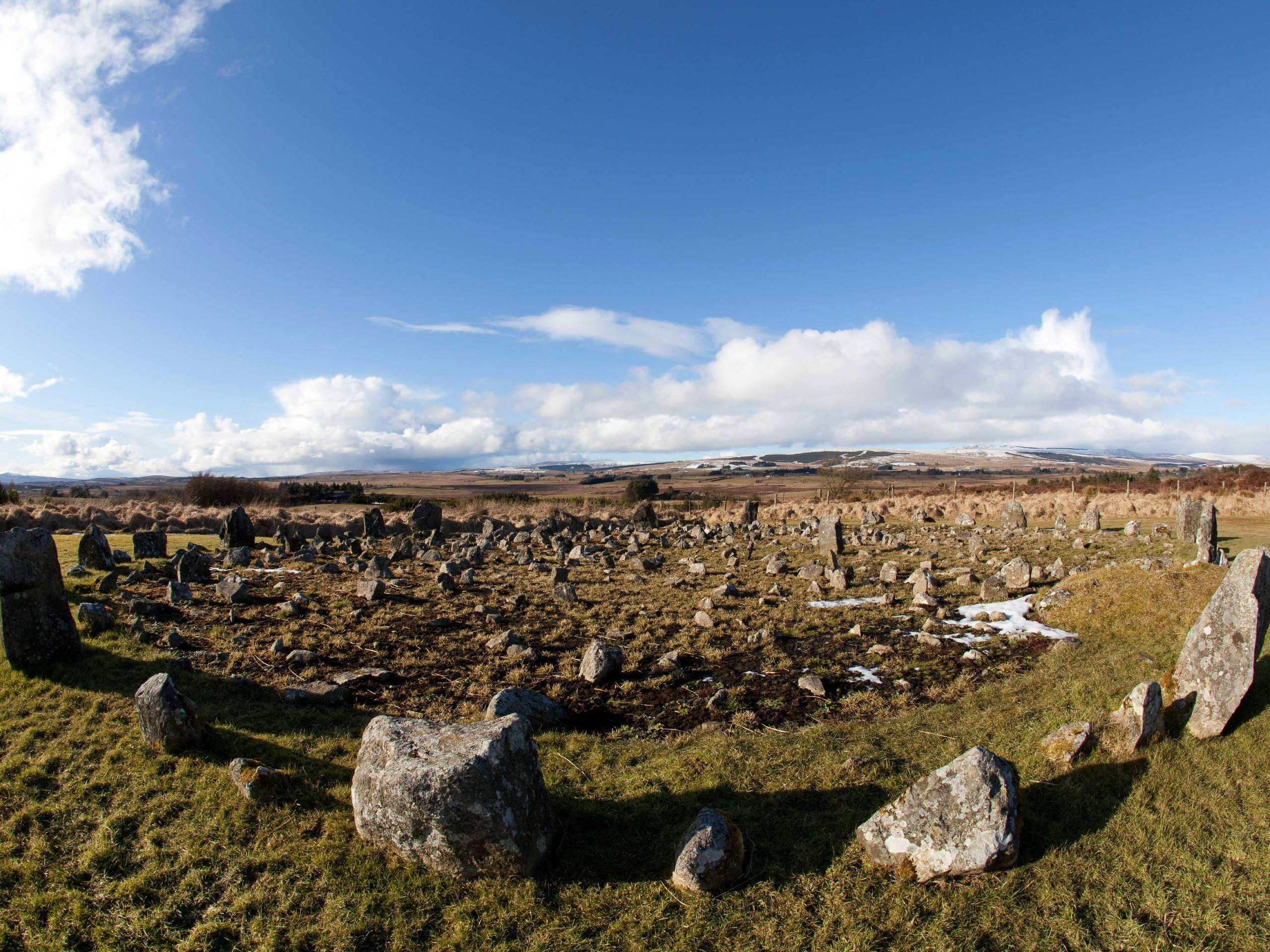
The Beaghmore Stone Circles Walk is a great route in County Tyrone, Northern Ireland that will take you through the Sperrins AONB to visit a fascinating historical site. While out walking the trail, you will utilize quiet roads in order to loop around the countryside and visit a series of early Bronze Age stone circles and cairns that were discovered in the late 1930s. As previously mentioned, this route follows along several roadways, so make sure to exercise caution if walking with children or dogs.
Getting there
The trailhead for the Beaghmore Stone Circles Walk can be found along Blackrock Road, approximately 10.0mi northwest of Cookstown.
About
| Backcountry Campground | No |
| When to do | Year-Round |
| Pets allowed | Yes - On Leash |
| Family friendly | Older Children only |
| Route Signage | Average |
| Crowd Levels | Moderate |
| Route Type | Circuit |
Beaghmore Stone Circles Walk
Elevation Graph
Weather
Beaghmore Stone Circles Walk Description
If you enjoy long distance walking routes through the countryside and visiting interesting and mysterious historical sites, then you will be sure to love the Beaghmore Stone Circles Walk. This fun walking route will allow you to experience the landscape of the Sperrins Area of Outstanding Natural Beauty and explore a series of stone circles and cairns that are thousands of years old.
Setting out from the trailhead, you will make your way to the southwest along Beaghmore Road, enjoying the views across the picturesque countryside before turning right onto Keerin Road. Following this to the north, you will cross over the Owenkillew River and make your way gradually uphill until you meet up with Davagh Road.
Turning right here, you will follow Davagh Road to the southeast, heading gently downhill until you meet up with Blackrock road. Turning right here, you will follow the road and cross back over the river in order to arrive at the Beaghmore Stone Circles. Take some time to explore the fascinating early Bronze Age monolithic structures, before continuing along the road on the return to the trailhead.
Similar hikes to the Beaghmore Stone Circles Walk hike

Helen’s Tower Walk
The Helen’s Tower Walk is a quick adventure in County Down that will lead you slightly uphill to an historic…

Annalong Wood and Blue Lough Circular Walk
The Annalong Wood and Blue Lough Circular Walk is a rugged and challenging adventure in the Mourne Mountains of Northern…

Drumnaph Nature Reserve Walk
The Drumnaph Nature Reserve Walk is a fun outdoor excursion that will lead you through a variety of landscapes offering…


Comments