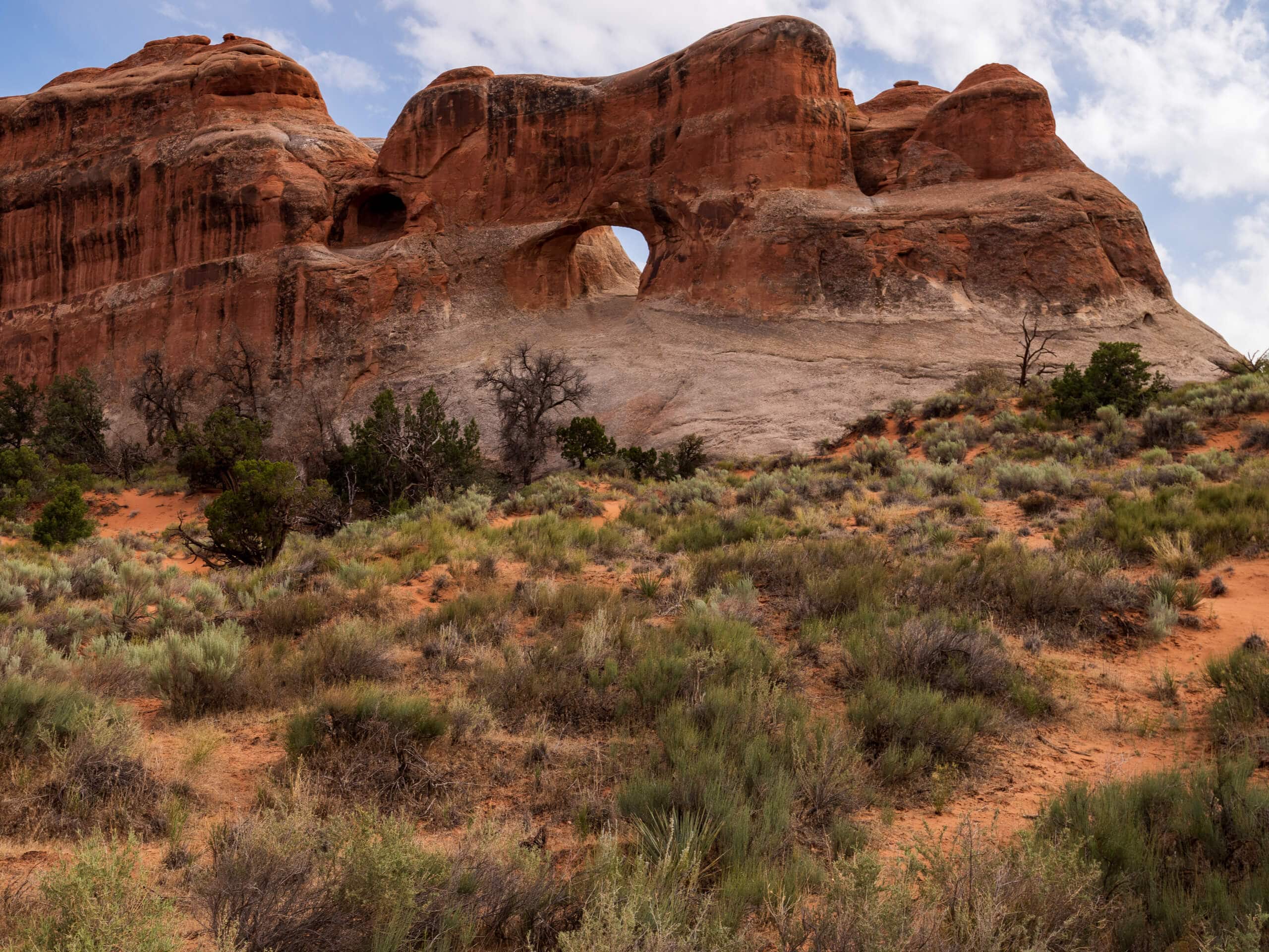


The Tunnel
View PhotosThe Tunnel
Difficulty Rating:
The Tunnel is a short, out-and-back route to a unique geological formation in Arches National Park: a 53ft-long tunnel through a sandstone buttress. This hike doesn’t see a lot of traffic and the trail can be difficult to navigate. Good map-reading skills, a GPS unit, and/or an incredible sense of direction is essential for this hike.
Getting there
The Tunnel trail begins at the parking area on the northside of Courthouse Wash Bridge 5.3mi up Main Park Road from the Arches Visitor Center off of highway 191.
About
| Backcountry Campground | No |
| When to do | Year-round |
| Pets allowed | No |
| Family friendly | Older Children only |
| Route Signage | Poor |
| Crowd Levels | Low |
| Route Type | Out and back |
The Tunnel
Elevation Graph
Weather
The Tunnel Description
The Tunnel Trail is a rugged route to a unique geological formation just off of Main Park Road in Arches National Park. This hike does not have a well-defined trail, so bringing along a map and/or GPS unit is highly recommended. The last little section of trail up to The Tunnel is steep; solid footwear with good grip is necessary for this section. The Tunnel itself is a 4-foot-wide, 5-foot-tall, 53-foot-long tunnel through a sandstone buttress that was formed by gradual water erosion. If you stick your head in the tunnel, you will see the trickles and drips that continue to chip away at the walls of The Tunnel to this day.
From the parking lot, follow the path to the left, heading towards courthouse wash. Hug the large rock formation on your right as the trail swoops up to track northwest. Continue northwest for 0.6mi past two more large rocky features on the right. After 0.6mi, turn to your right and head northeast for 0.4mi to the Tunnel.
Check out this fascinating feature and have a rest in the shade before turning around and following your footsteps back to the parking lot.
Similar hikes to the The Tunnel hike

Big Horn Overlook Trail
The Big Horn Overlook Trail is a family-friendly hike in Dead Horse Point State Park. This trail takes you to…

Colorado River Overlook Trail
The Colorado River Overlook Trail is a short and easy route that affords hikers stunning views of the Utah desert.…

Dead Horse Rim Loop and Big Horn Overlook Trail
The Dead Horse Rim Loop and Big Horn Overlook Trail is a fantastic day-hike in the southern section of Dead…


Comments