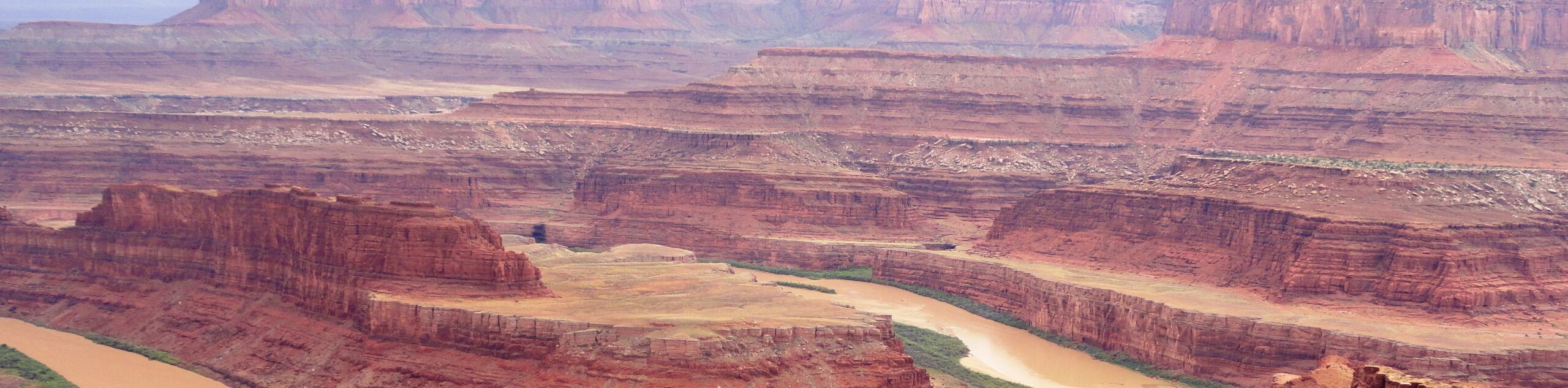
The Corona Arch Trail
View Photos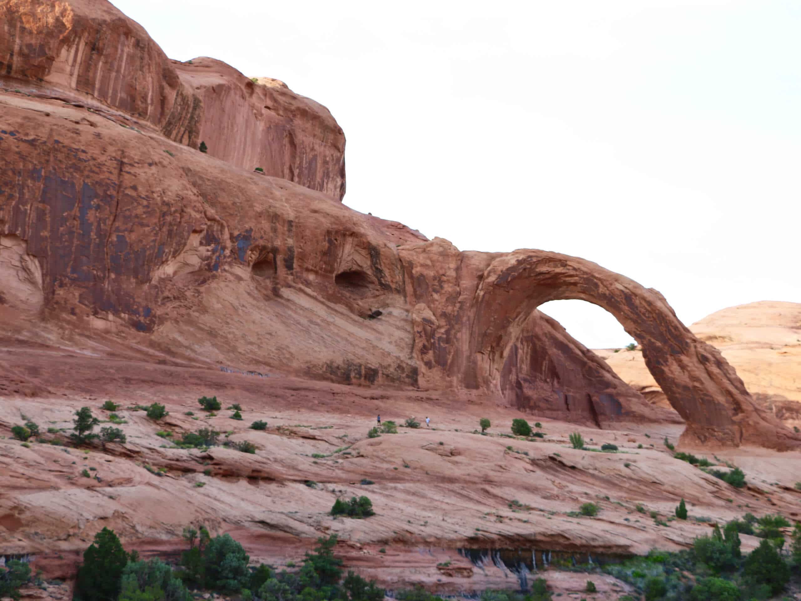
The Corona Arch Trail
Difficulty Rating:
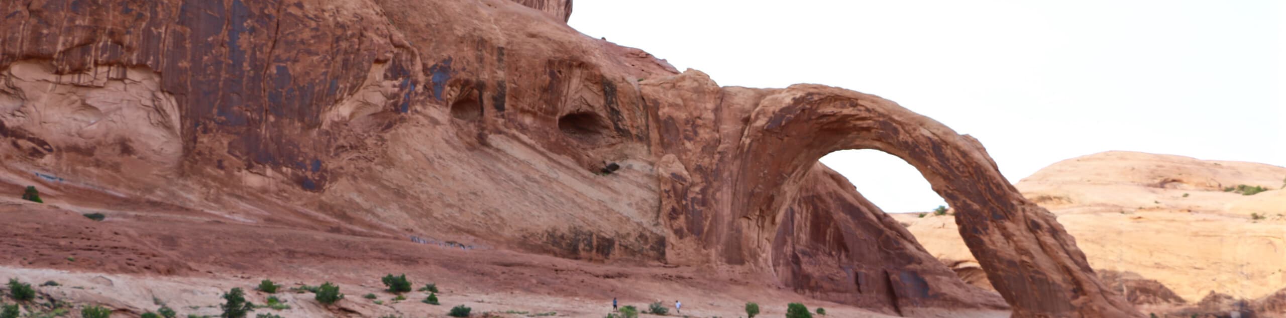
The trail to the Corona Arch and the Bowtie Arch is a short, moderately challenging hike just outside of Moab, Utah, that passes the Bowtie Arch and the Pinto Arch on route to the expansive and impressive Corona Arch. This trail is dog-friendly (as long as pups are kept on leash). Overall, this is a great little hike to one of the largest and most magnificent arch formations near Moab- the Corona Arch.
Getting there
This trail begins at the Corona Arch Trailhead in the Gold Bar camping area just off of highway 279, about 10.0mi down the road from highway 191.

About
| Backcountry Campground | No |
| When to do | year-round |
| Pets allowed | Yes - On Leash |
| Family friendly | Older Children only |
| Route Signage | Average |
| Crowd Levels | High |
| Route Type | Out and back |
The Corona Arch Trail
Elevation Graph
Weather
The Corona Arch Trail Description
The hike to Corona and Bowtie Arch formations is a fantastic adventure just outside of Moab, UT. This hike is dog-friendly; however, there is a point on this route where hikers will have to use a ladder to climb a steep section of trail. If your dog is too large to carry up this section, consider doing a different hike in the area. Dogs must also be kept on leash at all times. The trail to Corona Arch is well marked over the sections of slickrock with cairns. There are a couple of exposed sections on this trail that have cables to use as handrails. If you are not comfortable with exposure, you can view the arch from the first set of cables without venturing over any vertiginous terrain.
The natural wonder of the Corona and Bowtie Arch formations are well worth this hike. The Corona arch is one of the largest arch formations in Moab, spanning a whopping 140 by 105ft. Make sure you pack a camera with you on this hike—to say that this trail is picturesque would be an understatement.
From the trailhead, follow the path up the slope and across the railroad tracks. 0.5mi down the trail, the path will divide. Following the path on the left will lead you a short distance to the Pinto Arch formation. Continue on the right-hand path to see the Corona and Bowtie Arches. The arches will become visible about 0.2mi past the junction, and the trail continues on for another 0.7mi total.
This last stretch of trail is a bit exposed and lightly technical with cable railings and a small ladder, but it should be do-able for moderately experienced hikers and older children.
Once at the Corona Arch, bask in the glory of this incredible geological formation. When you are ready to head home, simply turn around and follow the same trail back to the trailhead.
Frequently Asked Questions
Is the Corona Arch Free?
Yes, access to the Corona Arch is free. The Corona and Bowtie Arch trail is on BLM land, so hikers do not have to pay the park entrance fee required for trails within Arches National Park.
How long is the Corona Arch
The Corona Arch formation is 140ft long and 105ft high.
Insider Hints
This trail is open to dogs but does feature a short ladder up a steep section of trail—make sure the pup can navigate this obstacle or that you are able to carry your furry friend up with you.
Dogs must be on leash at all times on this trail.
Don’t forget the camera! These arch formations are absolutely breathtaking.
Similar hikes to the The Corona Arch Trail hike
Big Horn Overlook Trail
The Big Horn Overlook Trail is a family-friendly hike in Dead Horse Point State Park. This trail takes you to…
Colorado River Overlook Trail
The Colorado River Overlook Trail is a short and easy route that affords hikers stunning views of the Utah desert.…
Dead Horse Rim Loop and Big Horn Overlook Trail
The Dead Horse Rim Loop and Big Horn Overlook Trail is a fantastic day-hike in the southern section of Dead…
Comments