Fisher Towers hike
View Photos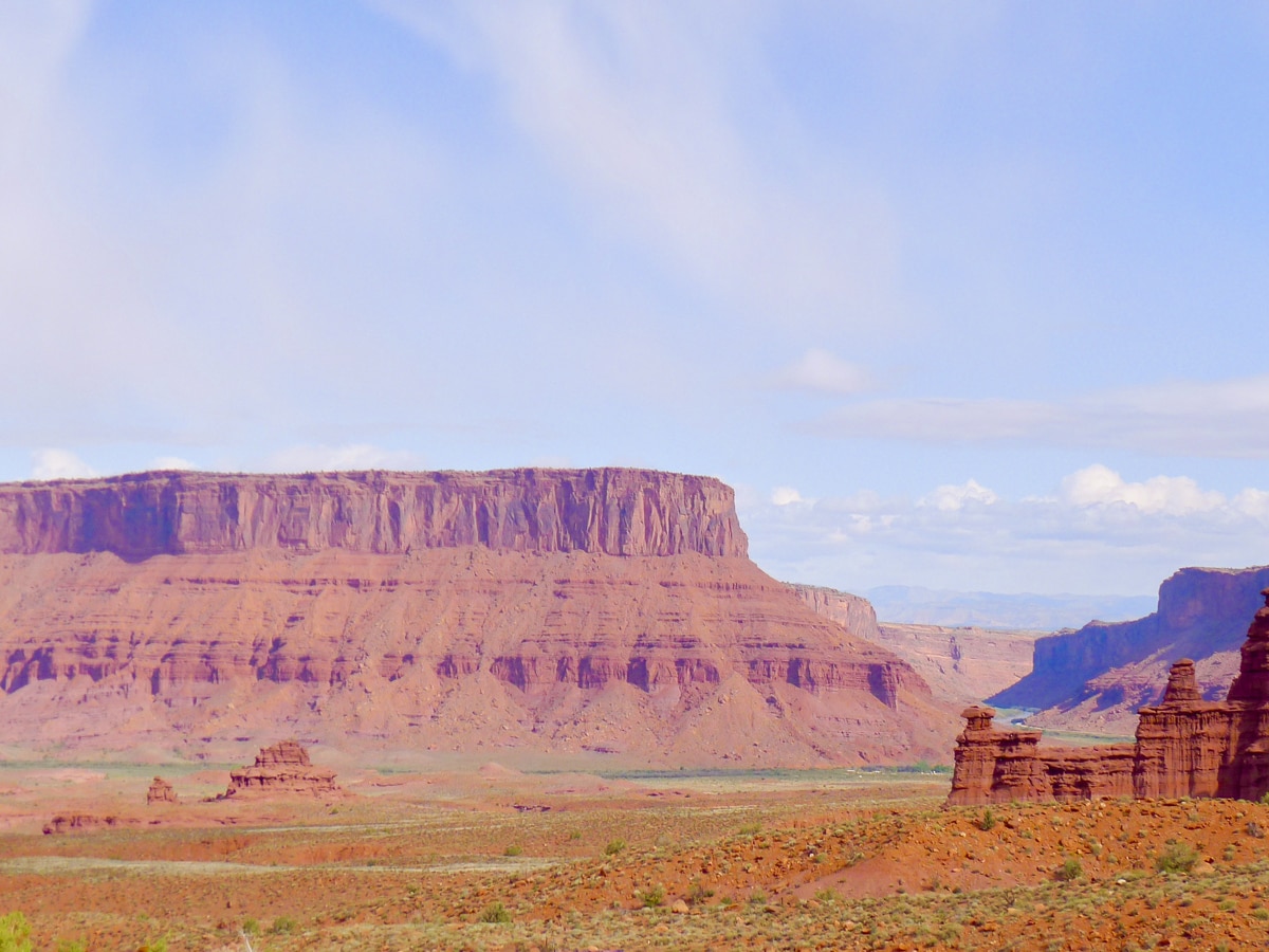
Fisher Towers hike
Difficulty Rating:
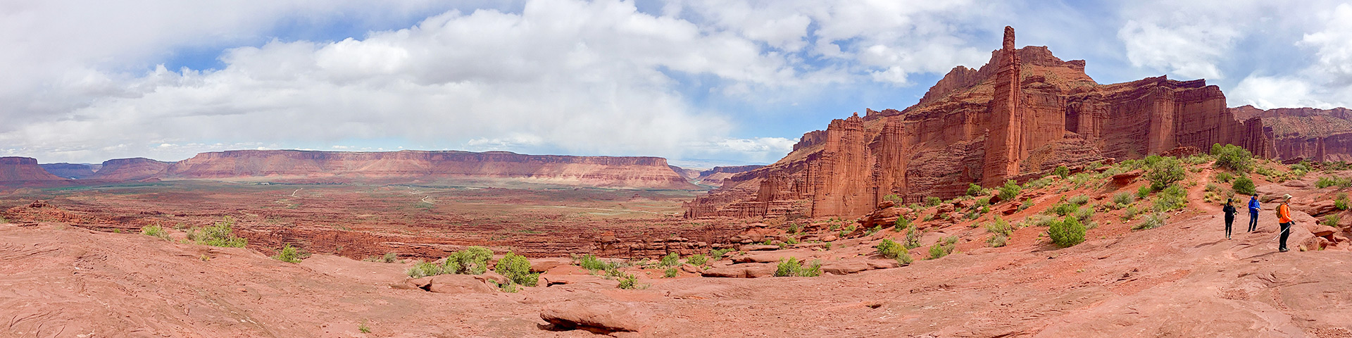
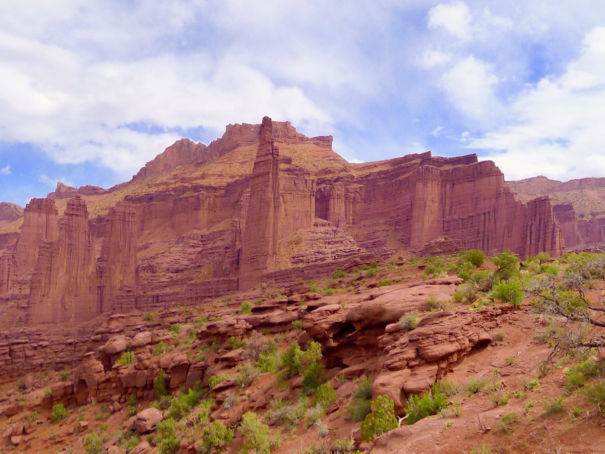
This popular trail brings hikers through monumental sandstone towers popular with many climbers, otherwise known as the majestic Fisher Towers. The trail slowly climbs beside the towers until if finally gains a ridge, granting panoramic views of all the towers as well as the expansive valley and the Colorado River.
Getting there
From Moab drive north along the 191 for 2.5mi until you reach the first highway junction. Turn right onto the 128 East (this junction is before you cross the Colorado River). This scenic highway continues for 21.0mi until you turn right onto the signposted dirt road leading towards the Fisher Towers. This road is easily driven by sedans.

About
| When to do | Year Round |
| Backcountry Campsites | Yes |
| Toilets | Yes |
| Family friendly | No |
| Route Signage | Average |
| Crowd Levels | Moderate to High |
| Route Type | Out and back |
Fisher Towers
Elevation Graph
Weather
Route Description for Fisher Towers
The parking lot at the trailhead is relatively small compared to the popularity of the hike. Arrive early or be prepared to park a ways down the access road. The area is named after an old miner who, back in the 1880s, lived near the towers.
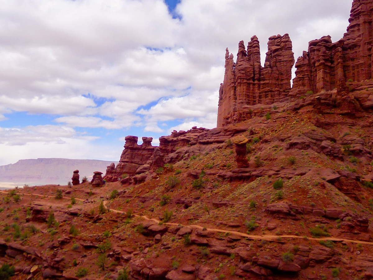
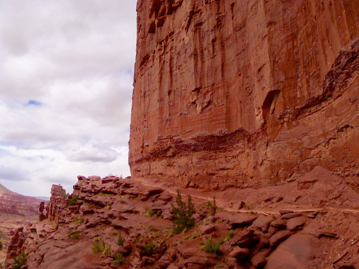
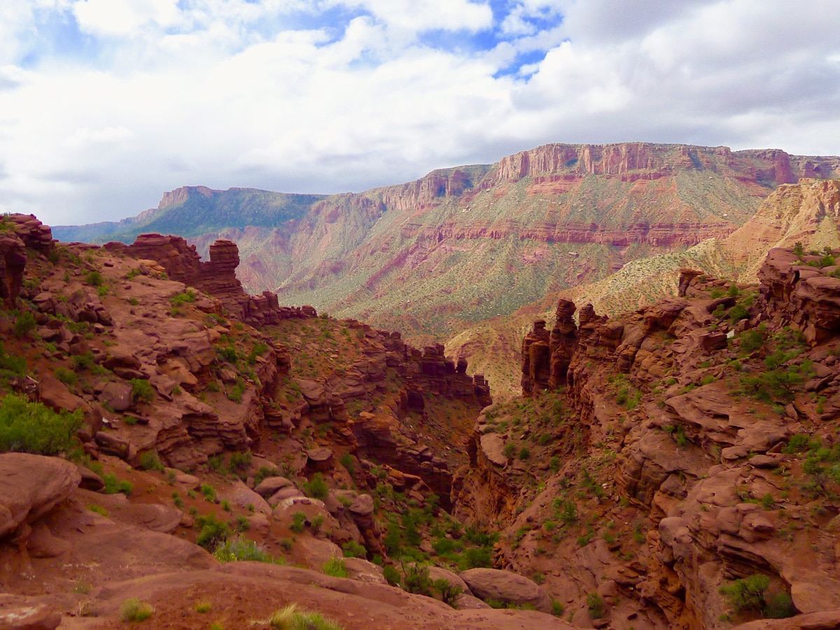
On the right hand side of the parking lot the trail begins. You will descend into a small canyon shortly after beginning, and then quickly climb out of it on the other side. From here the trail continues at a constant uphill grade that is not especially steep. The first two-thirds of the trail hug the base of the towers, snaking in and out with each valley or canyon.
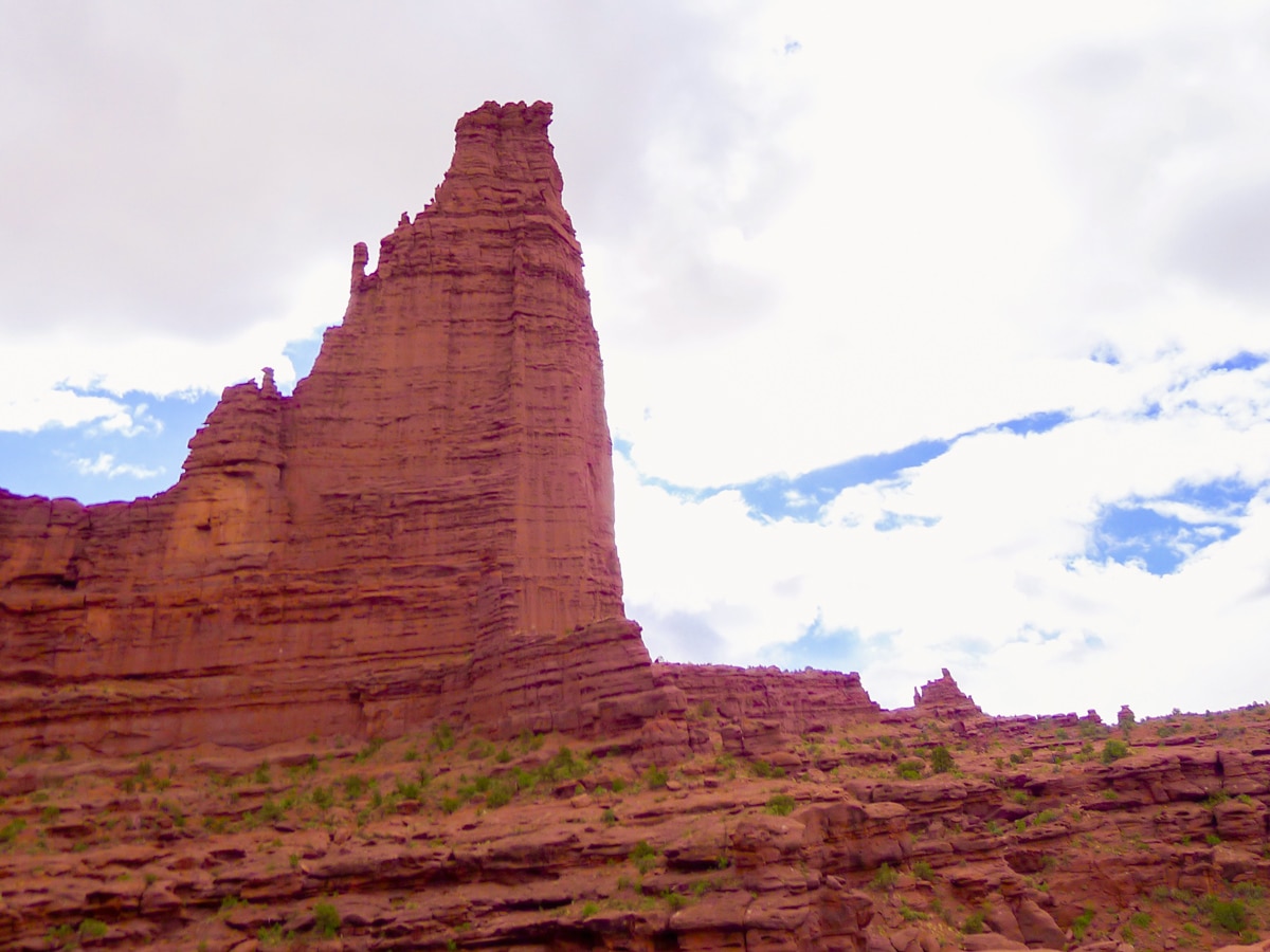
A short ways along the trail you will reach a well signposted junction leading climbers to the left and hikers to the right. The red dirt trail continues for another little ways before reaching a point with a gorgeous view of the Titan. This rock tower is 900 feet tall, and its presence is truly captivating! Like a fish fin the titan juts out from its peers to dominate the skyline.
The only difficult section of the trail is aided by a metal step ladder, which brings you down an otherwise difficult to navigate rocky step. Take care when it’s wet, as the bare stainless steel can be slippery.
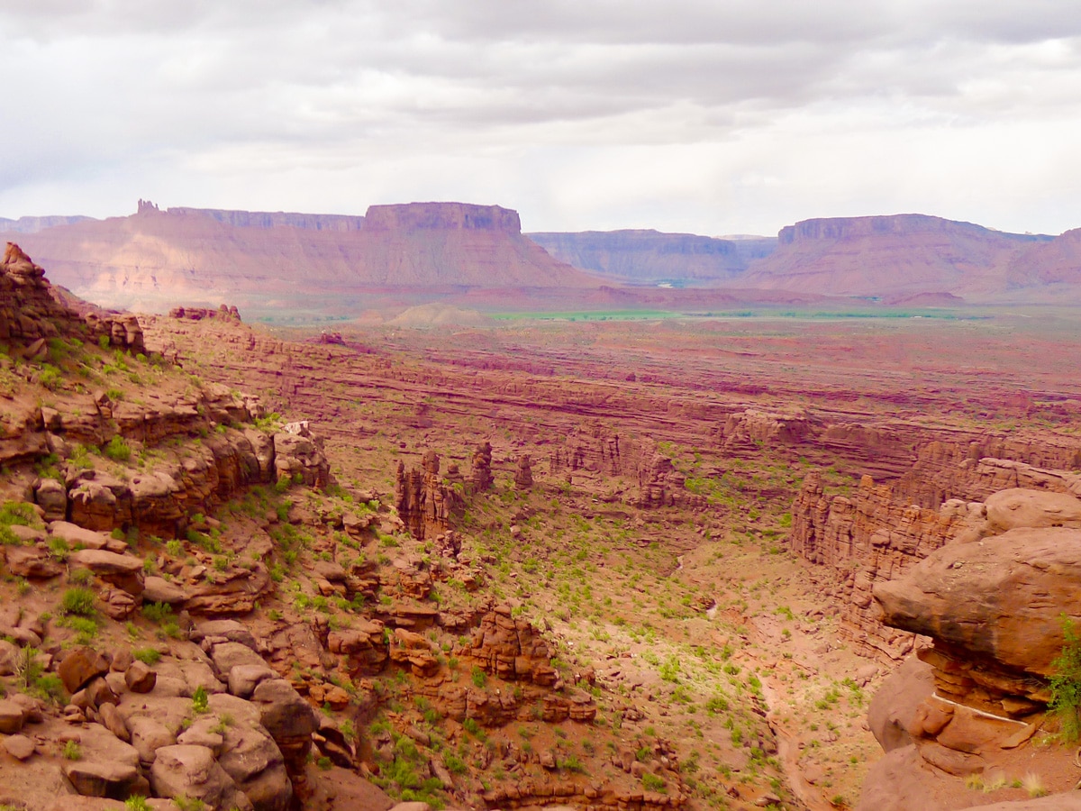
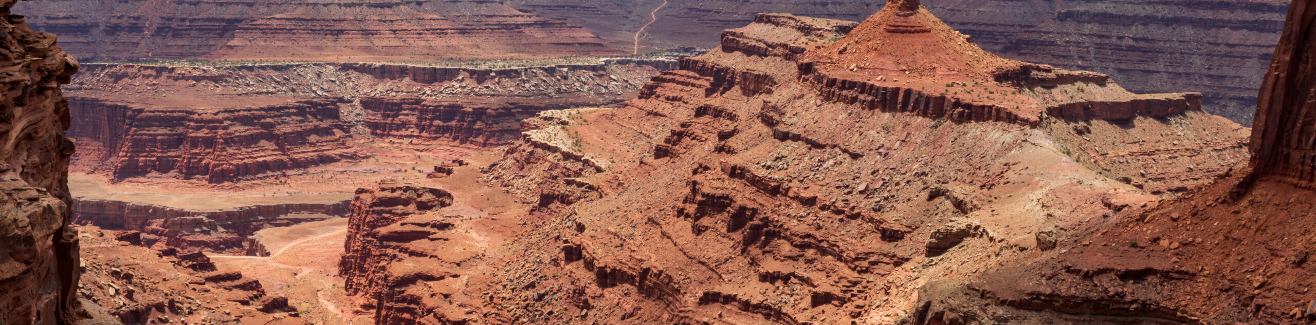
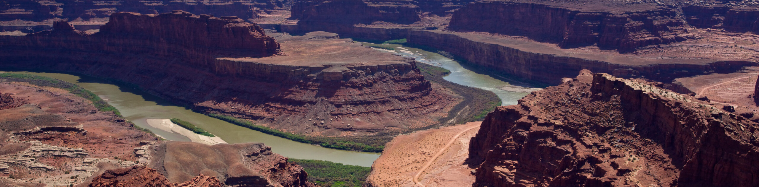
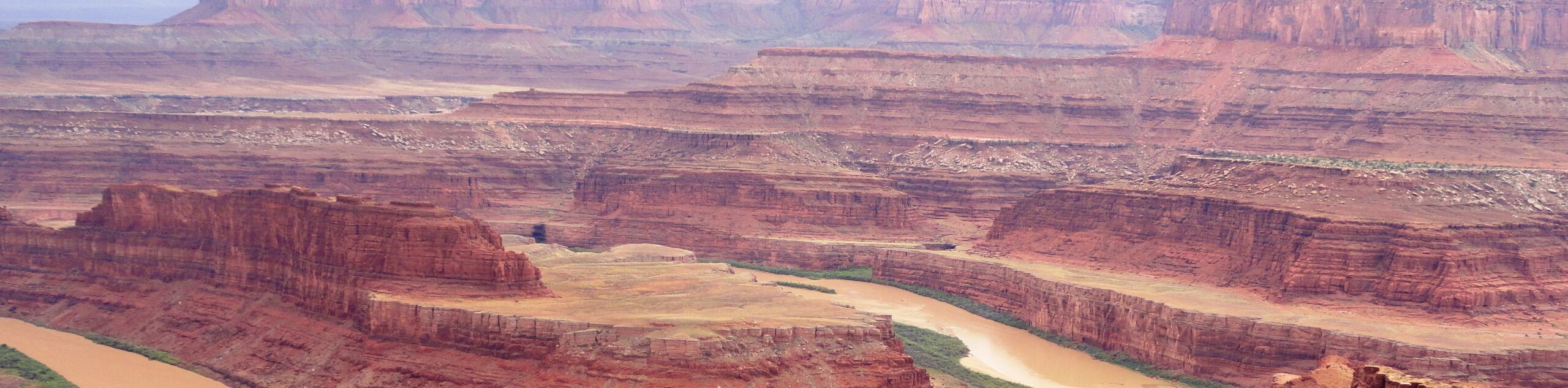
Towards the end of the path the trail diverts from the towers and leads out along a ridge for several hundred yards. On one side you will get magnificent views of the steep cliffs that line the entirety of the huge valley, as well as the brown flowing Colorado River. On the other you will see tetrahedral hills covered in small shrubs. Both of the contrasting scenes are stunning. Looking back the way you came you will be treated with a panoramic view of all the towers, with the Titan taking center stage. Return to the parking lot the way you came.
If you want to find other great hikes around Moab and Arches National Park, check out the Delicate Arch Hike, Double Arch Hike or the Dead Horse Point Hike.
Insider Hints
There is a BLM campground operated right beside the trailhead. Stay here if you want sunrise or sundown shots of the towers.
Many guiding outfits in Moab run climbing trips up several of these towers. Consider looking into climbing on of the classic routes on any of the towers.

Similar hikes to the Fisher Towers hike
Big Horn Overlook Trail
The Big Horn Overlook Trail is a family-friendly hike in Dead Horse Point State Park. This trail takes you to…
Colorado River Overlook Trail
The Colorado River Overlook Trail is a short and easy route that affords hikers stunning views of the Utah desert.…
Dead Horse Rim Loop and Big Horn Overlook Trail
The Dead Horse Rim Loop and Big Horn Overlook Trail is a fantastic day-hike in the southern section of Dead…
leo_Martini 5 years ago
I suggest to start early!! You'll beat the heat as well as crowds.
Frank M. 5 years ago
Amazing views throughout. Cool rock formations and great views of the area.
Stevie M 5 years ago
Magical hiking trail that offers gorgeous views.
April O. 5 years ago
Needed to wait for an hour before I was able to park my car. It was packed with people when I visited.
Gabriel10 5 years ago
Outstanding landscape! It looks like an art exhibit!
brandonlong 5 years ago
Perfect panoramic views of landscapes and land formations!
Kitera Sunama 6 years ago
The sky was gray all day. The photos I've taken would have been better if the sky was blue.
Yuli H. 6 years ago
It's quite easy, but it might not be suitable for all ages. Plus it's quite popular so expect a lot of people.
Meadow M. 6 years ago
The rock formation is just so cool. Great landscapes. It was a nice hike for us.
Joe Bart 6 years ago
It was very easy to discern the path. Love the views along the way.