Tahoe Rim Trail to Picnic Rock Viewpoint
View Photos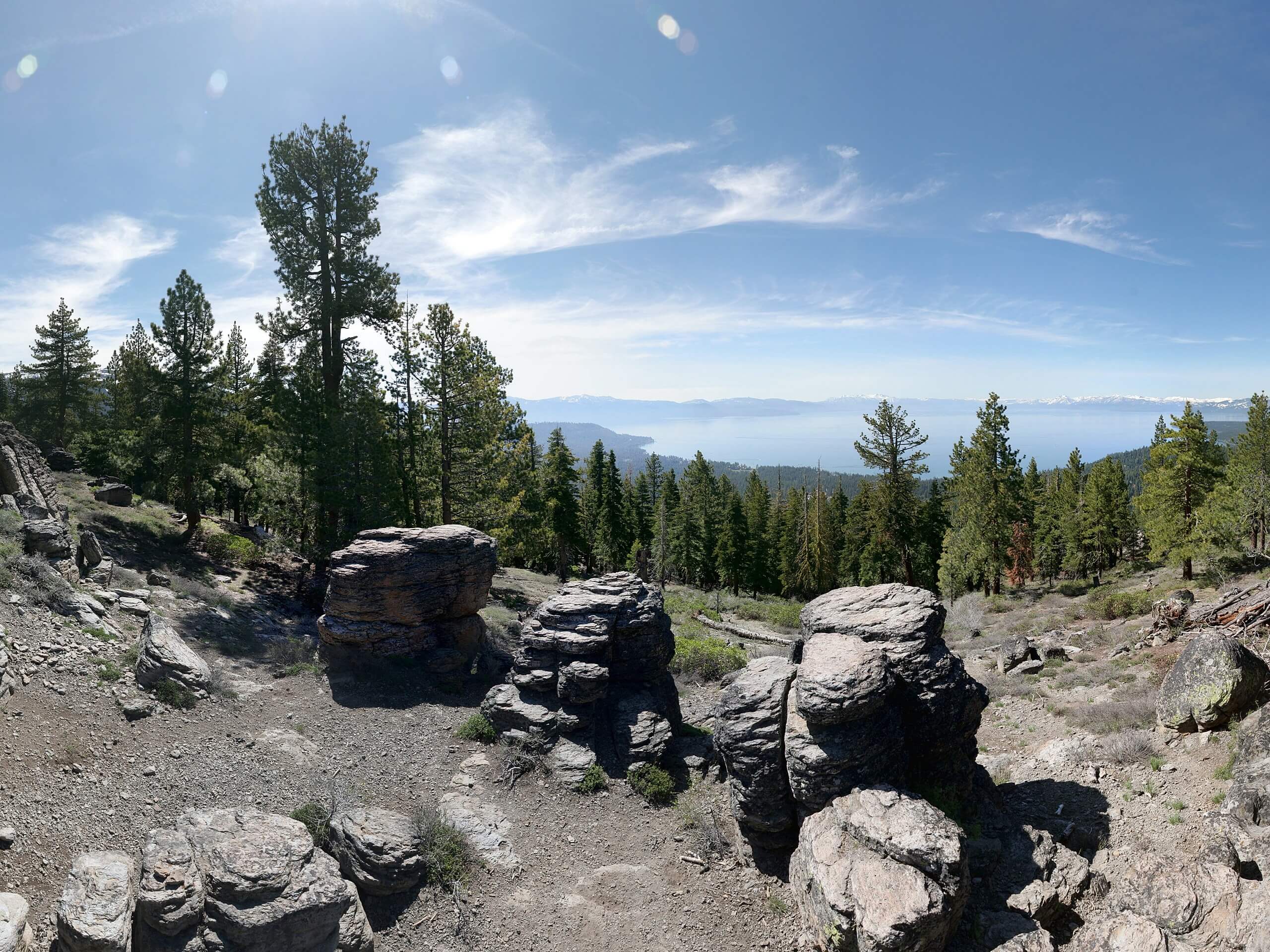
Tahoe Rim Trail to Picnic Rock Viewpoint
Difficulty Rating:
The Tahoe Rim Trail to Picnic Rock Viewpoint is a great adventure that boasts wonderful vistas of Lake Tahoe and the High Sierra. Kids and adults alike can easily navigate the terrain up to the overlook which is, coincidentally, a great place to set up a picnic.
Getting there
The Tahoe Rim Trail to Picnic Rock Viewpoint is accessed via the Tahoe Rim Trailhead off Senator Paul J. Lunardi Memorial Highway.

About
| Backcountry Campground | No |
| When to do | Year-round |
| Pets allowed | Yes - On Leash |
| Family friendly | Yes |
| Route Signage | Poor |
| Crowd Levels | High |
| Route Type | Out and back |
Tahoe Rim Trail to Picnic Rock Viewpoint
Elevation Graph
Weather
Tahoe Rim Trail to Picnic Rock Viewpoint Description
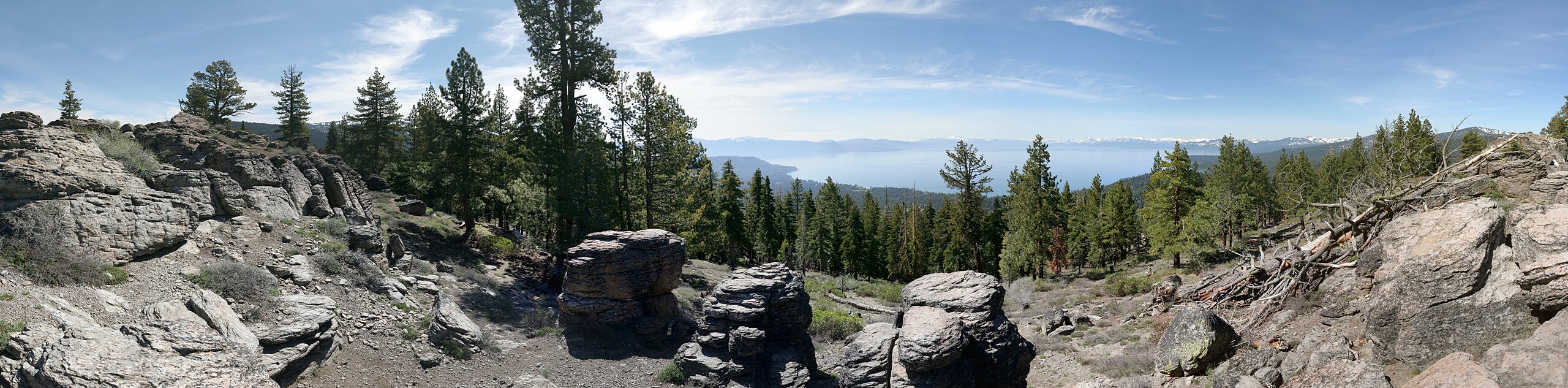
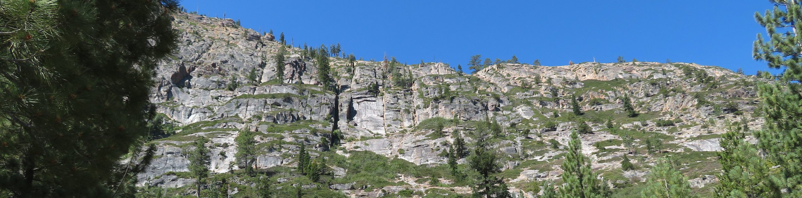
The Tahoe Rim Trail to Picnic Rock Viewpoint is an epic excursion above the northern shore of Lake Tahoe that awards adventurers with breathing panoramas of the alpine lake. Venture up through granite gardens and mixed pines to the Picnic Rock, which is so accurately named, as you will likely be in the company of picnic—goers. Note that this route can be accessed year-round, but the terrain can be extremely slippery in the winter and after rainfall, so exercise caution! Additionally, when trekking in the summer months, we recommend wearing sun protection as much of the path is exposed.
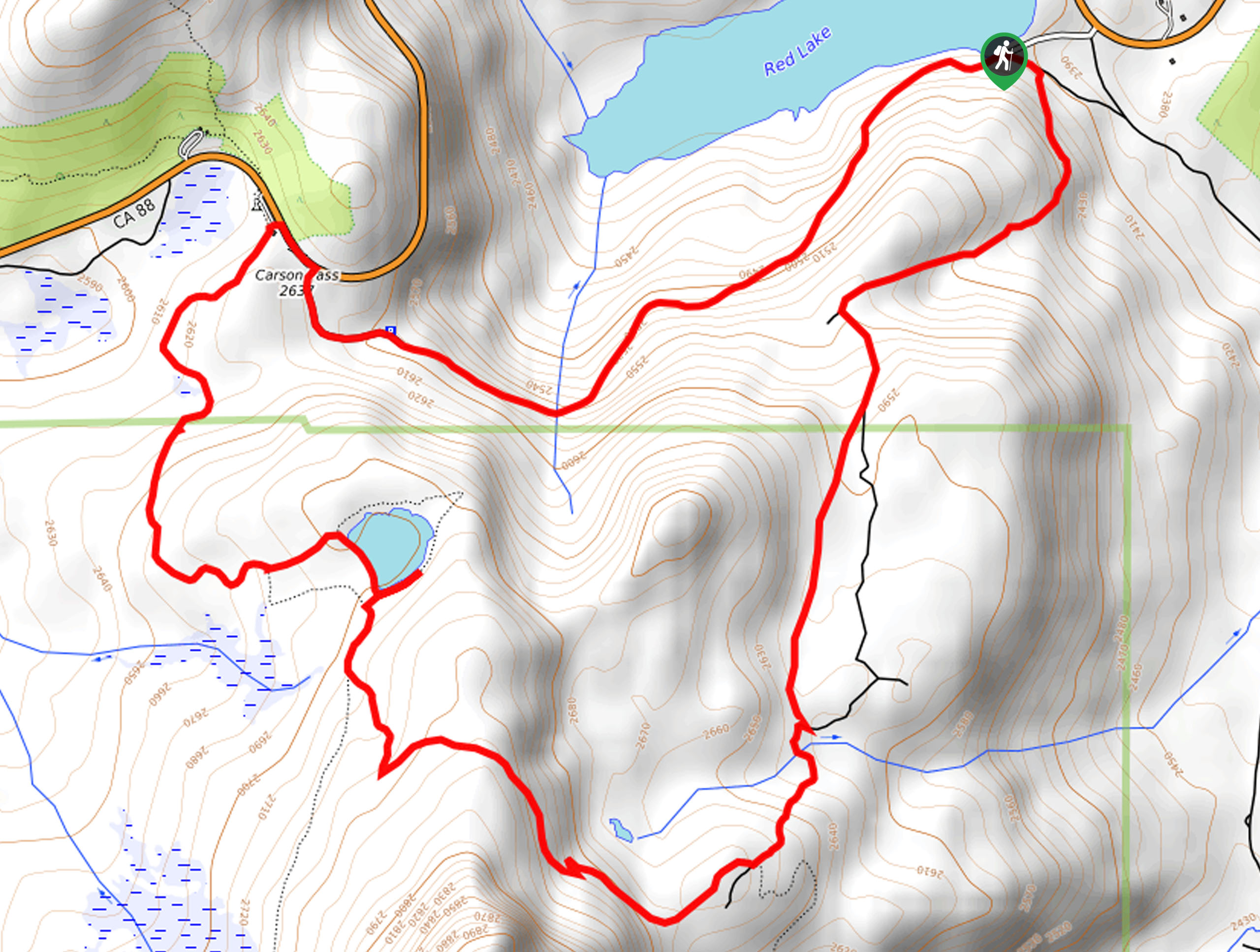
When your shoes are laced, and your water bottle is full, you can begin your hike. Setting out from the trailhead, hikers will have to cross over the highway and onto the Tahoe Rim Trail. From here, the route will divert you west and up a switchback. Mind your footing on the rocky terrain as you climb! Soon the path will redirect you east to an intersection—keep left here. Continue ascending the path, and at the next junction, keep left, and you will be led west up to the summit of Picnic Rock.
You will be rewarded with expansive views of Tahoe Lake in the south from atop the rock and the snow-dusted Sierra Nevada summits that hem the waters. Take your time admiring the grandeur of the landscape, and when you are ready, retrace your footing along the path back to the trailhead.
Similar hikes to the Tahoe Rim Trail to Picnic Rock Viewpoint hike
Red Lake, Frog Lake and Carson Pass Hike
Seeking a day hike away from the crowds of Lake Tahoe? The Lake, Frog Lake and Carson Pass Hike is…
Winnemucca and Round Top Lakes Hike
The Winnemucca and Round Top Lake Hike is an awesome adventure in the Mokelumne Wilderness. Wander through mixed pine forests…
Squaw Creek to Shirley Canyon Hike
The Squaw Creek to Shirley Canyon Hike is a must-add to your hiking itinerary. Located near Olympic Valley, this route…
Comments