

South Yuba River Hike
View PhotosSouth Yuba River Hike
Difficulty Rating:
The South Yuba River Hike is an enchanting nature walk through lush woodlands that are interwoven with cascading snowmelt streams. Immerse yourself in the abundant vegetation and let the sweet smell of the conifers encompass you as you hike down to the riverbank.
Getting there
The South Yuba River Hike is accessed via the South Yuba Trailhead off Woodsmuir Lane.
About
| Backcountry Campground | No |
| When to do | Year-round |
| Pets allowed | Yes - On Leash |
| Family friendly | Yes |
| Route Signage | Average |
| Crowd Levels | Moderate |
| Route Type | Out and back |
South Yuba River Hike
Elevation Graph
Weather
South Yuba River Hike Description
The South Yuba River Trail is a great adventure down into a scenic river valley. Overgrown in sections, this route has a slightly primitive nature, so it’s not a bad idea to bring along the trail GPS.
Additionally, much of the trail is lined with poison oak in the summer months, so wear long pants and stay on the marked path when possible. We also encourage you to bring along some bug spray when hiking in the warm weather, as mosquitos are abundant in the area. Though open year-round, we prefer this hike in the fall when the bugs are gone; however, this is also a bit of a gamble, as the river can be dry!
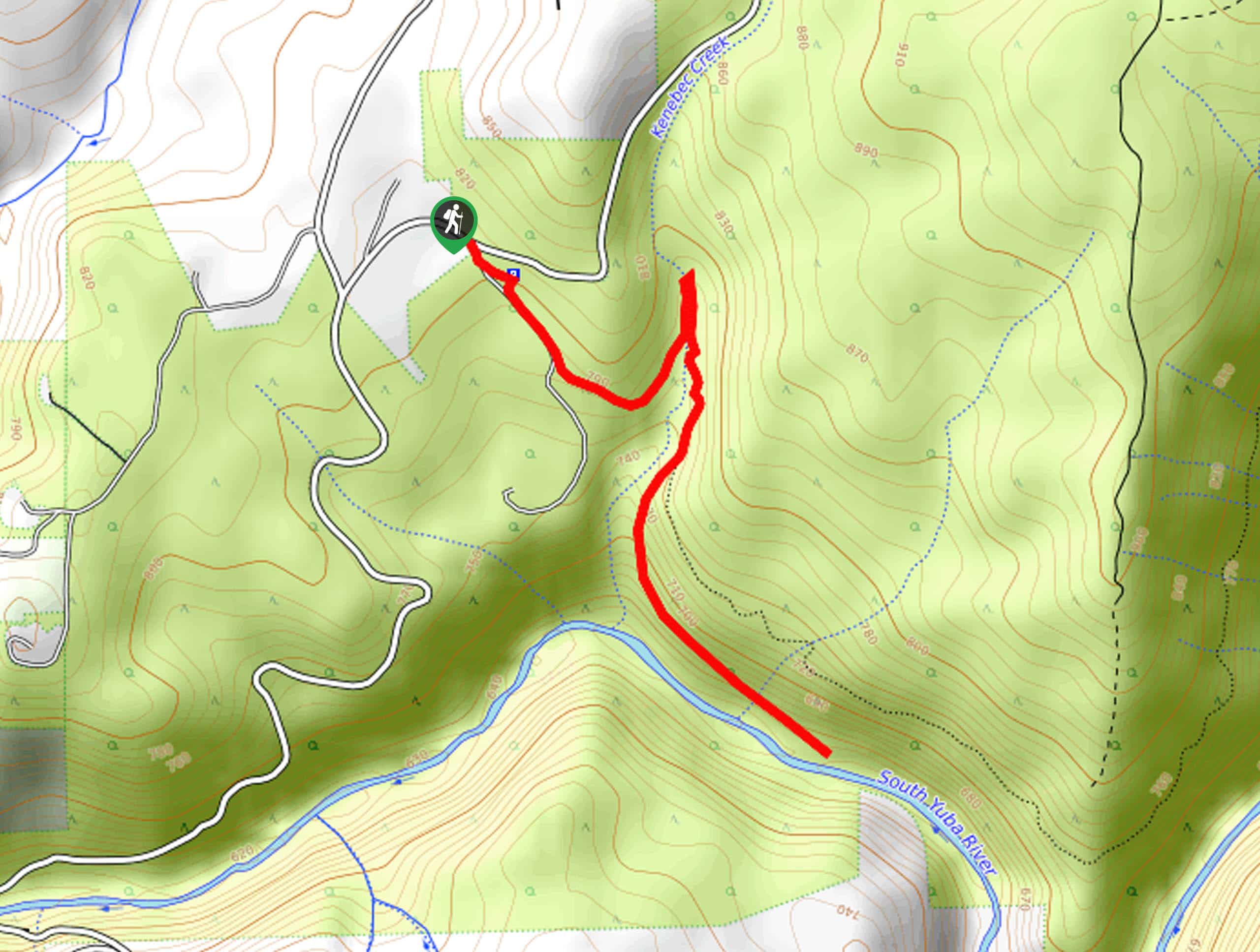
Setting out from the South Yuba Trailhead off Woodsmuir Lane, the South Yuba River Hike will lead you south, before curving north to Kenebec Creek. Here, you will need to cross over the creek and once again track south. Let the soothing sounds of the babbling waters relax you, as you wander through the woodland terrain. Eventually, you will reach an intersection and veer right to be diverted onto the Illinois Crossing Access. Follow this route down into the river valley and you will soon reach the trail’s end at the South Yuba River.
Marvel in the beauty of the blue-hued waters bounded by towering trees. Mind your footing on the rocky terrain and rejuvenate your tired feet in the chilly waters if the water level of the river is high enough. When you are ready, simply retrace your steps along the path to get back to the trailhead.
Similar hikes to the South Yuba River Hike hike

Red Lake, Frog Lake and Carson Pass Hike
Seeking a day hike away from the crowds of Lake Tahoe? The Lake, Frog Lake and Carson Pass Hike is…

Winnemucca and Round Top Lakes Hike
The Winnemucca and Round Top Lake Hike is an awesome adventure in the Mokelumne Wilderness. Wander through mixed pine forests…

Squaw Creek to Shirley Canyon Hike
The Squaw Creek to Shirley Canyon Hike is a must-add to your hiking itinerary. Located near Olympic Valley, this route…


Comments