Stanley Glacier hike
View Photos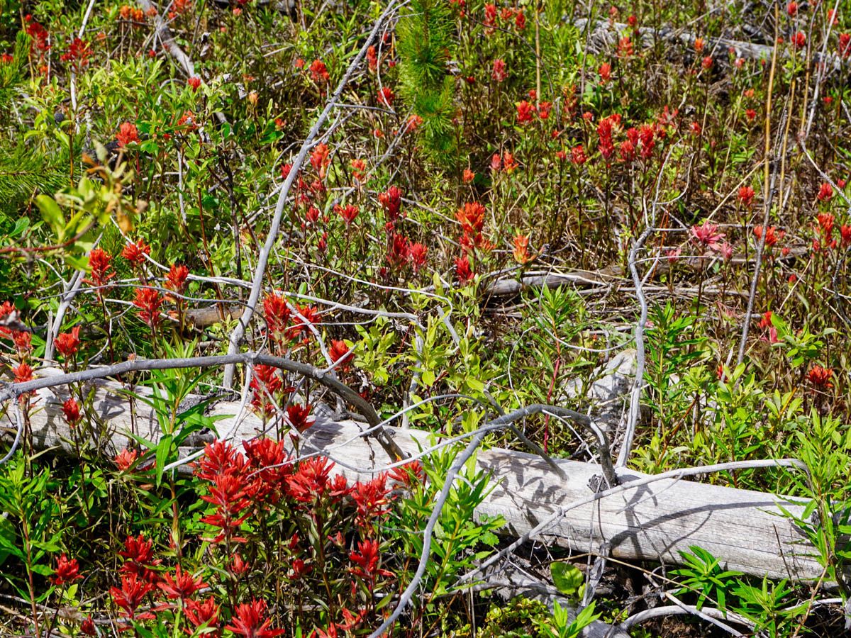
Stanley Glacier hike
Difficulty Rating:
The Stanley Glacier hike in beautiful Kootenay National Park is a true delight. The trail goes from burnt forest with mesmerizing wildflowers, to alpine meadow, to the amazing Stanley Glacier. This gentle climb has it all – complete with beautiful cascading waterfalls too!
Getting there
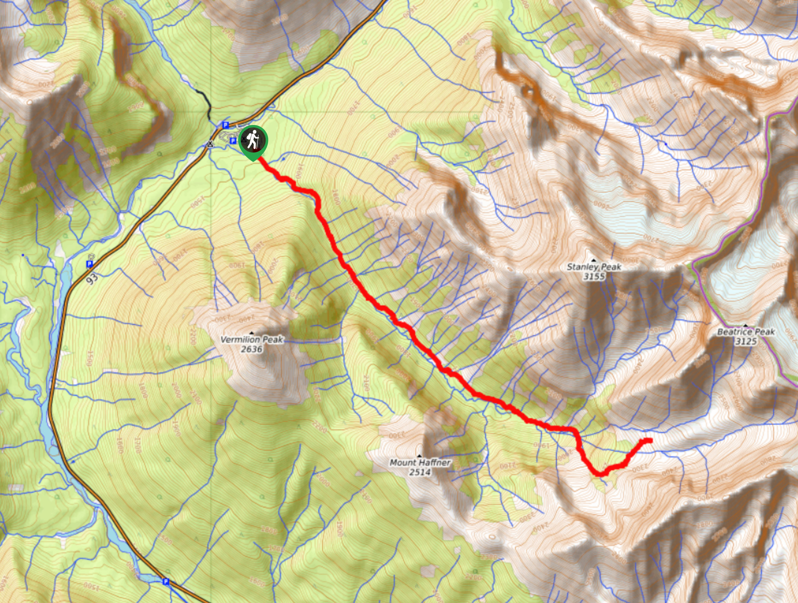
Going west along the Trans-Canada Highway from Banff, turn south at Castle Junction towards Radium highway 93. The Stanley Glacier parking lot is on the left side of the road, four kilometers from the provincial border.

About
| When to do | June through October |
| Backcountry Campsites | No |
| Toilets | Trailhead |
| Family friendly | No |
| Route Signage | Average |
| Crowd Levels | Moderate |
| Route Type | Out and back |
Stanley Glacier
Elevation Graph
Weather
Route Description for Stanley Glacier
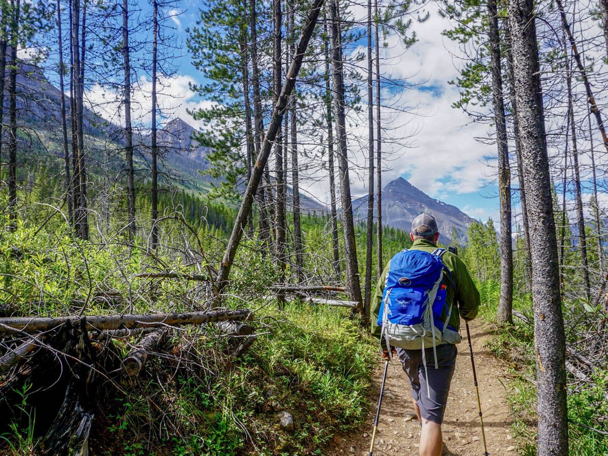
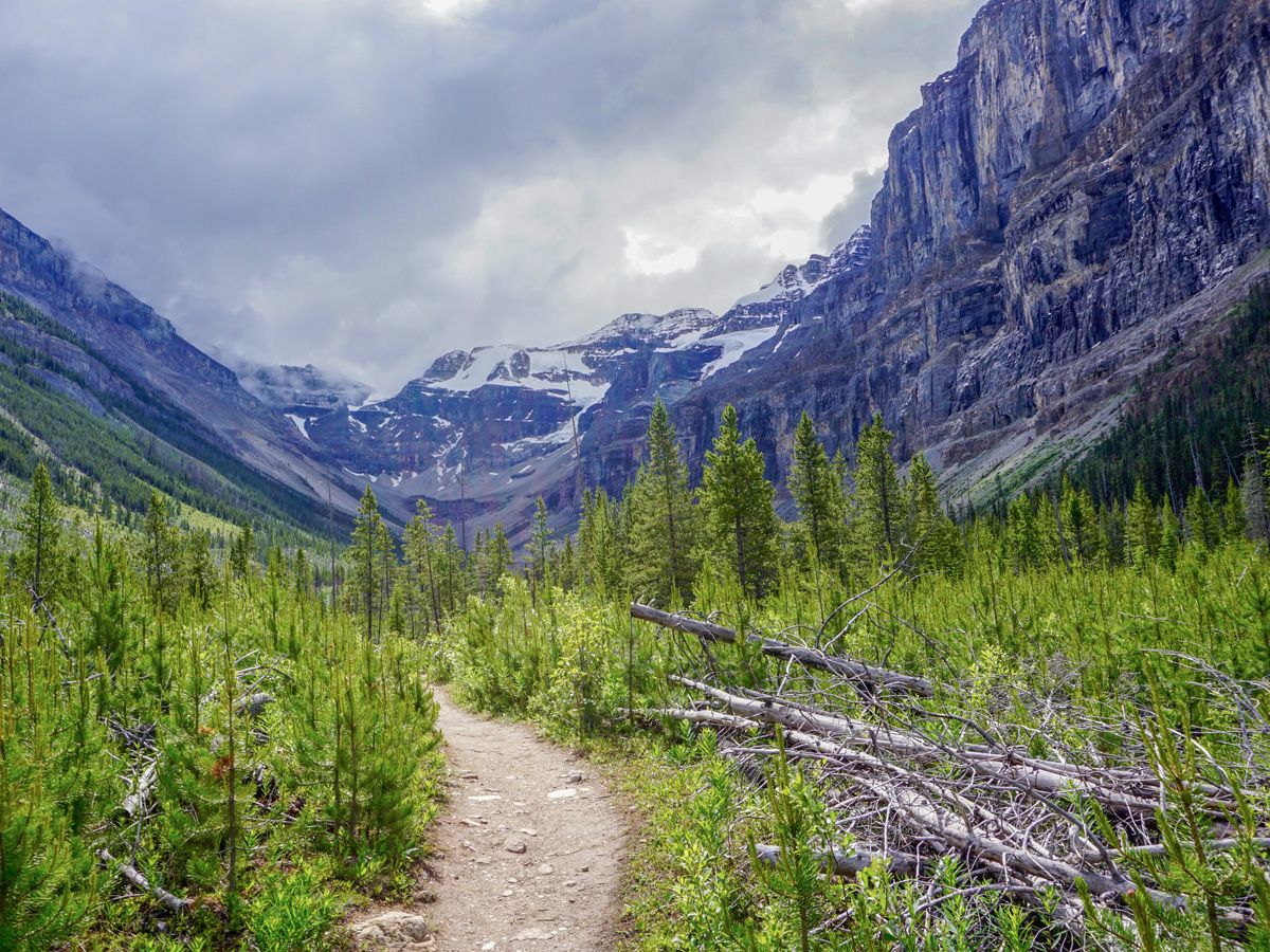
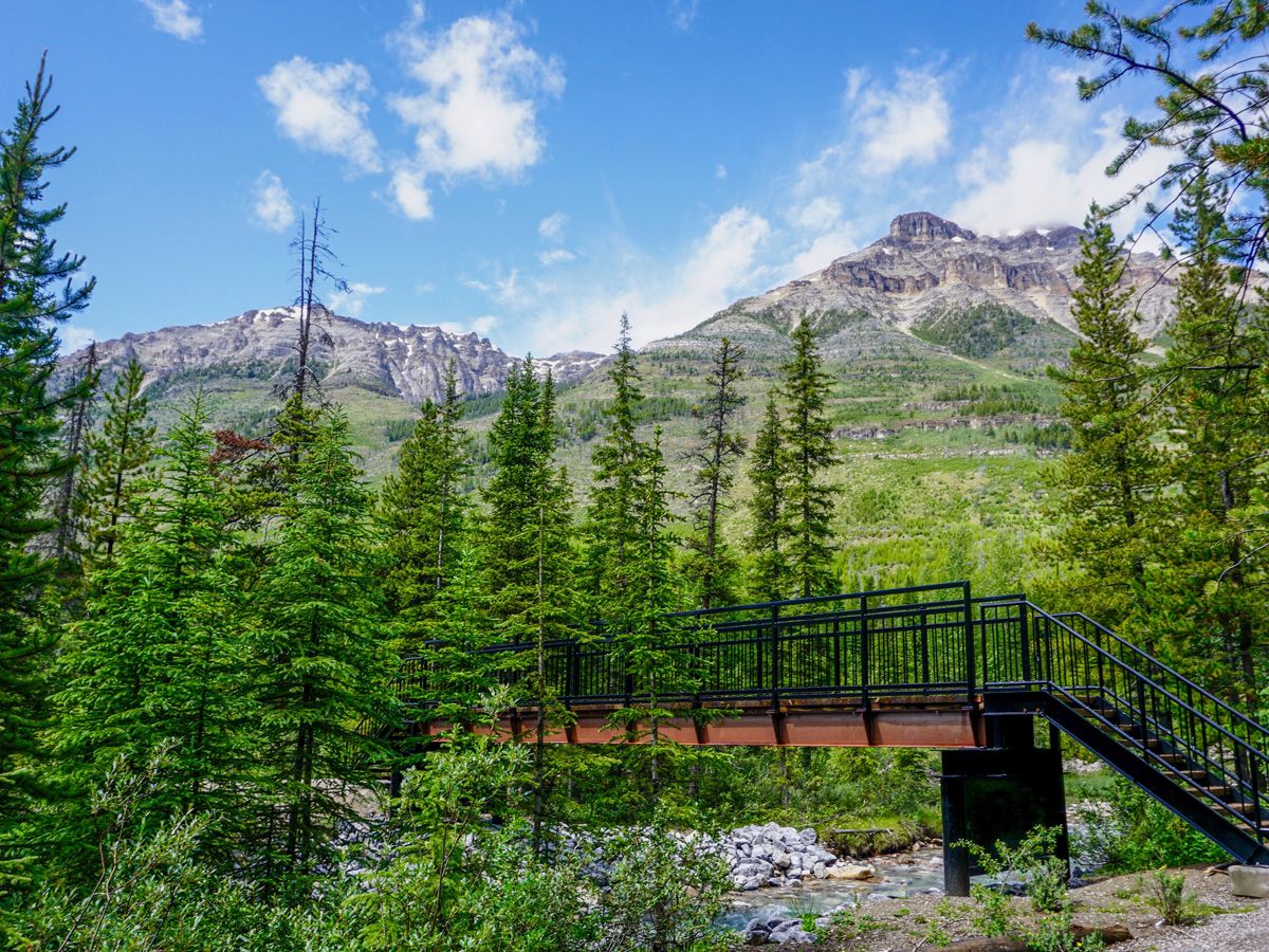
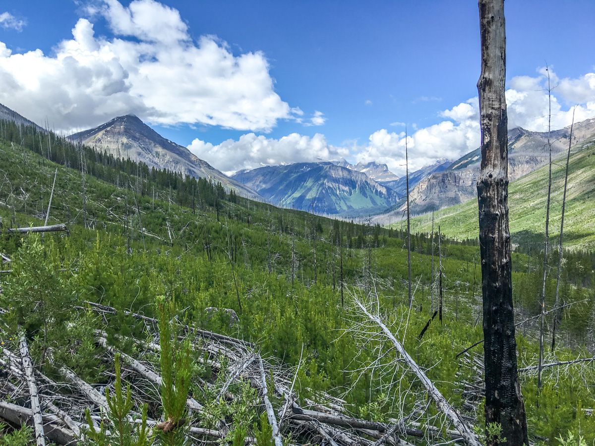
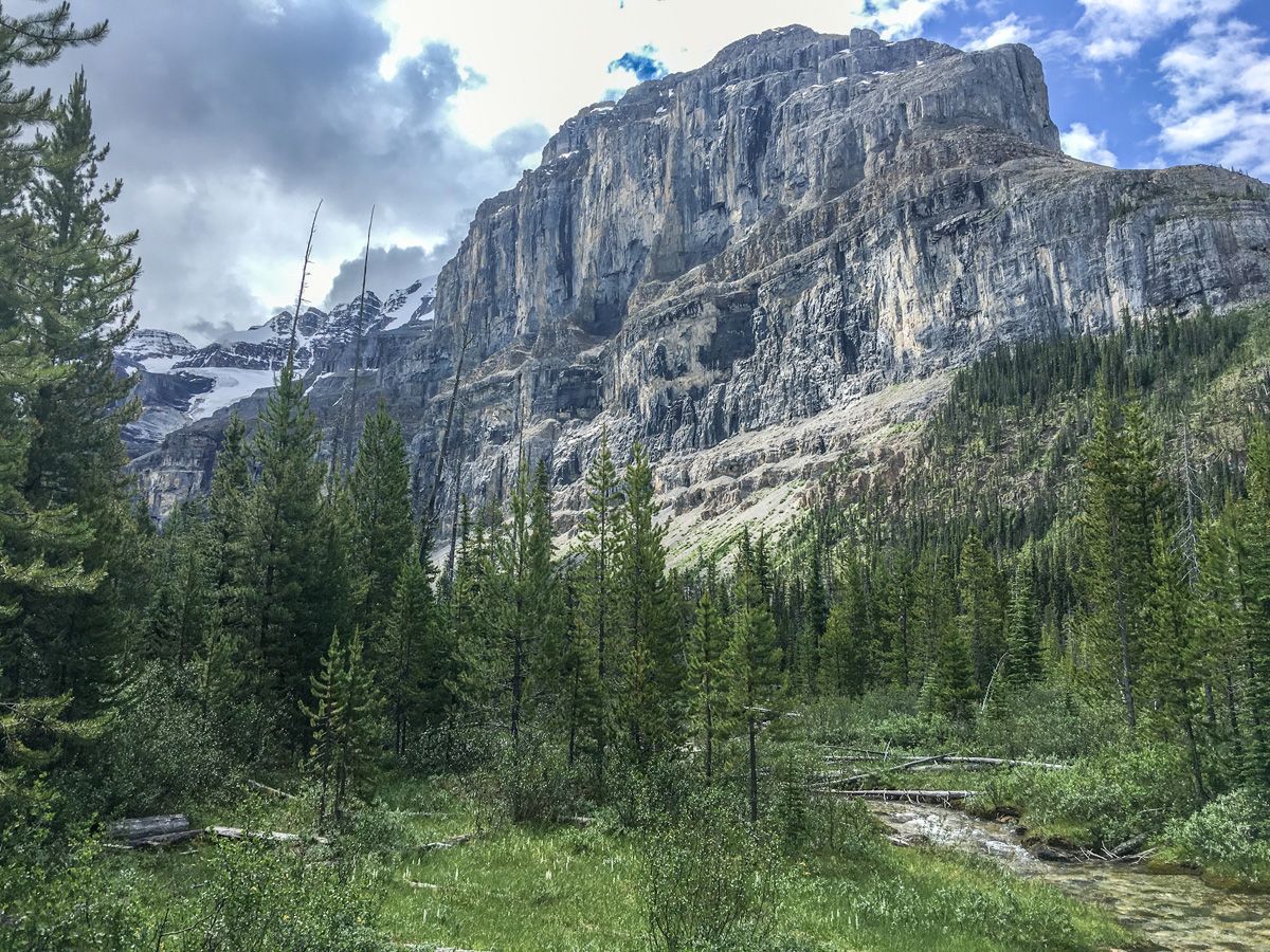
Proceed over the Vermillion River Footbridge and start up the trail. The burnt forest characterizes the beginning of the trail, as it was struck by lightning in 1968. The amazing wildflowers that grow in this area are truly stunning, and the lack of foliage allows for more frequent viewpoints. Watch out if you are attempting this hike during high winds, as the tree branches are brittle and can break off.
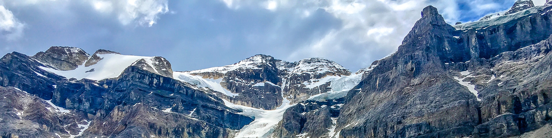
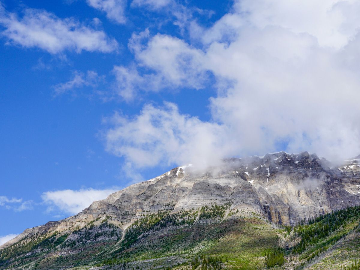
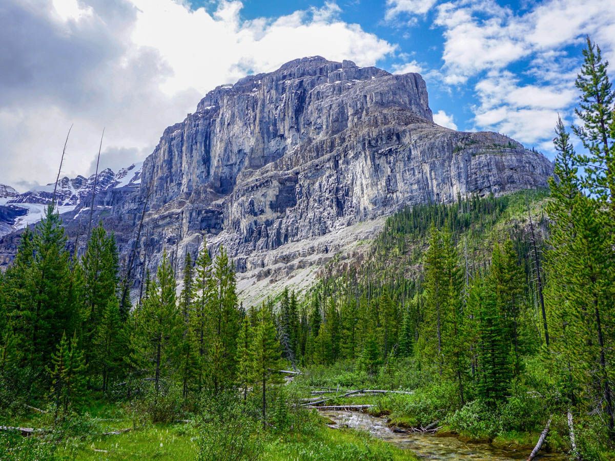
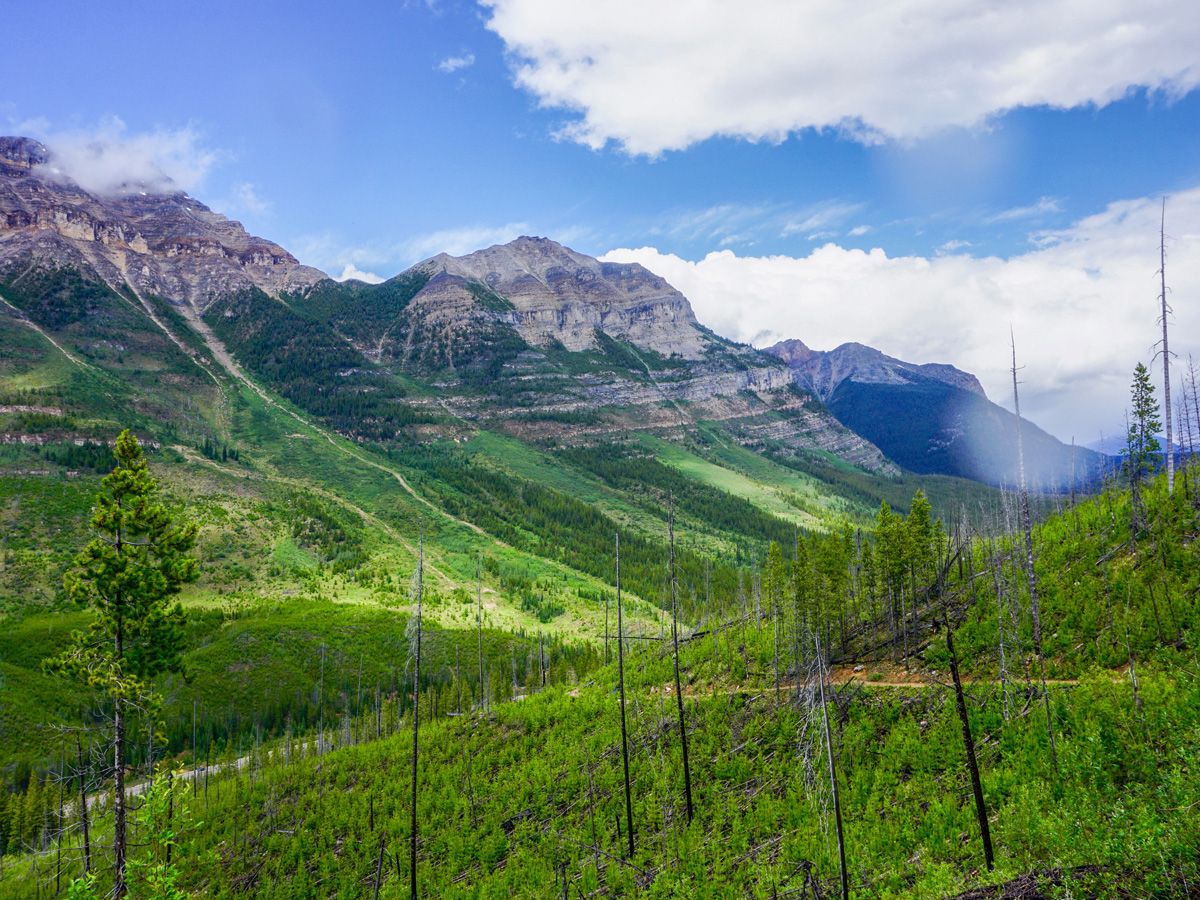
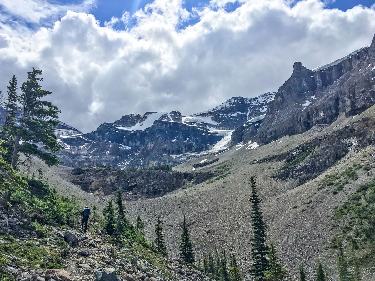
Climb steadily up switchbacks until you reach a river formed by the runoff of the Stanley Glacier –this is roughly 1.2mi into the hike. Cross the creek then continue beside it as the forest around you slims. The climbing is not as strenuous as you enter a pristine alpine meadow with incredible views in all directions. Many waterfalls run down to either side of the valley in spring and early summer. The trail from here continues ahead, with the wonderful Stanley Glacier on your right-hand side.
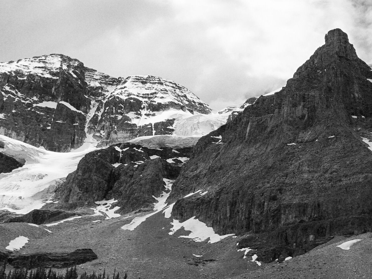
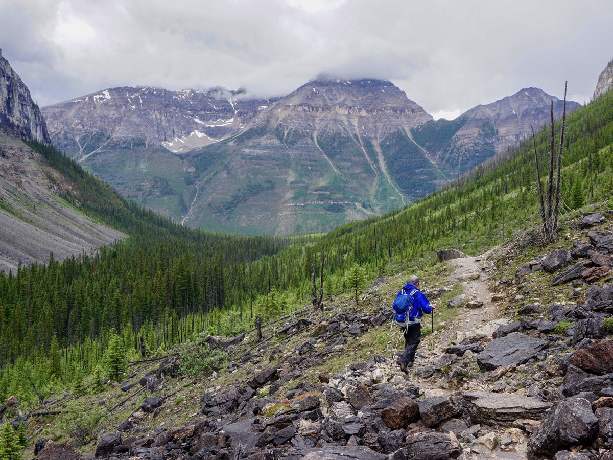
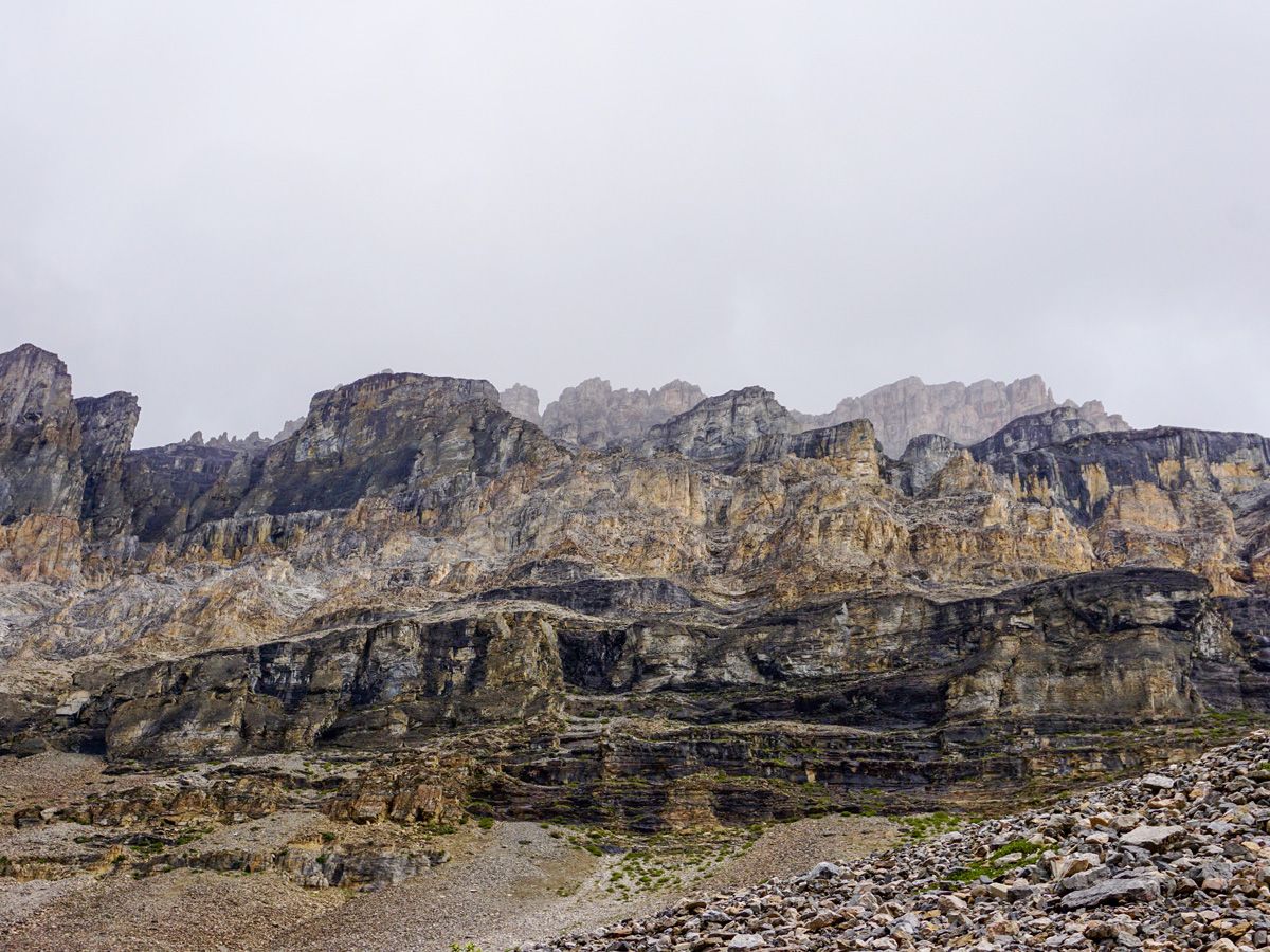
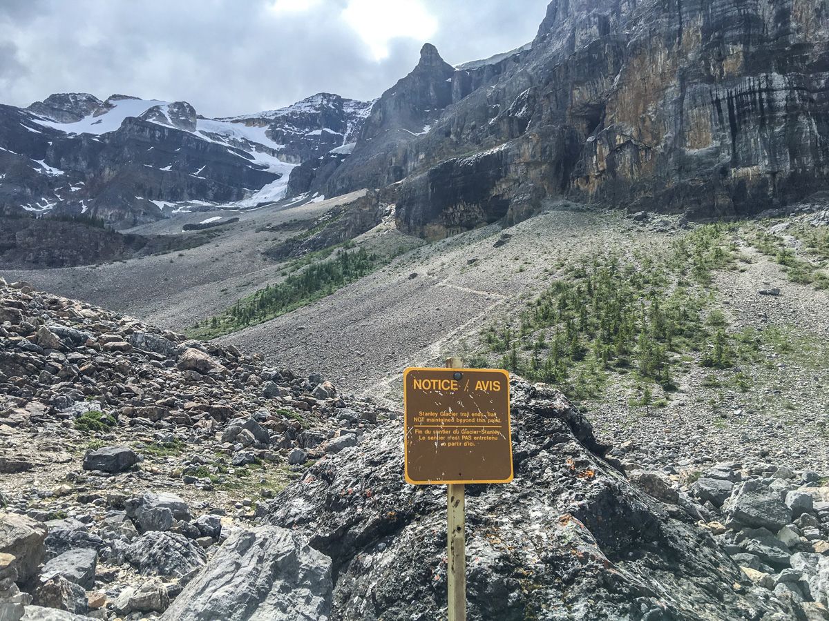
You can see a path rising on both sides of the valley up ahead. This is an optional ascent to a great viewing area, which adds 1.9mi and 787ft onto the hike (the GPS track shows this route). You reach the decision point 2.6mi into the trail, and the sign denotes that the end of the maintained route has arrived. If you want to continue, immediately enter a boulder field and start to climb up. It’s steep, but the views make it worthwhile.
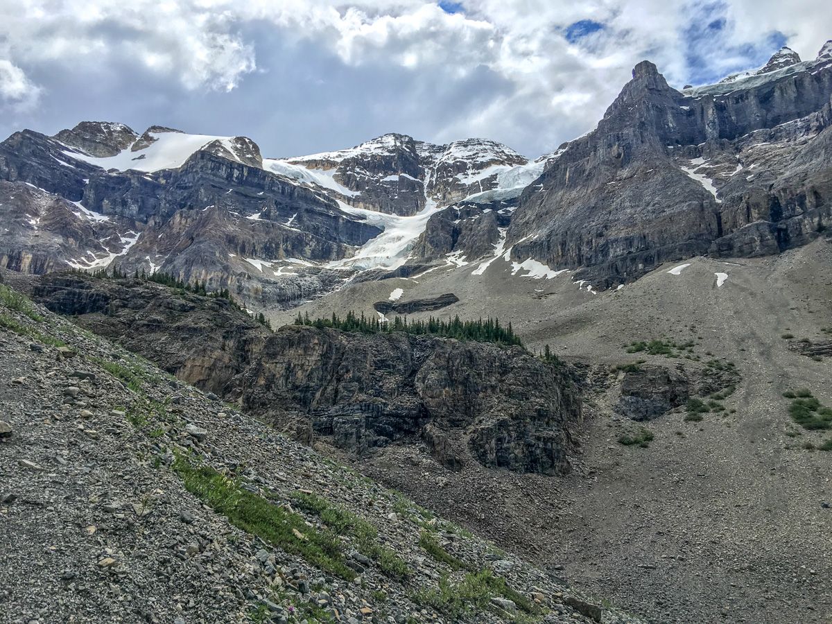
The highest point you will reach is a group of trees on a plateau. From here you can choose to turn back and return the way you came or continue through the trees, across a stream and down the other side of the valley. We prefer the circuit as it gives different views of the side walked up. Rejoin the main path and continue down the way you came up, enjoying great scenery across the main valley to Mount Whymper.
If you don’t do the extension, then this is a perfect hike for the youngsters in the group. It is not too long, has plenty of scenery changes, and great views.
Find other great hikes in Kootenay National Park:
Insider Hints
Stop off or stay at the wonderful Storm Mountain Lodge. The food is delicious and the historic cabins are usually reasonable.

Similar hikes to the Stanley Glacier hike
Haffner Creek Trail
The Haffner Creek Trail is a lengthy hiking route that will lead you along a winding creek for some scenic…
Kimpton Creek Trail
The Kimpton Creek Trail would be a nice and easy hike through the forest along a charming creek if it…
Redstreak Creek Trail
Hiking the Redstreak Creek Trail is a quick and relatively easy hike that features several steep sections of terrain and…
tamglen 4 years ago
Highly recommend this hike. First 4 km are quite easy as described. If you are physically able do not miss the additional 3 km loop. The ascent is steep and the descent is equally tricky with loose rock/ gravel. However the views are so worth it.
andrea.hothi 5 years ago
Beginning was really great with a nice path and beautiful views and a waterfall, but then it got very rocky and the views didn't pay off like at the beginning.
YukihiroSato 5 years ago
There are so many beautiful views to see here.
AnnSue 5 years ago
This trail was less strenuous compared to Ball pass and Floe Lake. There were more meadows and wildflowers in here. Wonderful view of the glaciers .
Hiking-eh 5 years ago
This is a nice hike. Long long beautiful views of the mountains and valley.
lukeboii 5 years ago
wicked mountain scenery. packs a lot into a pretty quick hike- waterfalls, wildflowers, the works.
WendyMag. 5 years ago
Terrific views. Moderate hike. You'll be amazed from beginning to the end.
isaacanderson 5 years ago
Perfect wonderland with amazing views!
Tara Green 5 years ago
A great trail with amazing views of the Stanley Glacier
Meighan 5 years ago
The subsiding glacier and the mountain views are amazing.