Goetheweg Hike
View Photos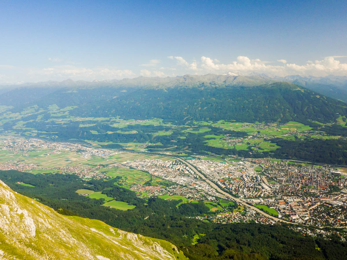
Goetheweg Hike
Difficulty Rating:
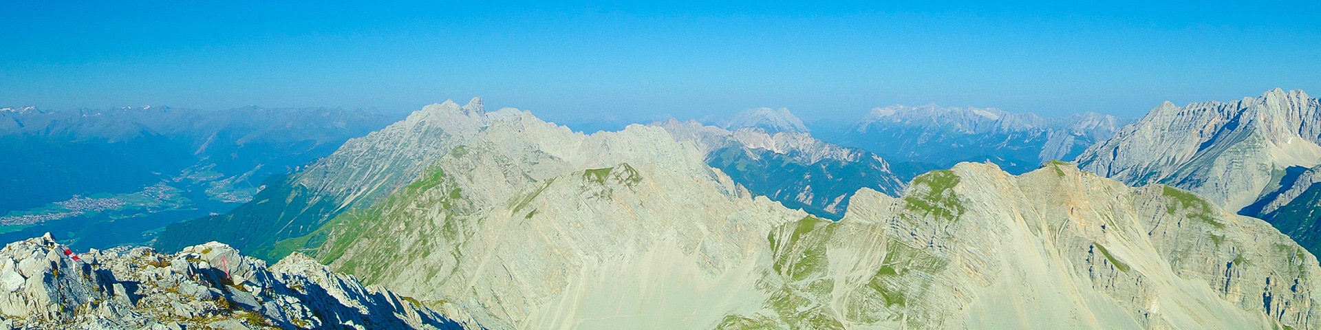
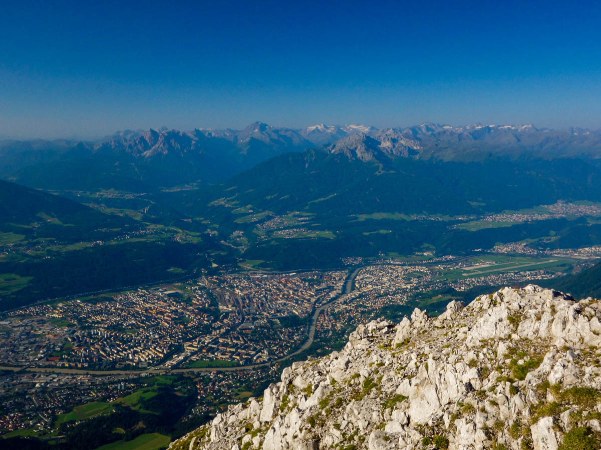
The Goetheweg Hike is a scenic route that offers some of the best aerial views of Innsbruck. The trail walks along the slopes of the Nordkette mountain range directly above the city and offers a commanding view of the surrounding terrain. If you’re staying in the Innsbruck area, then this is the trail to do.
Getting there
To get to the Goetheweg Trailhead, drive to the Nordkettenbahn cable car station at Innsbruck Hungersburg - directly in Innsbruck! You can park your car there.

About
| When to do | June to October |
| Backcountry Campsites | No |
| Toilets | Yes, at the trailhead and at Pfeishütte |
| Family friendly | No |
| Route Signage | None |
| Crowd Levels | Low |
| Route Type | One Way |
Goetheweg Hike
Elevation Graph
Weather
Goetheweg Trail Description
To start Goetheweg Trail from Innsbruck Hungersburg, take the cable car all the way up the mountain to Hafelekar. There are two stops of the cable car; the first stop is Seegrube and the second one is Hafelekar. Make sure you go to the final stop: Hafelekar.
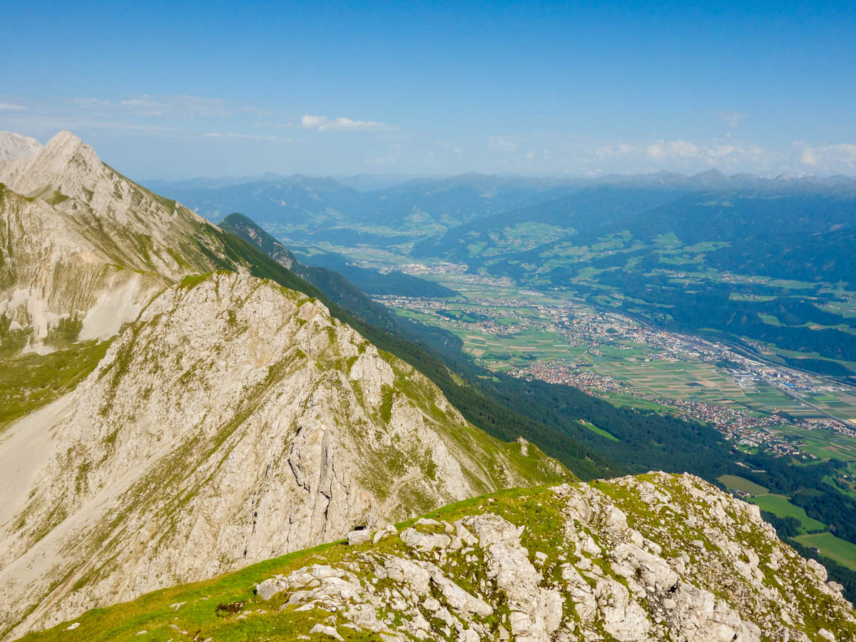
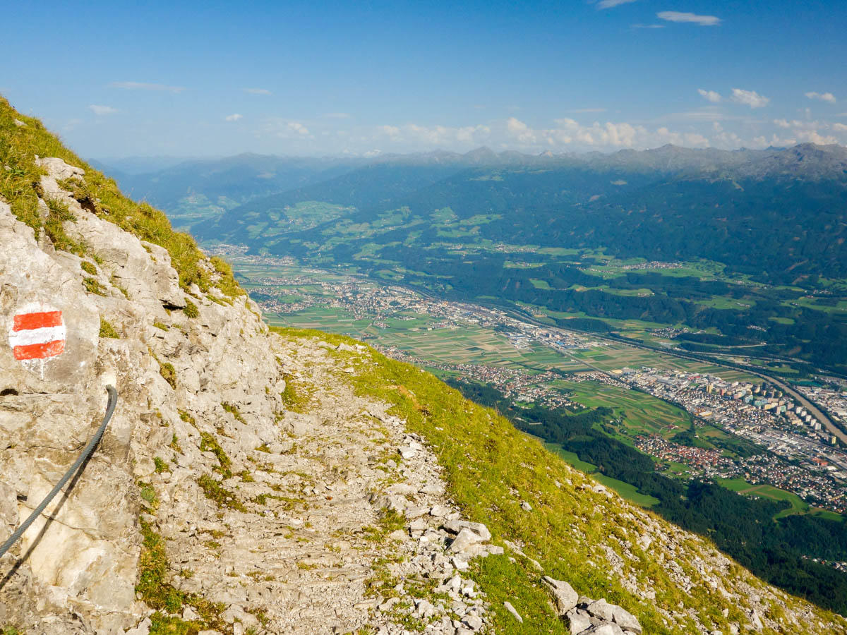
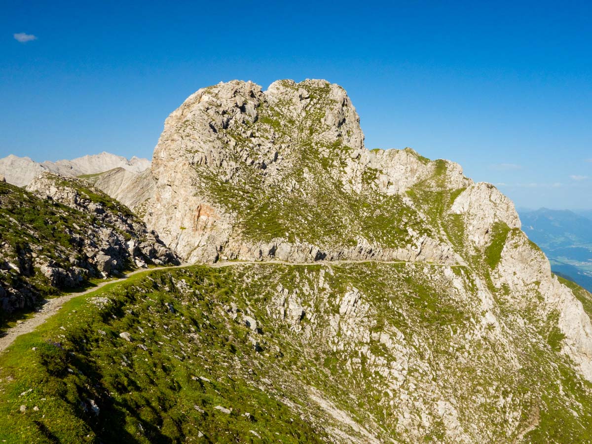
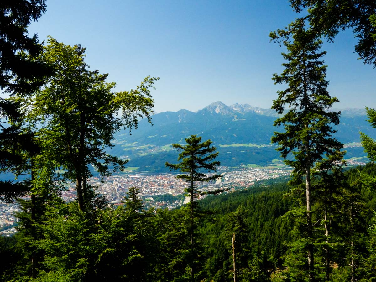
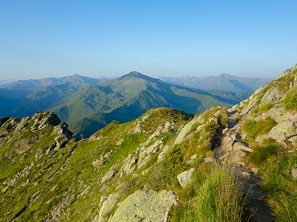
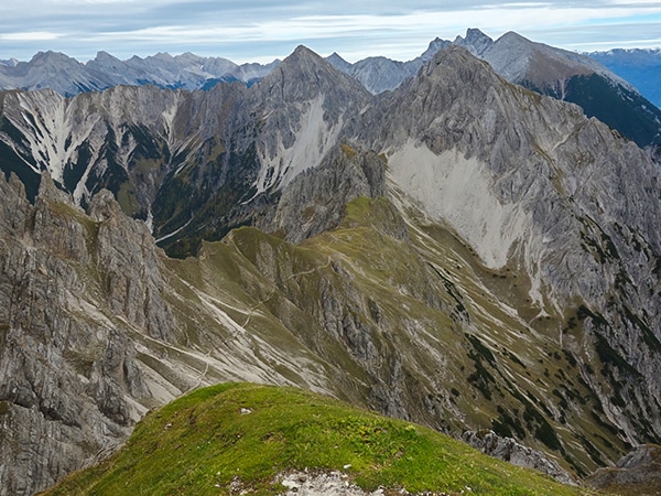
At Hafelekar you’ll already have a stunning view over Innsbruck. When you step out of the cable car station you’ll see a peak called Karlsspitze directly in front of you. Take the trail along the mountain crest that passes just to the right of this peak. There is also a sign saying GEO Trail. This is the most beautiful section of the hike. You’ll have the best views of Innsbruck and the Inntal.
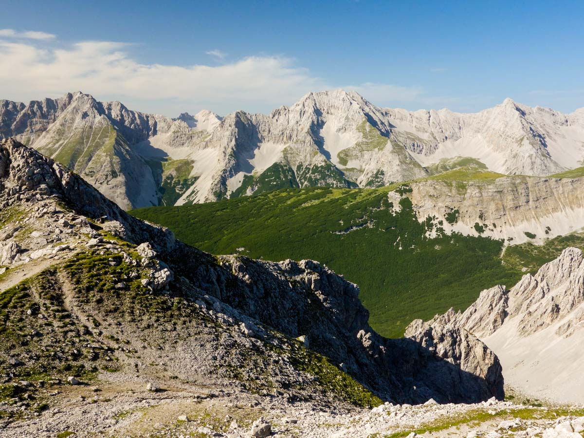
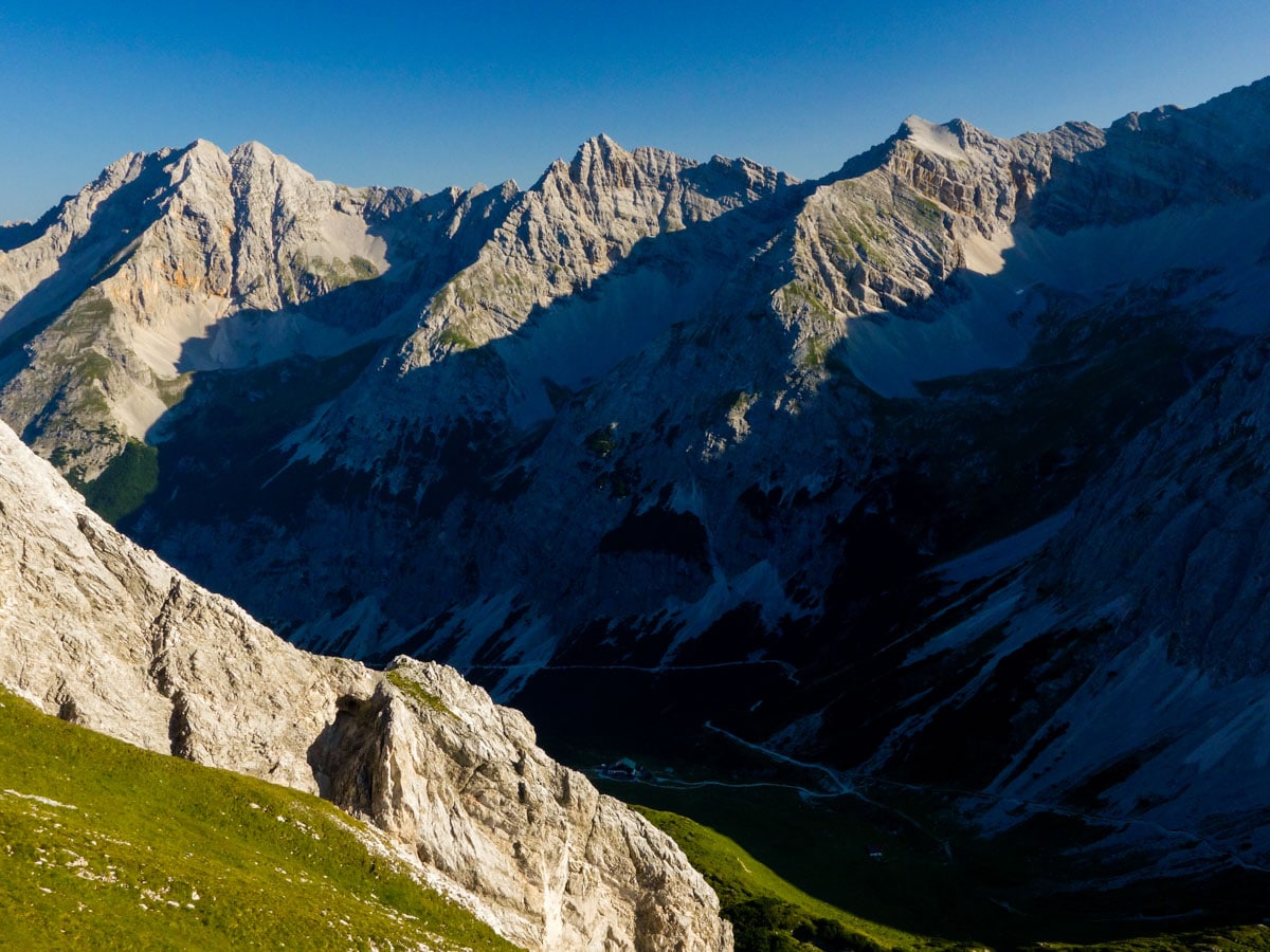
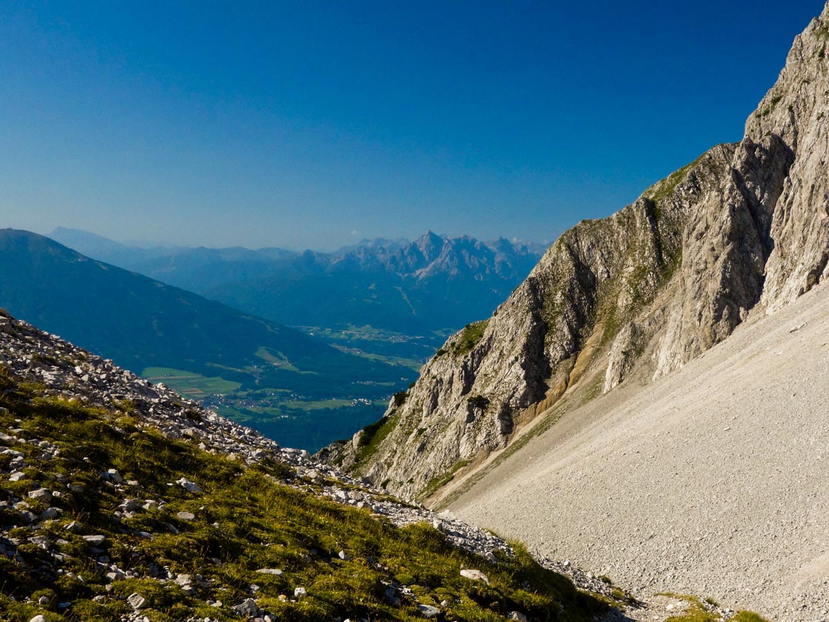
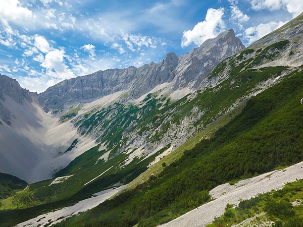
After about 40 minutes you’ll cross over a little pass and the scenery changes quickly. As you hike in a basin surrounded by barren mountain peaks, it will feel a little alien, as there is little to no vegetation here.
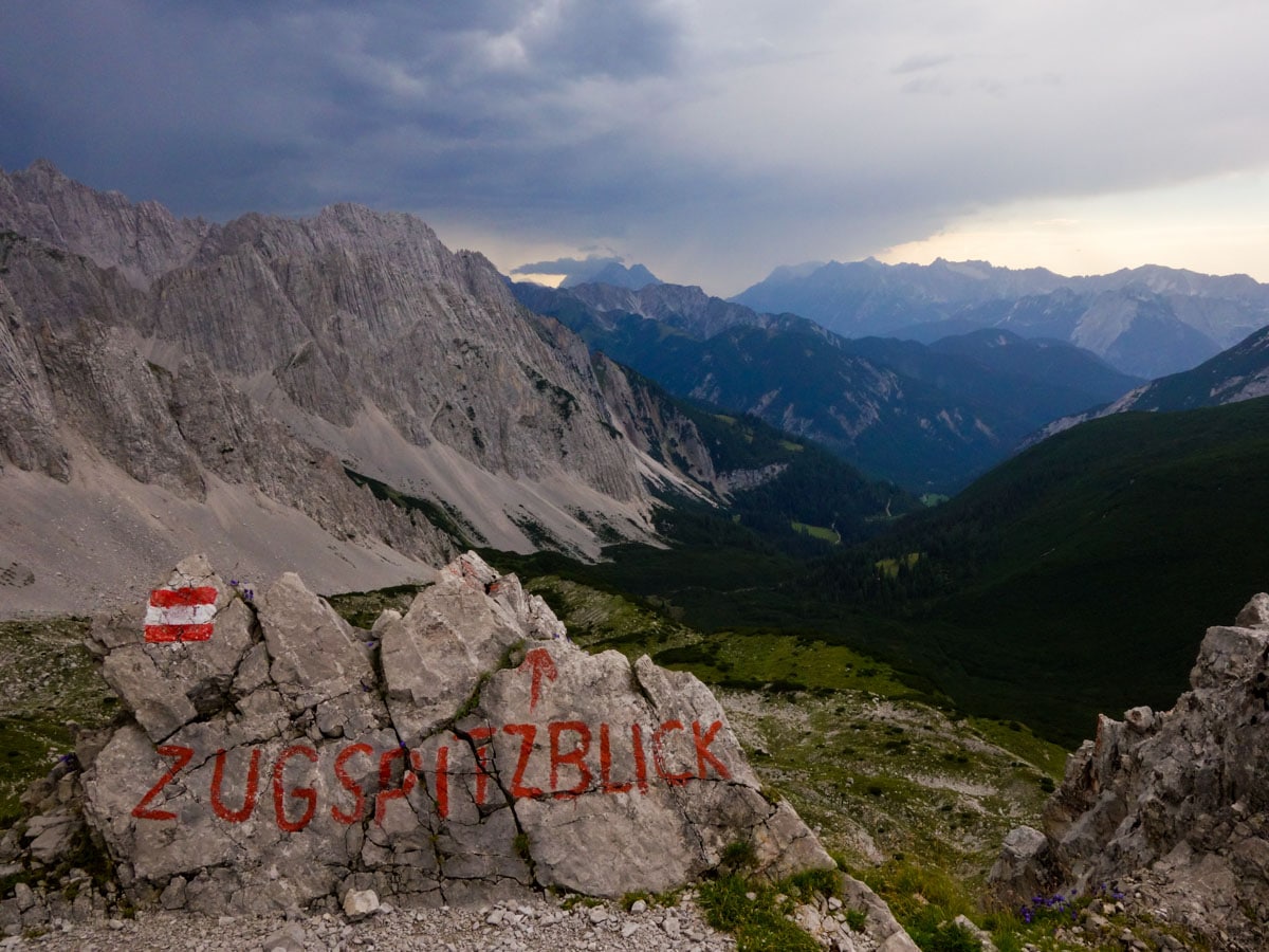
After some time, you’ll reach a nice vista point on the trail. There is a big stone on the ground with red writing on it. It points in the direction of Zugspitze: the highest mountain in Germany!
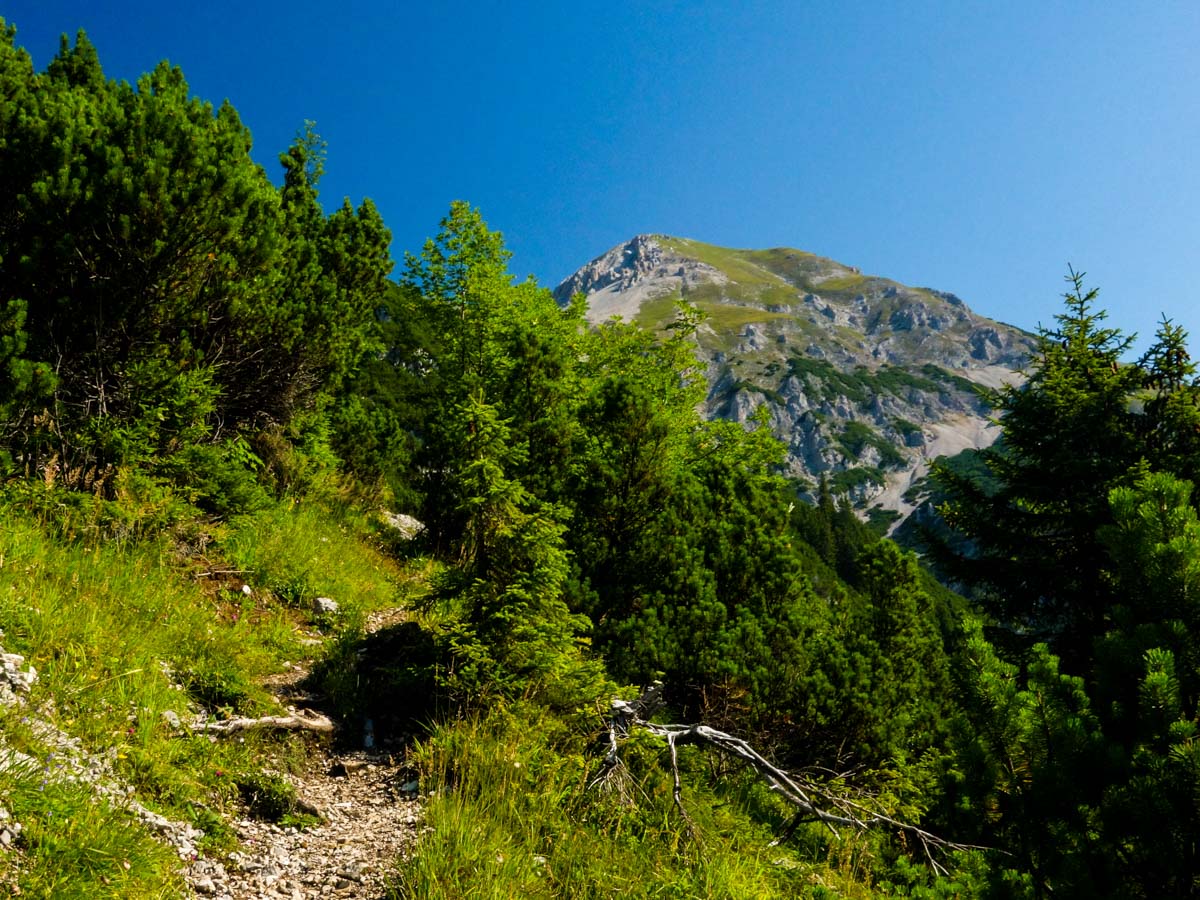
Continue on the trail until you cross another little pass. On top of that pass is a junction where you continue straight (if you go left you can summit a nearby peak, but it would involve some serious scrambling).
Continue on this trail until you reach the Pfeishütte mountain hut. You can take a break here and buy some beverages. Afterwards, get back on your trail. Shortly after Pfeishütte there is a junction. Go right. The path will lead you up the mountain basin. Continue on this trail and keep on it for the remainder of the hike.
As you walk around the big mountain to your right, you willsoon reach a pass. The views from the pass are exceptional. Here you can decide whether you want to summit Rumer Spitze or continue back down to Innsbruck Hungersburg. To summit Rumer Spitze take the path right up the mountain (some scrambling necessary). To go to Innsbruck Hungersburg, continue straight.
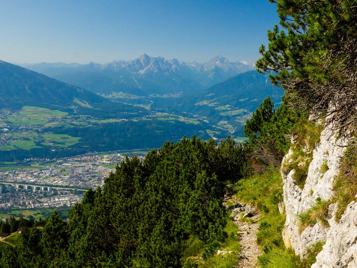
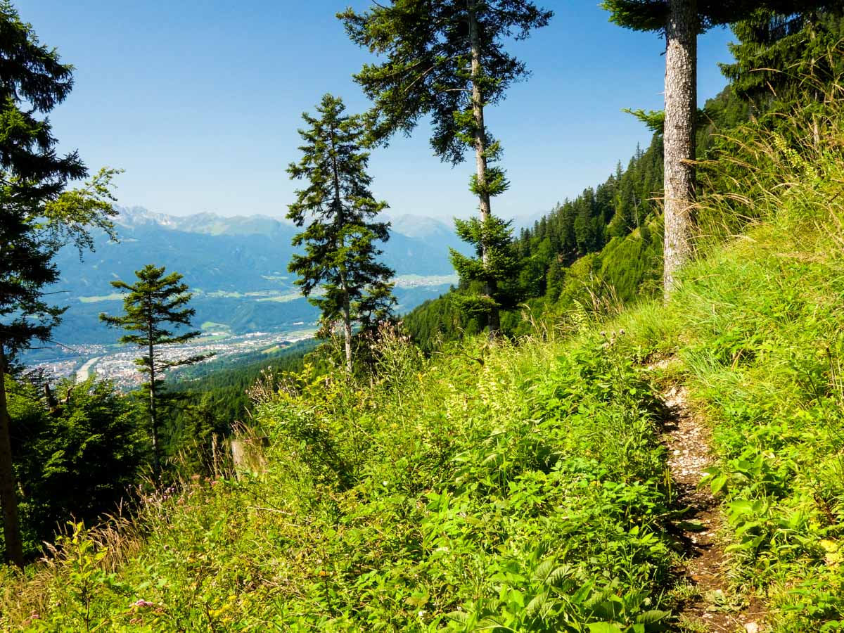
From this point on the trail is all downhill. During the descent you’ll pass some huts where you can buy beverages and enjoy the view. As you descend, the surrounding forest gets denser and cooler. In the last section the trail can get quite confusing because there are lots of junctions; however, all the trails from here eventually lead you to Innsbruck Hungersburg if you just follow the mountain crest. You can even see the cable car you rode in on from further away, so keep that point in mind. You can also look out for the “red-white-red” markings on stones or trees; these will also show you the way.
Trail highlights
Innsbruck
With a rich history of human activity that spans from the early Stone Age, through centuries of Roman occupation, to its modern-day status as the capital of Tyrol, Innsbruck has always been a prominent settlement in this part of the Alps. Serving as Austria’s fifth-largest city, Innsbruck is a popular tourist destination due, in part, to the region’s world-class ski slopes.
Hafelekar Peak
Located along the Nordkette range of mountains to the north of Innsbruck, Hafelekar Peak is a rugged mountain consisting of Wetterstein Limestone that stands at 2,334m. A unique feature that can be found near the peak is the Hafelekar Survey Station, which is the only cosmic radiation observatory in Austria.
Find other spectacular hikes in Innsbruck:
Insider Hints
You can start this hike in the late afternoon. If you plan to sleep at Pfeishütte then you can finish the loop the next day. You’ll have the best light for taking pictures if you split the hike into two days. Note that the hut stops serving dinner at 8pm, so don’t leave this too late!
The descent is not technically difficult, but it can be quite slippery sometimes. Trekking poles are a great help!
You can summit Rumer Spitze on this hike. However, this involves difficult scrambling. The trail up to Rumer Spitze is very difficult and steep. Definitely not appropriate for kids! Nor most of us that don’t like hard scrambles.
Click the link to find out more about hiking the Austrian Alps.

Similar hikes to the Goetheweg Hike hike
Halltal Hike
Halltal is a long and strenuous hike. This typical Austrian walk takes hikers along an amazing, panoramic trail, eventually leading…
Kellerjoch Loop Hike
The Kellerjoch Loop is a relatively easy Innsbruck hike that takes you through lush green meadows to the peak of…
Reither Spitze Hike
The Reither Spitze hike is a high alpine walk that takes you above the treeline, giving you spectacular 360° views…
Jakob F. 5 years ago
A gorgeous and peaceful place to visit
Cloudhigh 5 years ago
What a beautiful place! Beautiful view over the whole of Innsbruck.
Andrea R 5 years ago
A beautiful hike in Innsbruck surrounded by mountains
Rixy Lily 6 years ago
It gave me vivid memories of the beautiful views of villages and mountain peaks.
Dawn C. 6 years ago
Trekking poles are a great help for this hike. It's a hike for people who likes a bit of challenge.
Issa Deraulo 6 years ago
The forest can get colder than the rest of the hike. Make sure you bring extra layers.
Wakata Shirai 6 years ago
Great hike. Amazing view of the mountain ranges. I highly recommend this hike to people who want to experience solitude.
Lucy Potter 6 years ago
The GEO trail offers the most beautiful views. You should definitely do this hike.
Johnson Bonanza 6 years ago
This hike is a bit tricky, but the views are fantastic!
Hilly P. 6 years ago
Great place to enjoy hiking. The descent is not technically difficult, but it can be quite slippery sometimes. It feels relaxing when you are surrounded by mountains.