

Maiden Rock Trail
View PhotosMaiden Rock Trail
Difficulty Rating:
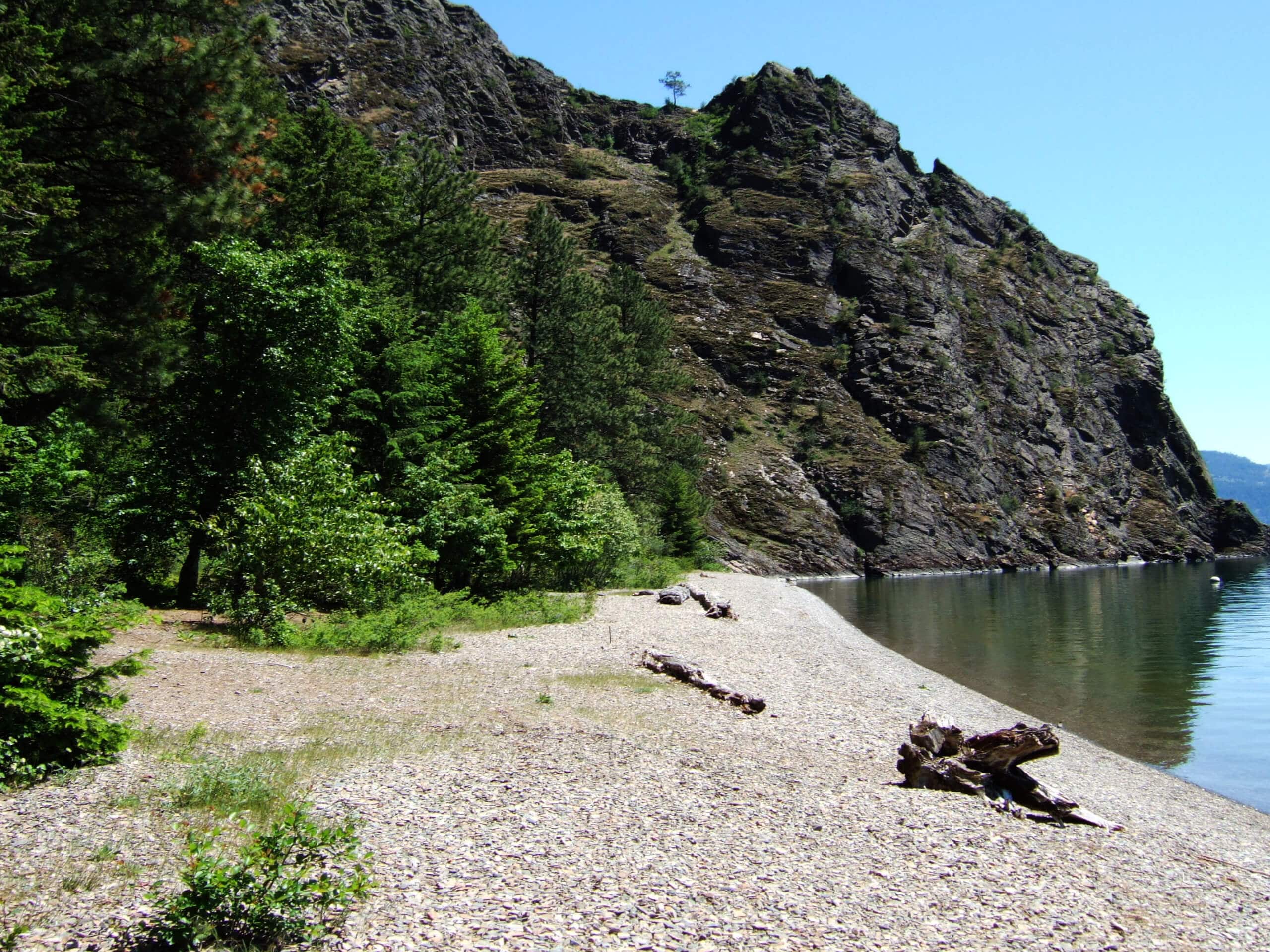
The Maiden Rock Trail is a crowd favorite amongst locals, so we thought we would share it with you. This epic expedition steeply descends through rocky screes that occurred due to glacial activity and culminates at a beautiful, secluded beach on Lake Pend Oreille.
Getting there
Access this adventure from the trailhead off Butler Creek Road.
About
| Backcountry Campground | Backcountry Camping |
| When to do | May-October |
| Pets allowed | Yes - On Leash |
| Family friendly | Older Children only |
| Route Signage | Average |
| Crowd Levels | Moderate |
| Route Type | Out and back |
Maiden Rock Trail
Elevation Graph
Weather
Maiden Rock Trail Description
Those seeking a memorable adventure in the north of Idaho will likely enjoy the Maiden Rock Trail. While the destination is the main attraction, the trail down to the beach is just as scenic—passing through lush woodlands and exciting scree fields. While the trip to the lakeshore is a breeze, it is important to reserve some energy for the climb back out! Note that much of the terrain is uneven and rocky, so wear a sturdy pair of footwear and consider a pair of trekking poles.
With plenty of water and beach attire in tow, begin your hike by climbing into the woodlands. Immediately beginning the descent, you will soon reach a rock field that is easily navigable. Continue hiking southeast through the open forest, and you will reach the upper end of a rock glacier, mind your footing and admire the grandeur of the bounding cliffs. In the spring and after rain, you will likely be accompanied by a meandering creek.
Continue climbing, and you will eventually reach another scree field. Beyond this point, the steepness will intensify, so take your time, and you will eventually reach the shoreline. Cool off in the refreshing waters, rest, and rehydrate. When you are ready, retrace your footing along the path, all the way back up to the trailhead.
Similar hikes to the Maiden Rock Trail hike

West Canfield Butte Hike
Those seeking a short but rewarding adventure near Coeur d’Alene are encouraged to hike the West Canfield Butte Trail. This…

Marie Creek Trail
Hiking the Marie Creek Trail makes for a pleasant way to spend the day. This beautiful adventure wanders along a…

Burton Peak Hike
Explore old-growth forests and lush montane meadows on the Burton Peak Hike. While the adventure demands some stamina, the expansive…


Comments