Canfield Mountain Loop Trail
View Photos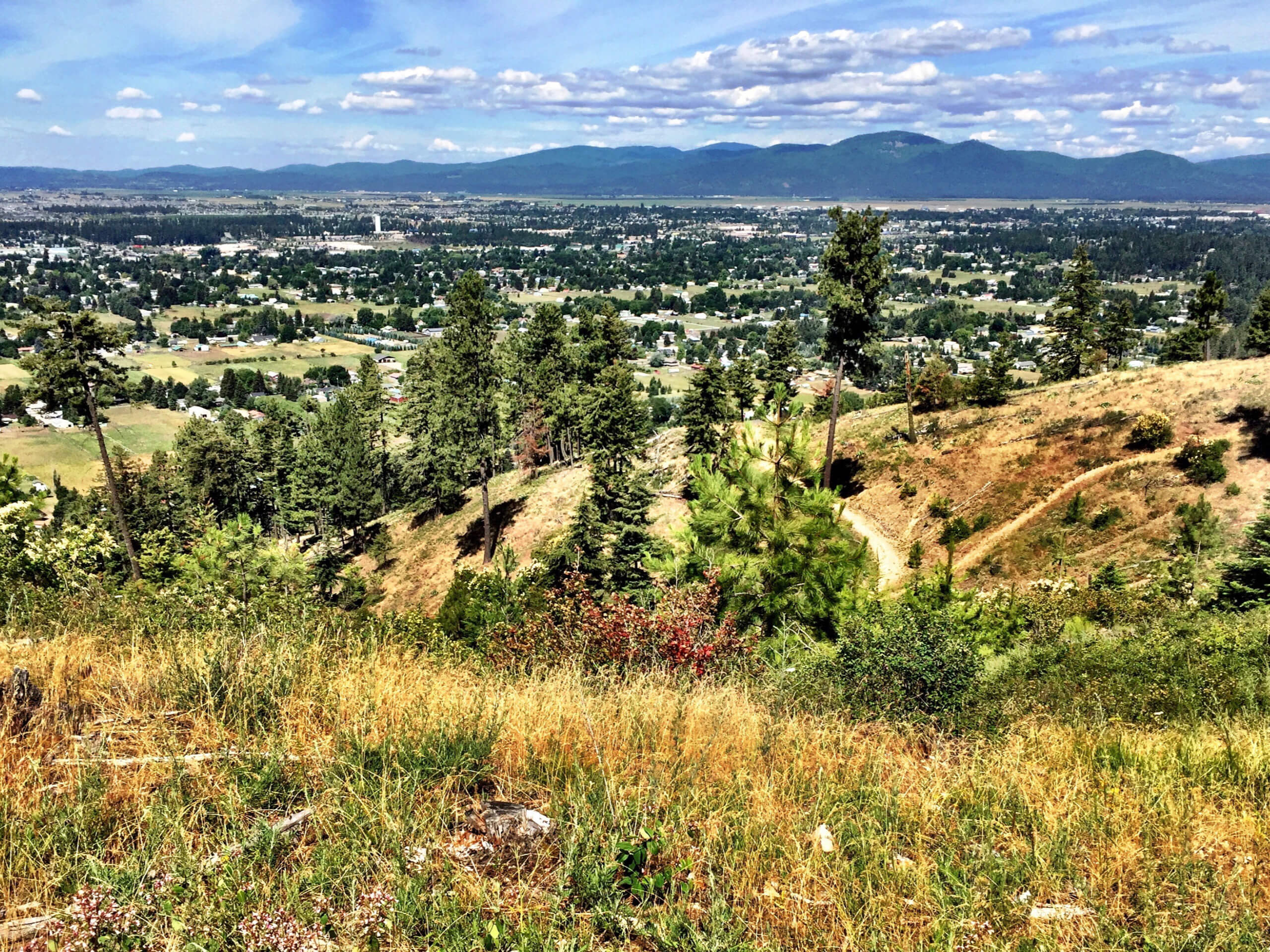
Canfield Mountain Loop Trail
Difficulty Rating:
Boasting outdoor pursuits, the Canfield Mountain Loop is a popular destination where adventurers of all types can indulge their recreational interests. While you can partake in mountain biking or off-roading, hiking is absolutely our favorite way to explore this incredible trail system overlooking Coeur d’Alene, Idaho.
Getting there
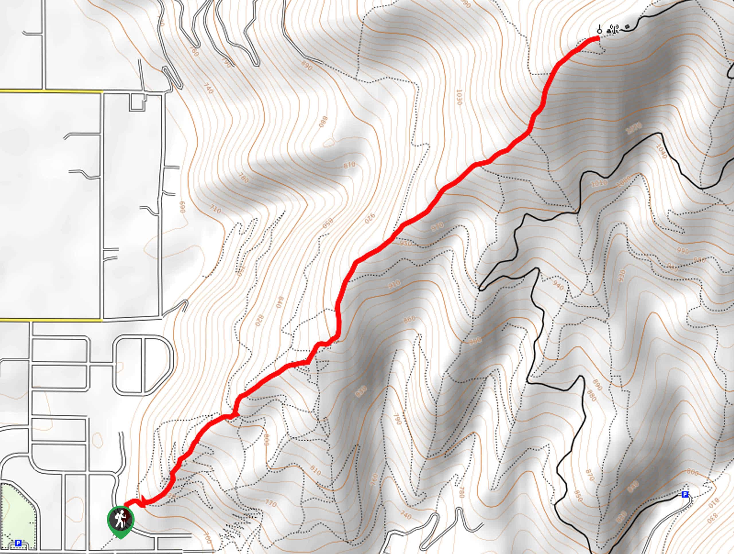
The Canfield Mountain Loop departs from the parking lot off N Nettleton Gulch Road in the Canfield Mountain Trail System.

About
| Backcountry Campground | No |
| When to do | Year-round |
| Pets allowed | Yes - On Leash |
| Family friendly | Older Children only |
| Route Signage | Poor |
| Crowd Levels | High |
| Route Type | Lollipop |
Canfield Mountain Loop Trail
Elevation Graph
Weather
Canfield Mountain Loop Trail Description
Immerse yourself in nature and indulge in spellbinding scenery on the Canfield Mountain Loop Trail. Located in the Canfield Mountain Trail System, this route sees plenty of traffic, so arrive prepared to share the trail! Those seeking a more tranquil experience are encouraged to head out in the early morning or in the evening to avoid the rush. Additionally, as the route is shared with bikers and ATVs, much of the terrain is rocky and rutted, so be cautious of your footing.
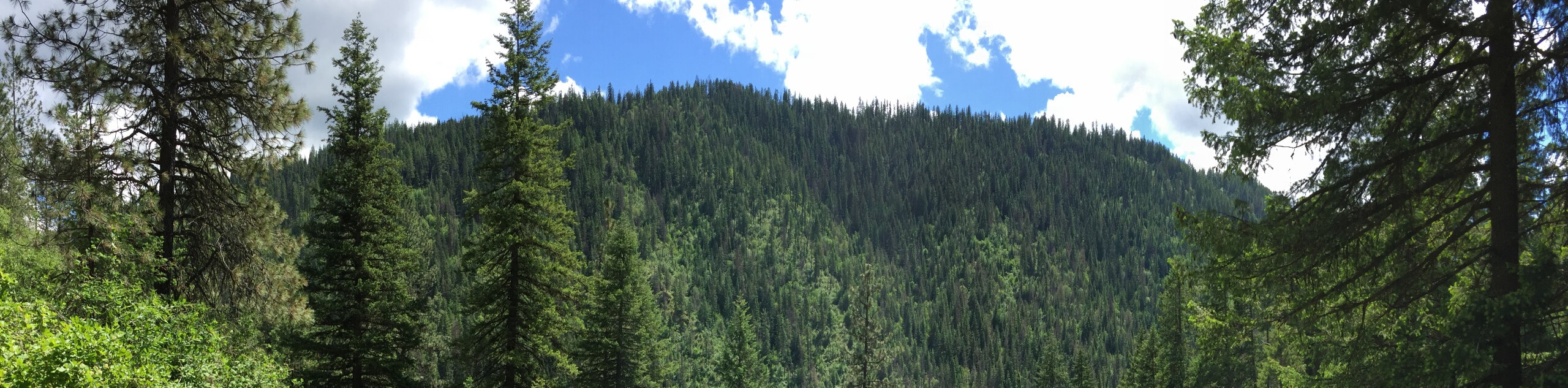
While most of the trail travels beneath the closed tree canopy, there are sections of exposure, so make sure you wear SPF and dress in layers as insurance against changing conditions. Note the mosquitos in this area are relentless, so bug repellent is a must! Unfortunately, this scenic circuit is poorly signposted, and cell reception is spotty, so make sure you download the trail GPS prior to your departure.
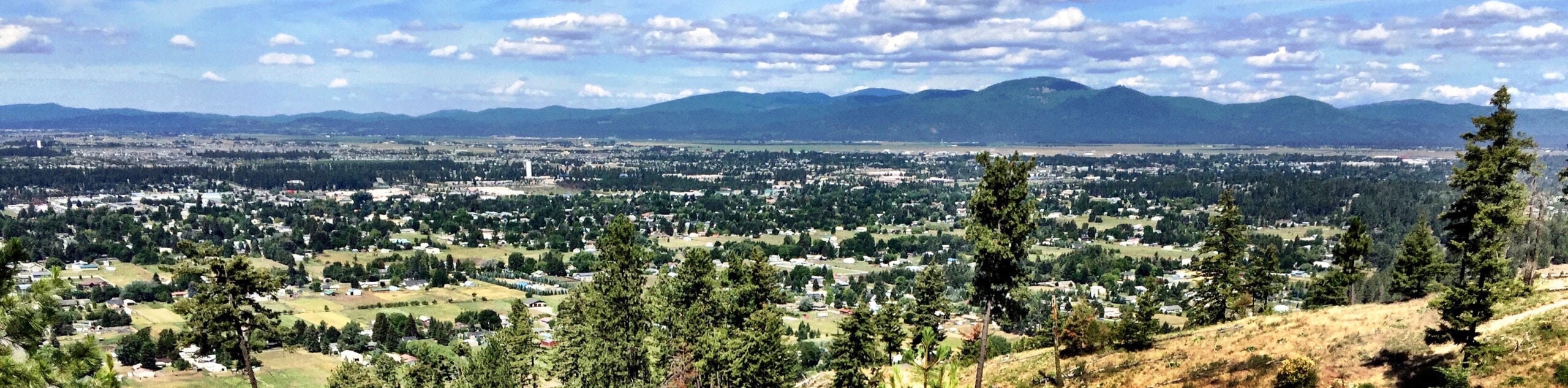
The ruggedness of the Canfield Mountain Loop is all part of its charm. Explore the rough and remote wilds that are so conveniently located along the boundary of Coeur d’Alene. Granting the perfect excuse to explore the great outdoors, you enjoy the wilderness, then reward yourself with a latte in Dalton Gardens. While you can access this network of trails year-round, we encourage spring and summer exploration when the vegetation is lush and wildflowers carpet the forest floor. Although much of the trails are wooded, there are several overlooks that boast wonderful views of the cityscape and Northern Idaho’s second-largest lake—so make sure you bring your camera!
Embark on your adventure along the Canfield Mountain Loop from the parking lot and trailhead off N Nettleton Gulch Road. Setting out from here, you will follow the N Nettleton Gulch Road into the woodlands. Tracking southwest, the path will consistently climb, getting your heart rate up just a few steps after departing the trailhead. Soon you will be redirected northwardly through a corridor of mixed conifers, including white pines, cedars, and firs. When you ultimately reach an intersection with Trail C, veer left, then take a quick right, using the trail GPS to navigate the unmarked path.
At the subsequent junction, you will turn right onto Trail 1, up to the radio towers, which also coincidentally exposed incredible views of the City of the Coeur d’Alene and the shimmering lake bound by the Idaho Mountains. Revel in the scenery, then continue hiking, merging onto the rightmost Canfield Loop Road. This route will guide you to atop the West Canfield Butte and then down to the saddle. At this point, you will reconnect with the N Nettleton Gulch Road. Now you will begin your descent down the mountainside.
Mind your footing on the uneven terrain, and be cautious of off-roaders and bikers speedily making their way down the southern slopes of the Canfield Buttes. After some trekking, you will encounter a junction with Trail 3; turn left here. Now wandering southward, this path will expose wonderful wildflowers in the spring and summer months. Admire the beauty of the lively forestlands, and you will eventually reconnect with the N Nettleton Gulch Road again. From here, turn left and retrace your steps back to the trailhead, marking the end of your adventure.
Frequently Asked Questions
How long is the Canfield Mountain Loop?
The Canfield Mountain Loop is a 5.3mi adventure in the Canfield Mountain Trail System.
Can you drive up to the summit of Canfield Mountain?
No, vehicles (other than service trucks) cannot drive up to the summit of Canfield Mountain, though ATVs and motorized trail bikes are permitted on the trails.
How tall is West Canfield Butte?
West Canfield Butte stands at an elevation of 4162ft.
Insider Hints
The parking lot fills up fast, so arrive early to secure a spot
Mind your footing on the roots, rocks, and ruts that obstruct the path
Keep your dogs on-leash to protect them from wildlife and ATV traffic
Dress in layers as insurance against changing conditions
Insect repellent and sunscreen are recommended
Bring plenty of water to stay hydrated
Grab a tea at Inland Café and Tea after your adventure
Similar hikes to the Canfield Mountain Loop Trail hike
West Canfield Butte Hike
Those seeking a short but rewarding adventure near Coeur d’Alene are encouraged to hike the West Canfield Butte Trail. This…
Marie Creek Trail
Hiking the Marie Creek Trail makes for a pleasant way to spend the day. This beautiful adventure wanders along a…
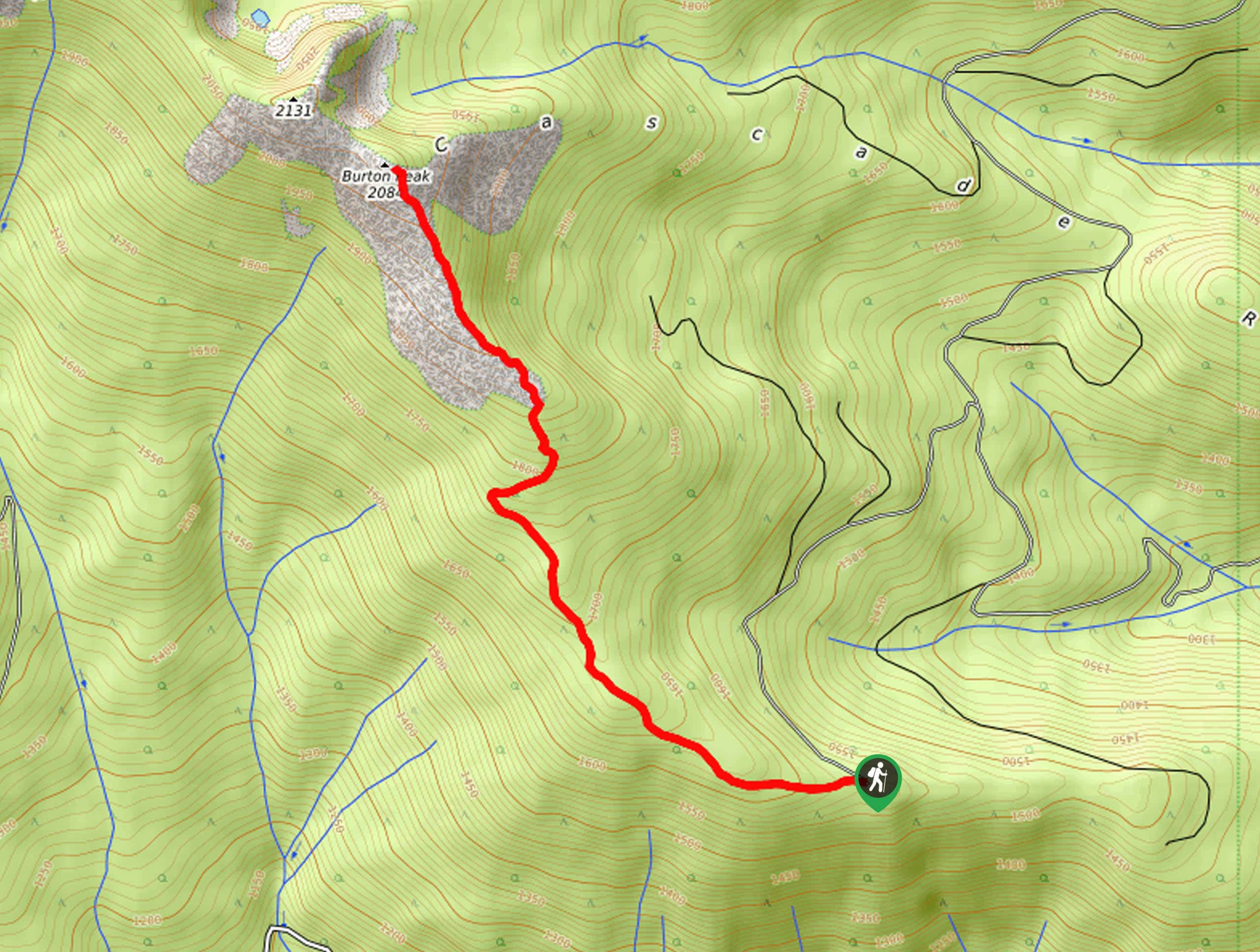
Burton Peak Hike
Explore old-growth forests and lush montane meadows on the Burton Peak Hike. While the adventure demands some stamina, the expansive…
Comments