
Big Trees Trail
View Photos
Big Trees Trail
Difficulty Rating:
The Big Trees Trail is a long and involved adventure near Coeur d’Alene in Idaho’s wilderness. While demanding, this route yields incredible scenes of the Idaho Mountains, nearby lakes, and the array of wildflowers that adorn the forest floor.
Getting there
The Big Trees Trail is accessed from the Canfield Mountain Park Loop Trailhead off E Mountain Vista Drive.

About
| Backcountry Campground | No |
| When to do | Year-round |
| Pets allowed | Yes - On Leash |
| Family friendly | No |
| Route Signage | Poor |
| Crowd Levels | High |
| Route Type | Lollipop |
Big Trees Trail
Elevation Graph
Weather
Big Trees Trail Description
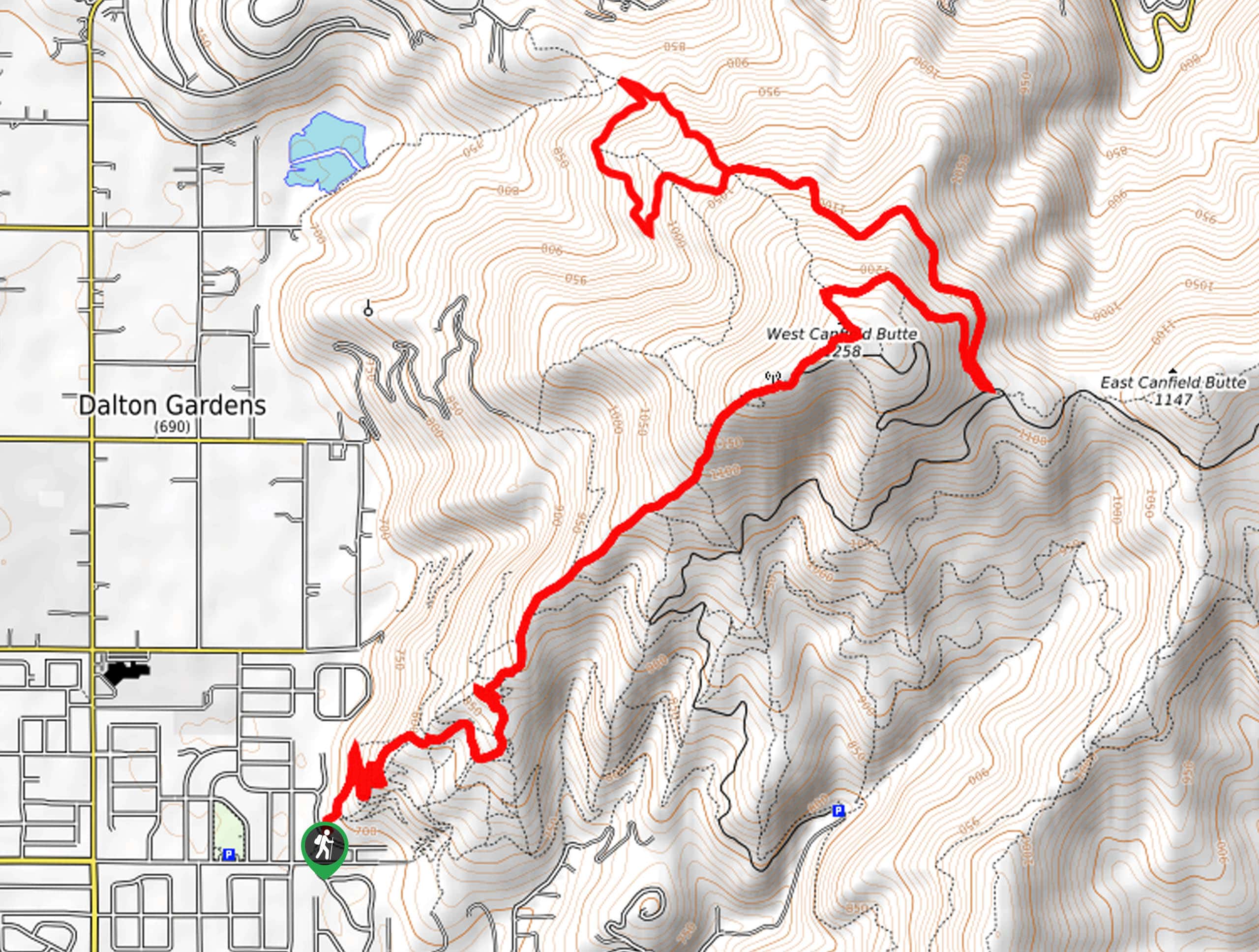
Immerse yourself in a sea of mixed pines, spruce, and cedars as you explore the Big Trees Trail. This challenging adventure will reward its conquerors with spellbinding views of the Idaho Mountains and adorning lakes, including Coeur d’Alene and Lake Hayden. Note the Canfield Mountain Trail System is shared with off-roaders and bikers, so the terrain is rocky and rutted. Additionally, the path is poorly signposted, so make sure you download the trail GPS before departure.
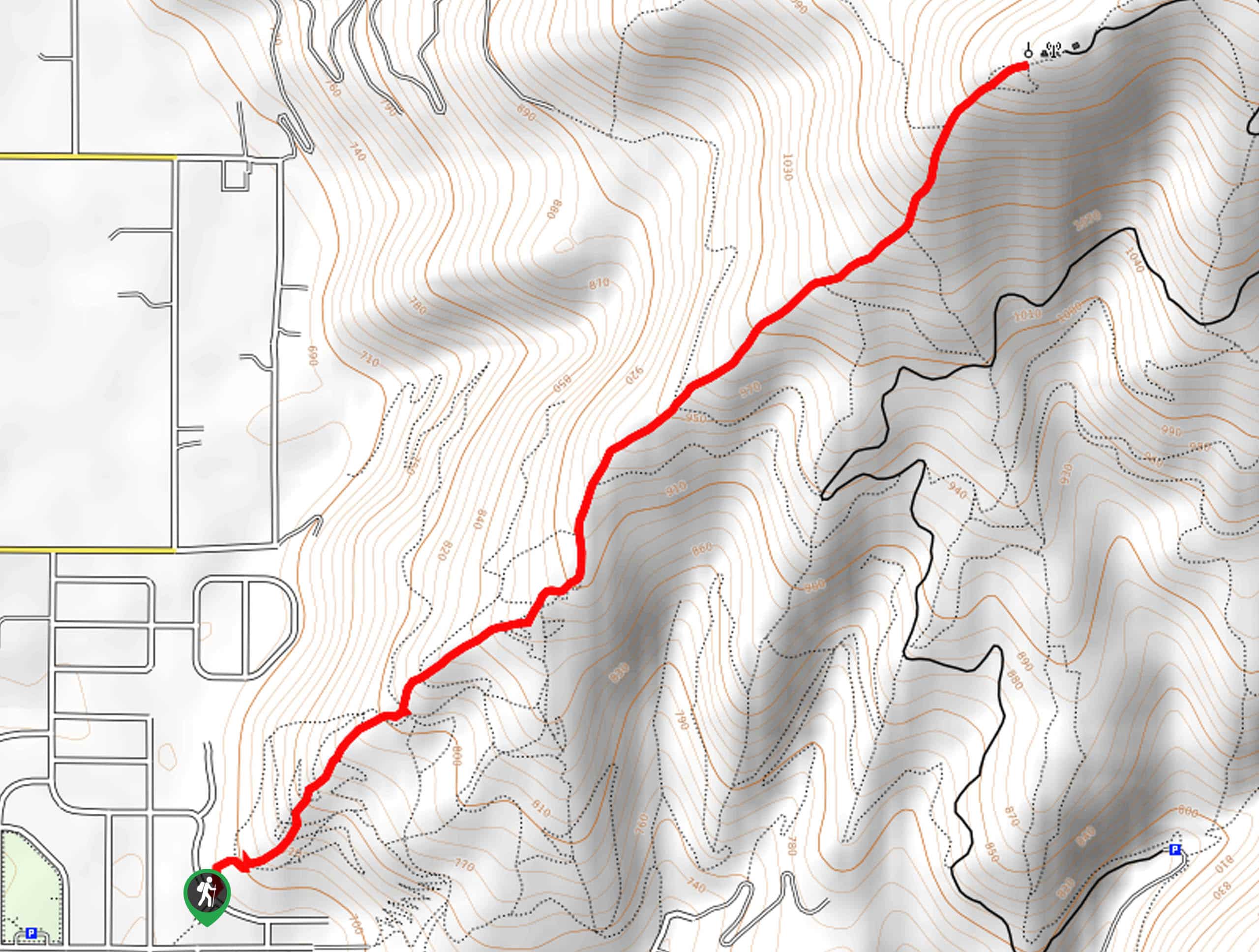
With plenty of water and sun protection in tow, your adventure along the Big Trees Trail begins from the Canfield Mountain Park Loop. Taking the leftmost section of the Canfield Mountain Park Loop, you will be led up a set of switchbacks before connecting with Trail 1. Using the trail GPS, Trail 1 will guide you up to the radio tower, where you will merge onto Trail D, which will lead you to the summit of West Canfield Butte. After some hiking, you will reach the saddle between the Canfield Mountains; here, you will be diverted northwest onto an un-signposted trail.
This route will guide you down the northern slopes of the West Canfield Butte, offering sparse views of Lake Hayden. The trail GPS will guide you around a circuit before ultimately guiding you back up to the saddle. From here, retrace your footing along the path back to the trailhead.
Similar hikes to the Big Trees Trail hike
West Canfield Butte Hike
Those seeking a short but rewarding adventure near Coeur d’Alene are encouraged to hike the West Canfield Butte Trail. This…
Marie Creek Trail
Hiking the Marie Creek Trail makes for a pleasant way to spend the day. This beautiful adventure wanders along a…
Burton Peak Hike
Explore old-growth forests and lush montane meadows on the Burton Peak Hike. While the adventure demands some stamina, the expansive…
Comments