Klahowya Trail hike
View Photos
Klahowya Trail hike
Difficulty Rating:
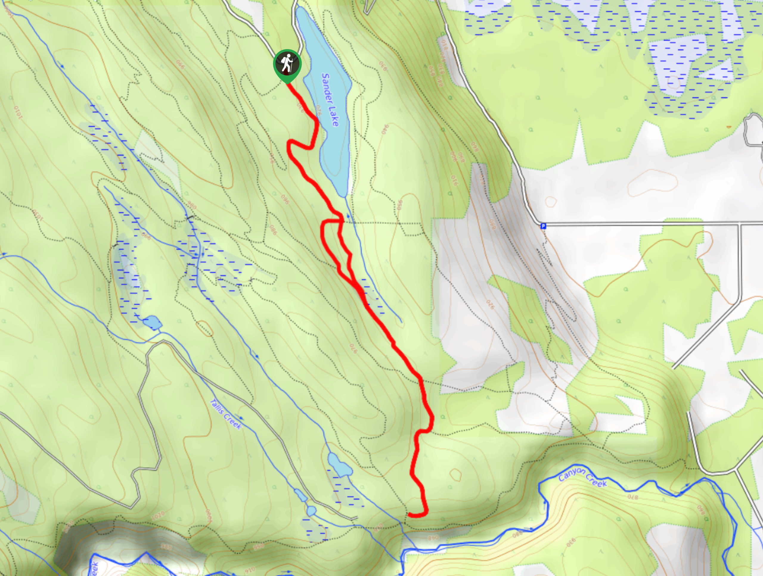
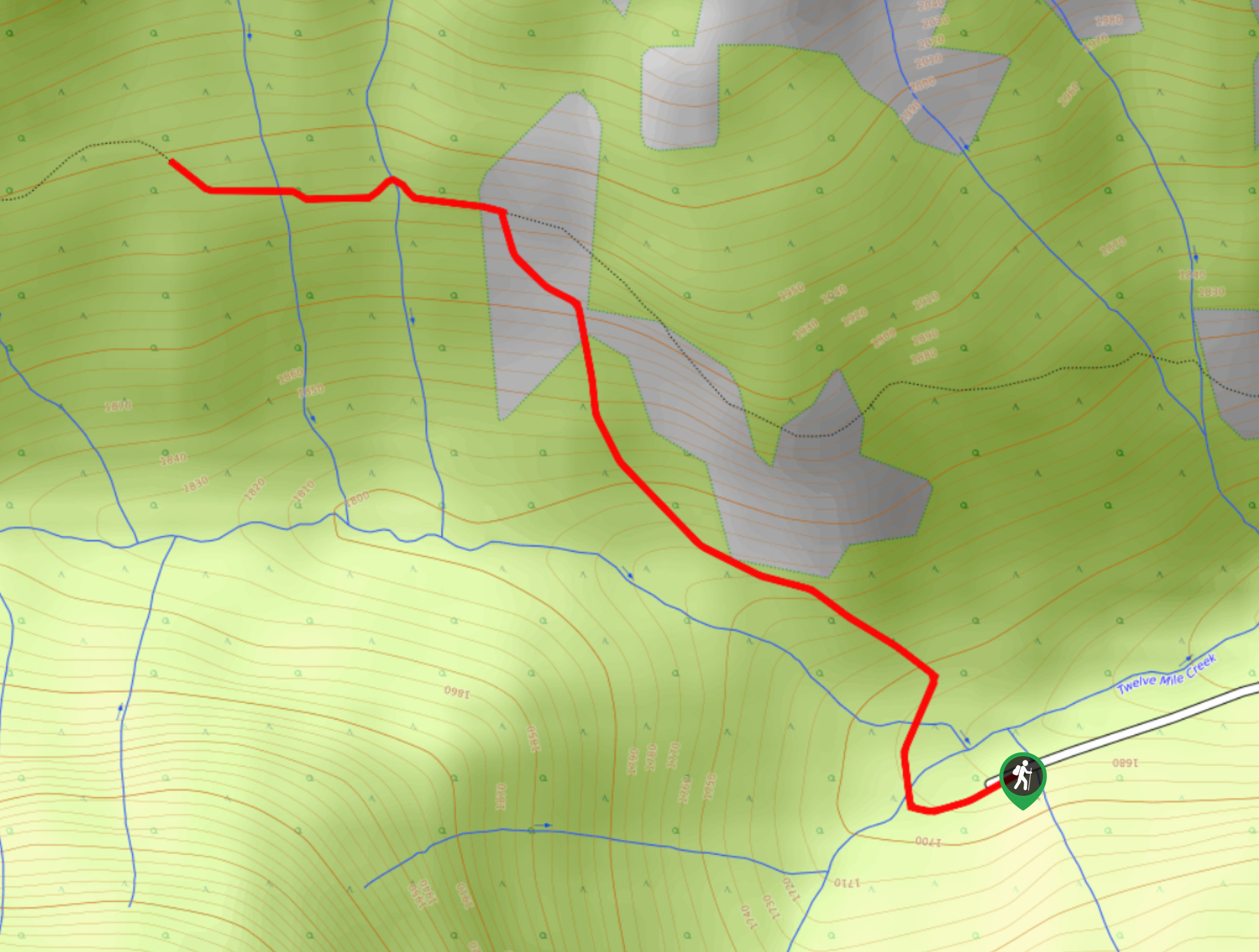
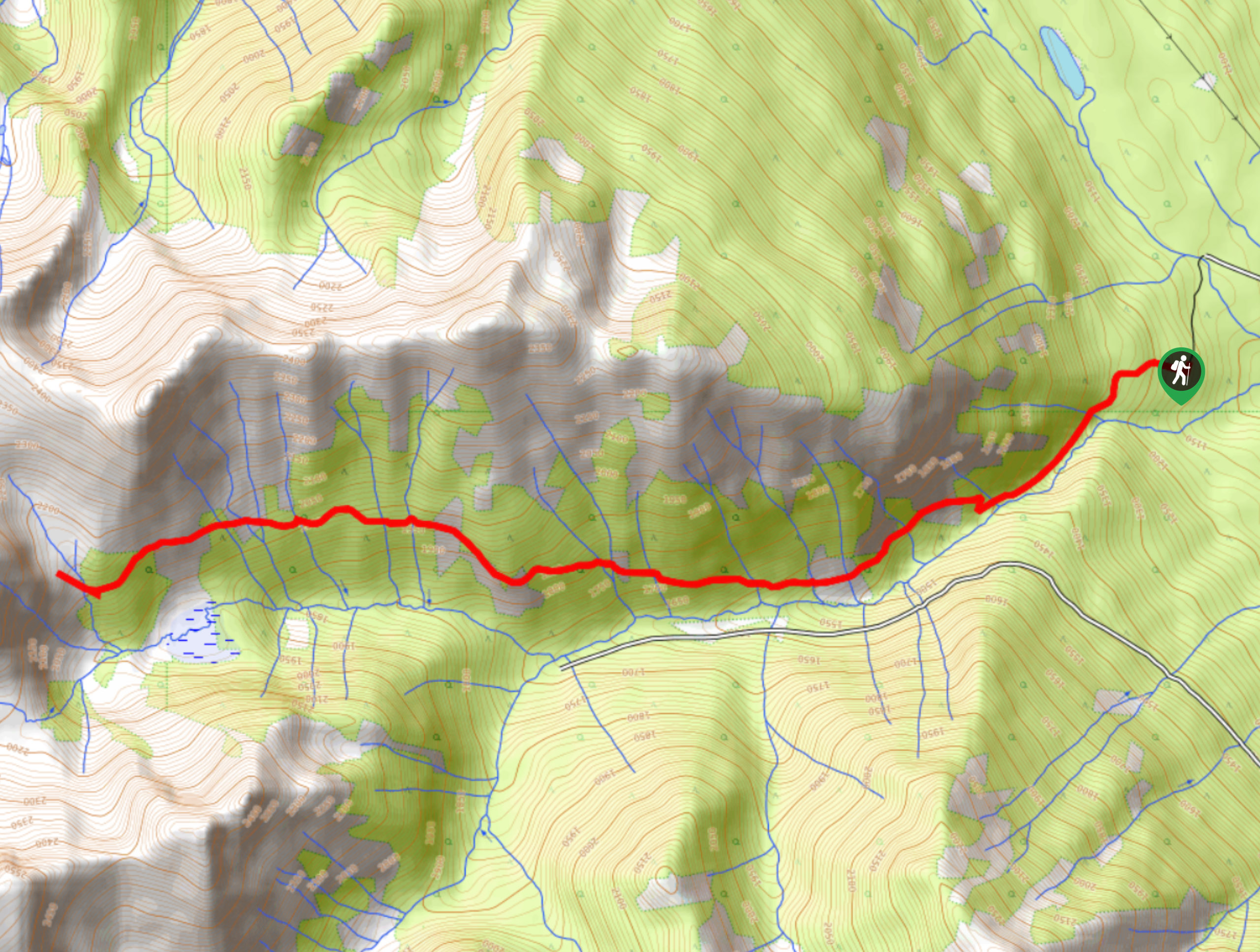
The Klahowya Trail is a 2.6mi loop trail within the Moonraker Trails Recreation Site near Golden that will take hikers from the shores of Sander Lake through the forest and onto a ridge overlooking Canyon Creek. Hikers along this trail can expect heavily forested paths and limited scenery; however, the woodland atmosphere provides a welcome retreat for those looking for solitude on the trails. This route is part of a dense network of trails, so make sure to bring a GPS or trail map along for the hike.
Getting there
To get to the trailhead for the Klahowya Trail from the Kicking Horse Mountain Resort, drive east for 2.4mi on Kicking Horse Trail and make a right turn onto Dogtooth FSR. Keep straight for 1.1mi and make a left on Canyon Creek Road. You will find the trailhead on the right at 2.4mi.

About
| When to do | May–October |
| Backcountry Campsites | No |
| Pets allowed | Yes - On Leash |
| Family friendly | Older Children only |
| Route Signage | Average |
| Crowd Levels | Low |
| Route Type | Circuit |
Klahowya Trail
Elevation Graph
Weather
Klahowya Trail Description
The Klahowya Trail is a quick hike through the dense forests southwest of Golden that will allow you to experience the natural beauty of the woodland landscape. Setting out from the western shore of Sander Lake, the trail heads into the tree cover along a dense network of hiking and mountain bike routes. Make sure to keep an eye on the trail map as you make your way through several junctions of interconnecting trails and a small marshy area.
While walking through the forest, the trail will follow along a series of gentle ascents and descents before climbing up a ridge overlooking Canyon Creek and the Columbia Valley. After reaching a junction with the Moonraker Trail, turn back and retrace your steps to the fork in the trail near the marsh. Head right for a brief change of scenery before the trail meets back up again on the return journey to Sander Lake and your parked vehicle.
Similar hikes to the Klahowya Trail hike
Mount 7 Trail
The Mount 7 Trail is a 5.6mi out-and-back hiking route near Golden, BC, that sets out from a…
Upper Certainty Mine Trail
The Upper Certainty Mine Trail is a 1.9mi out-and-back hiking route that will take you through some beautiful…
Lower Certainty Mine Trail
The Lower Certainty Mine Trail is a 6.0mi out-and-back hiking route near Golden, BC, that climbs through the…
Comments