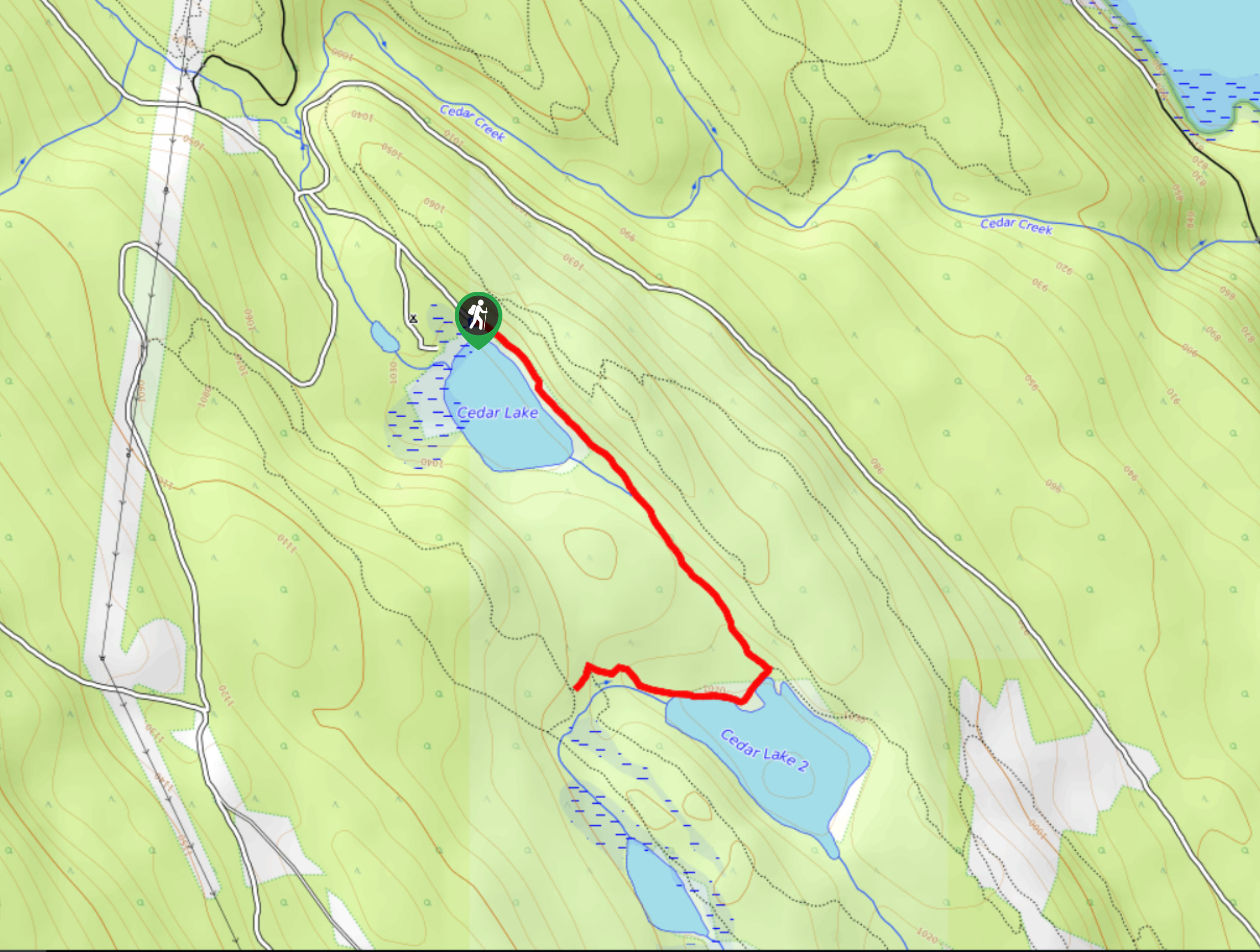
Edelweiss Slough
View Photos
Edelweiss Slough
Difficulty Rating:
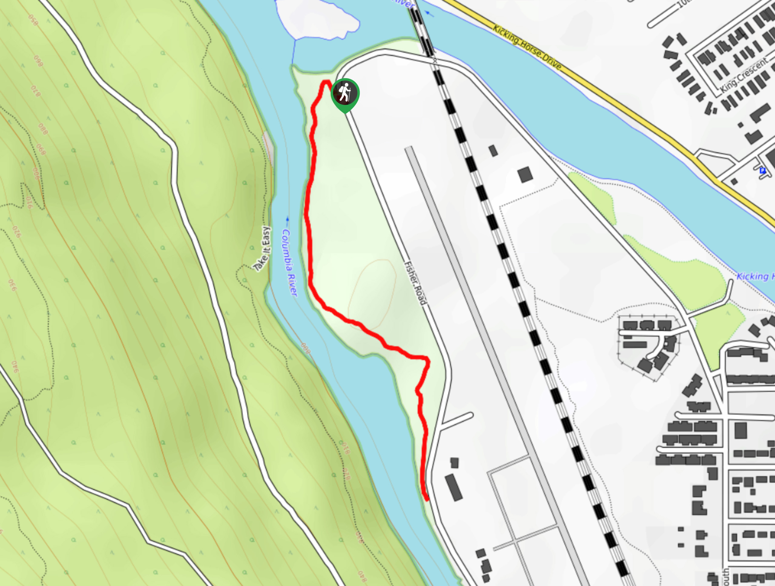
The Edelweiss Slough is a 0.6mi out-and-back hiking route that passes through a beautiful stretch of wetland landscape just north of Golden, BC. Along the trail, hikers will have some lovely views of this sodden part of the Columbia Valley and will have the chance to spot the various bird species that call the wetlands home. Parts of this trail can become very wet in the spring, so check trail conditions before your hike.
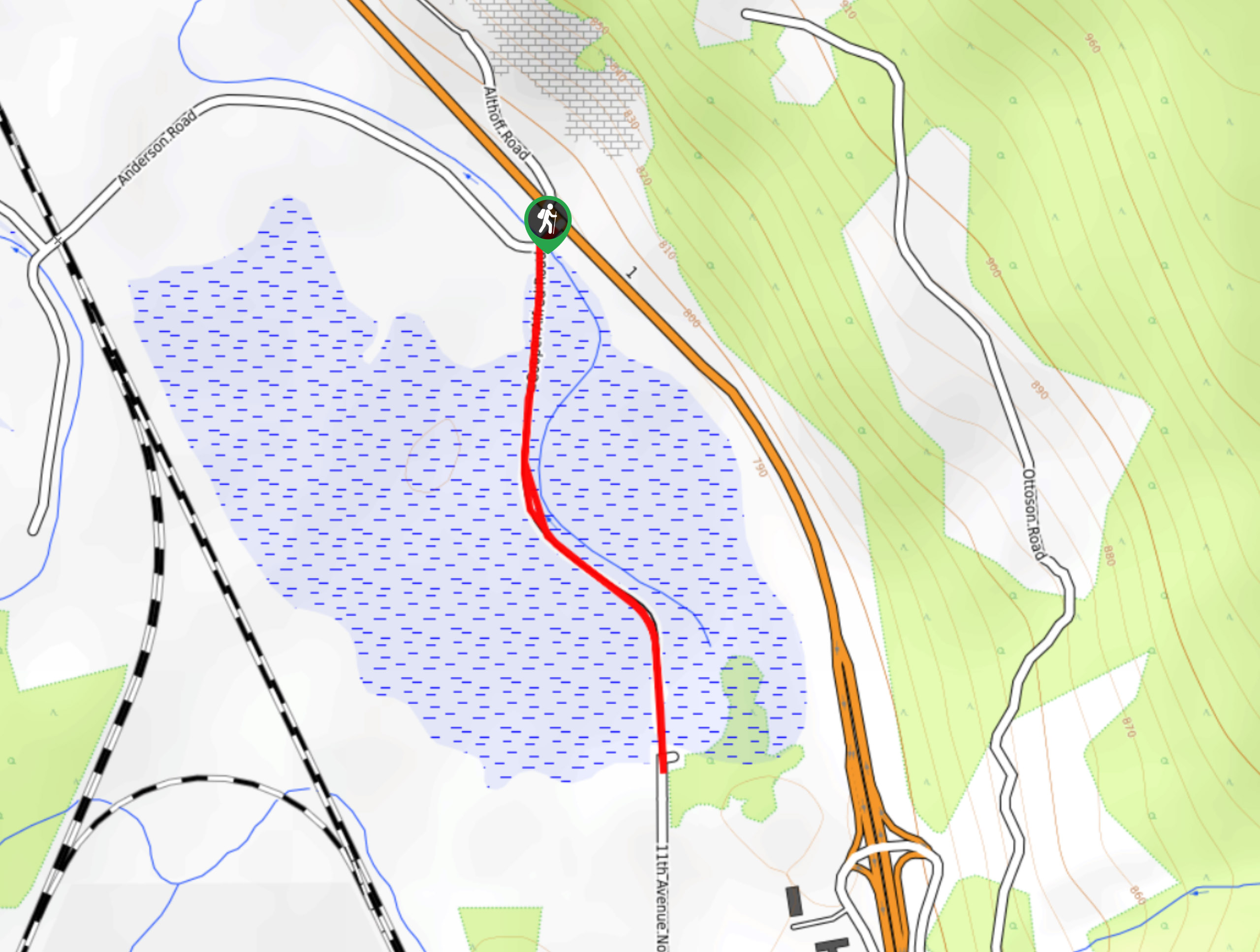
Getting there
To reach the trailhead for the Edelweiss Slough from Golden, head northwest on 10th Avenue for 0.9mi. The road will turn right and become 13 Street N. After 787ft, turn left and follow 11 Avenue N for 1476ft to find the trailhead straight ahead.

About
| When to do | Year-round |
| Backcountry Campsites | No |
| Pets allowed | Yes - On Leash |
| Family friendly | Yes |
| Route Signage | Average |
| Crowd Levels | Moderate |
| Route Type | Out and back |
Edelweiss Slough
Elevation Graph
Weather
Edelweiss Slough Description
Hiking the Edelweiss Slough is a quick trek through a charming stretch of wetlands providing hikers with scenic views of the valley and the chance to spot wildlife. The terrain along this hike is level, which makes it accessible for all types of hikers; however, you might want to bring some water-resistant footwear to stay comfortable along the trail due to the proximity to the water. As you wind your way through the marshy terrain, you will be able to spot several mountain peaks around you, including Navvy Peak and Table Mountain to the east and Moberly Peak to the north. Keep an eye out for birds and other wildlife species that inhabit the surrounding landscape.
Similar hikes to the Edelweiss Slough hike
Confluence Park Trail
The Confluence Park Trail is a 1.1mi out-and-back hiking route in Golden, BC, that skirts alongside the airport…
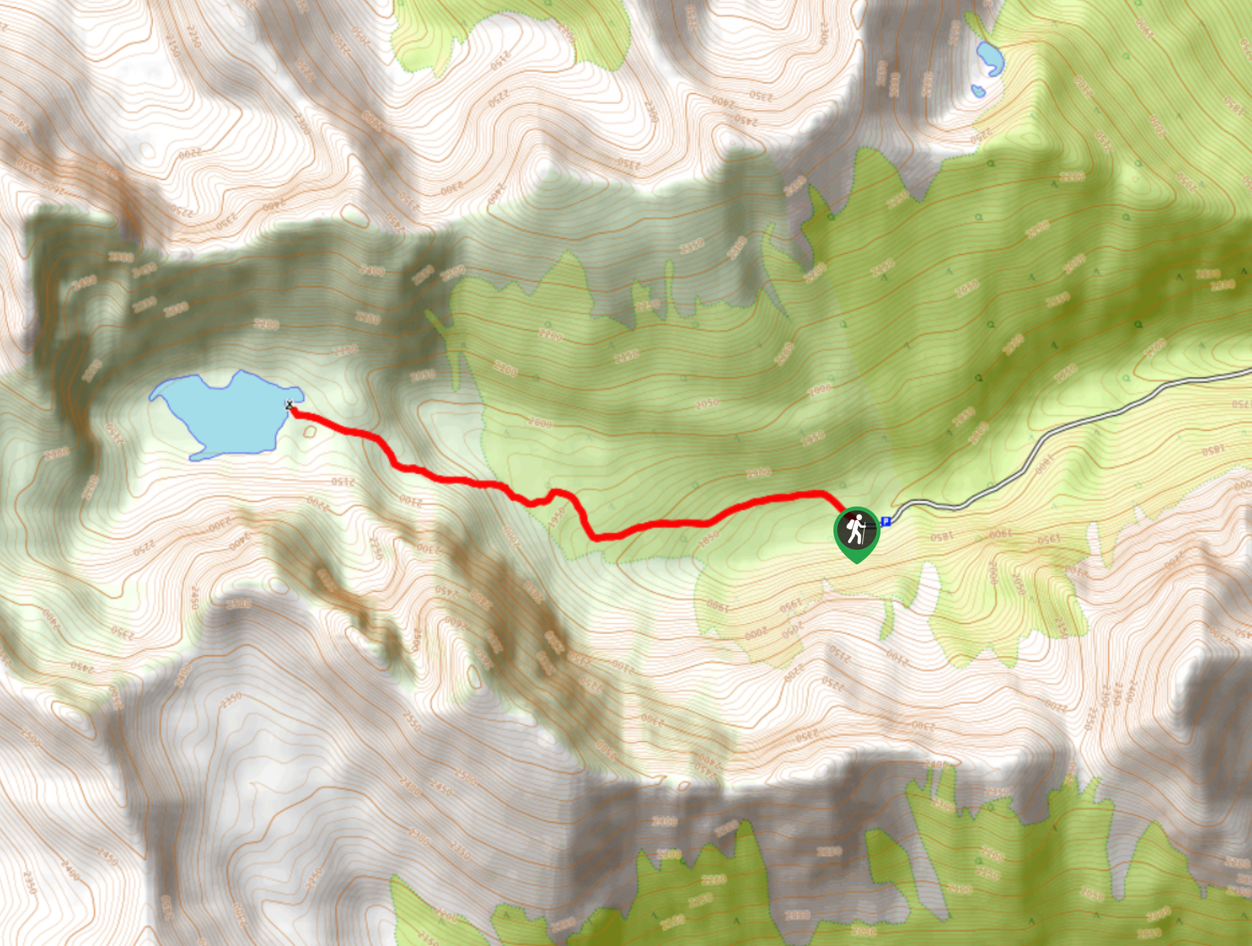
Gorman Lake Trail
The Gorman Lake Trail is a 3.6mi out-and-back hiking route through a beautiful alpine valley west of Golden,…
Cedar Camp Trail
The Cedar Camp Trail is a 2.0mi out-and-back hiking route found within the Moonraker Trails Recreation Site near…
Comments