
Confluence Park Trail
View Photos
Confluence Park Trail
Difficulty Rating:
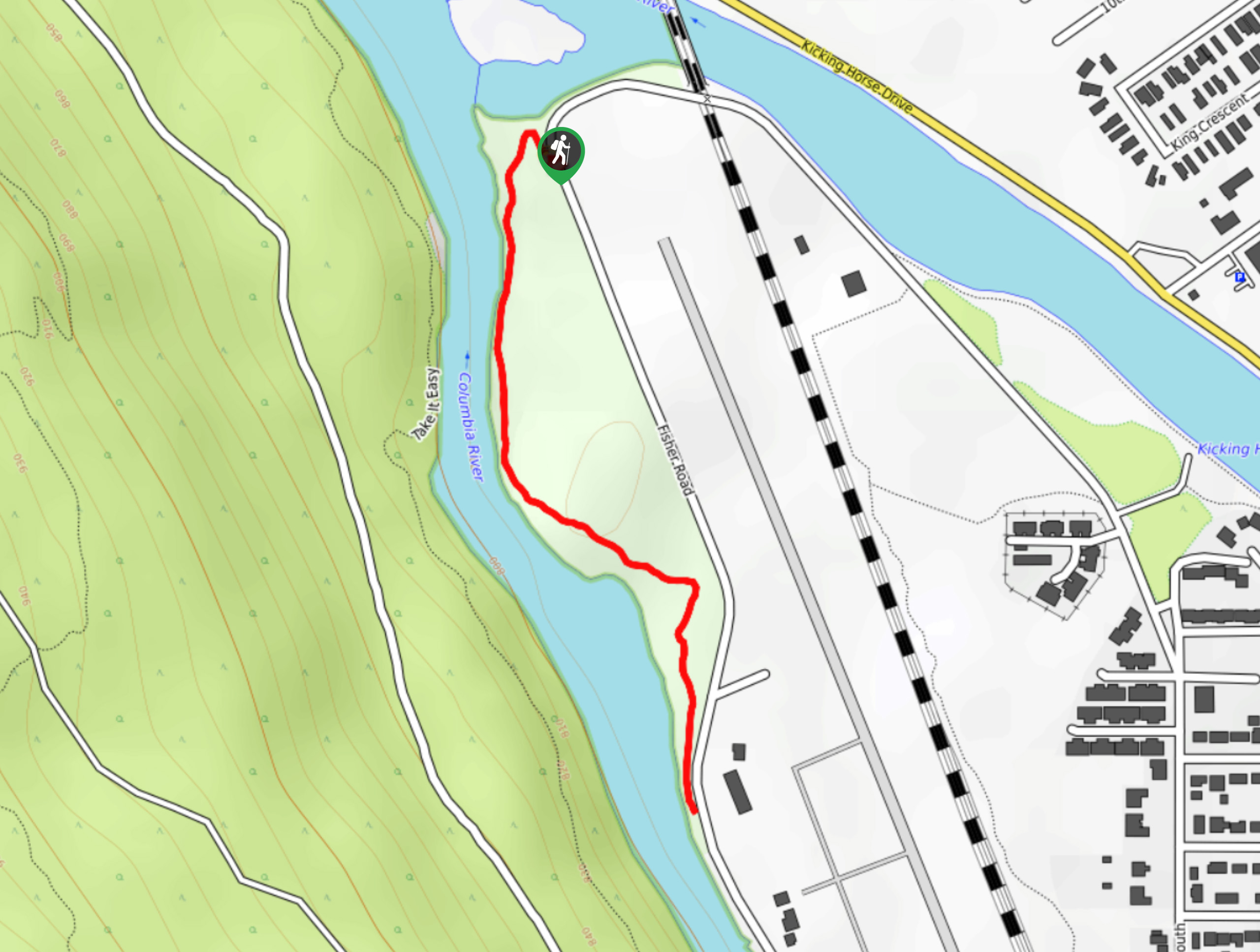
The Confluence Park Trail is a 1.1mi out-and-back hiking route in Golden, BC, that skirts alongside the airport runway and provides nice views of the Columbia River. This trail is easy to navigate and traverses some very flat terrain, making for a route accessible for hikers of all skill levels. During times of extremely high water, sections of this trail can be submerged in the river. Make sure to check trail conditions before your hike.
Getting there
To reach the trailhead for the Confluence Park Trail from Golden, head west on 9 Street for 2625ft and turn right onto 5 Avenue. After 1640ft, continue onto Fisher Road and follow it for 0.7mi to find the trailhead on your right.

About
| When to do | Year-round |
| Backcountry Campsites | No |
| Pets allowed | Yes - On Leash |
| Family friendly | Yes |
| Route Signage | Average |
| Crowd Levels | Low |
| Route Type | Out and back |
Confluence Park Trail
Elevation Graph
Weather
Confluence Park Trail Description
Located at the confluence of the Columbia and Kicking Horse Rivers, Confluence Park and the short trail that runs through it are a work in progress that, once finished, will allow hikers to explore the area along the banks of these powerful rivers. Due to the trail’s proximity to the water, high levels of rainfall and swelling of the riverbanks will often make the trail at least partially submerged during the wetter seasons of the year. Make sure to check trail conditions before heading out to explore the area.
The trail itself is made up of packed gravel and is level, making for an easy-to-navigate route that hikers of all skill levels can enjoy. Once on the trail, you will be able to view the scenic wetlands and beautiful stretches of forest that line the riverbank, as well as a few planes taking off from the nearby airport.
Similar hikes to the Confluence Park Trail hike
Edelweiss Slough
The Edelweiss Slough is a 0.6mi out-and-back hiking route that passes through a beautiful stretch of wetland landscape…
Gorman Lake Trail
The Gorman Lake Trail is a 3.6mi out-and-back hiking route through a beautiful alpine valley west of Golden,…
Cedar Camp Trail
The Cedar Camp Trail is a 2.0mi out-and-back hiking route found within the Moonraker Trails Recreation Site near…
Comments