

St Just to Cape Cornwall Walk
View PhotosSt Just to Cape Cornwall Walk
Difficulty Rating:
The St Just to Cape Cornwall Walk is a fantastic adventure along the Cornish Coast that will see you traverse the open countryside for views of the ocean. While out walking the trail, you will pass through the town of St Just and traverse the scenic headland of Cape Cornwall, where you can look out across the water where the Atlantic currents divide and flow into the English and Bristol channels. This is a beautifully scenic journey that can be enjoyed by walkers of most skill levels.
Getting there
The trailhead for the St Just to Cape Cornwall Walk can be found at the St Just Car Park on Market Street in the town of St Just.
About
| Backcountry Campground | No |
| When to do | Year-Round |
| Pets allowed | Yes - On Leash |
| Family friendly | Yes |
| Route Signage | Average |
| Crowd Levels | Moderate |
| Route Type | Circuit |
St Just to Cape Cornwall Walk
Elevation Graph
Weather
St Just to Cape Cornwall Walk Description:
The walk from St Just to Cape Cornwall will lead you across a variety of terrain, including the rugged coastal landscape and city streets. Be sure to wear proper walking shoes that will be comfortable for the journey. Additionally, you will need to keep an eye on children and dogs when both exploring the coastal terrain and along roadways.
Although a fair portion of this walk will lead you along roadways, the breathtaking scenery along Cape Cornwall is well worth the duller moments of this adventure. In addition to taking in some stunning views along the coast, you will make your way through the charming town of St Just and pass by old remnants of the region’s mining history that can be seen dotted throughout the trail. This is a great adventure that is suitable for a wide range of outdoor enthusiasts.
Setting out from the car park, turn right along Market Street and follow it for 383ft, where you will turn left to traverse a small set of stairs and gain access to a grassy area. Make your way northeast across the grass and turn left at the clocktower to arrive at the edge of Cape Cornwall Street. From here, you will turn left and make your way along the road for a few paces, before arriving at a fork. Head right here onto Boswedden Road and follow it northwest for 0.2mi.
Bearing left here, you will follow the track for 0.3mi, leaving the town behind for the open expanse of the picturesque Cornish countryside. After arriving at a fork in the trail, take the path on the left and continue on for 0.2mi, where you will make another left turn in order to head southwest and meet up with Cape Cornwall Road. Turn right onto the road and follow it for 420ft, before turning left onto another footpath, following it for a further 0.1mi to once again meet up with the road.
Make a left onto the Cape Cornwall Road and follow it to the west for 0.2mi, where you will find a footpath on the right. Turn right here and make an immediate left to continue in a westward direction toward Cape Cornwall. Keeping straight along this trail for 450ft as it runs parallel to the road, you will eventually arrive at a junction. Take the path directly in front of you that leads to the northwest and follow it for 0.3mi to make your way past a small chapel dedicated to Saint Helen and around the rugged, yet picturesque terrain of Cape Cornwall.
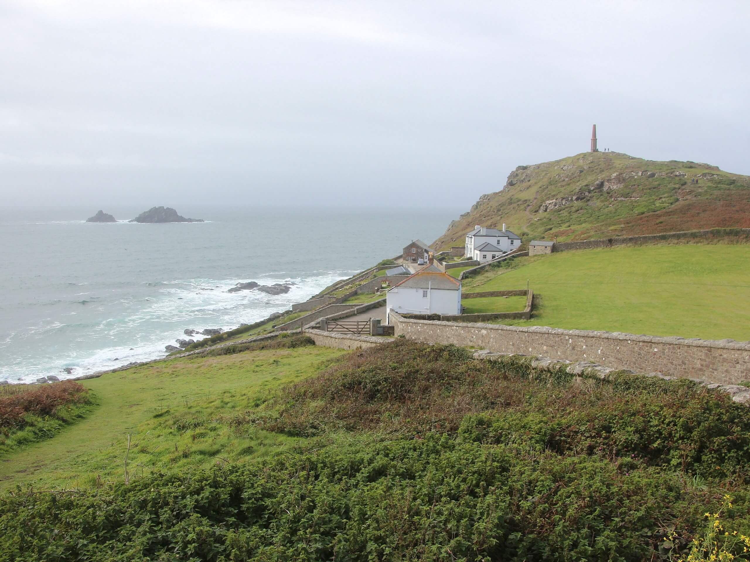
After arriving at the Cape Cornwall Chimney, you will enjoy some amazing views overlooking Porth Ledden and Priest’s Cove, before continuing along the trail as it bends to the southeast. Follow this until you meet up with Cape Cornwall Road and follow it left for 330ft. Here, you will turn right onto a track and continue along it for 0.1mi, where you will come to a fork. Make a sharp right here and follow the path for 0.2mi, where it will transition into Carn Gloose Road.
Make your way along the road as it leads to the southeast and pick up the path on your right after just 215ft. Here, you will make your way along the coast and enjoy some stunning views across the water, while also passing by remnants of the region’s mining past. Keep straight along this trail for the next 0.6mi as it traverses the Bollowall Cliff, before meeting up with the edge of a road.
Turning left here, you will follow the road for 0.2mi, where you will make a sharp right onto a smaller track. Keeping left along this for 0.2mi, you will eventually meet up with Carrallack Lane, which you can follow to the northeast for 0.4mi to arrive back at the car park where you began the St Just to Cape Cornwall Walk.
Trail Highlights
Cape Cornwall Chimney
The Cape Cornwall Chimney was constructed in 1864 and now stands as a remnant of the Cape Cornwall Mine that was operational between 1838 and 1883. While the majority of the tin mine was demolished, the chimney was kept as a navigational aid, thanks largely to its prominent hilltop position.
Frequently Asked Questions
Why is Cape Cornwall a cape?
Cape Cornwall is a headland along the Cornish Coast that juts out into the ocean at a point where the Atlantic currents divide.
When did the Cape Cornwall Mine close?
The Cape Cornwall Mine was operational from 1838 to 1883.
Insider Hints
Wear proper walking shoes that will be comfortable on both roadways and rugged terrain.
If you are interested in exploring more of the terrain around Cape Cornwall, check out the Cape Cornwall to Levant Mine Walk nearby.
Similar hikes to the St Just to Cape Cornwall Walk hike

Restronguet Passage Circular Walk
The Restronguet Passage Circular Walk is a fantastic outdoor excursion in Cornwall that offers beautifully scenic views overlooking a number…

Crantock and The Gannel Circular Walk
The Crantock and The Gannel Circular Walk is a beautifully scenic adventure near Newquay, Cornwall that will lead you through…

Egloshayle Circular Walk
The Egloshayle Circular Walk is a great outdoor excursion set in the Cornish countryside that will expose you to a…


Comments