
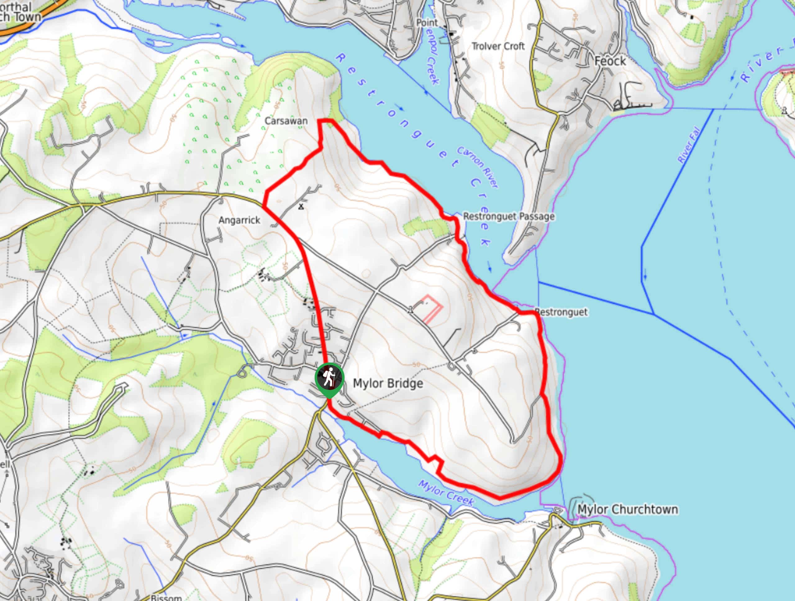
Restronguet Passage Circular Walk
View Photos
Restronguet Passage Circular Walk
Difficulty Rating:
The Restronguet Passage Circular Walk is a fantastic outdoor excursion in Cornwall that offers beautifully scenic views overlooking a number of different waterways. While out walking the trail, you will make your way through the countryside and along the water’s edge, taking in views of Restronguet Creek, the River Fall, Carrick Roads, and Mylor Creek, before making the return into Mylor Bridge. This is an excellent route if you are looking for a relaxing stroll with plenty of waterside views.
Getting there
The trailhead for the Restronguet Passage Circular Walk can be found along Lemon Hill Road, right next to the Lemon Arms pub.

About
| Backcountry Campground | No |
| When to do | Year-Round |
| Pets allowed | Yes - On Leash |
| Family friendly | Yes |
| Route Signage | Average |
| Crowd Levels | Moderate |
| Route Type | Circuit |
Restronguet Passage Circular Walk
Elevation Graph
Weather
Restronguet Passage Circular Walk Description
With a seemingly endless supply of views overlooking the Restronguet and Mylor creeks, as well as the River Fal and Carrick Roads – one of the largest natural harbours in the world – the Restronguet Passage Circular Walk is an amazing adventure in Cornwall that will certainly not be lacking in the scenery department. If you find yourself wanting some pre/post-walk refreshments, The Lemon Arms can be found right next to the trailhead and is a great place to pop in for a quick drink.
Setting out from the trailhead, you will make your way to the northwest through the charming village of Mylor Bridge, before breaking off to the northeast to cut across the countryside. After meeting up with the banks of Restronguet Creek, head east along the water’s edge, where you will enjoy some nice views across the creek and the River Fal.
Follow the path as it continues to skirt along the shoreline, turning to the southeast to pass by the Pandora Inn and Weir Point, where you will eventually reach the edge of Mylor Creek. After taking in the views of Carrick Roads, follow the banks of the creek to the northwest in order to arrive back in the village of Mylor Bridge where you started.
Similar hikes to the Restronguet Passage Circular Walk hike
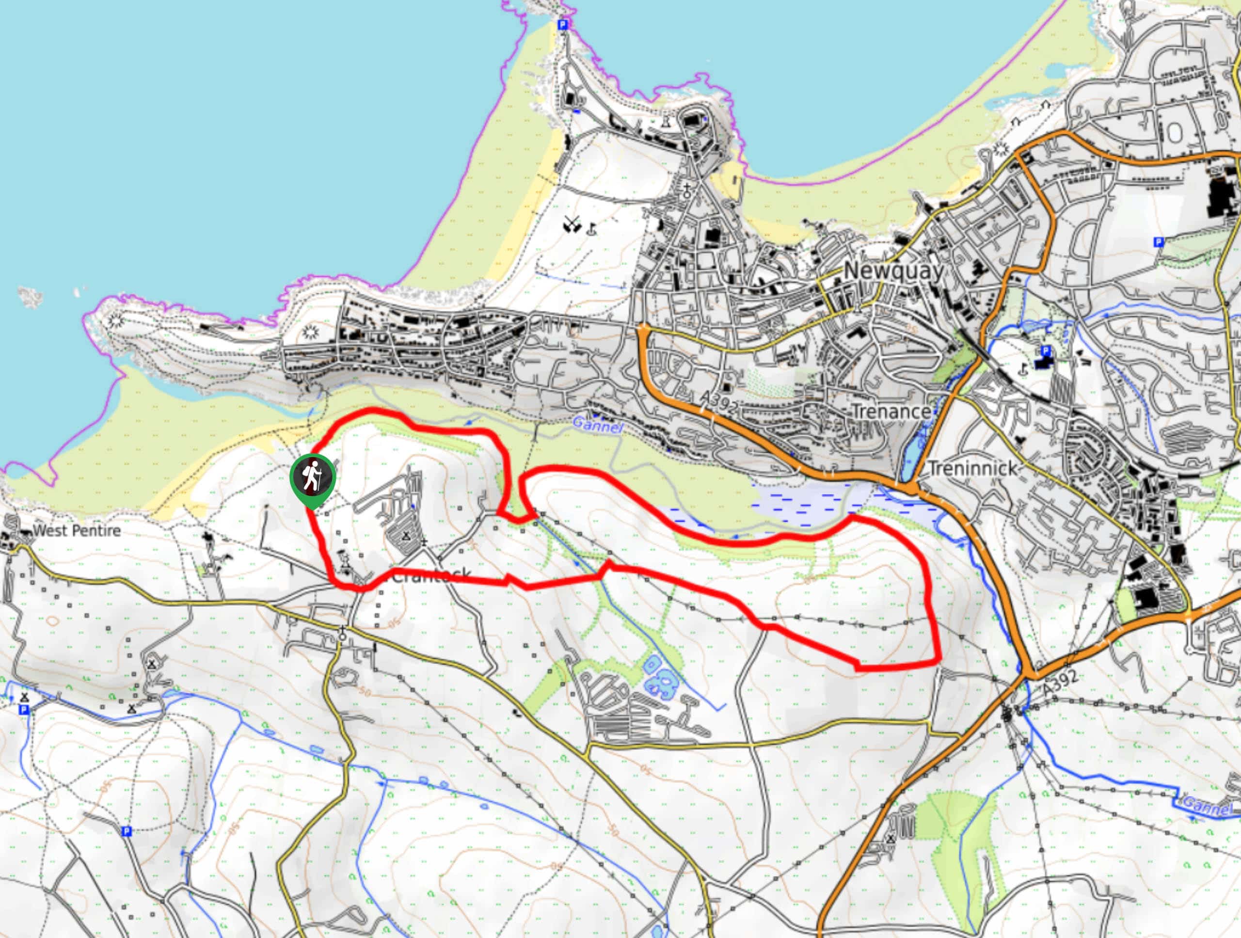
Crantock and The Gannel Circular Walk
The Crantock and The Gannel Circular Walk is a beautifully scenic adventure near Newquay, Cornwall that will lead you through…
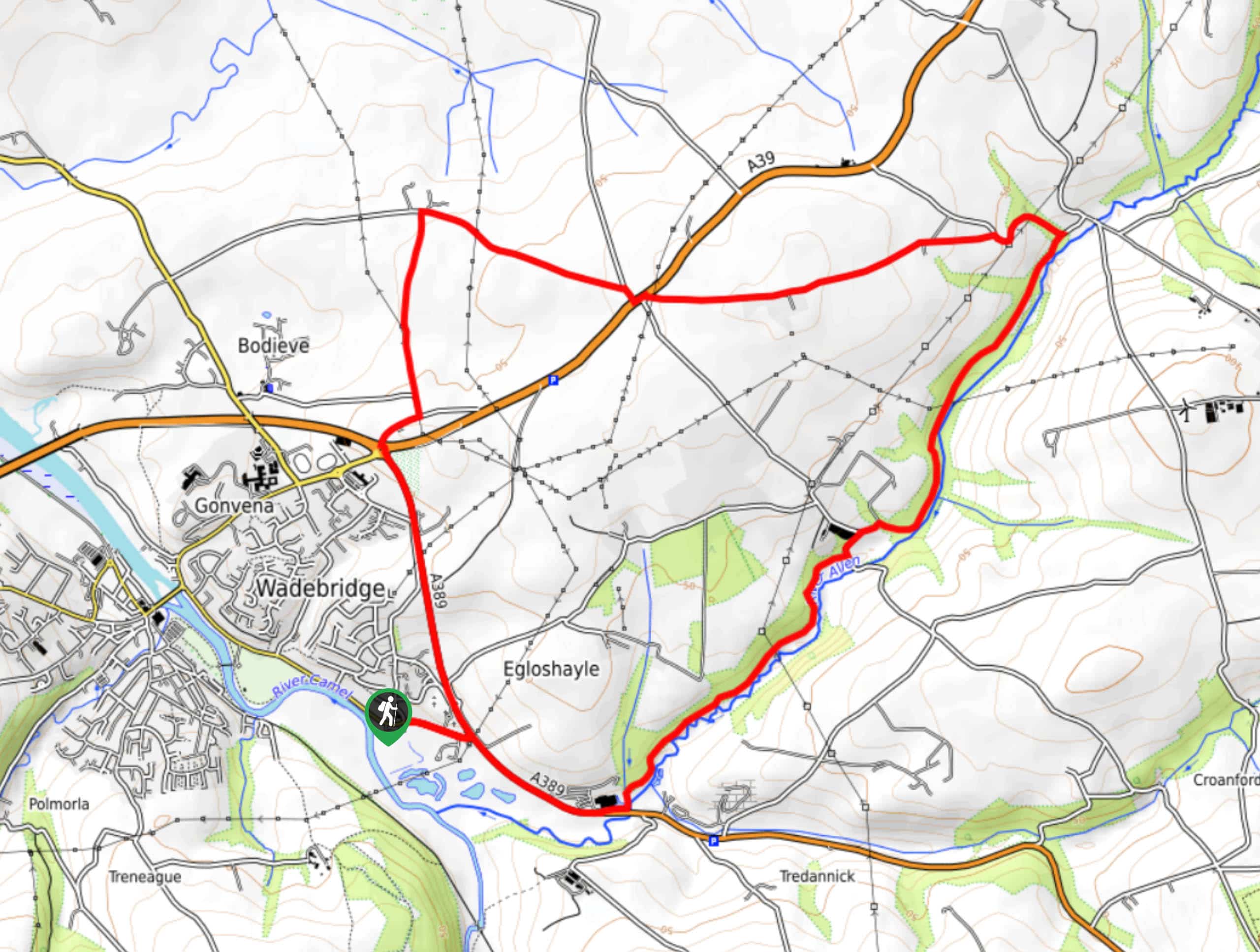
Egloshayle Circular Walk
The Egloshayle Circular Walk is a great outdoor excursion set in the Cornish countryside that will expose you to a…
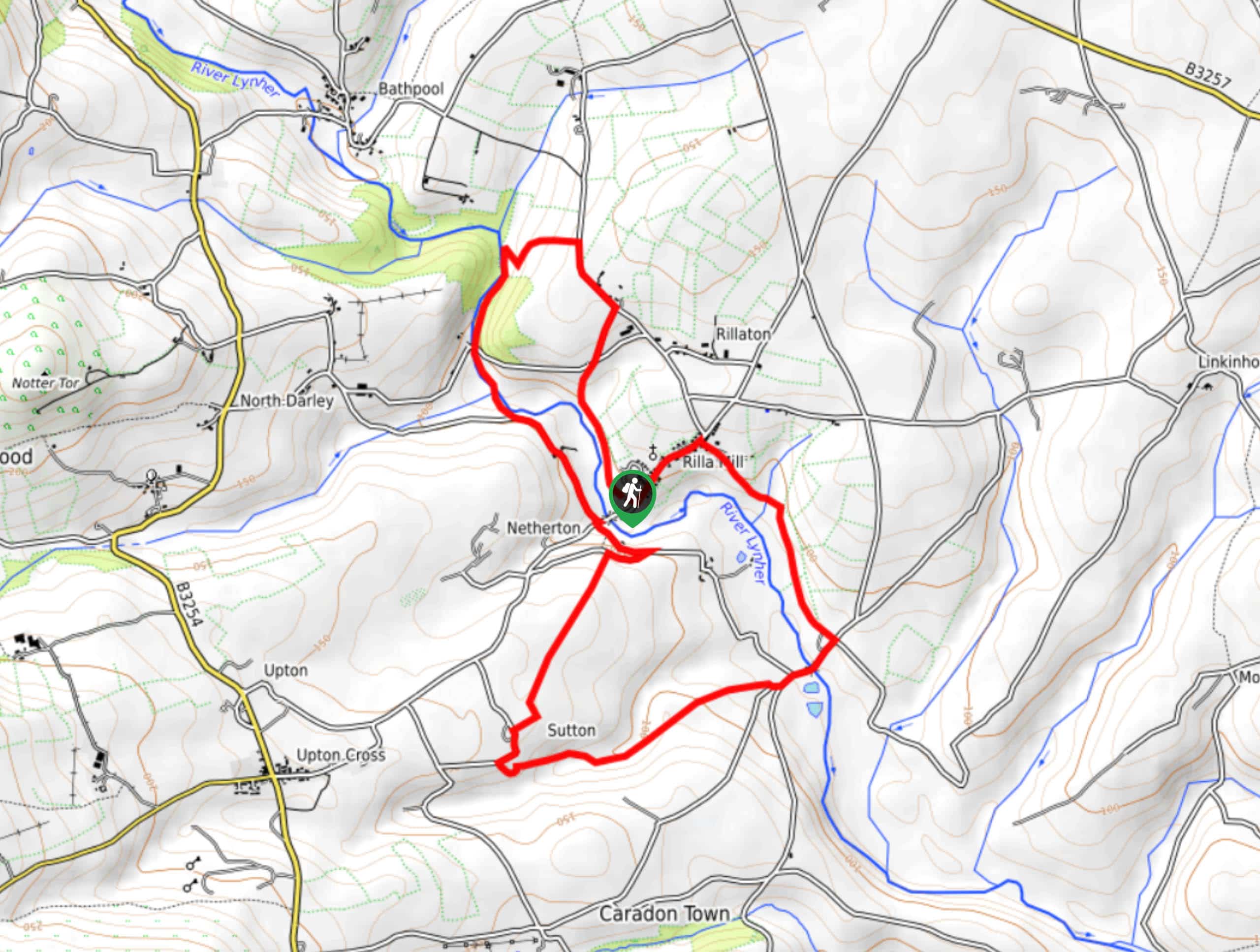
Rilla Mill Walk
The Rilla Mill Walk is a scenic journey through the Cornish countryside that passes through charming villages and features a…
Comments