
Crantock and The Gannel Circular Walk
View Photos
Crantock and The Gannel Circular Walk
Difficulty Rating:
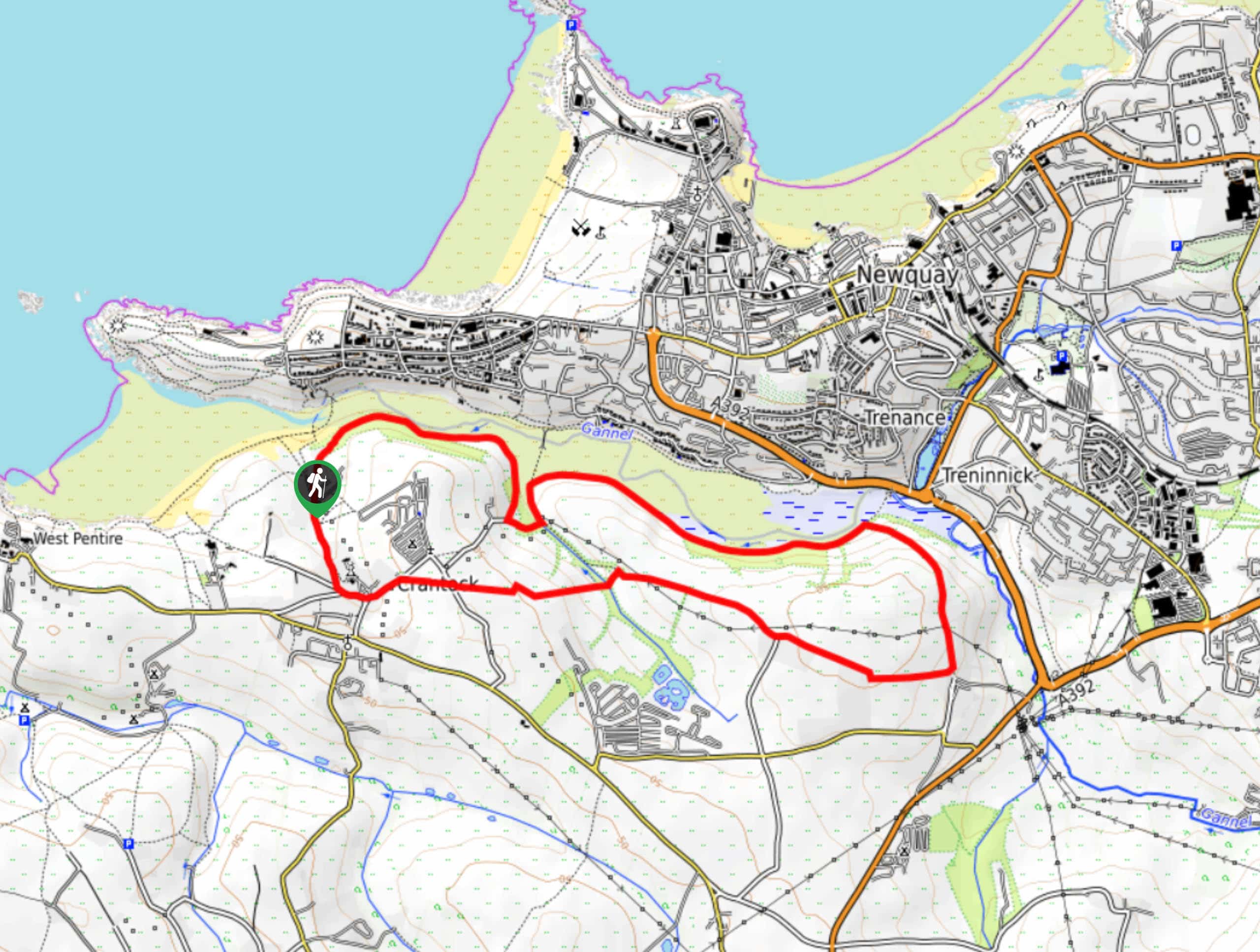
The Crantock and The Gannel Circular Walk is a beautifully scenic adventure near Newquay, Cornwall that will lead you through a charming riverside setting with views of the sea. While out walking the trail, you will make your way along the edge of Crantock Beach for views of the Cornish Sea, before traversing the banks of the River Gannel and peaceful farmlands. This is a wonderful walk that is perfectly suited for the entire family.
Getting there
The trailhead for the Crantock and The Gannel Circular Walk can be found at the Crantock Beach Car Park off Beach Road.

About
| Backcountry Campground | Quarryfield Campsite |
| When to do | Year-Round |
| Pets allowed | Yes - On Leash |
| Family friendly | Yes |
| Route Signage | Average |
| Crowd Levels | Moderate |
| Route Type | Circuit |
Crantock and The Gannel Circular Walk
Elevation Graph
Weather
Crantock and The Gannel Circular Walk Description
Whether the goal of your adventure is to explore the trails along the River Gannel or to head down to Crantock Beach to enjoy some fun in the sun, the Crantock and The Gannel Circular Walk is an excellent route in Cornwall that will be sure to produce plenty of great views and memories.
Setting out from the car park, you will head to the north along the edge of Crantock Beach, where you will be able to catch some pleasant views looking out onto the Cornish Sea. After picking up the footpath, follow it southeast along the water’s edge, as you look out across the River Gannel towards Newquay.
Once you have rounded Penpol Creek and reached the point where the river begins to narrow, you will follow the trail as it climbs uphill and loops around the fields in order to lead you back towards the west. Here, you will traverse the undulating coastal farmland, climbing gently back uphill as you make your way through the village of Crantock on the return to the car park. Before heading back to your vehicle, don’t forget to pop into the Beachcomber Cafe for some quick refreshments prior to making your way back home.
Similar hikes to the Crantock and The Gannel Circular Walk hike
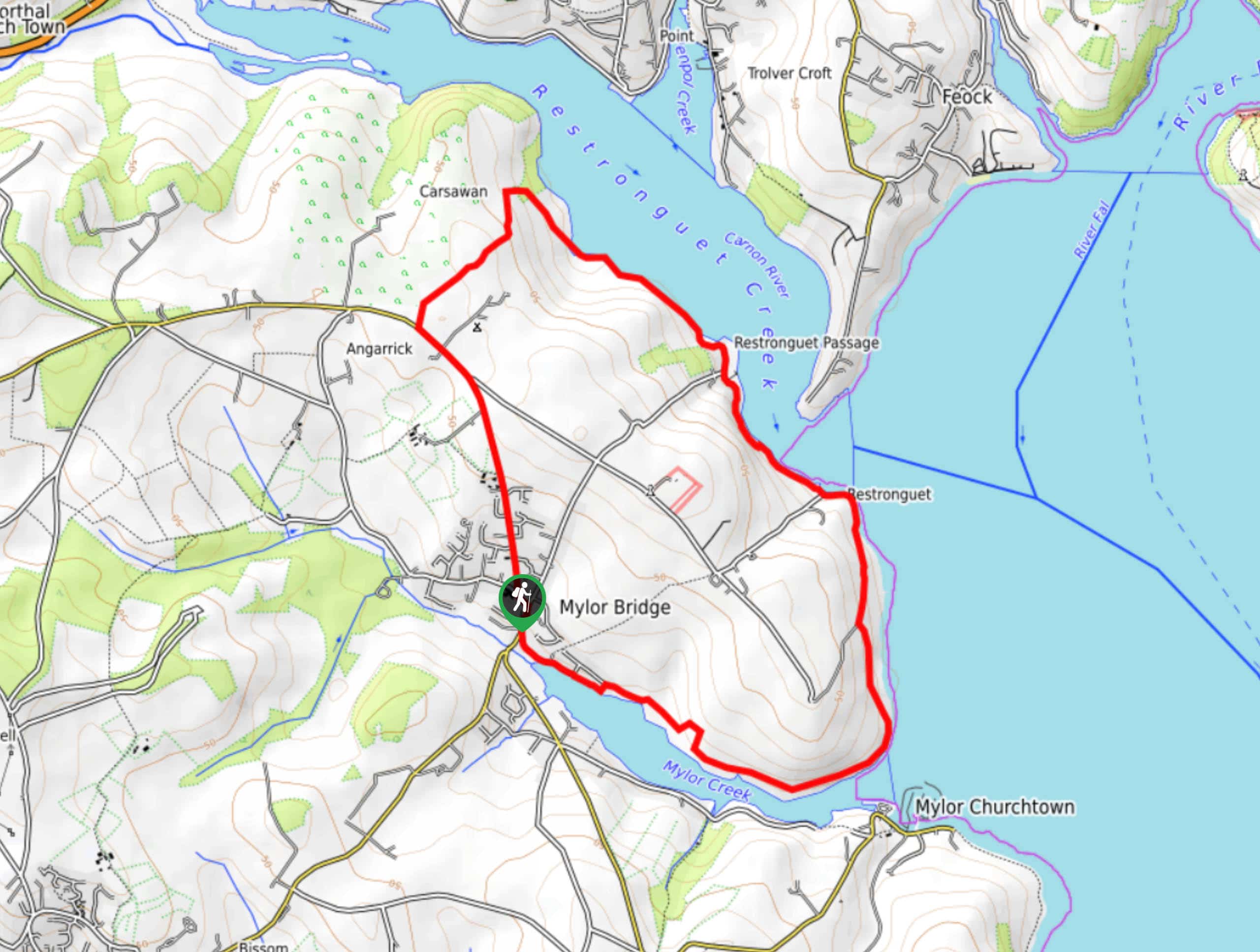
Restronguet Passage Circular Walk
The Restronguet Passage Circular Walk is a fantastic outdoor excursion in Cornwall that offers beautifully scenic views overlooking a number…
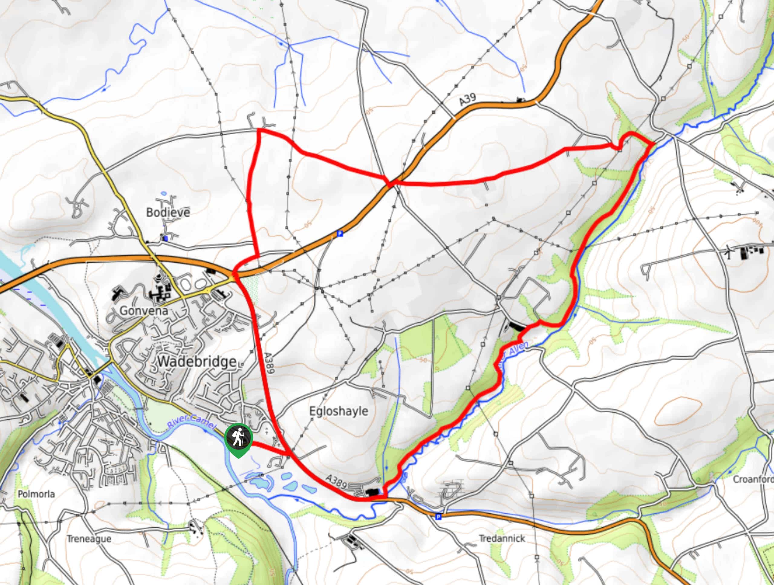
Egloshayle Circular Walk
The Egloshayle Circular Walk is a great outdoor excursion set in the Cornish countryside that will expose you to a…
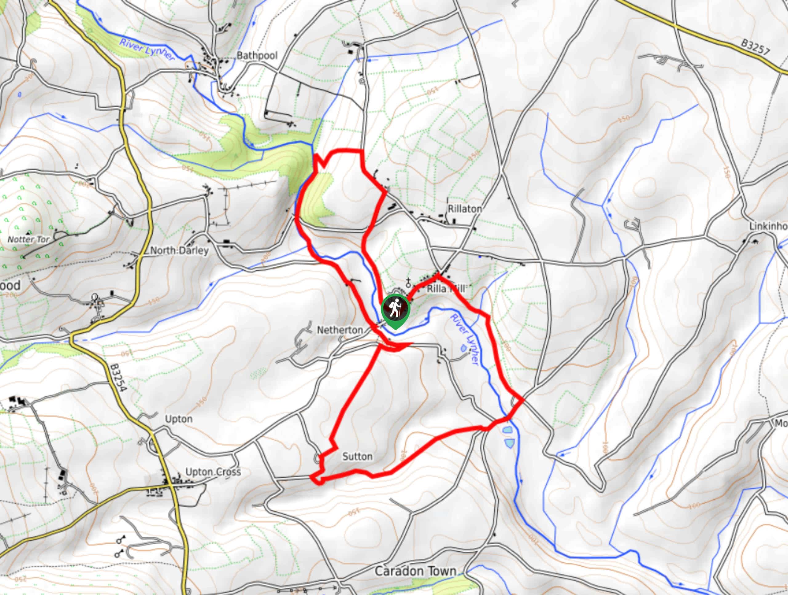
Rilla Mill Walk
The Rilla Mill Walk is a scenic journey through the Cornish countryside that passes through charming villages and features a…
Comments