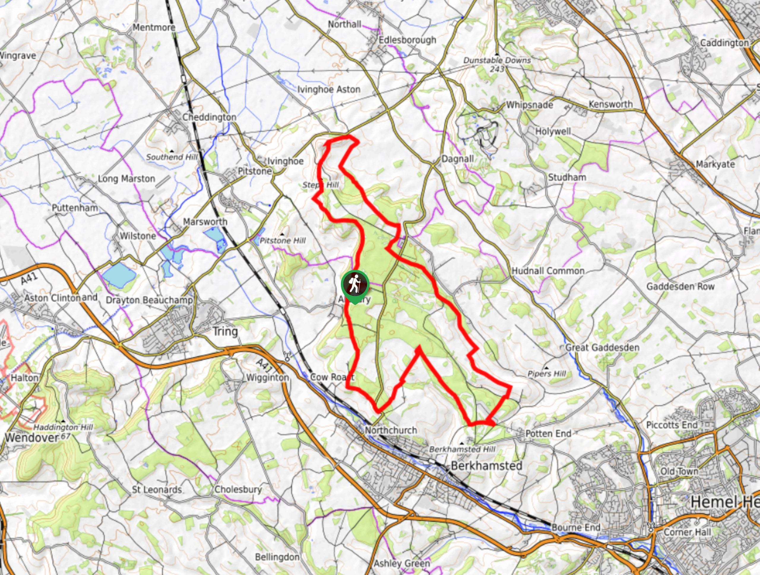


Ashridge Boundary Run Trail
View PhotosAshridge Boundary Run Trail
Difficulty Rating:
The Ashridge Boundary Run Trail may be long at 16.7mi, but the varied views rolling by will keep you entertained as you traverse woodland, open fields, and countryside undulations. Pack some food along and enjoy a picnic at one of the many viewpoints dotting this lovely walk in the Chiltern Hills.
Getting there
To get to the start of the Ashridge Boundary Run Trail, follow the B4506 from Berkhamsted before turning left towards the Ashridge NT Car Park or the Brownlow Cafe, situated at the end of the street.
About
| When to do | Year round |
| Backcountry Campsites | No |
| Pets allowed | Yes - On Leash |
| Family friendly | Older Children only |
| Route Signage | Average |
| Crowd Levels | Moderate |
| Route Type | Circuit |
Ashridge Boundary Run Trail
Elevation Graph
Weather
Ashridge Boundary Run Trail Description
The Ashridge Boundary Run Trail follows a lovely 16.7mi loop that has you traversing and undulating along lush countryside scenery, through woodland and open fields. You’ll find plenty of viewpoints sprinkled across this hike, making any spot a great place to stop and enjoy a picnic lunch! At points, the route can be hard to follow, so get your GPS ready before heading out.
Other amazing walks in Chiltern Hills
Check out our guides to Wendover Loop, Wendover Woods, Dunstable Downs, Hurley Loop or The Rose and Crown Ivinghoe Beacon Walk. Or see all of our Chiltern Hills walks on 10Adventures.
Similar hikes to the Ashridge Boundary Run Trail hike

Bledlow Great Wood and Radnage Walk
The Bledlow Great Wood and Radnage Walk may be a long walk, but the ever-changing scenery will keep you well…

Great Cookshall Wood Walk
Travel through a shaded, woodland setting on the Great Cookshall Wood Walk, a 5.6mi circular route that starts…
Ridgeway Path: Ivinghoe Beacon to Wendover
Take on a section of The Ridgeway, claimed to be Britain’s oldest road. Over the last 5,000 years, several footprints…


Comments