Peyto Glacier Hike
View Photos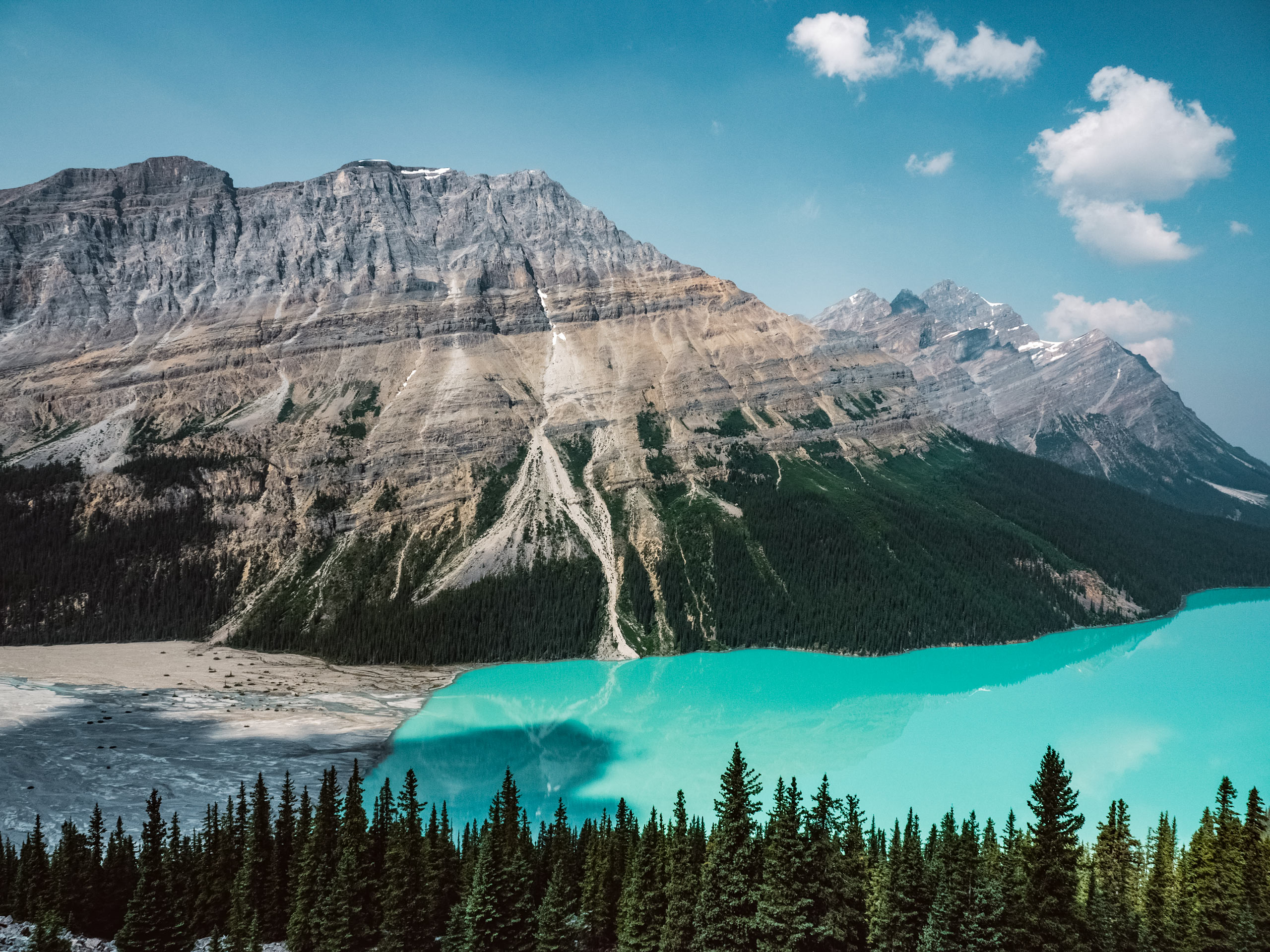
Peyto Glacier Hike
Difficulty Rating:
The Peyto Glacier Hike follows the trail to Cauldron Lake, which is an optional side trip from the glacier. Although it starts at one of the most populated viewpoints on the Icefields Parkway, it quickly leaves the crowds behind. You will cross glacial creeks, climb glacial moraine, and get up close and personal with the incredible Peyto Glacier as peaks loom above.
Getting there
To get to Peyto Glacier hike, you will travel north on the Icefields Parkway.From the Trans-Canada/Icefields Parkway junction, continue north for 26.1mi or 3.0mi north of Num-Ti-Jah Lodge. You will turn left to the Peyto Lake viewpoint parking lot at Bow Summit.

About
| When to do | June-September |
| Backcountry Campsites | No |
| Pets allowed | Yes - On Leash |
| Family friendly | No |
| Route Signage | Poor |
| Crowd Levels | Low |
| Route Type | Out and back |
Peyto Glacier Hike
Elevation Graph
Weather
Peyto Glacier Trail Description:
This is a strenuous trail on technical terrain that requires a large creek crossing over Peyto Creek. The floods of 2013 have washed away the bridge, so be cautious of water levels and prepare for a ford. This water can move swiftly and be high, especially during spring melt. Consider this when planning your trip.
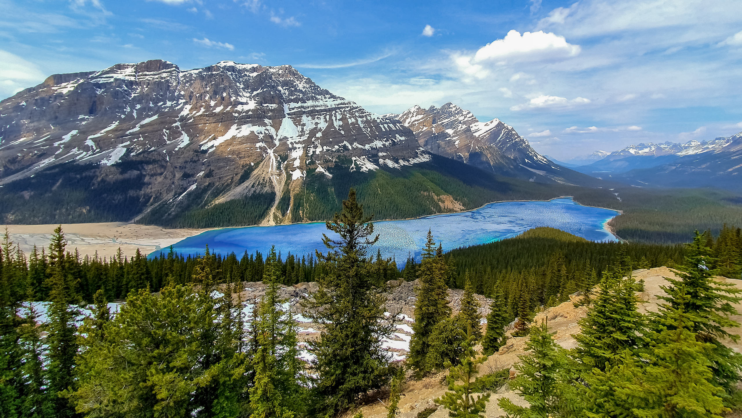
Peyto Glacier via Cauldron Lake trail requires some extra effort, but you will be glad you left the crowds at Peyto Lake Viewpoint. You are not likely to run into many other hikers on this route, and you will be met with a jaw-dropping view of the grand Peyto Glacier. This trail has options to continue on to Cauldron Lake, which is a high alpine lake of turquoise colour. For those looking for a bit more adventure, this is a must-do.
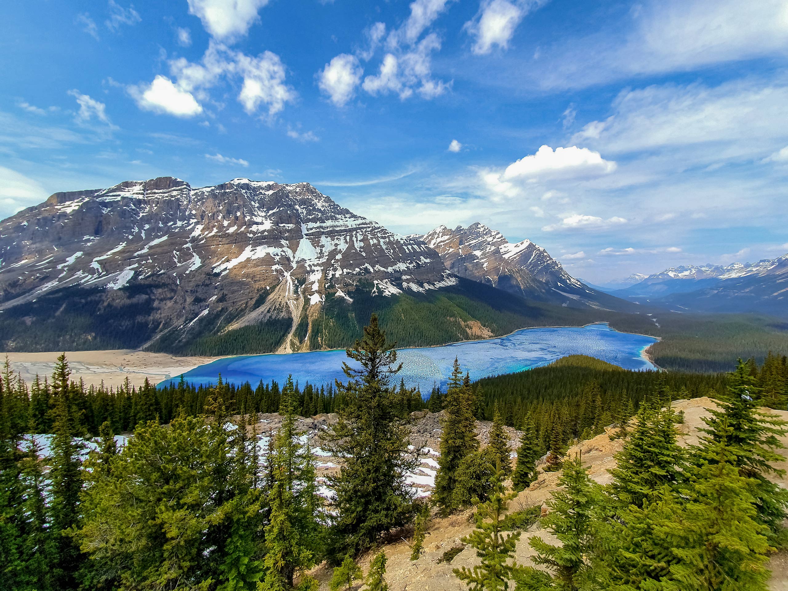
Beginning at the parking lot, head towards the Peyto Lake Viewpoint, where you are likely to be amidst large crowds. This is a major stopping point for those travelling the Icefields Parkway. You will continue beyond the viewpoint and descend roughly 902ft towards Peyto Lake. This may seem easy now, but don’t forget that you will need to ascend this hill on your return at the end of the day.
Follow the trail to the left that leads to the gravel flats at the back of the lake. You will see Peyto Creek feeding into the lake here. You will follow the path diagonally, aiming for the narrows and the beginning of the glacial moraine. You may choose a place to cross the creek, wherever seems safest. Be sure to explore your options here as the water changes constantly and a cairn from last week might not be relevant this week.
When crossing, be sure to take your time choosing a safe place to do so. Bring poles to help stabilize you, and be prepared for glacial waters that can be extremely cold. After crossing, continue right to the moraine and follow the path that climbs on the right, following the moraine up a ridge.
You will be able to see the incredible waterfalls that are created from the outflow of Cauldron Lake above. As you gain the lateral moraine on a good trail, remember to look back for incredible views of Peyto Lake and the creek feeding into it on the flats you crossed. A whole new perspective is gained from this vantage point.
At the top of the moraine, you will come to a fork. The trail to the left will take you to the Peyto Glacier. The trail to the right takes hikers on to access Cauldron Lake and Cauldron Peak scramble. Take the trail off to the left and continue hiking until you reach the toe of the Peyto Glacier. You will see the Peyto Hut operated by the Alpine Club of Canada. This hut is commonly used for mountaineers and skiers on the Wapta Traverse in the winter. There is also a weather station here that is used by glaciologists to collect data.
Enjoy the incredible expanse of the Peyto Glacier and views of surrounding peaks. You will be able to spot Peyto Peak, Mistaya Peak and Cauldron Peak easily from here. The return is the same as your approach. You will want to make sure you assess the creek before crossing on your way back because water levels can change throughout the day.
Hiking Route Highlights
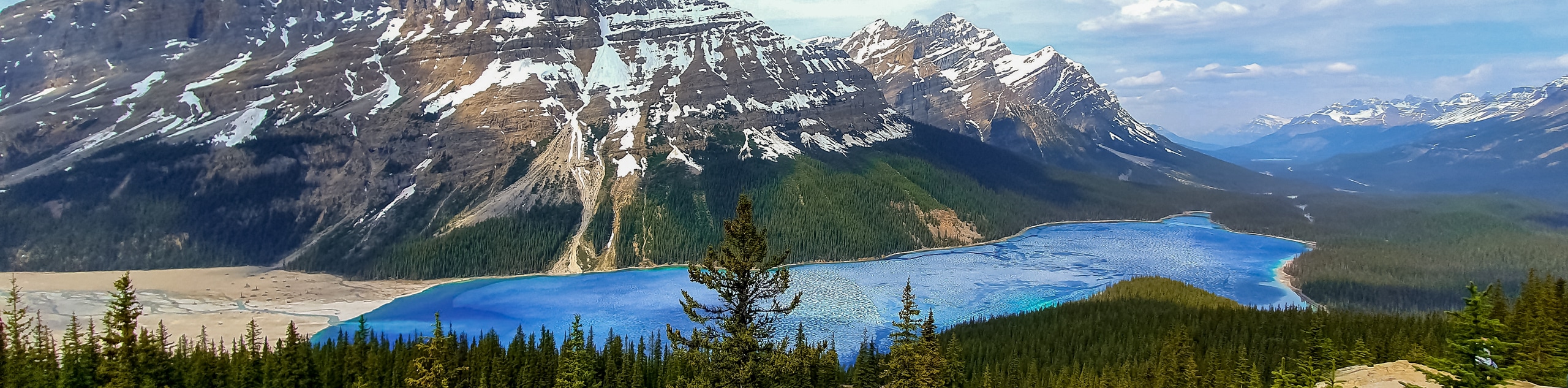
Peyto Lake
Peyto Lake is a glacier-fed lake in Banff National Park. Its incredible turquoise colour comes from the glacial rock silt that has settled in the bottom of the lake. After seeing the glacial and creek that feeds the lake, you’ll want to spend some time taking it in from the viewpoint.
The lake sits at an elevation of 1860m, and has been a popular sightseeing location since the Icefields Parkway opened in 1941. Some say that with the correct amount of imagination, the lake resembles a fox looking out to the right side. See if you can spot the silhouette from the viewpoint!
Icefields Parkway
The Icefields Parkway is one of Canada’s renowned scenic drives that connects both Banff and Jasper National Parks. It is an incredible stretch of road with endless opportunities to explore. There are hikes, lookouts, tours, and information centres along the route. Choose to drive the whole stretch in a day, or break it into sections while camping at some of the Parks Canada operated campgrounds.
Insider Hints
Consider the water levels of the creek before choosing this trail
Know the route and bring a map
Be prepared for technical terrain
Take in the views at Peyto Lake viewpoint
Similar hikes to the Peyto Glacier Hike hike
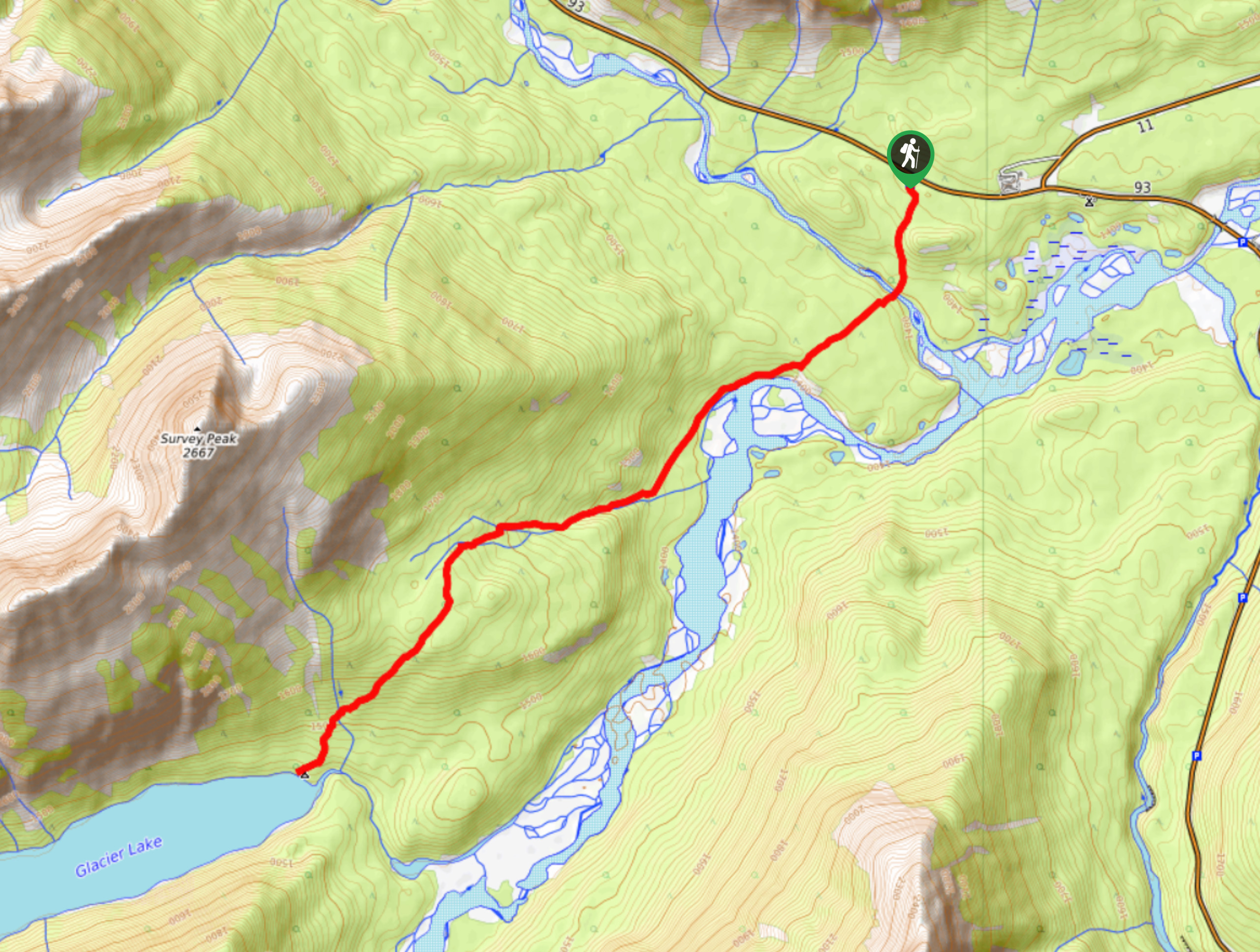
Glacier Lake
The relatively flat Glacier Lake trail is commonly used by backpackers; however, it makes for an excellent day hike. Whether…
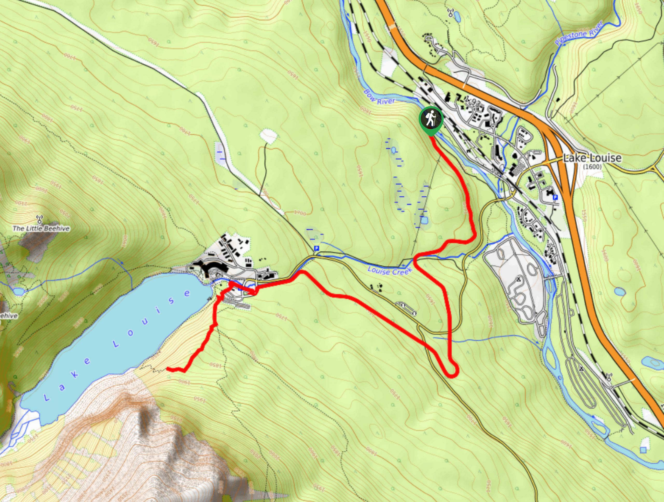
Tramline Trail
Taking the Tramline trail to the central Lake Louise area is an amazing way to explore the trail system without…
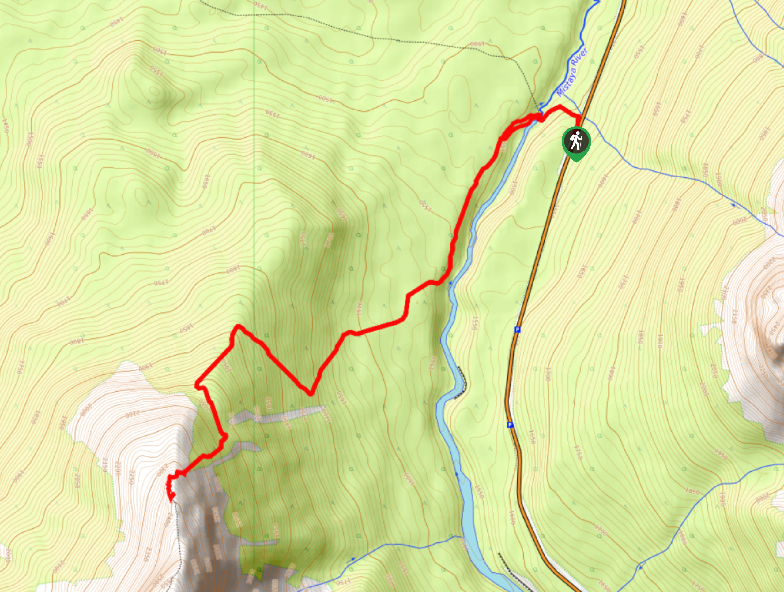
Sarbach Lookout
Hiking to Sarbach Lookout is a great way to cleanse your palate after walking through the crowds at Mistaya Canyon.…
Comments