

Centennial Ridges Trail
View PhotosCentennial Ridges Trail
Difficulty Rating:
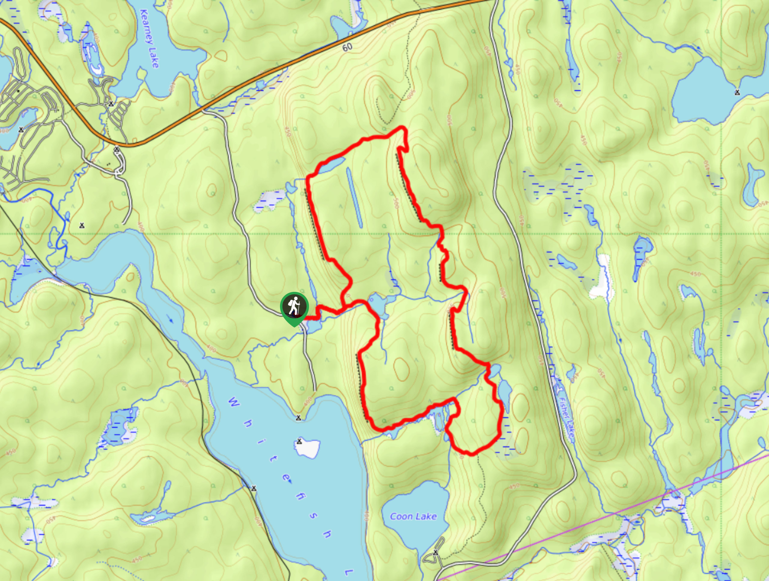
The Centennial Ridges Trail is a 6.1mi lollipop hiking route in Algonquin Park that will take you uphill along the rugged terrain of the Canadian Shield. While out on the trail, you will pass through beautiful stretches of woodland terrain to reach an elevated position atop the ridge where you will enjoy breathtaking panoramic views overlooking the forests and lakes of Algonquin. Although parts of this hike can be tough, it is more than manageable for casual and beginner hikers looking for a bit of a challenge.
Getting there
To reach the parking area for the Centennial Ridges Trail from the Algonquin Provincial Park West Gate, drive to the northeast on ON-60E for 23.9mi and turn right onto Centennial Ridges Road. COntinue on for 1.3mi, where you will find the parking lot on the left.
About
| When to do | March-October |
| Backcountry Campsites | No |
| Pets allowed | Yes - On Leash |
| Family friendly | Older Children only |
| Route Signage | Average |
| Crowd Levels | Moderate |
| Route Type | Lollipop |
Centennial Ridges Trail
Elevation Graph
Weather
Centennial Ridges Trail Description
Located near several campgrounds within Algonquin Provincial Park, the Centennial Ridges Trail is an easily accessible and fairly popular hiking route right off the highway that will see a high amount of foot traffic during the summer months. Be sure to arrive early enough during peak season to secure parking and enjoy some peace and quiet on the trails. In terms of terrain, this route will see you climb uphill along some rough and rocky trails, with sections that are frequently bogged down with mud. Make sure to wear proper hiking boots for this trek.
Although there are a few ups and downs along the Centennial Ridges Trail, the breathtaking views overlooking the surrounding landscape of Algonquin Park more than makes up for any minor hardships that you may face. The trail climbs uphill past several small lakes to reach an elevated position atop the ridge. From here, you will enjoy stunning views overlooking the tranquil forests surrounding you in every direction and the blue expanse of Whitefish Lake below to the southwest. For the relative ease of accessibility, this is a fantastic option for a day hike in Algonquin Park.
Setting out from the car park, follow the trail through the forest to the east for 0.3mi to pass by two small lakes and arrive at a junction in the trail. Take the path to the left and follow it uphill for 0.7mi to make your way along a small cliff, where you will come to a charming vantage point overlooking the forest.
From here, continue along the trail as it bends to the northeast and skirts along the edge of a small lake, taking you further uphill until you arrive at another viewpoint atop the ridge after 0.9mi. At this high point of the trail, you will enjoy stunning panoramic views that sweep across the rugged terrain of the Canadian Shield, allowing you to fully appreciate the natural beauty of the forests, lakes, and hills that characterize this region.
After pausing to enjoy the breathtaking views over Whitefish Lake, follow the trail to the southeast as it descends the summit of the ridge and traverses a stretch of undulating terrain. After 1.6mi of hiking from the viewpoint, you will cross over a stream and pass by Cloud Lake, making your way through a bit of a boggy area before the trail turns toward the west.
Keep right along the trail as it skirts the edge of several smaller lakes, taking you downhill towards the edge of another small cliff for some amazing views overlooking Whitefish Lake. Continue on for 0.6mi, making your way past Rutter Lake to arrive at the original fork in the trail. Make your way straight through and you will arrive back at the parking lot where you began your hike along the Centennial Ridges Trail.
Insider Hints
Bring plenty of bug spray to combat the mosquitoes along the trail.
Wear sturdy hiking boots with good ankle support, as the trail is fairly rough and rugged in places.
The road into the trailhead closes for the winter. If you would like to hike the trail during the winter season, you will need to travel an extra 1.2mi each way.
Paid parking is available at the trailhead.
White trail markers take you clockwise around the trail and blue markers are counterclockwise.
Similar hikes to the Centennial Ridges Trail hike

Whiskey Rapids Trail
Hiking the Whiskey Rapids Trail is a great family-friendly experience in Algonquin Provincial Park that will take you through a…

Beaver Pond Trail
The Beaver Pond Trail is a quick and easy adventure in Algonquin Provincial Park that will lead you around a…

Lookout Trail
Hiking the Lookout Trail is a great outdoor experience in Algonquin Provincial Park, thanks to its short overall distance and…


Comments