Tilly Jane Trail
View Photos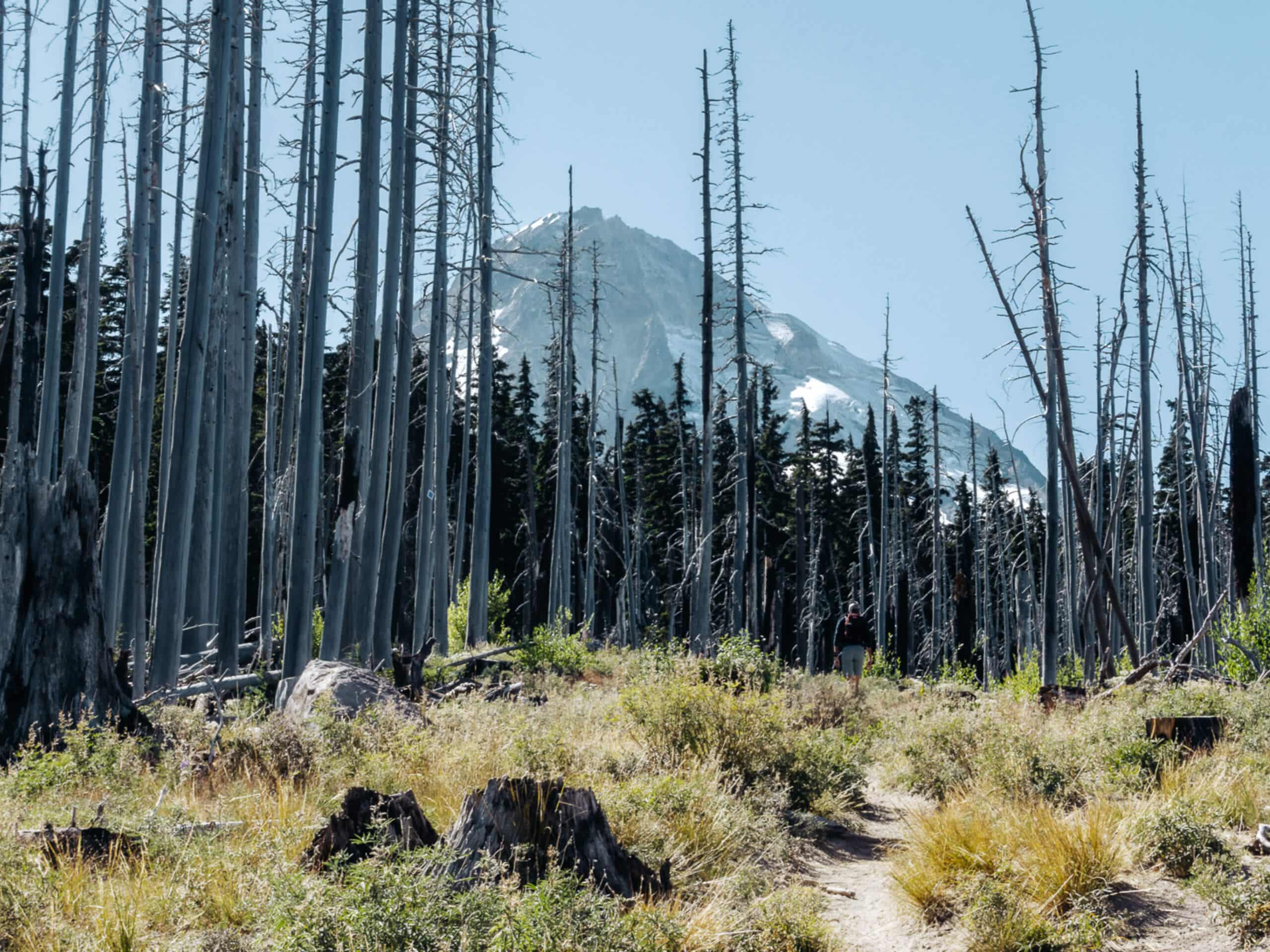
Tilly Jane Trail
Difficulty Rating:
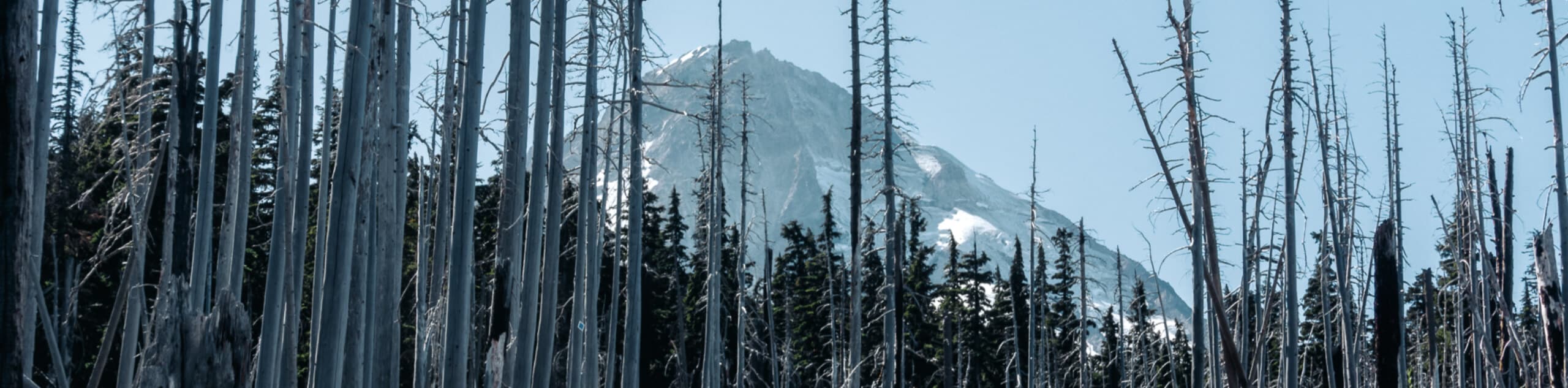
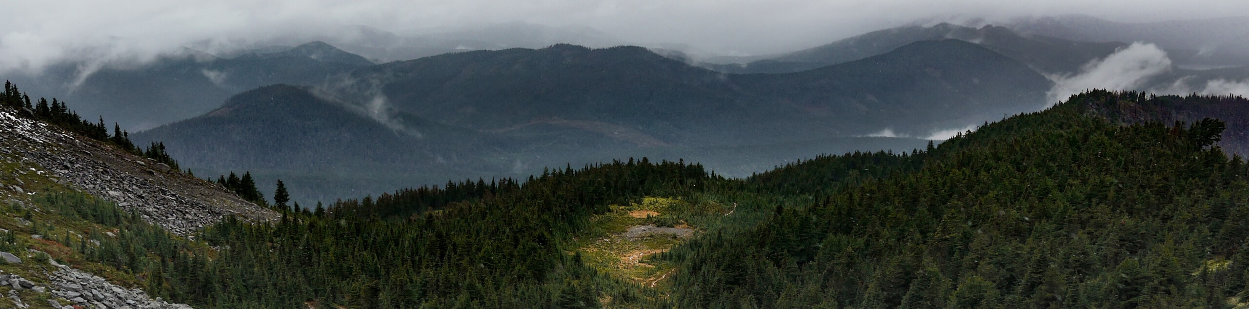
The Tilly Jane Trail is a challenging hiking route in Mount Hood National Forest that climbs uphill through woodlands and meadows, offering pleasant views of the surrounding landscape. While out on the trail, you will navigate a dense section of forest and some peaceful meadows, before climbing uphill through an area previously ravaged by wildfires in order to reach the Tilly Jane Campground. As a result of wildfires in the area, much of this trail is exposed; be sure to bring plenty of water and adequate protection from the sun.
Getting there
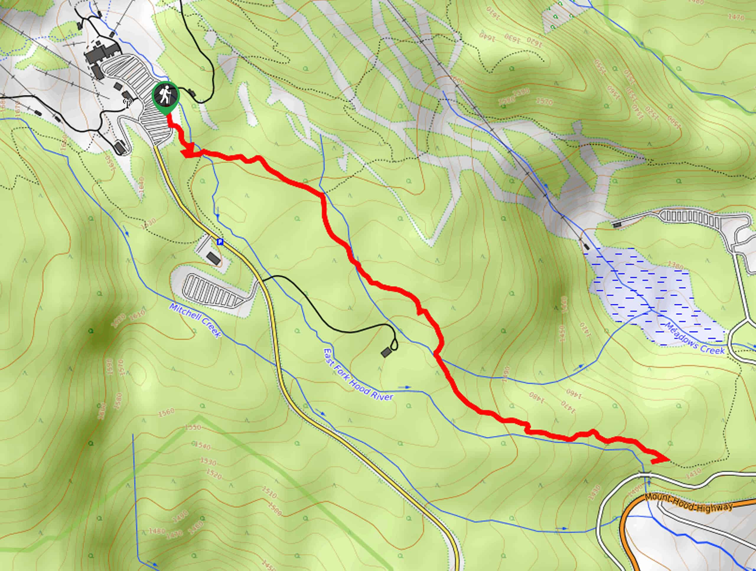
The trailhead for this hike can be found on Cloud Cap Road, right next to the Cooper Spur Family Ski Area.

About
| Backcountry Campground | Tilly Jane Campground |
| When to do | Year-Round |
| Pets allowed | Yes |
| Family friendly | No |
| Route Signage | Average |
| Crowd Levels | Moderate |
| Route Type | Out and back |
Tilly Jane Trail
Elevation Graph
Weather
Tilly Jane Trail Description
Situated in an area previously devastated by a wildfire, the Tilly Jane Trail is a spectacular hike in Mount Hood National Forest that will test your fitness and provide stunning views.
Setting out from the trailhead on Cloud Cap Road, you will make your way to the southwest, passing through a beautiful forest landscape alongside Doe Creek. After passing by the Cooper Spur Ski Area, the trail continues to climb uphill through the tree cover, eventually opening up into a meadow.
Continuing on to the southwest, you will navigate the old burned out section of the forest, taking in the amazing views of the surrounding landscape before arriving at the edge of Tilly Jane Creek. Here, you will cross over the creek to find the endpoint of the hike at the Tilly Jane Campground and Tilly Jane Guard Station. If you aren’t planning on camping overnight, simply retrace your steps back downhill to return to the trailhead where you started.
Similar hikes to the Tilly Jane Trail hike
Umbrella and Sahale Falls Hike
The Umbrella and Sahale Falls Hike is the perfect adventure in Mount Hood National Park for those who enjoy scenic…
Bald Butte Trail
The Bald Butte Trail is a wonderful outdoor adventure that showcases some of the exceptional terrain and beautiful views within…
McNeil Point Trail
The McNeil Point Trail is a challenging excursion in Mount Hood National Forest that features steep terrain and breathtaking views…
Comments