Mount Scott Trail
View Photos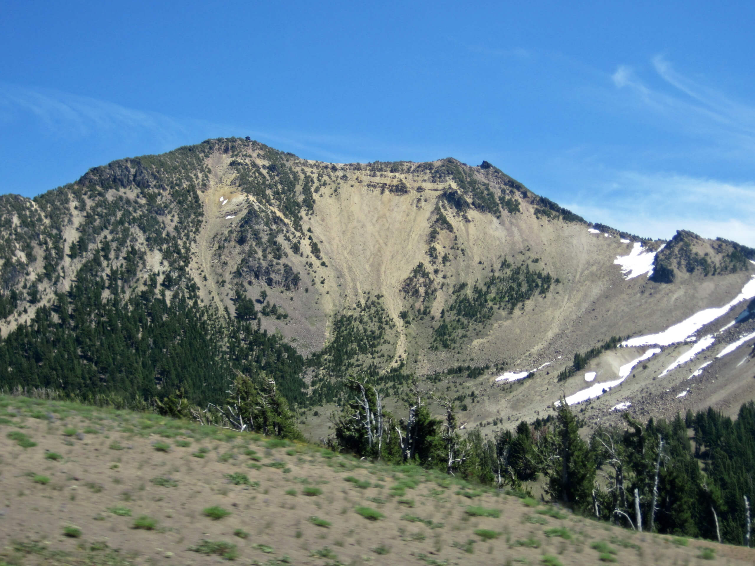
Mount Scott Trail
Difficulty Rating:
Mount Scott Trail is a wonderful moderately difficult hike in Crater Lake National Park that leads you to the top of the tallest mountain in the park. Rising above the east side of Crater Lake, Mount Scott is a great objective for impressive views, but it’s not too difficult to complete. While the park map says it’s hard, this route is moderately challenging at best with no technical or loose sections and the incline is consistent and manageable.
Active children should be able to complete this hike. We recommend planning your trip for the early morning–sunrise even, if you’re willing–for the best experience. Expect sweeping views of the park and the lake on clear days!
Getting there
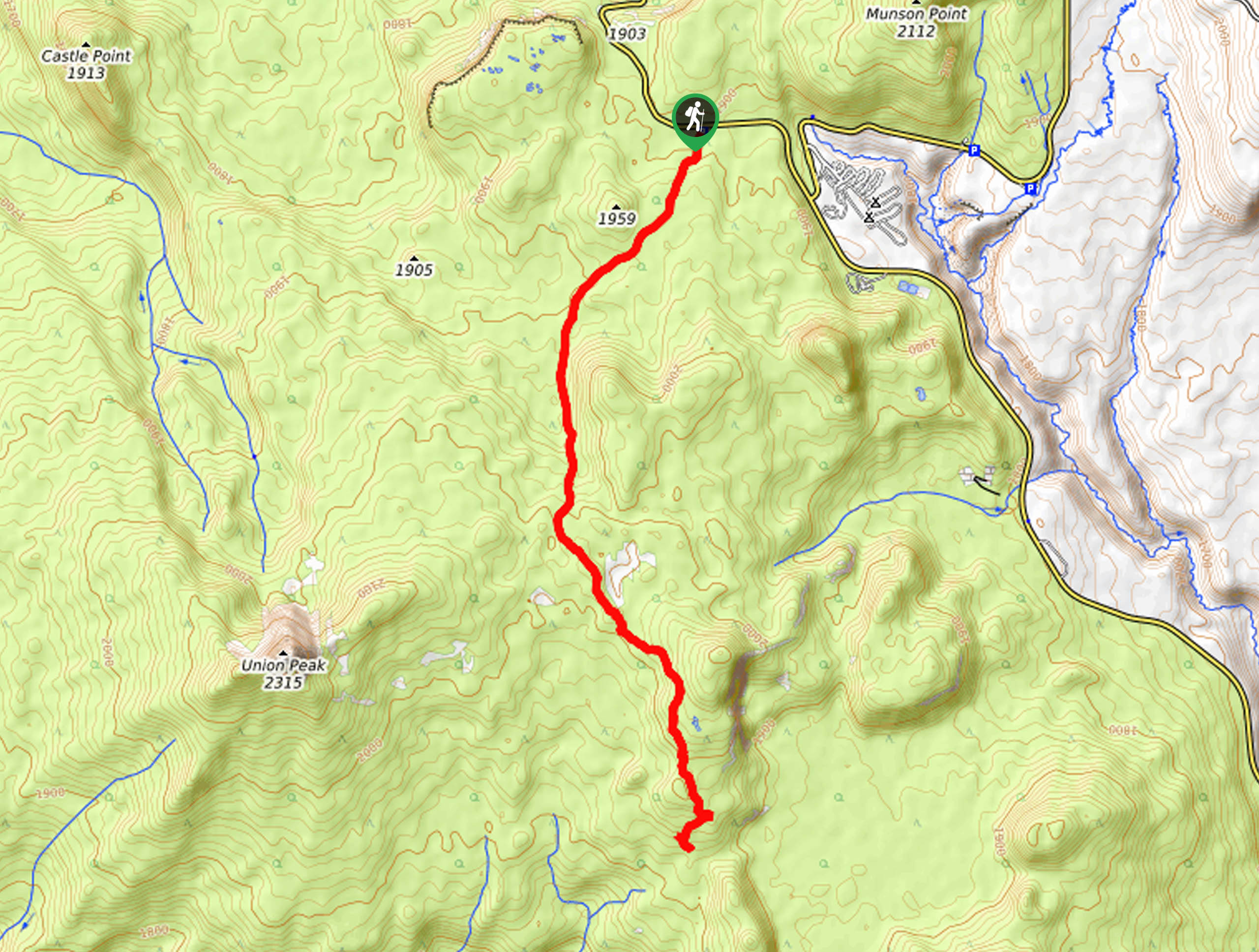
The trailhead for Mount Scott Trail is off E Rim Drive.

About
| Backcountry Campground | No |
| When to do | June to October |
| Pets allowed | No |
| Family friendly | Yes |
| Route Signage | Average |
| Crowd Levels | Moderate |
| Route Type | Out and back |
Mount Scott Trail
Elevation Graph
Weather
Mount Scott Trail Description
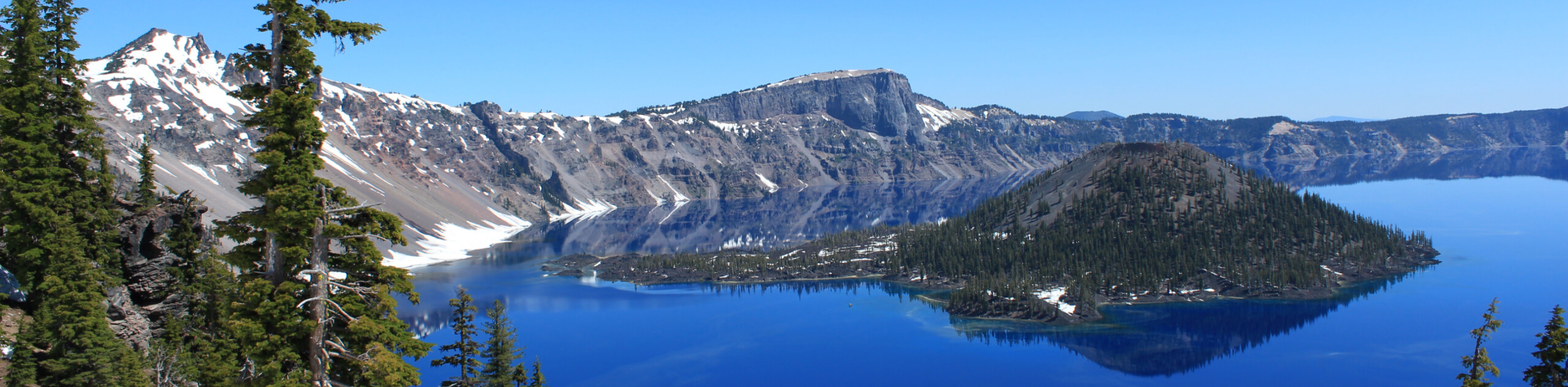
Mount Scott Trail is the tallest mountain in Crater Lake National Park, so it should go without saying that you can enjoy some fairly exceptional views from the top. Situated on the east side of Crater Lake, you can see 360 degrees of the lake and the Southern Cascades surrounding you.
Crater Lake came to be over 7,700 years ago when Mount Mazama exploded and collapsed. The lake is now the deepest in the United States at a whopping 1943ft and one of the clearest in the world. Surrounded by the Southern Cascades, it’s regarded as one of the most scenic lakes in the country.
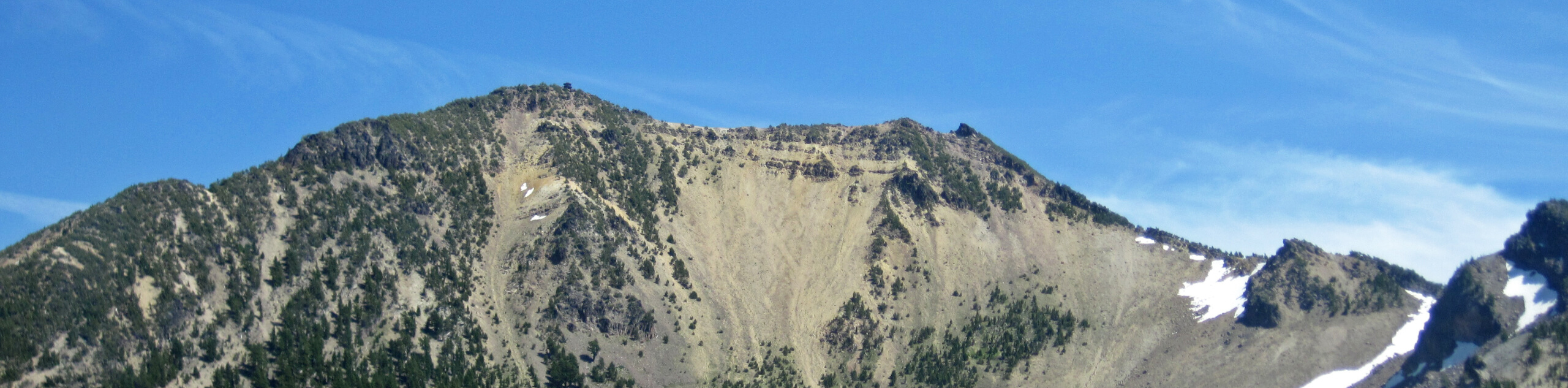
Mount Scott is a dominating 8648ft mountain, the highest point in the park. While that might sound intimidating, the trail to the top is only moderately difficult and presents no technical challenges, so it’s suitable for anyone willing to hike the moderate distance and incline.
Most skill levels and ages should be able to find their way to the top, but remember that dogs are not allowed in the park. You may wish to have poles, especially if you’re hiking in the shoulder season when slush can cling to the route. Try to plan your hike early in the day for the best, clearest view if possible. If you can time your hike for a bluebird day, you’ll be treated to sweeping panoramic views!
This route is well-maintained but will stay snowy from mid-September through July or so. Midsummer visits are ideal.
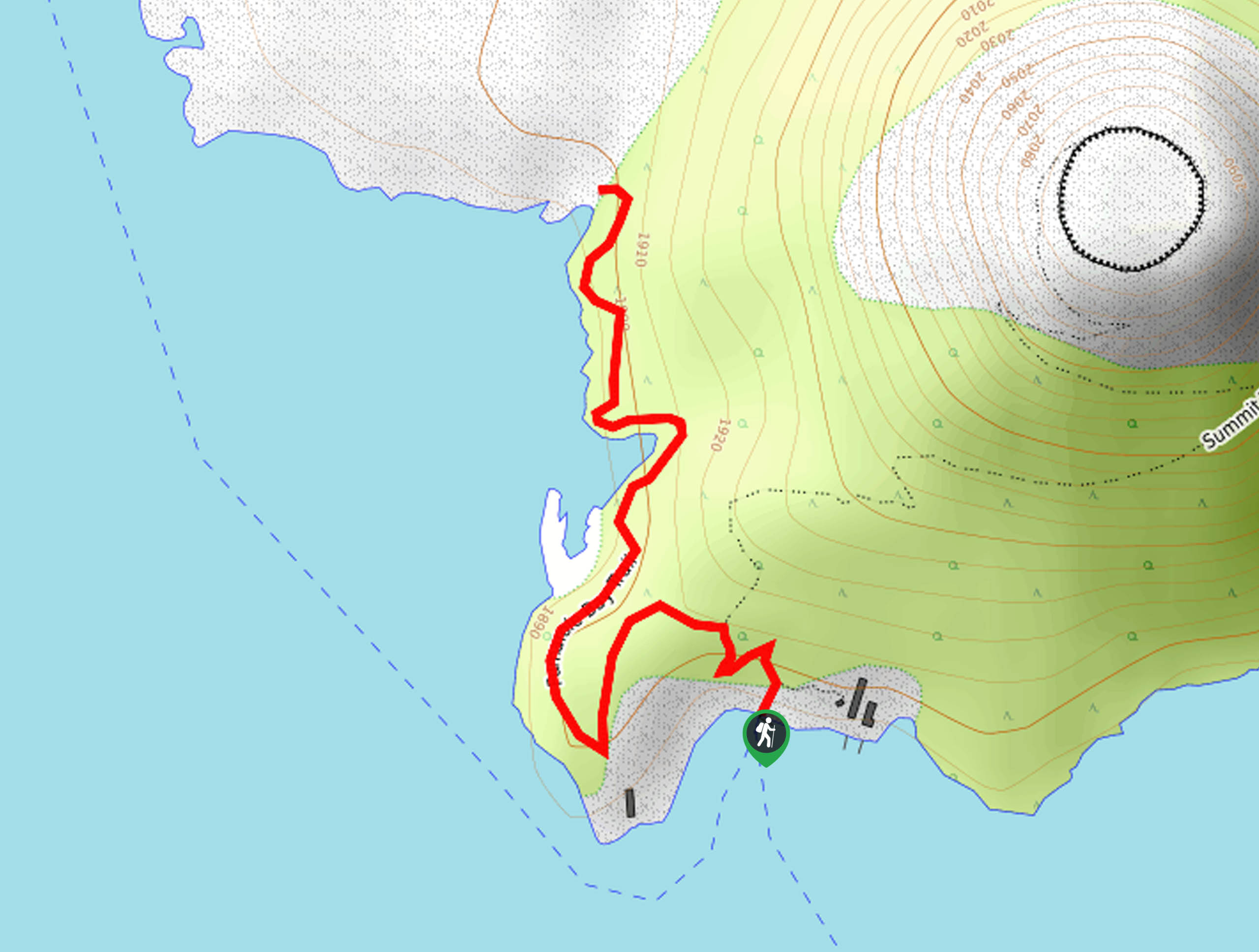
The trailhead is on E Rim Drive near the turnoff for Cloudcap Overlook. Look for the small parking lot on the southeast side of the road. This lot doesn’t have room for many vehicles, so arriving early is recommended.
You’ll begin on a flat stretch of trail through a meadow that leads to the base of Mount Scott’s southern flanks. Begin a gradual climb through the forest. You’ll take on a slightly steeper climb to a ridgeline, where the trail turns northwest.
Continue to climb through switchbacks as the trail weaves between two ridges. Where the switchbacks end, the route evens out and climbs a ridge towards the fire lookout tower at the summit. Head towards this tower.
From the top, marvel at the all-encompassing view. This is supposedly the only point in the park where you can capture the entire lake with a camera lens, so snap some photos before you leave.
To descend, you’ll simply follow the same route back down to the trailhead.
Hiking Route Highlights
Crater Lake
Crater Lake National Park was designated to preserve Crater Lake, a body of water formed by the crater left over from the eruption and collapse of Mount Mazama over 7,700 years ago. Crater Lake is the deepest lake in the country at 1949ft deep, and it’s known for its clarity and impressively deep blue color, earned because there are no inflowing streams. Crater Lake is flanked by the Southern Cascades, lending to its dramatic beauty. A network of hiking trails carve through the mountains around the lake. There’s also a summer ferry that runs visitors to Wizard Island on the west side of the lake, giving hikers lots of ways to explore this area.
Frequently Asked Questions
Is Mount Scott Trail the best hike at Crater Lake?
It’s definitely one of them! This hike takes you to the best vantage point over the lake with the widest view.
How many trails are there at Crater Lake?
There are about 30 trails in the park.
Can you swim in Crater Lake?
Yes, you can swim in Crater Lake. Prepare for chilly water!
Insider Hints
The roads around the lake are subject to seasonal closure. For more information, check out the NPS website.
Bring a camera for this hike and try to plan for a cloudless day!
Similar hikes to the Mount Scott Trail hike
Raven Trail
Raven Trail travels from the Crater Lake Lodge on the edge of Crater Lake through the trees along a ridge.…
PCT to Pumice Flat Trail
PCT to Pumice Flat Trail is a route that connects–you guessed it–the Pacific Crest Trail with Pumice Flats Trail in…
Fumarole Bay Trail
Fumarole Bay Trail is a short hike along the southwestern coast of Wizard Island in Crater Lake. If you’ve ferried…
Comments