Fort Funston Coastal Trail
View Photos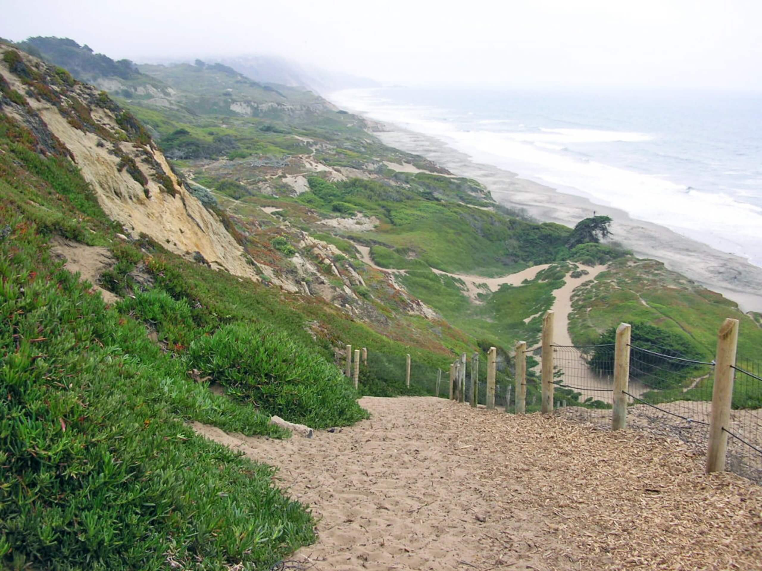
Fort Funston Coastal Trail
Difficulty Rating:
The Fort Funston Coastal Trail boasts an unrivaled experience, offering breathtaking ocean views and the opportunity to explore the remnants of the decommissioned naval defense base. Adventurers of all skill levels and ages can explore this wonderful seaside trail—including your pup!
Getting there
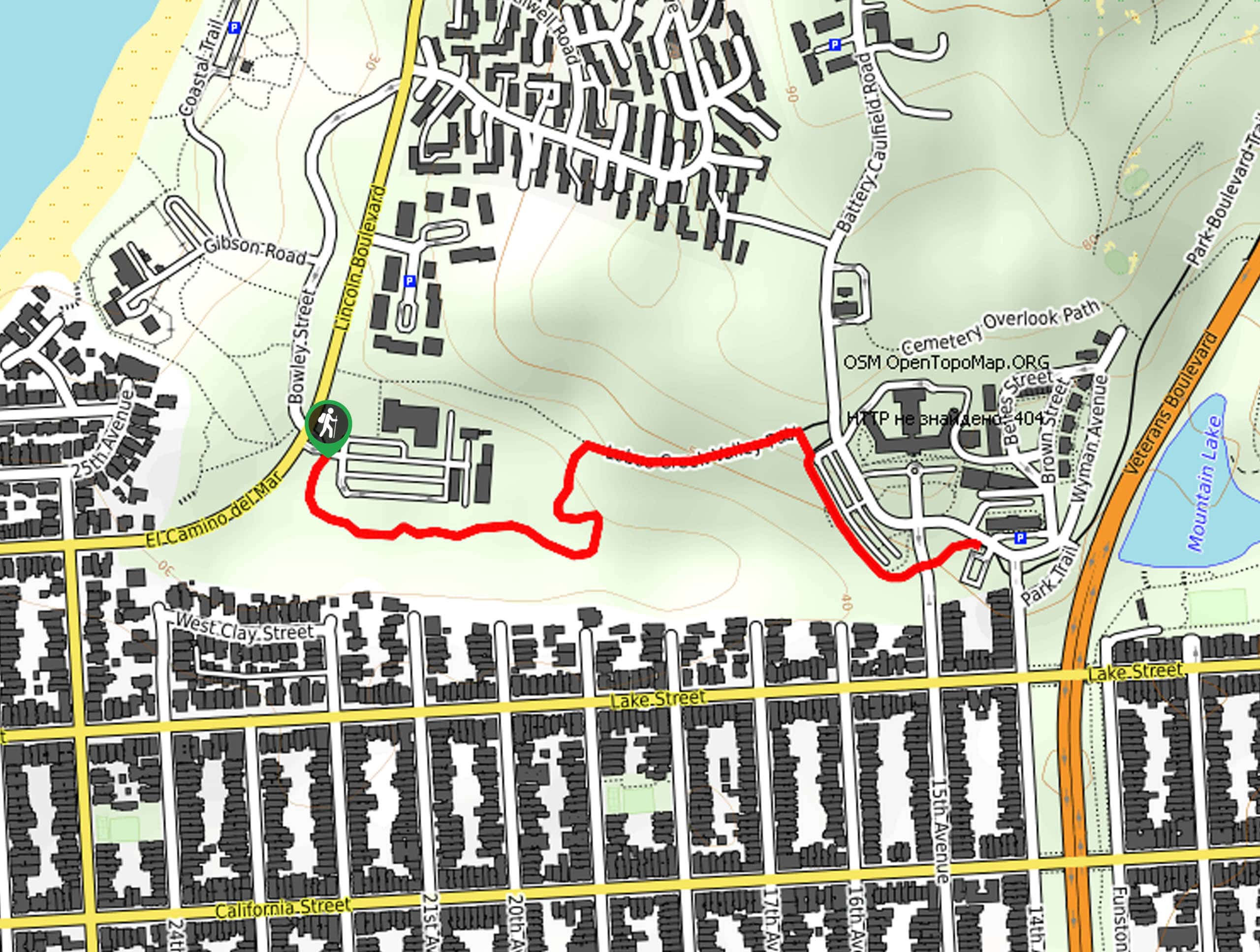
The Fort Funston Coastal Trail is accessed via the trailhead and parking lot of Skyline Boulevard.

About
| Backcountry Campground | No |
| When to do | Year-round |
| Pets allowed | Yes |
| Family friendly | Yes |
| Route Signage | Average |
| Crowd Levels | High |
| Route Type | Lollipop |
Fort Funston Coastal Trail
Elevation Graph
Weather
Fort Funston Coastal Trail Description
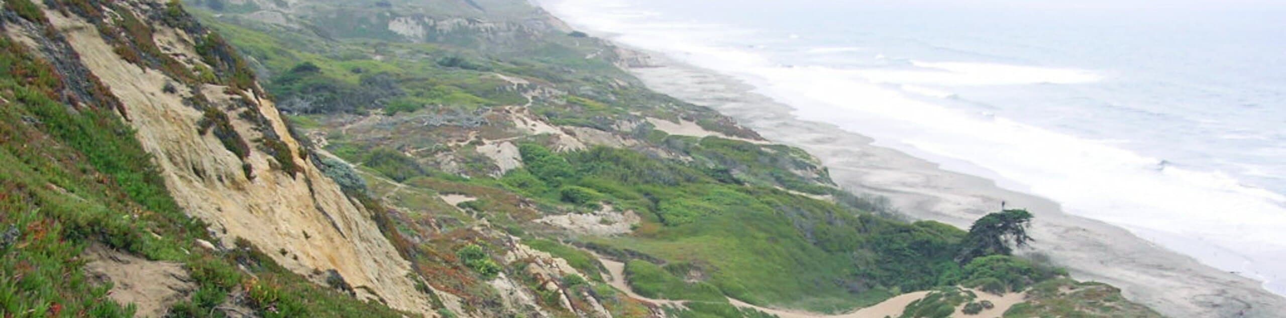
History buffs and eager sightseers alike will enjoy the Fort Funston Coastal Trail. The seaside stroll offers dumbfounding scenery that will not disappoint. Those visiting to indulge in the expansive vistas are encouraged to head out on a clear day to avoid fog-shrouded vistas! Due to its proximity to the coast, you can expect extremely windy conditions—which is probably why this is one of the state’s most popular hang-gliding destinations. Dress in layers as insurance against chilly conditions! Note that sections of the path are sandy, so those with joint issues may find trekking poles to be useful! Use the trail GPS to easily navigate the network of trails.
The Fort Funston Coastal Trail is a must-add to your Bay Area itinerary. Traveling atop the coastal headlands, this route offers postcard-perfect panoramas of the Pacific and the near 200ft shoreline cliffs that bound the surging surf. Hike amongst dozens of fellow adventurers eager to explore the historical base, including the Battery Davis. On a clear, windy day, you will likely notice intrepid spirits hang gliding into the horizon and hopeful anglers fishing along the pristine beach. We love this trek, and we can guarantee you will too; enjoy!
Your adventure along the Fort Funston Coastal Trail begins from the trailhead and parking lot off Skyline Boulevard. Setting out from here, follow the trail northwest, gradually climbing through the grasslands. Soon after your departure, you will confront an intersection—veer left here, hiking up to the Sunset Trail. Hiking south, you will wander along the forested route before opening to the grassy headlands. Enjoy the wonderful scenery as you hike to the observation deck. Marvel in the bravery of the hang gliders diving into the abyss and the beauty of the sandy beach below.
After reveling in the scenery, retrace your footing along the Sunset Trail, leaving at the following juncture and tracing the shoreline cliffs. Respect the railing and warnings—maintaining the marked path. On a clear day, you will likely be granted distant views of the Farallon Islands in the west. Soon the route will direct you east, through the Battery Davis Ruins and tunnel. Continue north along the Sunset Trail down into the sand dunes. If time permits, explore Funston Beach. If not, retrace your steps south, and keep left at the following intersections, tracking southeastward back to the trailhead and vehicle.
Trail Highlights
Fort Funston
Fort Funston is a decommissioned harbor defense installation in San Francisco. Previously known as the Lake Merced Military Reservation, the fort sits atop headlands along the Pacific coast and Ocean Beach below. After years of harbor defense, the site was ultimately retired in 1963 and now serves as a popular sightseeing destination and runway for intrepid hang-gliders. Additionally, adventurers can explore the remnants of heavy weaponry, Nike missiles, and Battery Davis’s 16inch guns.
Frequently Asked Questions
How much does it cost to visit Fort Funston?
The Fort Funston Trail and its parking are free.
How high are the cliffs at Fort Funston?
The coastal cliffs at Fort Funston tower over 200ft above the ocean.
How long is the Fort Funston Trail?
The Fort Funston Trail 2.0mi hike in San Francisco.
Insider Hints
Dress in layers, it will likely be windy here
Head out on a clear day to enjoy the epic maritime panoramas
Bring your pup along, this is a dog-friendly adventure!
Respect warning signs, the coastal bluffs are fragile and
Stay on the established trail to avoid exposure to poison oak
Similar hikes to the Fort Funston Coastal Trail hike
Lobos Creek Valley Path Hike
The Lobos Valley Creek Path Hike is a lovely adventure in Presidio Park that hikers of all skill levels and…
Hippie Hill and Stow Lake Loop Hike
The Hippie Hill and Stow Lake Loop Hike boasts a magical experience in the Golden Gate Park. Explore the city’s…
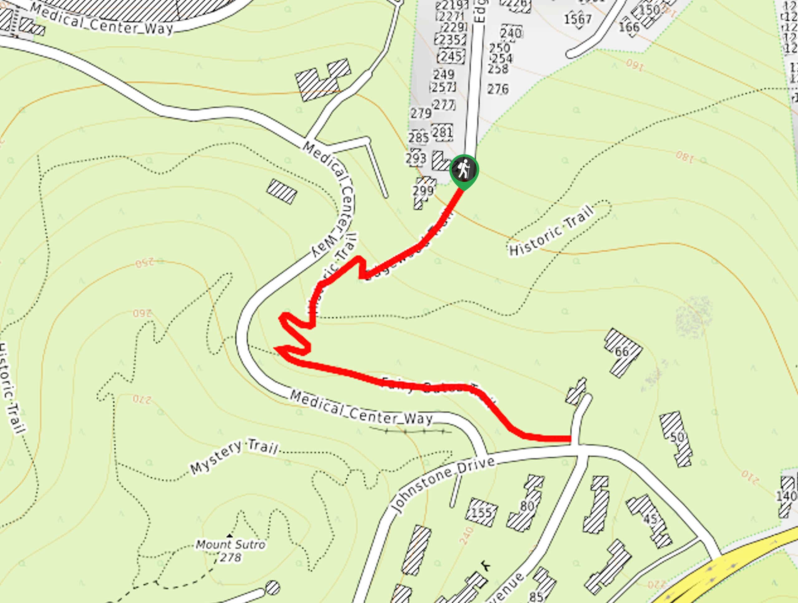
Fairy Gates Trail
The Rose Valley Falls Hike boasts an enchanting experience in San Francisco. Explore the Mount Sutro Open Space Reserve’s nook…
Comments