Tahoe Meadows Interpretive Loop
View Photos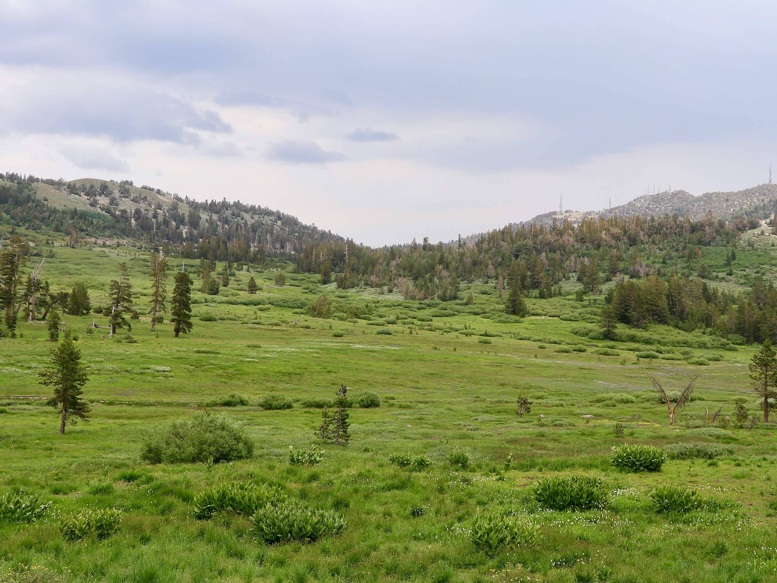
Tahoe Meadows Interpretive Loop
Difficulty Rating:
The Tahoe Meadows Interpretive Loop is a great outdoor excursion near Incline Village that the whole family can enjoy. Wander through luxuriant meadowlands, over boardwalks, and past several interesting interpretive signs along this scenic nature walk.
Getting there
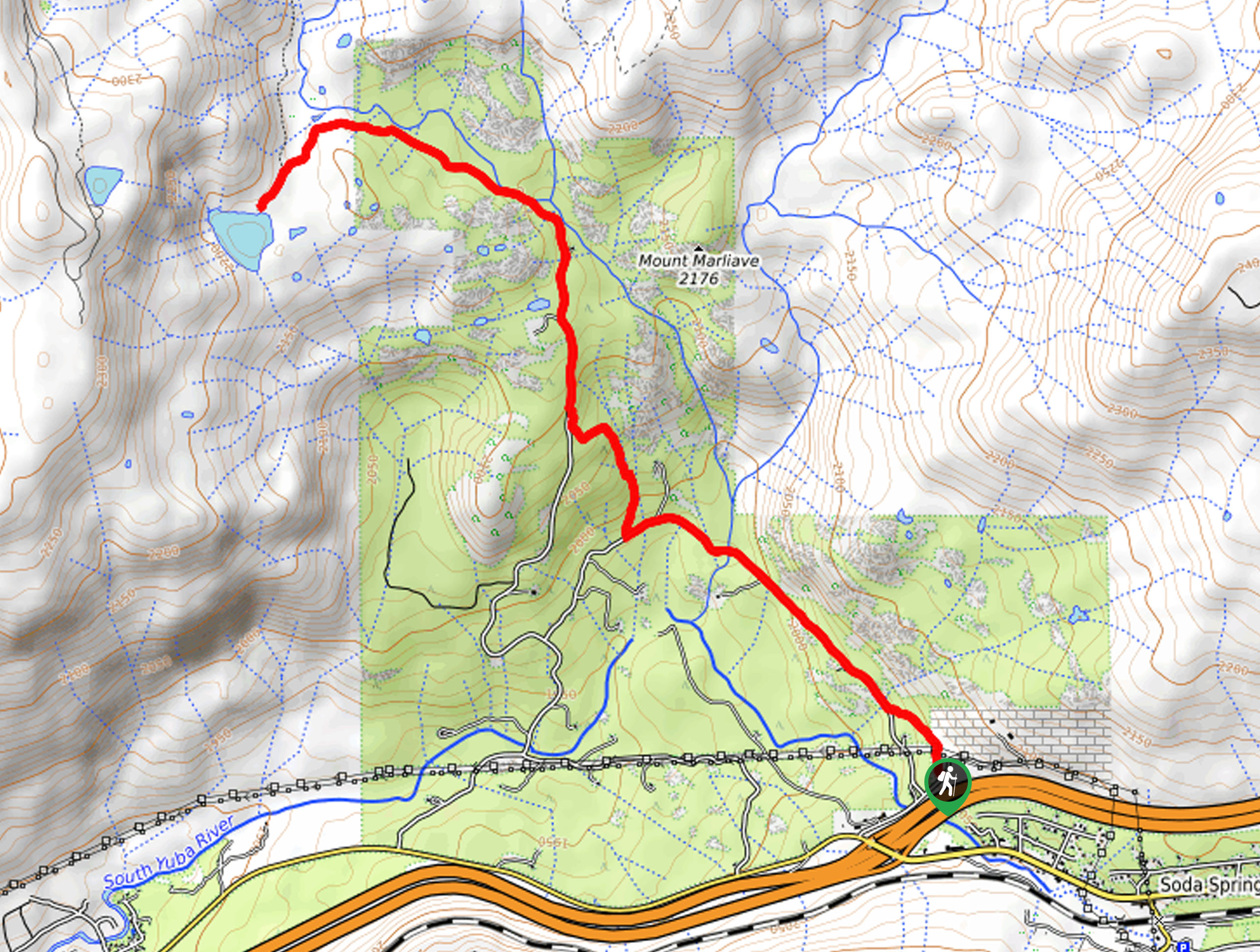
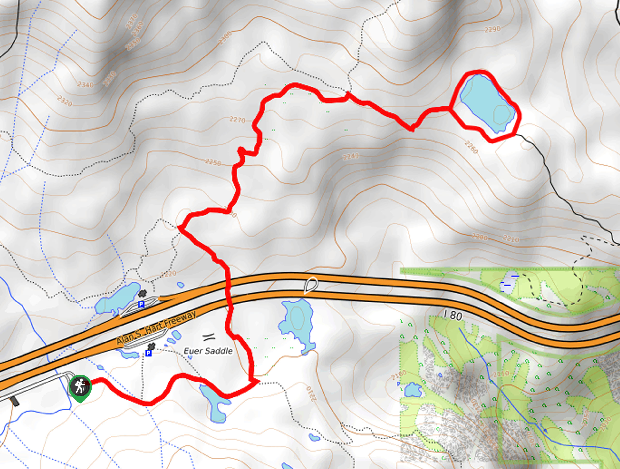
The Tahoe Meadows Interpretive Loop is accessed from the parking lot and trailhead off Mount Rose Highway.

About
| Backcountry Campground | No |
| When to do | Year-round |
| Pets allowed | Yes - On Leash |
| Family friendly | Yes |
| Route Signage | Average |
| Crowd Levels | Moderate |
| Route Type | Lollipop |
Tahoe Meadows Interpretive Loop
Elevation Graph
Weather
Tahoe Meadows Interpretive Loop Description
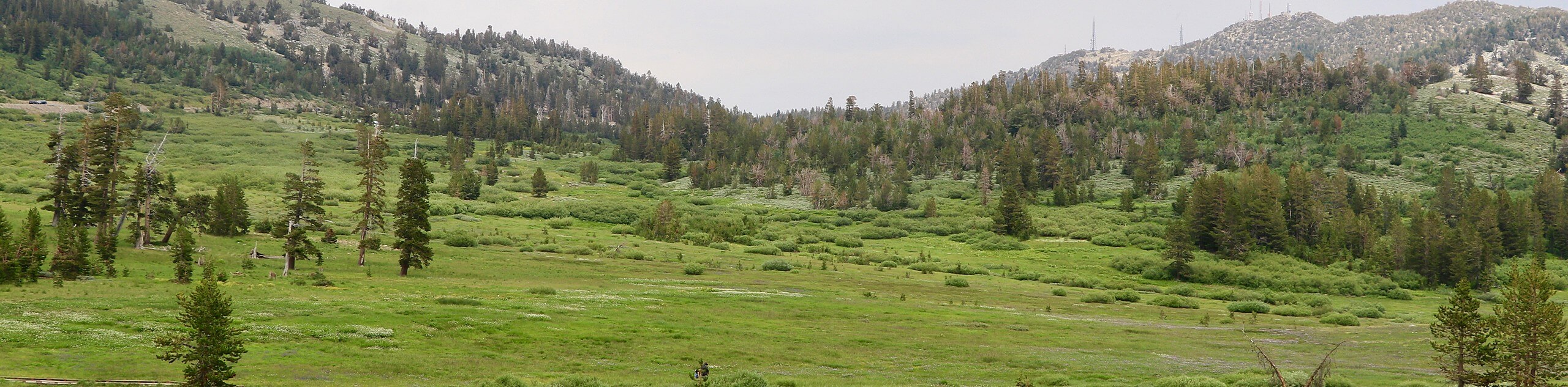
The Tahoe Meadows Interpretive Loop is an excellent adventure choice if you seek an easy-going, accessible hike near Incline Village. Traveling through meadowlands along boardwalks and bridges, this route is accessible to wheelchairs and strollers alike. Immerse yourself in the alpine terrain while learning more about the area’s ecology as you wander. Note much of the terrain is exposed, so make sure you dress accordingly and wear sun protection!
Setting out from the trailhead, the Tahoe Meadows Interpretive Loop follows the Tahoe Rim Trail northeast, along a boardwalk to an intersection. Keep left here, continuing along the Tahoe Rim Trail. Admire the lodgepole pines, willows, and wildflowers that adorn the meadowland and keep an eye out for hawks soaring above. At the next junction, turn right, and this section of the trail will redirect you south after crossing two footbridges.
As you begin your hike back to the trailhead, you will be rewarded with views of the encompassing mountains. Take the time to read the informative interpretive signs, and you will soon reconnect with the Tahoe Rim Trail—follow this route back to the trailhead.
Similar hikes to the Tahoe Meadows Interpretive Loop hike
Squaw Creek to Shirley Canyon Hike
The Squaw Creek to Shirley Canyon Hike is a must-add to your hiking itinerary. Located near Olympic Valley, this route…
Lola Montez Trail
The Lola Montez Trail is an epic backcountry adventure that boasts wonderful scenery, from dense pine forests to alpine meadows…
Summit Lake Hike
The Summit Lake Hike is a popular escape into the fresh air. Conveniently located off the highway, this beautiful route…
Comments