Tahoe City Rim Trail Loop
View Photos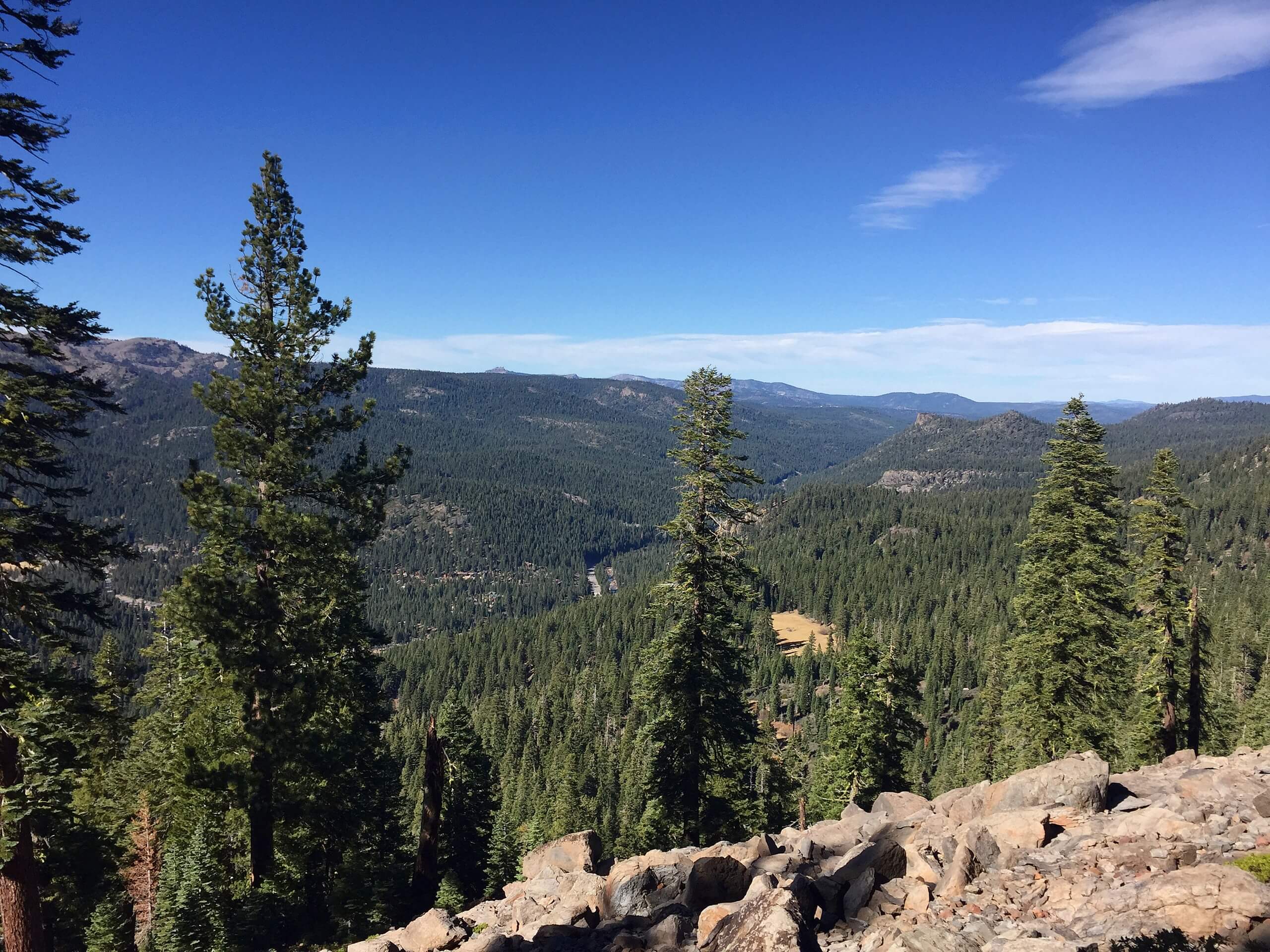
Tahoe City Rim Trail Loop
Difficulty Rating:
The Tahoe City Rim Trail Loop is an awesome adventure that boasts epic panoramas. Get a taste of what the famous Tahoe Rim Trail has to offer as you venture the circuit atop Tahoe City. Wander into the High Sierra and revel in the beauty of the dramatic mountainous landscape.
Getting there
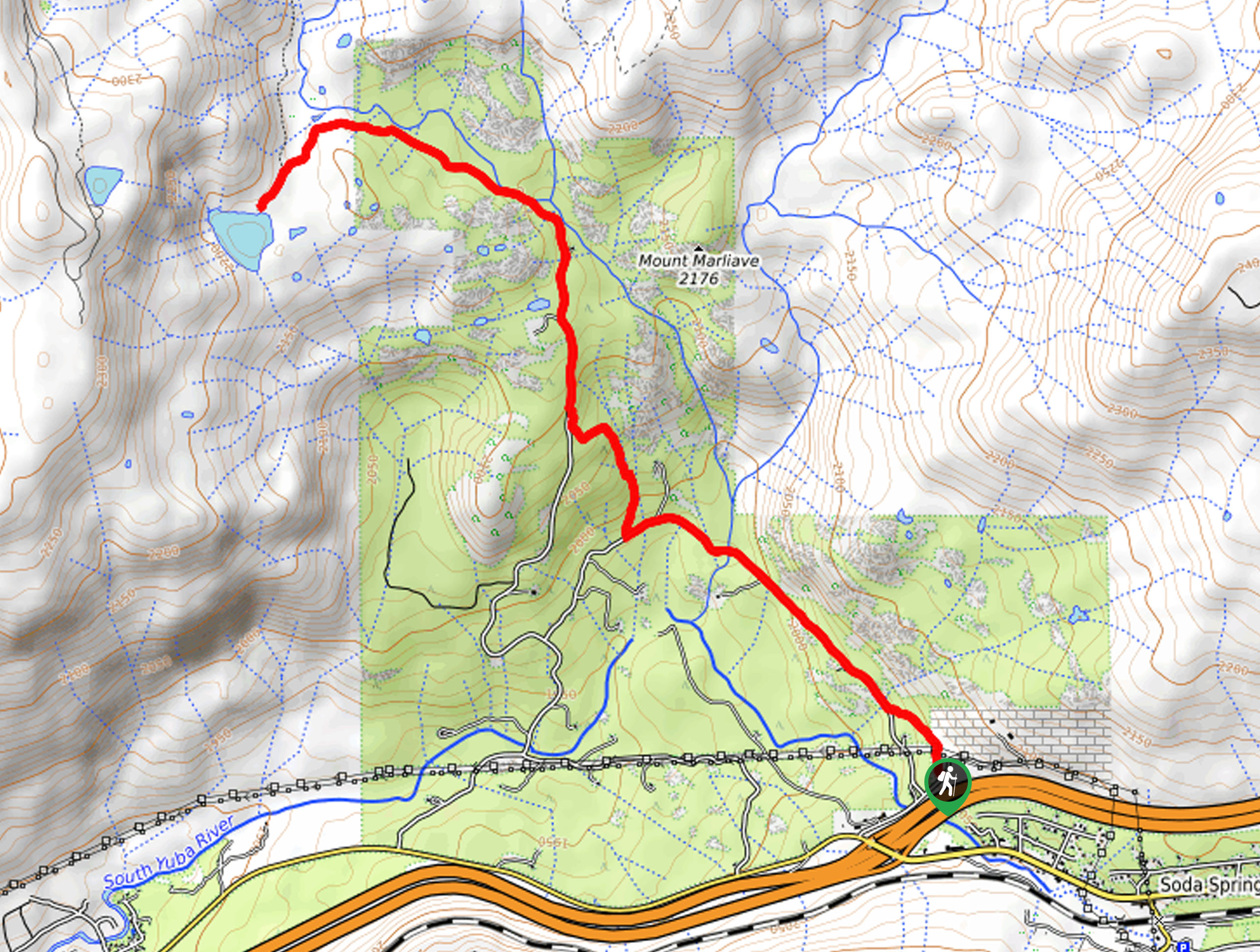
The Tahoe City Rim Trail Loop departs from the Tahoe Rim Trailhead off Fairway Drive.

About
| Backcountry Campground | Backcountry Camping |
| When to do | for route |
| Pets allowed | Yes - On Leash |
| Family friendly | Older Children only |
| Route Signage | Average |
| Crowd Levels | Moderate |
| Route Type | Circuit |
Tahoe City Rim Trail Loop
Elevation Graph
Weather
Tahoe City Rim Trail Loop Description
The Tahoe City Rim Trail Loop is an adventurer’s oasis, and there is no doubt as to why! With diverse scenery and various topographies to explore, hikers and bikers alike will be stimulated by the stunning landscape as they progress along the route. Traveling through both shaded and exposed terrain, we recommend dressing in layers as insurance against changing conditions. Additionally, as you will be hiking deep into the wilderness it is important to be mindful of wildlife!
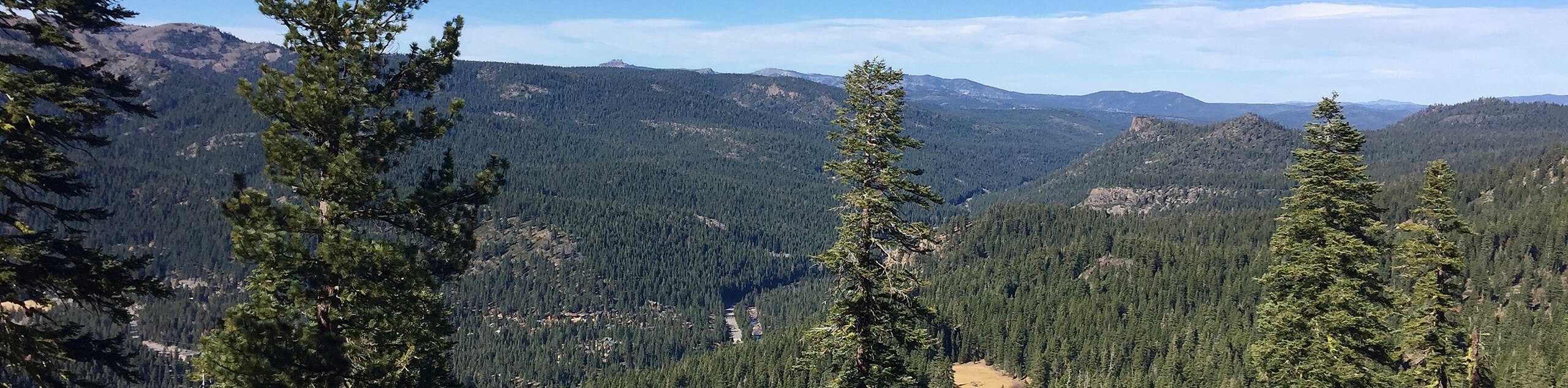
Setting out from the trailhead, the Tahoe City Rim Trail Loop follows the Tahoe Rim Trail up a switchback before climbing northwest along the cliffside above the Truckee River. Gradually climbing through woodlands and meadowlands, the path will eventually curve you north, up to the summit of Cinder Cone. From here, you will be granted distant views of Lake Tahoe in the east through the tree breaks.
Setting out from here, the path will begin to slowly descend along the Powerline Trail. At the path’s end, turn right onto the Ocelot Trail. At the next junction, track the Mount Watson Access Road south, all the way down to Fairway Drive. From here, keep right and briefly wander along the shoulder of the road back to the trailhead.
Similar hikes to the Tahoe City Rim Trail Loop hike
Red Lake, Frog Lake and Carson Pass Hike
Seeking a day hike away from the crowds of Lake Tahoe? The Lake, Frog Lake and Carson Pass Hike is…
Winnemucca and Round Top Lakes Hike
The Winnemucca and Round Top Lake Hike is an awesome adventure in the Mokelumne Wilderness. Wander through mixed pine forests…
Lola Montez Trail
The Lola Montez Trail is an epic backcountry adventure that boasts wonderful scenery, from dense pine forests to alpine meadows…
Comments