

Moraine Trail
View PhotosMoraine Trail
Difficulty Rating:
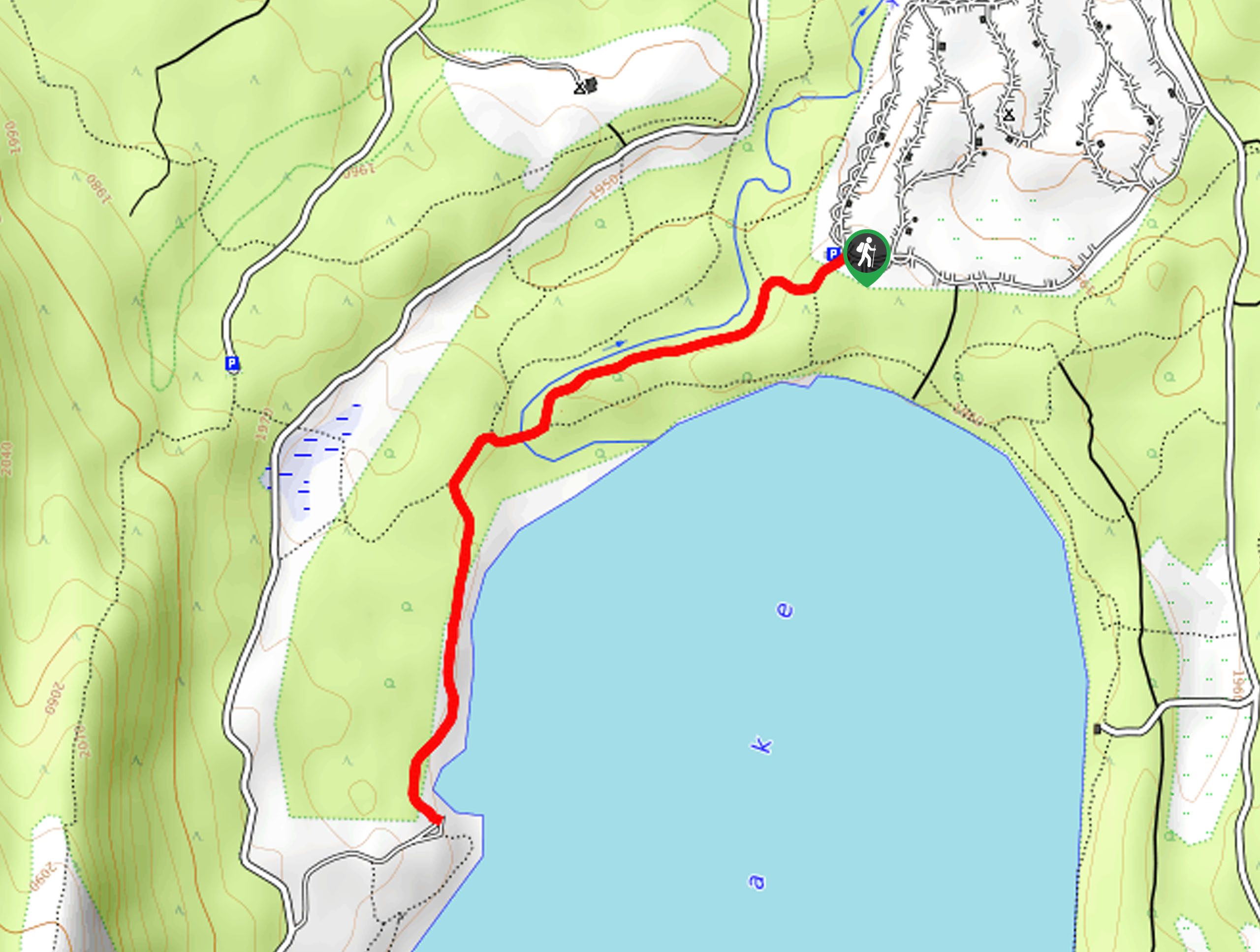
The Moraine Trail is a scenic nature walk along the shoreline of Fallen Leaf Lake. This epic excursion boasts breathtaking views of the shimmering alpine lake nestled amongst the looming summits of the Sierra Nevada Mountain Range.
Getting there
The Moraine Trail is accessed from the trailhead in the Fallen Leaf Campground.
About
| Backcountry Campground | Fallen Leaf Campground |
| When to do | Year-round |
| Pets allowed | Yes - On Leash |
| Family friendly | Yes |
| Route Signage | Average |
| Crowd Levels | High |
| Route Type | Out and back |
Moraine Trail
Elevation Graph
Weather
Moraine Trail Description
The Moraine Trail is a wonderful family-friendly adventure in South Lake Tahoe. If you are seeking an easy-going, scenic, half-day hike, then this trek is for you! Wander through lush meadowlands, mixed forests, and along shoreline cliffs. Immerse yourself in the alpine terrain and revel in the grandeur of the encompassing wilderness. Consider bringing a picnic and have lunch on the shore, overlooking the picture-perfect scene!
Setting out from the trailhead, the Moraine Hike follows the Moraine Trail southwest through enchanting woodlands. Wander through the lush greenery, over Taylor Creek, and alongside the western shore of Fallen Leaf Lake. As you meander along the shoreline, you will be granted views of adventurers enjoying the waters of the blue-hued lake.
You will eventually reach the trail’s end at Sawmill Cove—this is a great place for a picnic. Revel in the beauty of the encompassing Sierra Nevada Mountains that hem the lake, and when you are set, retrace your footing along the path back to the trailhead.
Similar hikes to the Moraine Trail hike

Squaw Creek to Shirley Canyon Hike
The Squaw Creek to Shirley Canyon Hike is a must-add to your hiking itinerary. Located near Olympic Valley, this route…

Lola Montez Trail
The Lola Montez Trail is an epic backcountry adventure that boasts wonderful scenery, from dense pine forests to alpine meadows…

Summit Lake Hike
The Summit Lake Hike is a popular escape into the fresh air. Conveniently located off the highway, this beautiful route…


Comments