

The Amphitheater Loop
View PhotosThe Amphitheater Loop
Difficulty Rating:
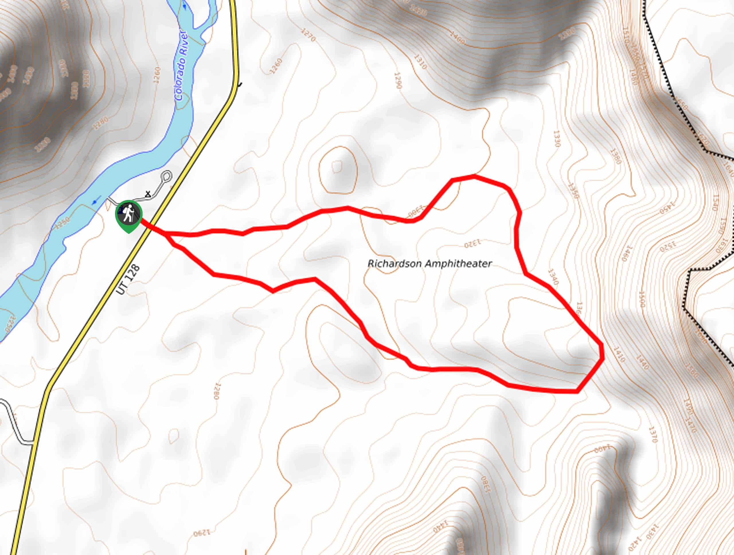
The Amphitheater Loop is a great hike through the desert landscape just northeast of Moab. This hike starts and ends at the Hittle Bottom Campground on the shores of the Colorado River. The Amphitheater Loop is dog-friendly, so you can enjoy this hike with the whole family, including your four-legged best friend.
Getting there
The Amphitheater Loop begins at the Hittle Bottom Campground along highway 128, 23.0mi northeast of Moab.
About
| Backcountry Campground | Campground at trailhead |
| When to do | year-round |
| Pets allowed | Yes |
| Family friendly | Yes |
| Route Signage | Average |
| Crowd Levels | Low |
| Route Type | Lollipop |
The Amphitheater Loop
Elevation Graph
Weather
The Amphitheater Loop Description
The Amphitheater Loop is a great, moderately challenging loop through the beautiful desert landscape northeast of Moab. This route does have one scrambly section, so hikers should be prepared to traverse over some steep and loose trail. The Amphitheater Loop gets little to no shade—bring good sun protection and more water than you think you’ll need. This hike is low-traffic and dog-friendly, so it’s a great place to take the pup for a walk or run over gorgeous terrain.
From the Hittle Bottom campground, cross over to the east side of the highway. Follow the trail for a couple of hundred yards to the divide that marks the beginning and end of the loop. We recommend heading right to follow the loop counterclockwise. The trail ahead is well defined and marked with cairns. Follow the loop for 2.4mi back to the start.
When you find yourself at the end of the loop, follow the path back to the highway and carefully cross back over to the Hittle Bottom Campground.
Similar hikes to the The Amphitheater Loop hike

Big Horn Overlook Trail
The Big Horn Overlook Trail is a family-friendly hike in Dead Horse Point State Park. This trail takes you to…

Colorado River Overlook Trail
The Colorado River Overlook Trail is a short and easy route that affords hikers stunning views of the Utah desert.…

Dead Horse Rim Loop and Big Horn Overlook Trail
The Dead Horse Rim Loop and Big Horn Overlook Trail is a fantastic day-hike in the southern section of Dead…


Comments