

Boulder Cave Trail
View PhotosBoulder Cave Trail
Difficulty Rating:
Boulder Cave Trail is a 1.2mi easy hike that takes you through a cave usually inhabited by bats. This hike is easy and family-friendly with very little elevation gain to consider and a short and sweet length. Expect heavy traffic. This trail can be subject to closure to maintain the condition of the cave and prevent human-bat interactions, so check its status before coming.
This trail is closed. The closure is expected to be long-term. We will update if and when it reopens.
Getting there
The trailhead for the Boulder Cave Trail is off Old River Road. There is parking here.
About
| Backcountry Campground | No |
| When to do | May-October |
| Pets allowed | Yes - On Leash |
| Family friendly | Yes |
| Route Signage | Average |
| Crowd Levels | High |
| Route Type | Out and back |
Boulder Cave Trail
Elevation Graph
Weather
Boulder Cave Trail Description
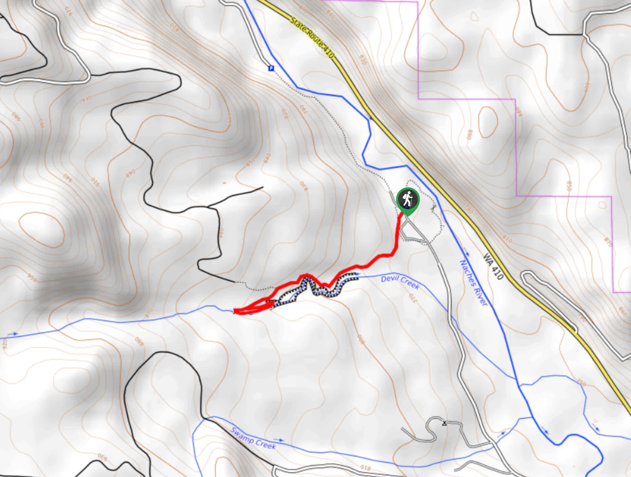
Boulder Cave Trail is a unique hike, taking you through a 330ft basalt rock cave with Devil Creek flowing beside you. It’s a fun hike for kids and bats are usually present in the cave. The hike itself is easy and short, but it does tend to see more traffic when it’s open.
Begin from the trailhead. Take the trail that follows Devil Creek. Hike through the cave, watching to make sure you don’t step in too much guano. It should go without saying, but leave bats undisturbed for your safety and their safety. At the end of the trail is a small waterfall. Here, turn around and retrace your steps to the trailhead.
Similar hikes to the Boulder Cave Trail hike

Silver Falls Trail
Silver Falls Trail is a delightful hike suitable for the whole family. It takes you into a fascinating canyon with…

Sheep Lake Trail
Sheep Lake Trail is a 3.9mi easy trail in Okanogan-Wenatchee National Forest that is suitable for quick day…

Icicle Creek Trail
Icicle Creek Trail is a 9.6mi hike that is rated as easy. While the distance on this trail…


Comments