
Lake Sundown Trail
View Photos
Lake Sundown Trail
Difficulty Rating:
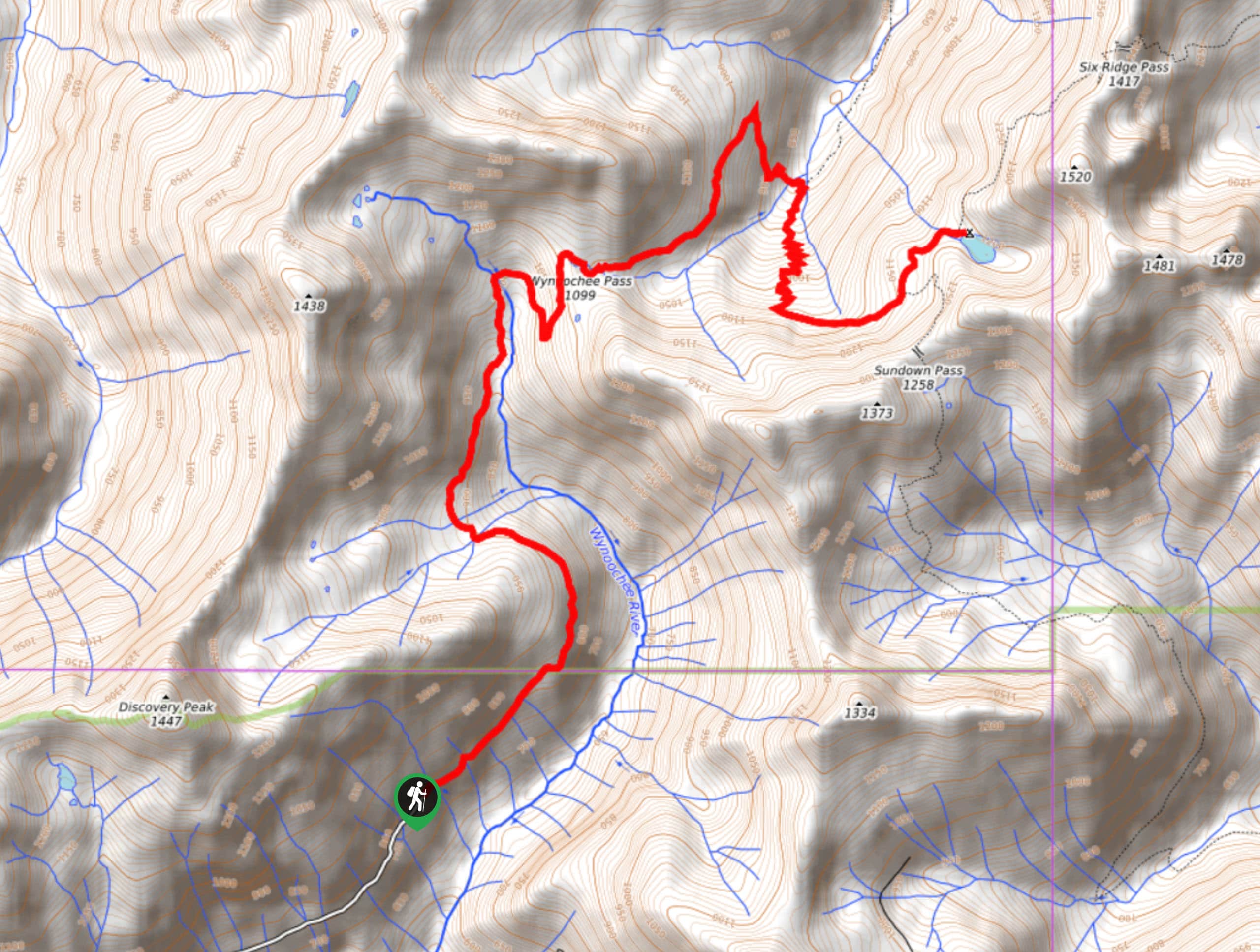
Lake Sundown Trail is a 10.5mi out-and-back hike in Olympic National Park that sees little traffic. Despite this, it’s quite well-kept and easy to follow. With undulating elevation changes and great viewpoints along the trail, it’s a hike that keeps you engaged despite a slightly longer total length.
Note that this trail is subject to seasonal closures to protect the elk population of the area. This is normally from October through April.
Getting there
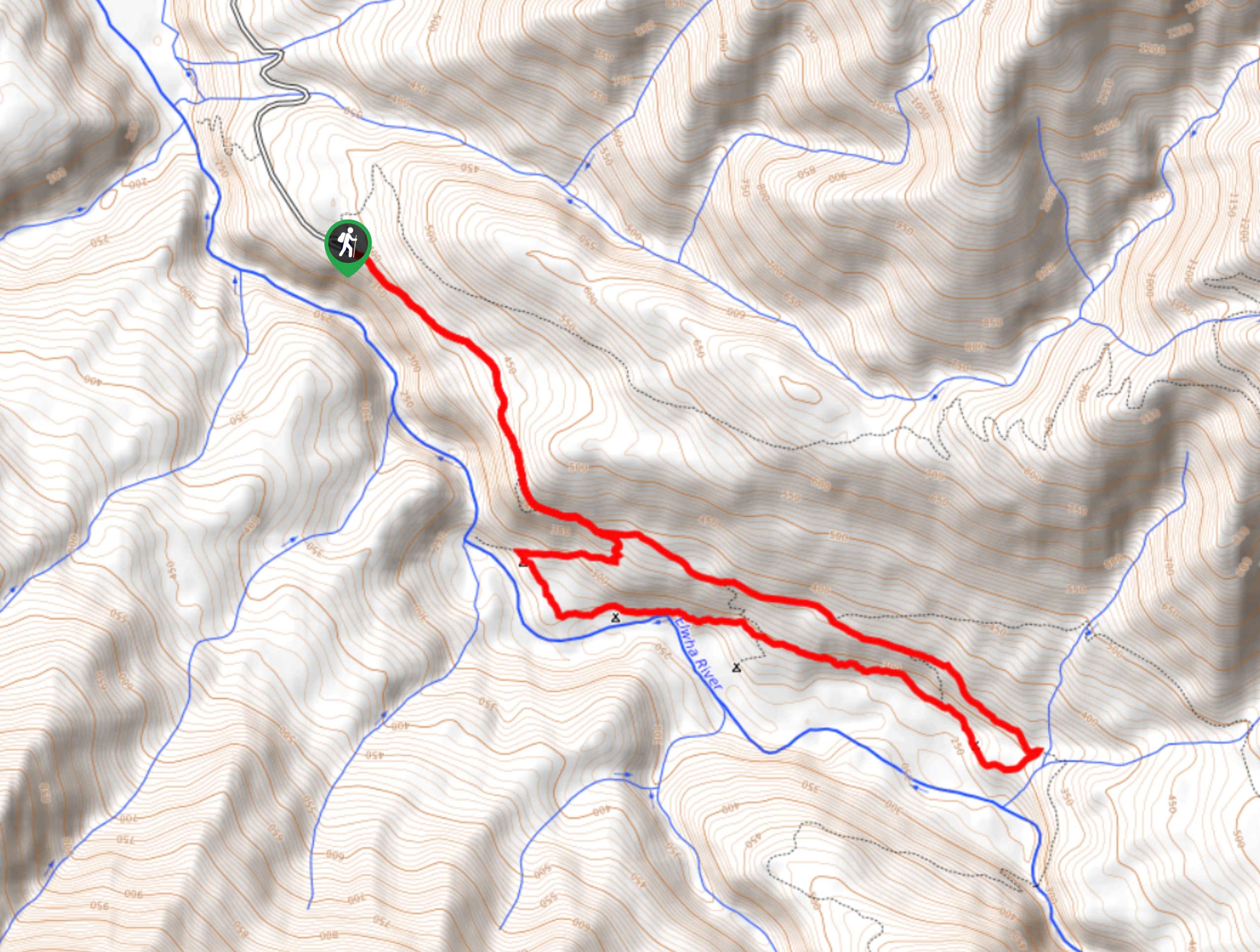
The trailhead for the Lake Sundown Trail is at Wynoochee Pass at the end of Forest Road 2270-400.

About
| Backcountry Campground | Lake Sundown |
| When to do | May-September |
| Pets allowed | No |
| Family friendly | No |
| Route Signage | Average |
| Crowd Levels | Low |
| Route Type | Out and back |
Lake Sundown Trail
Elevation Graph
Weather
Lake Sundown Trail Description
Lake Sundown Trail is a lightly trafficked hike that offers gorgeous mountain and lake views. Despite being fairly remote, this trail is quite well-kept and easy to follow.
The last few kilometres before the trailhead are inaccessible October-April to protect elk in the area. Plan your trip outside of these times. While the road in isn’t terrible, you may want a 4WD vehicle with higher clearance.
Beginning from the end of the road on Wynoochee Pass Trail, begin gradually climbing, rounding the end of the rudge up to Discovery Peak. There are a pair of creek crossings before the trail straightens out again.
You’ll cross the Wynoochee River next. Some hikers prefer to cross a bit further up the trail than where the GPS route indicates, but you can cross wherever you prefer. The trail runs up alongside the river a ways on the other side, so you should be able to find it again easily.
Wave your way up the opposite side of the valley face, then straighten out as you climb. There is one sharp turn to the right that takes you across a stream to a set of narrow switchbacks. At the junction, stay left to the lake, which will be on your right.
After enjoying the lake, turn around and retrace your steps to the trailhead.
Similar hikes to the Lake Sundown Trail hike
Grand Pass Trail
Grand Pass Trail is a beast of a day hike, with over 13.7mi to cover across varied, steep…
West Elwha River Trail
The West Elwha River Trail is a lovely moderate walk alongside the river to the Altair Campground and back. This…
Humes Ranch Loop Trail
Humes Ranch Loop Trail is a heavily trafficked loop hike in Olympic National Park. This trail is very beautiful and…
Comments