

Walk to Doan Summit via Banns Road
View PhotosWalk to Doan Summit via Banns Road
Difficulty Rating:
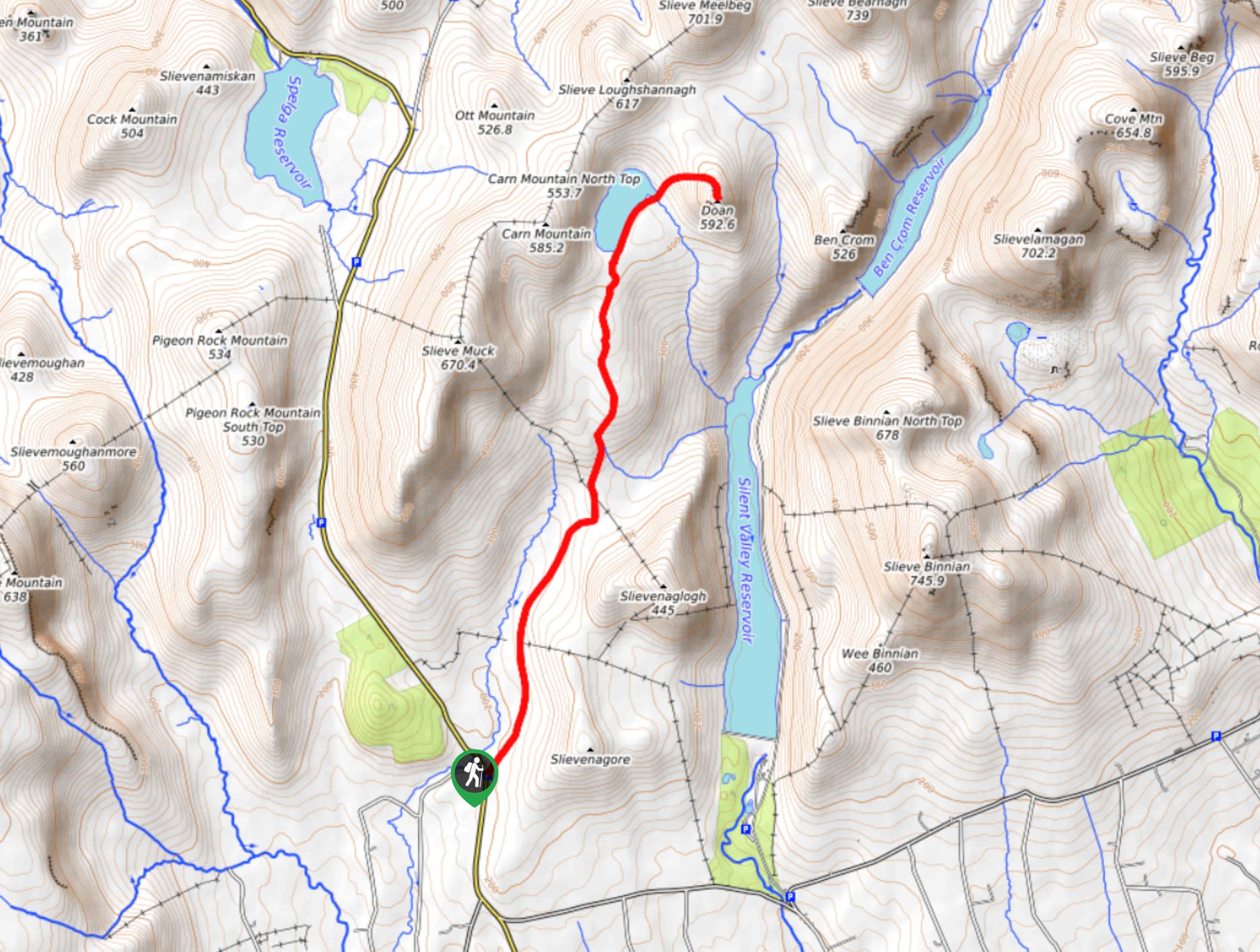
The Walk to Doan Summit via Banns Road is a fantastic outdoor excursion in Northern Ireland that will take you up to a summit viewpoint for an exceptional sightline over the surrounding area. While out on the trail, you will follow along a quiet road that cuts across the rugged terrain of the Mourne Mountains towards Lough Shanna, where you will bring your climb to the summit of Doan. There is a moderate amount of elevation gain along the route; however, the views over the Northern Ireland landscape are spectacular.
Getting there
The trailhead for the Walk to Doan Summit via Banns Road can be found at the Banns Road Car Park, located 4.7mi north of Kilkeel along Moyad Road.
About
| Backcountry Campground | No |
| When to do | April-September |
| Pets allowed | Yes - On Leash |
| Family friendly | Older Children only |
| Route Signage | Average |
| Crowd Levels | Moderate |
| Route Type | Out and back |
Walk to Doan Summit via Banns Road
Elevation Graph
Weather
Walk to Doan Summit via Banns Road Description
If you are after an exciting walking route that will showcase some amazing mountain terrain without much in the way of technical difficulty, then you will definitely want to explore the Walk to Doan Summit via Banns Road.
Setting out from the Banns Road car park, you will make your way to the northeast along the valley floor on a route that runs parallel to Yellow Water. Passing between the peaks of Slievenaglogh on your right and Slieve Muck on your left, you will begin to gain elevation on the way towards the shores of Lough Shanna.
After taking in the views of this charming lake, you will make your way along the shoreline to the northeast, climbing up the steep mountainside on the way to the summit of Doan. Here, you will enjoy some breathtaking views that sweep across the surrounding mountains. After you’ve finished experiencing the beauty of the surrounding terrain, simply head back down the mountainside and follow the same route to relive the views on the way back to the car park where you began.
Similar hikes to the Walk to Doan Summit via Banns Road hike

Helen’s Tower Walk
The Helen’s Tower Walk is a quick adventure in County Down that will lead you slightly uphill to an historic…

Annalong Wood and Blue Lough Circular Walk
The Annalong Wood and Blue Lough Circular Walk is a rugged and challenging adventure in the Mourne Mountains of Northern…

Drumnaph Nature Reserve Walk
The Drumnaph Nature Reserve Walk is a fun outdoor excursion that will lead you through a variety of landscapes offering…


Comments