Rough Tor and Brown Willy Circular Walk
View Photos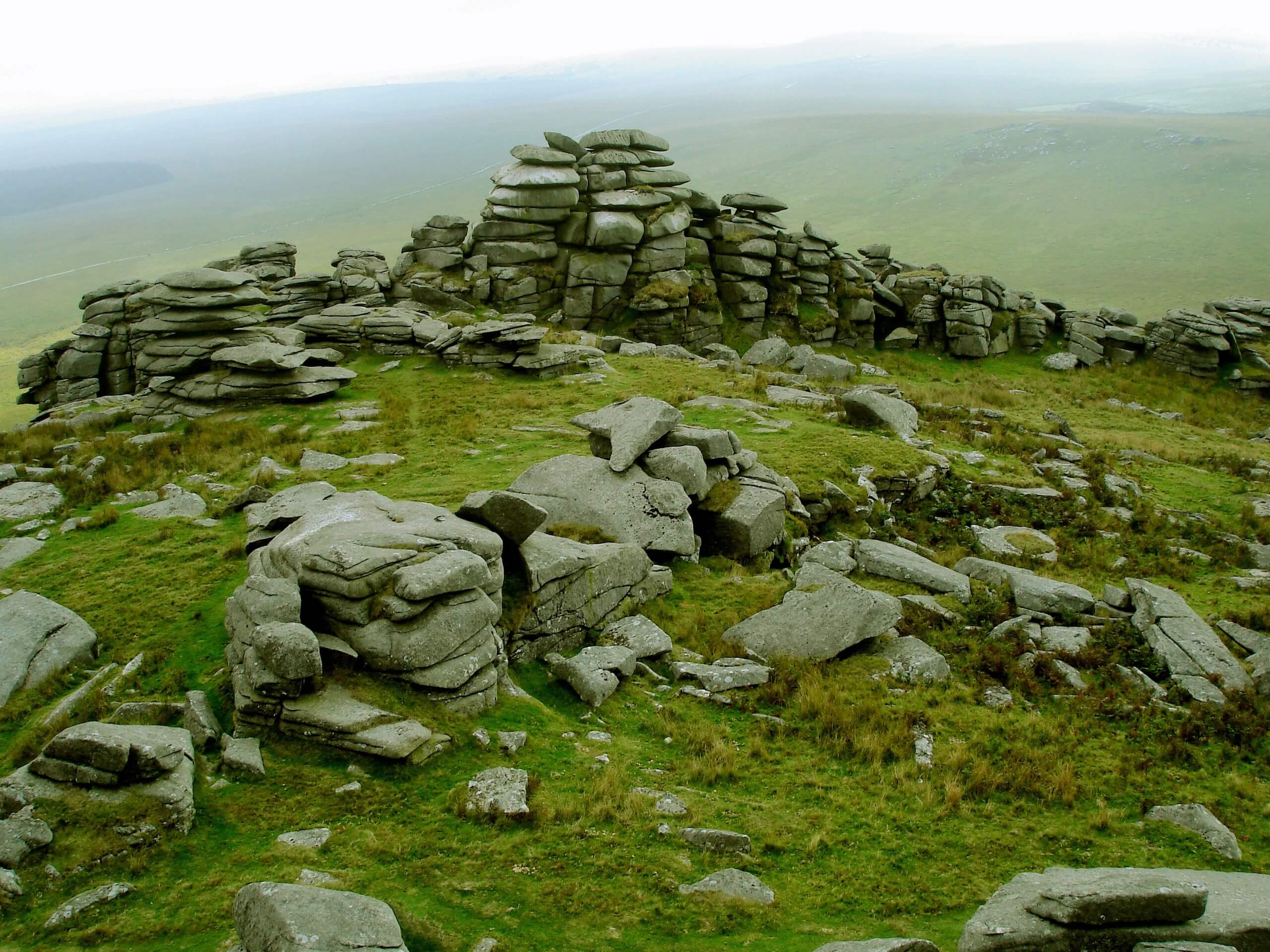
Rough Tor and Brown Willy Circular Walk
Difficulty Rating:
The Rough Tor and Brown Willy Circular Walk is a great outdoor excursion in Cornwall that will take you up two rugged summits for stunning views of the surrounding landscape. While out walking the trail, you will make your way uphill across Rough Tor and Brown Willy, taking in the exceptional views over Bodmin Moor and nearby Bronze Age historical sites in the process. While sections of this route can be difficult, this is a great walk for casual outdoor enthusiasts.
Getting there
The trailhead for the Rough Tor and Brown Willy Circular Walk can be found at the Rough Tor car park along Rough Tor Road, just southeast of Camelford.

About
| Backcountry Campground | No |
| When to do | Year-Round |
| Pets allowed | Yes - On Leash |
| Family friendly | Older Children only |
| Route Signage | Average |
| Crowd Levels | Moderate |
| Route Type | Lollipop |
Rough Tor and Brown Willy Circular Walk
Elevation Graph
Weather
Rough Tor and Brown Willy Circular Walk Description:
While it isn’t an overly difficult walking route, the Rough Tor and Brown Willy Circular Walk does feature some rugged hilltop terrain. Be sure to wear proper walking boots with good support for this adventure. Additionally, the route can be a bit muddy after a good rainfall, so water-resistant shoes are also a good idea. The route also features a good deal of uphill walking that will limit less-mobile travellers.
Although the trail can be a bit on the rough side, particularly if the weather conditions are poor, this is still an exceptional walking route that will provide some stunning views over Bodmin Moor and allow you to experience the ancient history of the region. In addition to reaching the summit of both Rough Tor and Brown Willy, you will pass by several examples of Bronze Age huts and enclosures. As such, this is a wonderful route for history and outdoor enthusiasts alike.
Setting out from the car park, you will make your way to the southeast and cross over a stream to arrive at a fork in the path. Taking the path furthest to the left, you will climb up the hillside for 0.7mi to reach a small saddle in between Little Rough Tor and Showery Tor. From here, you will continue on to the southeast and head downhill to meet the banks of the De Lank River.
After crossing over the river, you will make your way up the steep hillside to reach the summit of Brown Willy, the highest point in Cornwall at 1378ft above sea level. Once you have taken in the views overlooking Bodmin Moor, make your way back downhill and across the river, following the same path back up to the saddle.
Once there, you will turn to the left in order to traverse the rock strewn summits of Little Rough Tor and Rough Tor. Here, you will enjoy some more amazing views that sweep across the moor, before heading downhill to the northwest. After 0.9mi, you will arrive back at the car park where you began the Rough Tor and Brown Willy Circular Walk.
Trail Highlights
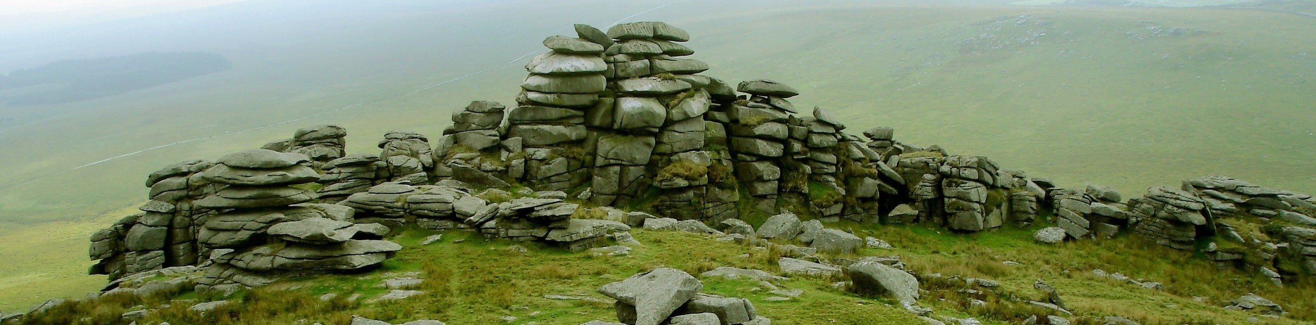
Rough Tor
Located on Bodmin Moor in Cornwall, Rough Tor is a rock covered peak that overlooks the town of Camelford and the surrounding moorland. Numerous Bronze Age huts and estone enclosures can be found along the slopes of the hill, providing a window into the history of human habitation in the area. At 400m above sea level, Rough Tor is the second highest peak in Cornwall.
Brown Willy
Surrounded by the desolate landscape of Bodmin Moor, Brown Willy is a rugged peak located roughly 1 mile southeast of Rough Tor. At 420m above sea level, Brown Willy is the highest point on Bodmin Moor, as well as Cornwall. The name of the peak is possibly derived from the Cornish Brann Ewhella, which means ‘highest hill’.
Frequently Asked Questions
What is the highest point in Cornwall?
The highest point in Cornwall is Brown Willy, which stands at 1378ft above sea level.
Where do I park for Rough Tor?
Located along Rough Tor Road to the southeast of Camelford, the Rough Tor car park is an excellent place to begin your walking adventure up Rough Tor or Brown Willy.
Insider Hints
Make sure to wear proper walking boots with good support.
Walking poles will come in handy when traversing the rocky and uneven terrain.
Remember to bring an extra layer, as it can be very windy at the summit viewpoints.
Similar hikes to the Rough Tor and Brown Willy Circular Walk hike
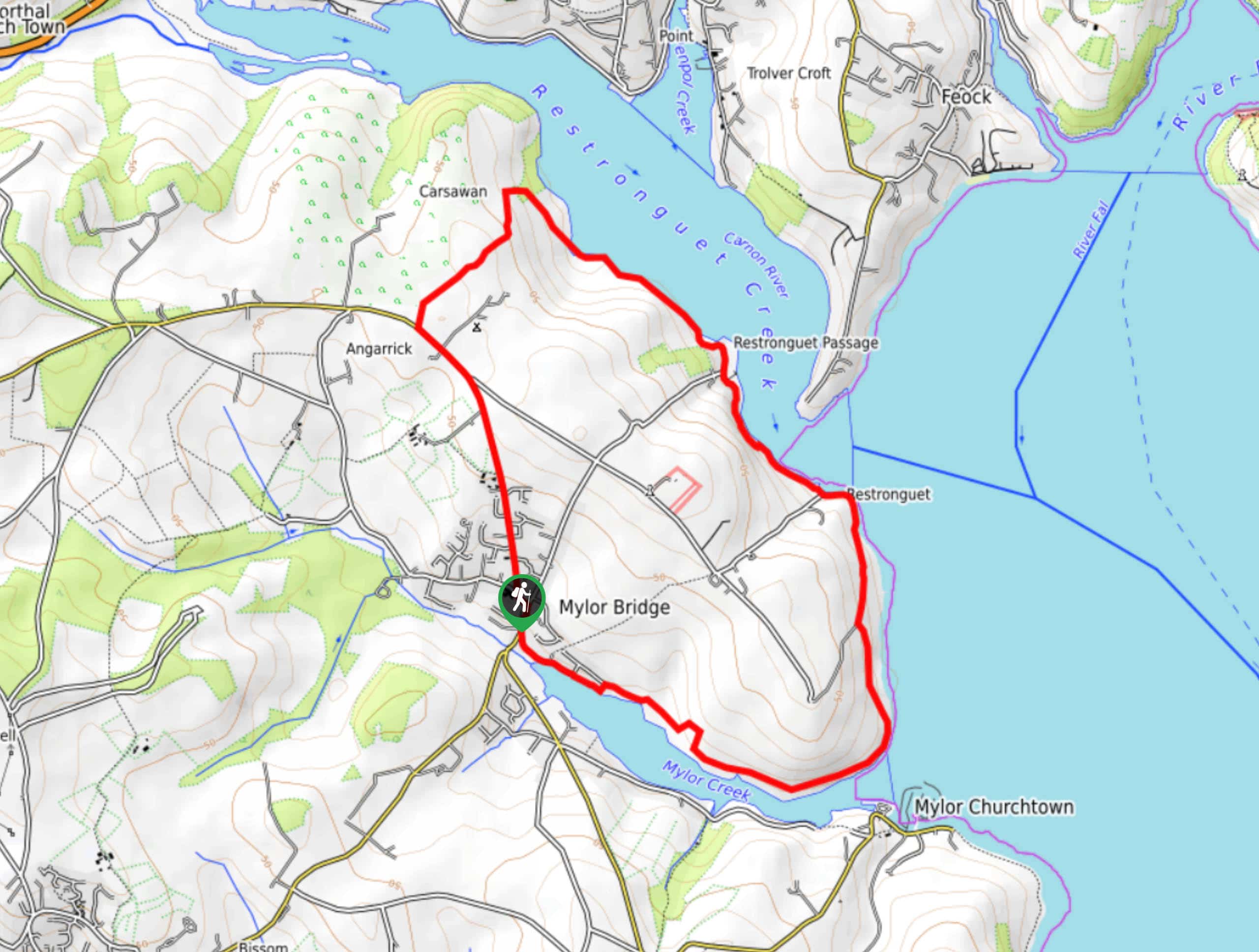
Restronguet Passage Circular Walk
The Restronguet Passage Circular Walk is a fantastic outdoor excursion in Cornwall that offers beautifully scenic views overlooking a number…
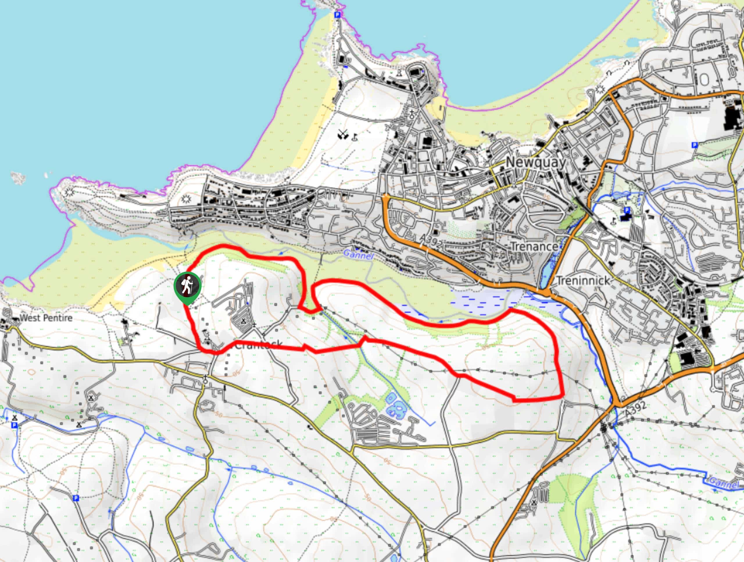
Crantock and The Gannel Circular Walk
The Crantock and The Gannel Circular Walk is a beautifully scenic adventure near Newquay, Cornwall that will lead you through…
Egloshayle Circular Walk
The Egloshayle Circular Walk is a great outdoor excursion set in the Cornish countryside that will expose you to a…
Comments